OpenStreetMap logo OpenStreetMap

Users' Diaries

Recent diary entries

OpenStreetMap (OSM) ist mehr als nur ein Kartendienst im Internet: Es ist eine globale Gemeinschaft, die daran arbeitet, freie und editierbare geographische Daten für die ganze Welt bereitzustellen. Als leidenschaftlicher Verfechter der Bedeutung offener Daten und der Gemeinschaftszusammenarbeit möchte ich in diesem Blogartikel teilen, warum ich mich für OSM engagiere und warum ich glaube, dass auch Sie es in Betracht ziehen sollten.

Freie und Offene Daten

In einer Welt, in der geographische Informationen zunehmend kommerzialisiert werden, bietet OSM eine kraftvolle Alternative: Eine freie Karte, die von jedermann verwendet und bearbeitet werden kann. Diese Offenheit fördert nicht nur Innovation und Kreativität, sondern stellt auch sicher, dass diese wichtigen Daten dort verfügbar sind, wo kommerzielle Anbieter vielleicht kein Interesse haben zu investieren. Indem ich zu OSM beitrage, unterstütze ich ein Modell, das Wissen und Ressourcen demokratisiert, was meiner Überzeugung nach für eine gerechtere Welt unerlässlich ist.

Community und Zusammenarbeit

OpenStreetMap ist das Produkt einer engagierten Gemeinschaft von Freiwilligen rund um den Globus. Diese Gemeinschaft ist vielfältig: Sie umfasst nicht nur Kartographen und Geografen, sondern auch Menschen aus allen Bereichen des Lebens, die ihr lokales Wissen einbringen. Durch meine Beteiligung an OSM habe ich nicht nur die Möglichkeit, zur Karte beizutragen, sondern auch von anderen zu lernen und dauerhafte Verbindungen aufzubauen. Diese Zusammenarbeit auf globaler Ebene stärkt mein Gefühl der Zugehörigkeit und zeigt mir, dass meine Beiträge, egal wie klein sie sind, einen Unterschied machen.

Bildung und Empowerment

See full entry

Location: Rodenbeck, Minden, Kreis Minden-Lübbecke, Nordrhein-Westfalen, Deutschland

Am 24.04.2024 fand für die Touristiker des Saarlandes der zweite Teil eines Seminars zum Thema Route 3.0 & OpenStreetMap statt. Auf Einladung durch Klaus Wallach von der Tourismus Zentrale Saarland nahmen mit Barthwo und mir auch zwei saarländische Mapper an dem von Thomas Froitzheim durchgeführten Seminar teil. Motiviert wird das Seminar durch die neue Richtlinie Route 3.0 des Deutschen Tourismusverband (DTV).

Ziel des Seminars war es, die Touristiker mit dem Konzept OpenStreetMap bekannt zu machen und zur Kontrolle der richtigen Hinterlegung von Wander- und Radtourrelationen in OSM zu schulen. Dabei konnten die Touristiker sehen, dass sehr viele der Routen bereits von fleißigen Mappern in OSM hinterlegt wurden. Im Rahmen der Schulung kamen Tools wie BRouter-Web, GPX Viewer sowie WayMarkedTrails zum Einsatz. Anhand dieser Tools können die Touristiker nun:

  • die aktuellen .gpx-Dateien bestehender Routen aus ihren Datensystemen mit den Relationen in OSM vergleichen, um fehlende oder fehlerhafte Relationen zu identifizieren, sowie
  • ohne Vorerfahrung mit wenigen Klicks .gpx-Dateien erstellen, die bei kurzzeitigen temporären Umleitungen den Touristen zur Verfügung gestellt werden können.

Die meisten Touristiker kamen im Rahmen des Seminars zum ersten Mal mit der Datenstruktur von OpenStreetMap in Kontakt. Da das Anlegen oder Modifizieren von Relationen durch unerfahrene Nutzer viele Risiken birgt, wird eine Lösung unter Zuhilfenahme der Mapper-Community benötigt, anstatt den Touristikern das recht komplexe und zeitaufwendige Thema Relationen aufzubürden.

See full entry

The SMCoSE YouthMappers Chapter, renowned as one of Tanzania’s largest mapping communities, hosted a transformative mapathon on April 14, 2024, at the esteemed Sokoine University of Agriculture. This event marked a pivotal moment of collaboration, extending invitations to other YouthMappers chapters in Morogoro, thus amplifying the inclusivity and impact of the initiative. Central to the mapathon’s objective was the concerted effort to contribute to Project #15530 within the HOT Tasking Manager, focusing on mapping cities across the Eastern and Southern Africa Region. By leveraging the power of open data, participants aimed to craft detailed base maps crucial for diverse applications, ranging from urban planning to efficient disaster response strategies.

Amidst an atmosphere described as “fantastic,” the event witnessed a remarkable accomplishment, the successful mapping of approximately 25,000 buildings. This feat not only underscores the collective dedication of the participants but also showcases the tangible outcomes of community-driven endeavors. Moreover, the mapathon served as a platform for new mappers to acquaint themselves with essential mapping tools such as ID Editors and JOSM, empowering them to contribute meaningfully to the OpenStreetMap ecosystem.

Special recognition is duly owed to the Open Mapping Hub Eastern and Southern Africa (OMHESA) for their unwavering support, notably through the prestigious Spatial People Award. This acknowledgment not only highlights the significance of collaborative partnerships but also accentuates the pivotal role of organizations in facilitating impactful mapathons and community initiatives. In essence, the event epitomized the ethos of collaboration, learning, and contribution inherent within the mapping community, further advancing the cause of open data dissemination and spatial awareness in the region.

See full entry

Location: Mazimbu Darajani, Morogoro Municipal, Morogoro Region, Coastal Zone, 67000, Tanzania

Theatro da Paz, Belém/Pará - Brasil

O Theatro da Paz foi fundado em 15 de fevereiro de 1878, durante o período áureo do Ciclo da Borracha, quando ocorreu um grande crescimento econômico na região amazônica. Belém foi considerada “A Capital da Borracha”. Mas, apesar desse progresso a cidade ainda não possuía um teatro de grande porte, capaz de receber espetáculos do gênero lírico. https://www.theatrodapaz.com.br/

Credito da Foto; Wikipedia, https://pt.wikipedia.org/wiki/Wikip%C3%A9dia:Wiki_Loves_Par%C3%A1#/media/Ficheiro:Teatro_da_Paz_3.jpg Theatro da Paz, Belém/Pará - Brasil

See full entry

Location: Campina, Belém, Região Geográfica Imediata de Belém, Região Geográfica Intermediária de Belém, Pará, North Region, Brazil

I am currently on a visit to Ireland 🇮🇪 and a lack of proper office space makes it difficult to stay productive. I will try to prepare something cool to show off this week. Sorry for keeping you waiting!

🍟

Location: Murphystown, Leopardstown Rise, Glencullen Electoral Division, Sandyford, Dún Laoghaire-Rathdown, County Dublin, Leinster, D18 CV48, Ireland
Posted by mpulve on 22 April 2024 in English. Last updated on 25 April 2024.

Why is OpenStreetMap ID not updated like OpenStreetMap ArcGIS? These are two different datasets that need to be linked/updated! Is ArcGIS taking over for OpenStreetMap and requiring a fee? ArcGIS needs to update OpenStreetMap ID if they participate! OpenStreetMap ArcGIS has not updated dataset in months! Please help with coordinating these two data set updates! Otherwise this in-browser edition will soon be obsolete! Use ArcGIS to compare your area with the link listed: ArcGIS OSM Are there any differences? Can anyone explain why? On the ArcGIS OSM there are more buildings that they imported from datasets. They should have updated the OSM ID data sets to match their information. Now there is a ArcGIS OSM version 2 that appears to be replacing ID OSM… ESRI

Location: Florence, Pinal County, Arizona, 85132, United States

IVIDES.org® realizou oficina sobre importação de POIs no OSM a partir de arquivo de dados do Censo Demográfico do Brasil 2022


O Instituto Virtual para o Desenvolvimento Sustentável promoveu uma oficina sobre importação de pontos de interesse (POI) no OpenStreetMap, a partir de um arquivo de valores separados por vírgula (.csv).

O conteúdo abrangeu os pontos de interesse obtidos do conjunto de dados do Censo Demográfico 2022, mas os organizadores salientam que a rotina pode ser utilizada para a importação de outros tipos de pontos geocodificados no OpenStreetMap.

Todos os arquivos da apresentação podem ser encontrados no portal do treinamento, que inclui também a agenda dos demais encontros.

https://ivides.org/oficinas-mapeamento-openstreetmap

Um agradecimento especial ao público participante ao vivo e aos(às) participantes futuros desta ação! Agradecemos ainda aos nossos parceiros: HUB YouthMappers Rio de Janeiro, YouthMappers Brasil, YouthMappers Internacional e os laboratórios associados - Laboratório de Cartografia - GeoCart-UFRJ, Laboratório ESPAÇO de Sensoriamento Remoto e Estudos Ambientais - Espaço-UFRJ, Laboratório integrado de Geografia Física Aplicada - LiGA-UFFRJ e Laboratório de Modelagem Geográfica - LabModel UERJ. E também ao Victor Hugo Timotheo, que participou da transmissão, no apoio técnico.

IVIDES.org® é uma marca registrada. Para entrar em contato sobre esta ação: ym.ufrj@gmail.com.


See full entry

Introduction

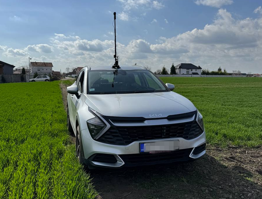
Car in action with Insta360 ONE

In this post, I will try to explain my process how to get best out of Insta360 ONE RS 1-inch camera and successfully upload images to Mapillary. It started out of my frustration of dealing with this camera and Mapillary and I hope you will not have to go through what I have been🙂. I will be focusing here more on software side (how to deal with data) rather than on hardware side (how to set up rig for image capture).

Let me first start with disclaimer that this is not easiest camera to work with Mapillary (hence this guide) and that not even Mapillary is recommending it. It definitively captures better images than GoPro 360, but everything with GoPro is more smooth over whole process, so be aware of this. Camera needs to record in video mode and it relies on additional GPS dongle you have to buy.

See full entry

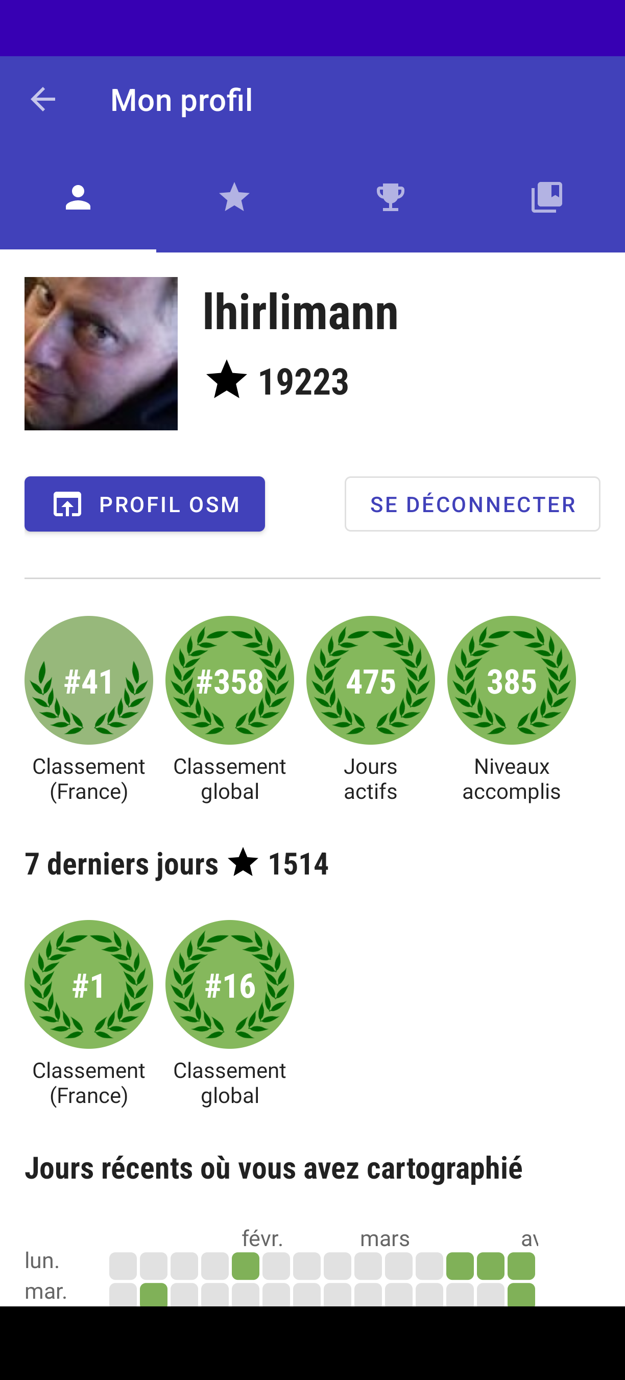
En aout dernier, j’avais été surpris de la facilité avec laquelle j’étais devenu le contributeur n°1 en Grèce, via l’application StreetComplete. Je viens d’accomplir la même chose, mais en contribuant sur la France. Capture d'écran de l'application, où l'on voit mon classement

Comment mi suis-je pris :

  • J’ai pris un endroit loin de chez moi, où je n’avais pas encore travaillé
  • J’ai sept jours durant fait une sortie à vélo d’une heure avec StreetComplete et vesspucci
  • j’ai tagué, j’ai ajouté et tagué

C’est aussi simple que cela et ne prend pas beaucoup de temps. Je ne reproduirai sans doute pas la chose, car près de chez moi, ça commence à faire un sacré trajet afin que je rentre dans des zones en besoin de tags.

We created a F-Droid repository for all Agroecology Map applications.

F-Droid is an open source app store and software repository for Android.

Agroecology Map is a Free Software, based on OpenStreetMap, citizen science platform that aims to assist in mapping and exchanging experiences in Agroecology.

  • How to add the Agroecology Map F-Droid repository?
  1. Settings
  2. Repositories
  3. Add (+) Repository (https://fdroid.agroecologymap.org/repo/)
  4. Scan QR Code or Enter repository URL manually

Step-by-step https://youtube.com/shorts/4Cw3jPzmS2I?si=zYxrgR1fHMfHEDq7

私たちが使っているGoogle mapなどにはかず多くのレイヤーを用いて作られていると学びました。自分でマッピングすることが、日本地図を測量して初めて作った伊能忠敬のようでワクワクしています。ちなみに彼の記念館や屋敷、昔の街並みは千葉県の香取市にあり、「佐原の町並み」として観光地になっています。

Posted by clay_c on 17 April 2024 in English. Last updated on 10 June 2025.

Pipelines are notoriously tough to map. They lie mostly underground, often with little to no visible trace on aerial imagery. What may look like a pipeline route on the ground may actually be a tangled bundle of pipelines, and even if we can figure out an individual pipeline’s true route, imagery tells us nothing about its name, who operates it, or what substance it carries.

Fortunately, the Pipeline and Hazardous Materials Safety Administration (PHMSA), an agency of the U.S. Department of Transportation, publishes authoritative, open data on pipeline routes. The NPMS Public Viewer, however, presents this data as raster images and limits how far you can zoom in. Despite this, we can use it quite effectively to identify pipelines and trace their precise routes.

Workflow

Requirements: JOSM, with Expert Mode enabled (this can be found at the bottom of the View menu).

image

Choose a county

See full entry