Users' Diaries

Recent diary entries

How this started

A researcher from Puerto Rico reached out to me with a question about sub-national population figures in Iraq. While trying to help, I realised something surprising: although Iraq had conducted its first full population and housing census in decades — the 2024 Iraq Census — those population figures had not been mapped onto the administrative boundaries in OpenStreetMap. The data existed and was public; it simply had never been connected to the polygons.

This diary documents the work of closing that gap, from the national level down to district (qada) level, and — just as importantly — it records why some of the numbers on the official Arabic source do not line up one-to-one with the population now tagged on OSM polygons. If you are comparing the source document against OSM and something looks off, this entry is meant to explain it.

Primary source

The governorate and district figures come from the published 2024 census results:

https://alssaa.com/post/show/43032-iraq-2024-population-census-results-for-the-governorates

The page is in Arabic and lists each governorate’s total and a breakdown by qada (district). I worked from this document throughout. Where I refer to a name by translating it from the Arabic source, I put the translation in quotation marks — the official/authoritative spelling is the Arabic one, and I don’t want to imply my English rendering is canonical.

The guiding principle: population follows the polygon

The single most important decision in this whole exercise: each population figure was tagged onto the OSM polygon that geographically contains that place — not necessarily onto the governorate or district the census table lists it under.

See full entry

Location: محلة 215, Al-Kindi, Al-Karkh Central Subdistrict, Al-Karkh District, Baghdad, Green Zone Municipality, Zawra District, Baghdad Governorate, Iraq

What an event.

The local community prepared a really nice venue with a surprising Guest as entertainment as well as really tasty snacks. Well done.

I should have asked on the first day so now it’s just some thinking: Was there no way of getting better ventilation into the rooms at the university? But as I said, it’s now too late and I won’t linger on that any more.

More thoughts are still to come.

Location: Im Hüstengrund, Viermünden, Frankenberg (Eder), Landkreis Waldeck-Frankenberg, Hesse, 35066, Germany

After a few “shakedown cruises” with the Max2 I began collecting imagery in earnest in August, and learned a few lessons.

  1. Massive 10Gb files overwhelm older MicroSD-to-USB card readers. I struggled to copy the .360 files from the SD card to my desktop computer’s SSD drive, and resorted to Disk Drill (sometimes worked) and Roadkill’s Unstoppable Copier (sometimes worked) to copy them when copy, xcopy, and the Windows copy utility failed. I asked GoPro if it could identify the problem. When GoPro asked if I had tried a different card reader, I blew $7 on a new one rated USB-2 and it worked without problem. Issue solved, and something learned–just because a piece of hardware worked flawlessly for a decade doesn’t mean it will work today with the larger file sizes inherent to 360-degree imagery.

  2. The battery lasts about 2 hours or less and a 64Gb SD card fills up in about 2 hours. Letting the camera battery die while filming is a headache, because the file isn’t closed properly. This is where Disk Drill came in handy to repair it so it could be copied and uploaded to Mapillary. A similar issue appears if you run out of storage. I blew $99 on a 256Gb SD card to avoid running out of space and put my wife in charge of monitoring battery life on the Quik smart phone app. Her reward for this is lunch at restaurants we have discovered while collecting imagery.

  3. The Max2 can be toggled between collection at 5.6K and 8K resolution. I have experimented with both. Mapillary recommends 5.6K video at 30 frames per second but I have found that this makes reading house numbers difficult to impossible, and signage of businesses becomes very iffy. When experimenting with 8K resolution, I found both house numbers and signage become clearer and thus readable for addition to the OSM database. The tradeoff is file size, which quickly becomes an argument for a larger SD card (the Max2 can accommodate up to 1 Tb if you are willing to spend the money).

See full entry

Salut

Une belle personne m’a parlée de QuackOSM quand je lui faisais part de la difficulté d’installer un serveur Overpass-API pour faire des requêtes en locales sans charger les serveurs communautaires.

Alors j’ai essayé … Et ça déchire de simplicité. 🤩

📢 ATTENTION: la doc est explicite : relations must be of type boundary or multipolygon. Il y d’autres contraintes, ce sera donc à voir selon les besoins …

Comme QuackOSM est un module Python et que je m’y perd tout le temps j’ai utilisé uv. QuackOSM se charge du téléchargement des fichiers PBF par exemple sur GeoFabrik OpenStreetMap Data Extracts.

Il suffit donc d’une seule ligne :

uvx --from 'quackosm[cli]' quackosm \
 --osm-extract-query France \
 --osm-extract-source geofabrik \
 --working-directory ./ \
--ignore-cache \
--cpu-limit 8

Ou si vous avez déjà le fichier “france-latest.osm.pbf”

uvx --from 'quackosm[cli]' quackosm france-latest.osm.pbf \
 --ignore-cache \
 --cpu-limit 8

Pour obtenir le fichier “geofabrik_europe_france_nofilter_noclip_compact_sorted.parquet” (9 Go) au format GeoParquet.

À noter:

  • l’extra quackosm[cli] pour éviter “ModuleNotFoundError: No module named ‘click’”
  • Au premier appel, uv télécharge et résout les ~40 dépendances (duckdb, pyarrow, numpy, shapely, etc.) et les met en cache localement

En suite on peut utiliser DuckDB pour faire des requêtes sur des objets OSM.

Par exemple avec l’outil de bureau DBeaver on créer une connexion DuckDB (le driver est téléchargé automatiquement), on ouvre une console SQL sur la connexion et :

See full entry

(Пост написан без использования ИИ)

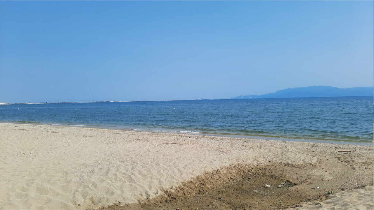
Песок, вода и вид

Нормальный песок, без мусора. Вода тёплая, но после чистая только утром и в обед. Виднееться остров Тафос. Сам вид

Транспорт и парковка

See full entry

Location: Ακόντισμα, Неа-Карвали, Δήμος Καβάλας, периферийная единица Кавала, периферия Восточная Македония и Фракия, Македония и Фракия, 640 06, Греция
Posted by rphyrin on 31 August 2026 in English. Last updated on 3 September 2026.

According to my personal schedule, I was supposed to attend the Guadeloupe room at around 14:50, for a talk titled “State of Panoramax.”

But in reality, the opening speech was still continuing at least until 15:02, and I had to sign out at 15:16.

I managed to finally come back at around 15:56, but by that time, the Guadeloupe room was already empty.

I managed to access the “traces of discussion about the talk” that were still left behind in the Venueless chatbox.

Someone asked this question at 15:21: “Question for Panoramax: What’s your take on privacy. Even with blurring, by having people take photos across a wide time range, AI will be able to deduct when someone was at home, where certain cars were parked and so on, revealing lots of personal info. Is that a good thing that we want to support?”


I have known Panoramax for a long time.

While editing WeeklyOSM’s entries, I frequently received news about their releases and updates. I also happened to learn about updates regarding Baba, a mobile app for contributing to the Panoramax project, because of my activity with WeeklyOSM.

But recently, I finally installed Baba and uploaded photos to Panoramax for the first time, thanks to someone’s suggestion on c.osm.org. I documented the whole train of thought behind this decision in this Mastodon thread.

The real reason was my realization that photographs uploaded through StreetComplete’s note feature are temporary and are going to be deleted soon. I wanted something similar, but permanent. Someone on c.osm.org – I forget who and in which thread – suggested using Panoramax instead. I tried it, and it worked.

Even so, at first, I had quite a hard time finding the right Panoramax instance, because most of them are limited to specific geographic regions, and my country is not listed.

See full entry

Posted by Evgeny Arbatov on 31 August 2026 in English.

Whenever I run, I carry a GPX device to track my route. Over time, I’ve collected a large set of personal GPX traces. It made me realize that this personal dataset isn’t particularly valuable when I look at individual traces, but it can be made useful once I’ve collected multiple traces over the same city neighborhood. The problem is that I have no idea where OSM ways are missing. This sounds like a great use case for aggregated personal data, because you tend to run the same streets most of the time. The basic idea is very simple: split GPX files into smaller segments, cluster them, and check whether each cluster maps to a known path or street in OSM. Then create an OSM extract for the new paths, along with the original GPX files, so that edits in JOSM are faster. It works! The slow part is making the edits, but at least you are aware of where OSM is incomplete in your neighborhood. The source code is on GitHub

Location: Khu phố 27, Phường An Khánh, Ho Chi Minh City, Vietnam

– Portuguese below  

DO THE RIGHT THING AND RECEIVE GOOD IN RETURN: THE ETERNAL CYCLE OF CONSTRUCTION


First Moment - That was the question: to attend in-person the SotM 2026 Paris or to support groups in Africa?

Around the same time that the organizers of State of the Map 2026 were offering early-bird tickets for the OpenStreetMap global community event, I was approached by groups of mappers from Africa, asking my company to support (as a sponsor) the initiatives they were planning, focusing in mapping features that were important to them and their community, based on their local realities.

So, rather than spending our resources on a sponsorship for the SotM 2026 event and attending in person in Paris, we decided to support three groups of young mappers from african countries: Cameroon, Kenya, and Ghana.

CityMapper Externship: Urban Street Level Mapping by the UN Maps Community Ambassador Initiative Cameroun - Link

UN Mappers Kenya Youth Climate Mapping Externship 2026 by the UN Maps Community Ambassador Initiative Kenya - Link1 and Link2

First 2026 mapathon by the YouthMappers UEW (Ghana) - Link 1 and Link 2

See full entry

Posted by rphyrin on 30 August 2026 in English. Last updated on 31 August 2026.

The first time I became aware of the very existence of the “State of the Map” event was, I think, around 2022.

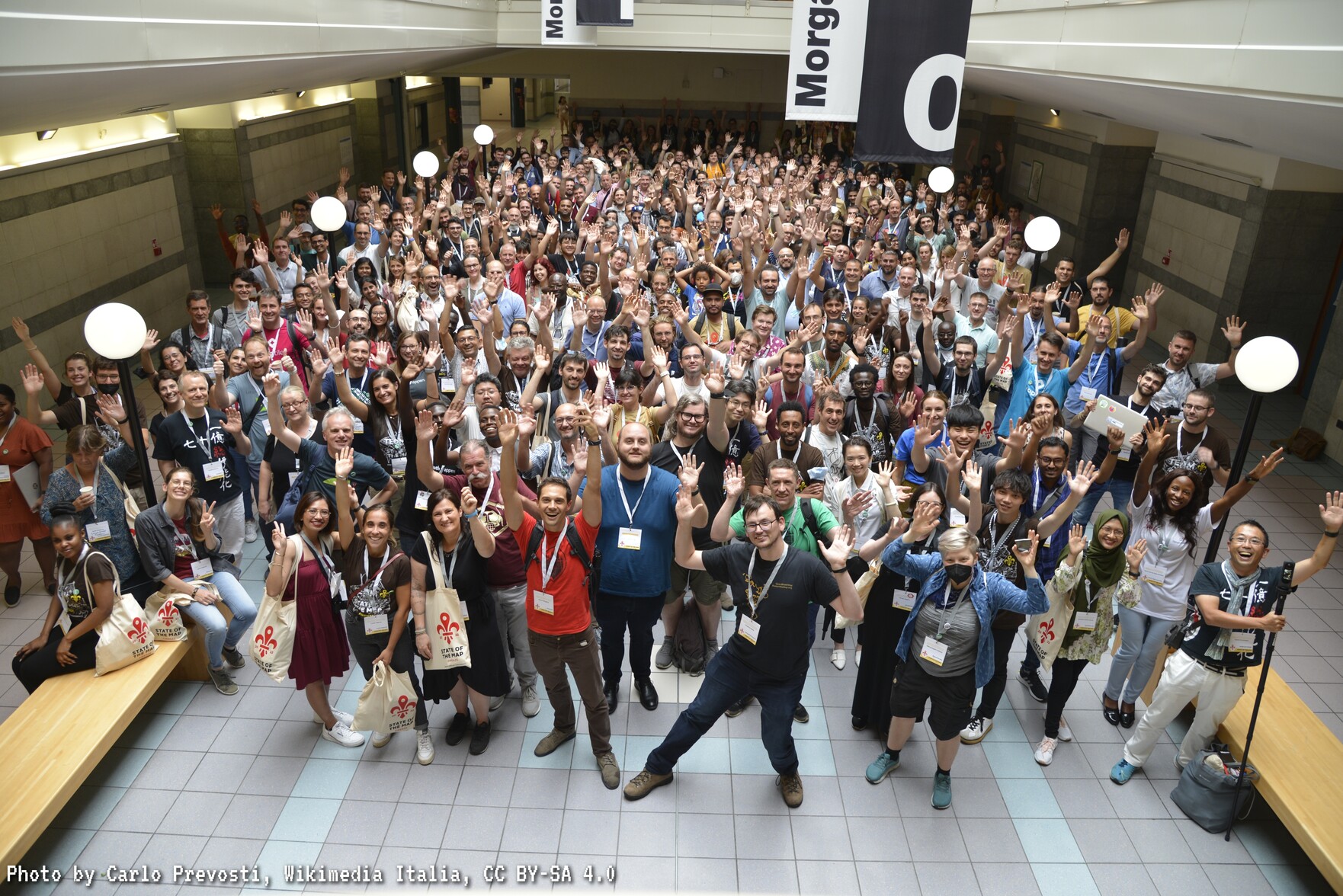
At that time, it was held in Italy. I think I heard about it somewhere online. All I remember is the group photo of the participants (there were plenty of people there) and the beautiful, cool-looking SotM 2022 logo.

That year, I had just recently graduated, so I could get involved in the OpenStreetMap movement more intensely than I had in the years before (before that, I usually only actively mapped during college holiday seasons. Once the holiday was over, I didn’t map anymore). That’s why at that time I started interacting with the community more, and eventually learned about this “State of the Map” event.

Even though I still don’t remember exactly where I first received the news about the event.

At that time, my first reaction was, “I don’t think I’m able to commute farther than either Jakarta or Bandung.” So, back then, I thought, “I don’t think I’m able to visit Italy.”


Fast-forward to after 2022. I gave several technical and/or philosophical talks about OSM sporadically, mostly online. From a technical standpoint, I talked about things like “how to map,” “how to use this particular tool,” or “introducing a tool that I recently built.” From a philosophical standpoint, I talked about ideas and dreams about “how the OSM platform should evolve in the future,” “how we should organize the people in the OSM movement,” etc., etc.

I finally had a chance to attend an OSM-related meeting physically, rather than online, for the first time around 2025. In this case, it was still within the boundaries that I had defined back in 2022 (Jakarta), so I was able to go.

See full entry

Posted by Blausand on 29 August 2026 in German (Deutsch).

(english below)

JugoTour 26

Am 1.Juli 2026 bin ich zum 20. Mal zu einer kontinentalen Fernradreise aufgebrochen. Dieses Jahr ging es endlich daran, den weißen Fleck auf meiner persönlichen Karte zu füllen: Ich hatte mich noch nie tief in den Balkan getraut. Auch wenn meine Reise 2001 von Israel nach Ägypten und zurück politisch aufregend und fern der EU war, so ist das doch schon fünfundzwanzig Jahre her und die Grenzübertritte im ehemaligen Jugoslawien jedesmal begleitet von einem gewissen thrill: Wird jetzt alles ganz anders sein?
Das Nebeneinander von Islam und Christentum war spannend zu sehen; sehr eindrücklich war auch, die Christen als historische Aggressoren und die muslimischen Gebiete als deutlich entspanntere Gesellschaft zu erleben.

Fokus auf Städte

Ich bin meinem Habitus treu geblieben, eine Perlenschnur durch die Hauptstädte zu fahren und sich nicht aus Liebe zur Natur auf besondere Abwege zu begeben. Trotzdem bekam ich natürlich geologisch allerhand zu staunen. Für die Anreise nach Klagenfurt buchte ich ein Zugticket nach Villach, für die Heimreise bekam ich über Flixbus einen Fernreisebus von HAK gebucht, der mich für 120€ in einem Rutsch mit Fahrrad bis Köln brachte.

Dauer und Übernachtungen

Die Tour mit kleinem Zelt dauerte drei Wochen; übernachtet habe ich meist abseits der Siedlungen, manchmal aber auch in AirB’n’B (Sarajevo) oder privat indoor (z.B. in Skopje), wenn ich spontan abends dazu eingeladen wurde, was häufig vorkam.

Location: Witternitz, Welzenegg, St. Peter, Gottesbichl, Klagenfurt am Wörthersee, Kärnten, 9020, Österreich
Posted by silversurfer83 on 29 August 2026 in English. Last updated on 31 August 2026.

Bonjour, as our gracious hosts like to say.

The French community, together with the university, put together a fun experience. Keep in mind that this is my first (larger) OSM gathering of any type.

As an longtime inhabitant of the forum at c.osm.org I already read a few views on different types of members of our actually very diverse community. While there are quite some typical German Mappers on OSM (mapping away without ever interacting and kinda thinking of OSM as their personal project) there are so many different people out there working with and for OSM.

To all those “brickheads” out there: There’s so much more out there than just your personal interest!

In this first installment of my random musings I’ll just leave a link to a good talk I saw on day one that touches some frequent points of concern:

https://2026.stateofthemap.org/sessions/3GRKKJ/

To all you people in Paris: See you around :)

Location: Cité Descartes, Champs-sur-Marne, Torcy, Seine-et-Marne, Ile-de-France, Metropolitan France, 77420, France

on 25/8/26, we were a combination of bored enough and annoyed enough to start cleaning up the metadata of german railway stations, so as the track numbers actually appear in clients such as OpenRailwayMap (ORM) ((which we use regularly))

today we are going to formalize the process, also so that our commit history is less tedious to write

anything we do which is to further the purpose of creating a basic standard of german railway OSM cartography will be simply marked as “DMC - [bahnhofname]”

and further, in almost every case unless otherwise specified, our information comes from the database within Bahnhof.de supplied by the Deutsche Bahn, and our own knowledge from living within and travelling across germany