
-
Users' Diaries
Recent diary entries
Posted by Jiri Podhorecky on 27 May 2025 in Czech (Česky).

V únoru 2025 byla vyhlášena nová přírodní památka Ptačí hrádek u Českého Krumlova. Tato lokalita o rozloze 24 hektarů zahrnuje lesní porosty s bohatou druhovou skladbou bylin, včetně chráněných druhů. Ptačí hrádek je také místem nedokončeného památníku z 19. století, který měl oslavovat vítězství spojeneckých armád nad Napoleonem v bitvě u Lipska.(EnviWeb.cz, Wikipedie)
Přírodní památka
Lokalita Ptačí hrádek je významná svými lesními ekosystémy, které zahrnují skalní výstupy na příkrých svazích se silikátovým podložím. Tyto biotopy jsou domovem pro řadu vzácných a chráněných druhů rostlin a živočichů. Ochrana této oblasti je důležitá pro zachování biologické rozmanitosti regionu. (Životní prostředí Jihočeského kraje)
Historie památníku
Památník, známý jako Ptačí hrádek, byl plánován jako monument na počest Karla Filipa ze Schwarzenbergu, který velel spojeneckým vojskům v bitvě u Lipska v roce 1813. Stavbu navrhl architekt Jan Sallaba, ale kvůli nedostatku financí byla dokončena pouze část stavby. Památník se nachází západně od zámku Český Krumlov a je považován za cennou ukázku klasicistní architektury. (Wikipedie, Zámek Český Krumlov, Památkový Katalog)
Technická zajímavost: Vodotrysk
V blízkosti Ptačího hrádku se nachází zbytky historické vodní nádrže, známé jako “U Vodotrysku”. Tato nádrž sloužila k přečerpávání vody z říčky Polečnice pro zásobování vodních děl a fontán v zámecké zahradě. Přestože samotný vodotrysk se nedochoval, místo zůstává technickou zajímavostí a připomínkou historického inženýrství. (Jižní Čechy, Český Krumlov)
Jak se tam dostanete
Ptačí hrádek je přístupný po zelené turistické značce ze zámecké zahrady v Českém Krumlově. Cesta je nenáročná a vhodná pro pěší výletníky. Během procházky si můžete vychutnat výhledy na město a okolní krajinu. (Jižní Čechy)
Posted by Graeme Herbert on 26 May 2025 in English.
El Gran Apagón
Many people around the world will have heard about the serious power outage that Spain and Portugal had a few weeks ago, as the power grid for almost the whole of the two countries failed for the best part of the day. I know, first world problems for those who live in countries where electricity network failures (or even availability) are still a regular feature of daily life. But the event was still a useful wake-up call on just how dependent we have become on that network for so much of our daily activity, not least because the outage also left people with very limited or non-existent mobile phone and internet coverage.
The blackout happened in the middle of the day when a large part of the adult population was at work, getting home for those whose journey depends on electrified train or underground Metro services turned into a problem for so many. With bus transport and other road transport services overwhelmed by demand the only solution for a lot of people will have been a perhaps unfamiliar walk through a large city like Madrid or Barcelona. And then we get back to the collapse in the mobile telephone network, those mapping services that so many instinctively use for navigation were suddenly just as unavailable as anything else dependent on the internet.

NOTE: I am in the DeFlock discord server. If you see any issues on Flock cameras or similar, or would like a second set of eyes in the Greater Gadsden area, ping me (I’m <@997714796537450597>) in the server, or contact me on any of my available platforms on my profile.
I have added: 1. changeset/166784827 2. changeset/164790735 3. changeset/163818346 4. changeset/159052678 So far.
I have noticed someone whether it be human or bot modifying and taking ownership of my points. If this has been noticed, please alert me immediately.

On April 26 and 27, I had the opportunity to share my experiences with YouthMappers Universitas Negeri Jakarta (UNJ) about how to contribute to the Mapillary platform.
for your information, mapilary is very helpful for open mapping activities such as openstreetmap, especially for validating road data because in reality open mappers must use all open sources and mapilary is one of the platforms for that.
in this activity i have provided information and simple techniques on how to collect street level imagery on narrow streets of jakarta using motorbikes and smartphones. YM UNJ has plans to create open mapping activities on openstreetmap and also mapilary.
This Mapillary activity is very helpful for other mappers to map areas that are still not perfectly mapped and do not have street level imagery data for validation.
more info check to this link MapilaryTraining

Recently, someone asked me to create a custom MapCSS style for JOSM that visually indicates how “fresh” OSM objects are—essentially, a way to distinguish recently updated or created objects from older ones at a glance.
Digging into the JOSM MapCSS implementation, especially the eval expression support, I realized this was very doable.
The Basic Idea
The approach is pretty straightforward. Each OSM object has a timestamp field (typically stored as a Unix timestamp). By comparing this timestamp to a reference timestamp (say, representing the current year—2025 in this case), we can calculate how “old” an object is.
So I hardcoded a reference timestamp for 2025, subtracted the OSM timestamp from it, and divided the result by the number of seconds in a year (ignoring leap years for simplicity). This gives us a rough “age” of the object in years.
Posted by Malle_Yeno on 25 May 2025 in English.
I’ve recently been taking on more tagging for wheelchair accessibility in my neighbourhood. It’s been one of those “you don’t see it until you think to look for it” kinds of things. I’m not disabled myself, so I never thought to consider the heights of steps (until I tripped on them.) Now that I look for them, I must freak out other people around me as they see me stare at my foot to see whether a step is ankle high or not.
There were a couple things I came to think about while mapping that I could not seem to find answers for in the wiki. A lot of the time, I just answer the question with the framework of “I’ve seen places do these things, so I will treat them as the standard and anything that falls under that bar is limited or not accessible.” I would be curious for others thoughts on them.
- Do establishments need powered doors to be accessible?
Here in Regina (and a lot of Canada, these were extremely common back in Ontario), doors have buttons that you can press to swing the door open mechanically. They have a wheelchair icon on them most of the time, so they are clearly marked as an accessibility feature.
While common, they are not ubiquitous. In my mapping practice, if a place does not have at least one powered door, I label it as limited wheelchair accessibility at maximum. My logic is that even if a door could be physically be opened manually by a patron in a wheelchair (as in, they can open the door and have enough space on the platform outside to maneuver while doing it – I have seen places where the platform is elevated and small enough that you would fall off trying to do so), they shouldn’t have to do that while the option of powered doors exists.

bin der hier!
Posted by Kanoxitu_zh on 25 May 2025 in Chinese (China) (中文(中国大陆)).
本人决定开始河北易县下辖所有镇landuse及10级行政区划补充计划,暂无截止时间,望周知。 计划名:Baoding Integrated Land Survey Project,Bilsp(比尔斯普) 预计是本人自吉安峡江县后规模最大,时间最久的一次测绘计划。数据主要来源于保定市人民政府公开的国土规划文件,百度,高德,天地图等平台,并根据主观判断合理纠偏。 (考虑到本人只能周六,周日上线,时间跨度可能较大)
Posted by Noman Bin Hossain on 24 May 2025 in English.
Successful Open Field Mapping Activity Led by YouthMappers at Eastern University, Bangladesh President Noman Bin Hossain.
On May 16, 2025, YouthMappers at Eastern University, Bangladesh successfully conducted an Open Field Mapping activity using Mapillary, a platform for crowdsourced street-level imagery. The initiative took place in Ashulia Model Town, Savar, and was led by our club president, Noman Bin Hossain.
This field event focused on capturing and uploading street-level imagery to support the enhancement of geospatial dataand promote accessibility of real-world visuals for map editing, disaster response, urban planning, and community development.
📍 Location: Road 6, Block B, Ashulia Model Town, Khagan, Birulia, Savar, Dhaka 📅 Date: May 16, 2025 🛠️ Tool Used: Mapillary 🔗 Captured Imagery: Mapillary

فکر کنم؟
الانم میخوام رندوم ببافم برم
نقشه ویرایش کردن مخصوصا POI ها که فایده نداره (ایران رو میگم مشخصاً یا کلا جایی که نقشه های بومی بهتر عمل میکنن)
خیابون ها شاید یکم بدرد بخوره، اونم کمتر پیش میاد الان حتی تغیرات بزرگ دادن مفید نیست تو اپن استریت مپ اساساً ، هر چند وقت یکبار جوگیر میشم یه کارایی میکنم ولی بعد دوباره متوجه میشم که فایده ایی نداره قبل ازینکه نقشه اتوبوس توسط شهرداری اصفهان کامل و جامع بشه، ۲ ۳ تا خط رو انجام دادم بخش اصلی کارش رو،الان همونم فایده ایی نداره
ماشاالله کیفیت تصویر ماهواره ایی هم در حد پشمکه، مگر جایی که دقت خیلی مهم نباشه ، مثلا میخوای محدوده یه فضای سبز رو مشخص کنی و اینجور حرفا ، این چند سال اخیر یکم بهتر شده ولی خب چه فایده (یادآوری مجدد که کشور خودمون رو میگم)
و کلی موارد دیگه که به ذهنم نمیرسه به قول گفتنی “جمع کن برو بابا “ 😆😆 مشخصاً با خودم هستم
پیغام پسغام:
میبینم که تکس ادیتور این اپ استریت مپ هنوزم هم بده برای نوشتن این جور چیزا یا مثلا کامنت میکس فارسی انگلیسی، این یارو مارک دان اپن استریت هم که خیلی بدرد درست کردن راست به چپ چ اینا نمیخوره ، مگر اینکه بخوای از ویژگی لینک استفاده کنی، که هدایت شن بقیه به یه جا که متنت قالب بندی و چینش ش درسته
Posted by umbraosmbr on 24 May 2025 in Portuguese (Português).

🗺️ Gravatá, PE está sendo mapeada com dados do Open Google Buildings!
🏘️A UMBraOSM está coordenando uma ação de mapeamento colaborativo em Gravatá, Pernambuco, usando os dados do projeto Open Buildings, disponibilizados pela Google sob uma licença compatível com o OpenStreetMap.
Essa iniciativa está atualizando o mapa da cidade com as edificações detectadas automaticamente, acelerando o processo de mapeamento e tornando as informações mais acessíveis e úteis para todos. Gravatá se junta a outras cidades brasileiras que estão sendo mapeadas com base nesses dados — e mostra que é possível mapear qualquer município do Brasil com qualidade e colaboração!
🔗 Participe do projeto no Tasking Manager da HOTOSM: https://tasks.hotosm.org/projects/20008
📬 Quer tirar dúvidas ou saber como contribuir? Fale com a gente pelo e-mail contato@umbraosm.com.br ou entre na comunidade brasileira no Telegram: 👉 t.me/OSMBrasil_Comunidade
Vamos juntos construir um Brasil mais bem mapeado! 🧭🇧🇷
Posted by umbraosmbr on 24 May 2025 in Portuguese (Português).

🚀 A menor cidade do Brasil no OpenStreetMap! 🗺
A UMBraOSM acaba de lançar um projeto na plataforma do Tasking Manager da HOTOSM para mapear Serra da Saudade (MG) — a cidade com a menor população do Brasil — usando dados do Open Google Buildings! 🏘✨
🔍 O projeto está disponível em: 🔗https://tasks.hotosm.org/projects/20994
Com essa iniciativa, mostramos que é possível mapear qualquer cidade brasileira com os dados abertos e de alta qualidade disponibilizados pelo Google. A licença do projeto permite o uso desses dados no OpenStreetMap, facilitando e acelerando o mapeamento colaborativo de edificações em todo o país.
💡 Quer ajudar? 📩 Fale com a gente: contato@umbraosm.com.br 💬 Ou entre na comunidade brasileira no Telegram: https://t.me/OSMBrasil_Comunidade
Vamos juntos fortalecer o mapa livre do Brasil, uma cidade de cada vez! 🇧🇷🧭
hashtag#OpenStreetMap hashtag#UMBraOSM hashtag#MapeamentoColaborativo hashtag#GoogleOpenBuildin

خريطه خرفيه صغير في عام 1975
Posted by Archit Rathod on 24 May 2025 in English.
Last updated on 30 May 2025.
Introduction
Hi everyone! I’m Archit Rathod, a Computer Science Master’s student at the University of Illinois Chicago and a passionate open-source contributor. My interests lie at the intersection of geospatial technologies, backend systems, and applied machine learning. Over the years, I’ve built full-stack web platforms, worked on real-time traffic modeling, and contributed to research in social networks and AI ethics.
This summer, I’m thrilled to be a Google Summer of Code 2025 contributor with OpenStreetMap, where I’ll be building a system to make navigation smarter and safer through real-time road closure data. I’m deeply grateful to the OSM community and my mentors for this opportunity, and I’m excited to learn, collaborate, and give back.
Project Description: Temporary Road Closures Database and API
OpenStreetMap provides excellent static map data, but temporary road closures, like construction, accidents, or local events, are often missing or delayed. This project addresses that gap.
I’m developing a centralized platform for real-time road closures. Key features include:
- A geospatial database using PostgreSQL/PostGIS for efficient closure storage and queries.
- A RESTful API using FastAPI, with outputs in OpenLR format for location referencing.
- A web-based UI for users to submit and view closures on a live map.
- A prototype integration with OsmAnd, showcasing how routing can dynamically adapt to avoid closed roads.
The goal is to have a fully working, open-source prototype by the end of the summer that enables OSM apps to respond to temporary disruptions, making navigation more reliable for everyone.
Weekly Progress Report
Coming Soon….
Contact Me
Feel free to reach out — I’d love to connect!
- 📍 Location: Chicago, IL, USA
- 📧 Email: architrathod77@gmail.com
- 🌐 Portfolio: archit-rathod.vercel.app
- 💼 LinkedIn: linkedin.com/in/archit-rathod
- 💻 GitHub: github.com/Archit1706
Interessantes Projekt
neu hier
Grüße gehen raus 😊😊
While editing the next edition of WeeklyOSM, I stumbled upon a fascinating case study that caught my full attention.
A certain team, responding to a certain request, set out to display a mobile device’s geolocation on a map—completely offline, without any network access.
Their initial approach? Crawling OpenStreetMap tile images one by one and storing them locally.
It didn’t take long before they hit a wall: the data size exploded, and keeping the tiles up-to-date turned into a maintenance nightmare. Sensibly, they scrapped that plan.
Next, they evaluated two open-source tools: tileserver-gl (JavaScript) and mbtileserver (Go).
In the end, they opted for mbtileserver, citing Go’s “security” over JavaScript. I still don’t fully grasp that reasoning (somehow, it involves a decision between verifying their own source code and verifying the entire JavaScript interpreter), and I even asked them in the comments section. But for now, let’s accept that as a given and move on.
After choosing mbtileserver, they needed MBTiles files to serve. Eventually, they discovered tilemaker, a tool that converts .osm.pbf files into .mbtiles.
They successfully tested it on a small area. Encouraged, they moved on to larger datasets. Then came the pain.
“…half an hour passes, and we experience a computer freeze as all the RAM runs out.”
Their machine couldn’t handle the memory load. So they requested a beefy VM—256 GB of RAM—and tried again. Still no luck.
That’s when they discovered tilemaker’s --store option, which dumps intermediate stages to disk instead of holding everything in RAM. That tweak made it work.
Creating an offline, custom OSM map has been my white whale for years. So I decided to replicate their setup on my own desktop.
I began with installing mbtileserver. That’s when I hit this cryptic error:
cc1.exe: sorry, unimplemented: 64-bit mode not compiled in
Quick Overview/Summary
It’s been a year since my last diary entry on this, and I haven’t done too much (I don’t think) in that timeframe. The GIF below should give a good idea of the progress made. Unfortunately, a couple of the changes made in the bottom left corner haven’t been rendered yet.

What’s changed?
I’m still pushing through and adding buildings, or adjusting existing ones. There does seem to be someone else working here every now and then, as I had some of my changes deleted/modified (although I’m not sure of the reason, as the changeset description is not great).
More recently, I have been trying to add in more landuse=* as there is next to none currently. This is still a challenge, though, as so much has changed in 7 years that you’d need an on-the-ground survey or a local to confirm if certain buildings are shops or not.
Plan Going Forward
Posted by KhubsuratInsaan on 23 May 2025 in English.
Last updated on 15 July 2025.
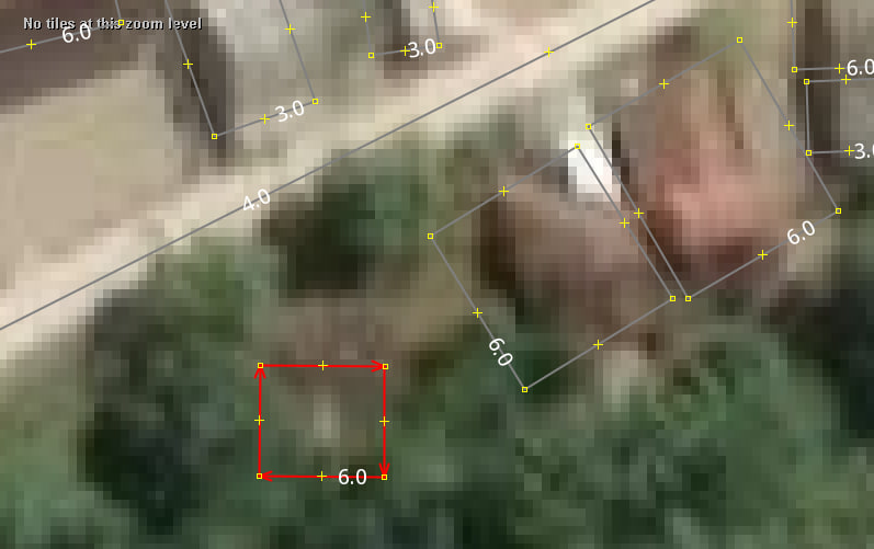
I have a craze for adding addresses to OSM. Unfortunately, in Delhi it is ridiculously hard to find a place with addresses properly displayed on the front. If you come across a house with no nameplate on it, you can be almost sure to not guess the correct house number.
This irks me a lot. So, I have decided to look for guide maps made by the locals while travelling around the city, and use those to map the neighbourhoods. I have got some nice pictures, which I have uploaded to my commons profile.
Here’s one I recently clicked. The amount of detail really supplements my survey a lot.

This diary entry is licensed under CC BY-NC-SA 4.0.

品牌內容細節有錯誤或修正需求, 在name suggestion index的Github修改, 可直接修改儲存為Fork分支,提issue後待審核即會更正。