
A hamlet in OpenStreetMap is, according to the wiki, “A smaller rural community, typically with fewer than 100-200 inhabitants, and little infrastructure.”. It is smaller than a village but larger than an isolated_dwelling. So, basically, it’s a very small rural town.
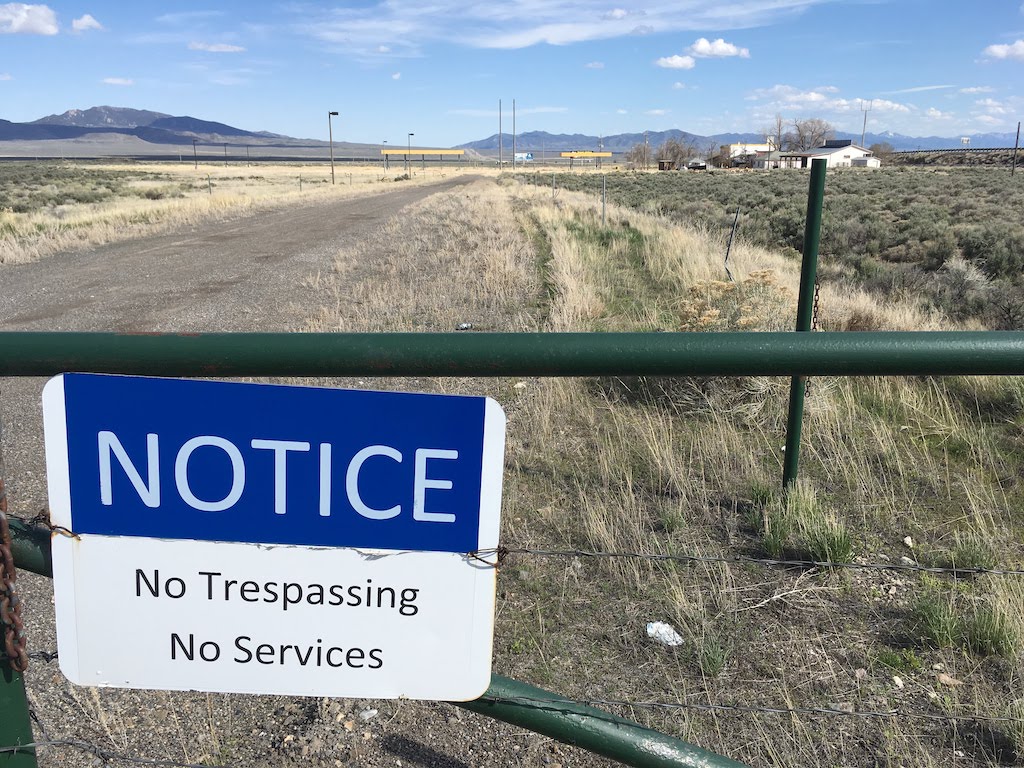
Oasis, Nevada. A hamlet in OSM.
According to OpenStreetMap, there are around 750 hamlets in Utah. I know we have a lot of small rural towns but I am not buying that it’s that many. Let’s have a look.
It turns out that all but 20 of the Utah ‘hamlets’ are the result of a poorly documented 2008 import of GNIS points. (There may be more changesets related to this import.) 500 of them have not been touched at all by human mappers since then.

The GNIS import failed to recognize some significant limitations in the GNIS source data:
- Many of the GNIS ‘Populated Places’ are not in fact populated. They should be a
place=localityin OSM. - There are many urban and suburban ‘Populated Place’ points in GNIS that don’t seem to point to anything locally know by that name.
Any ideas about how to clean this up? Are these patterns present in all states? Do different patterns exist in other places?
Discussion
Comment from Minh Nguyen on 30 April 2019 at 19:13
There’s some previous discussion in this diary entry from 2015.
In urban and suburban areas, these hamlets are more often then not neighborhoods (
place=neighbourhoodorplace=suburb), subdivisions (landuse=residential), apartment complexes (landuse=residentialresidential=apartments), or mobile home parks (landuse=residentialresidential=mobile).The patterns do vary from state to state, because GNIS uses different sources in each state and for different kinds of POIs. Some of these sources are over a century old; others are quite recent. The USGS just redesigned their website; unfortunately, it looks like the Geonames domestic names search engine is offline. Otherwise, you’d be able to search for individual features to get an idea for the kinds of sources used in Utah.
Comment from Carnildo on 30 April 2019 at 22:48
I know what you shouldn’t do: MapRoulette. I’m still dealing with the aftermath of a MapRoulette “cleanup” of TIGER roads in Eastern Washington.
Proper cleanup will require research and probably local knowledge to tell the localities from the ghost towns from the (former) railway stops from the trailer parks from the unincorporated communities. All in all, far more effort than the average MapRoulette user is willing to put forth.
Comment from mvexel on 30 April 2019 at 23:26
Carnildo – I think MapRoulette users can be educated / directed to be more careful. A lot of it is in the quality of the instruction, adding the proper links / warnings / caveats. I am sorry if it has caused trouble for your local area before. (Speaking as the maintainer of MapRoulette.) In the future (or even now if the challenge still exists) feel free to contact the challenge owner / author to let them know that you’re unhappy with the work mappers are doing based on their challenge.
I did actually work on a hopefully thoughtfully formulated MapRoulette challenge related to the topic of this entry, and I would appreciate some feedback on the instruction and description, especially from a MapRoulette sceptic like yourself :)
Comment from Carnildo on 1 May 2019 at 02:46
You’ve got considerably more faith in peoples’ willingness to read than I do.
On the surface, your challenge looks like something that any armchair mapper could clear out in an hour or two. My expectation is that if you open it to the general userbase, someone will come along and see a nice, easy task, and proceed to pump up their leaderboard score, completely overlooking the bit about “locals only”.
Comment from Minh Nguyen on 14 May 2019 at 18:07
The GNIS search engine is back online. For example,
gnis:id=1449908yields an entry from 1989 with this citation:Most of the rural places in your query come from USGS topo maps, though: