OpenStreetMap logo OpenStreetMap

TrickyFoxy's Diary

Recent diary entries

better-osm-org 0.8: ⚡️📸🏃‍♂️💬🫂🛰⌨️

Posted by TrickyFoxy on 31 January 2025 in English. Last updated on 2 February 2025.

Today I will talk about the new version 0.8 of userscript that adds several useful features to osm.org.

You can view existing features of the script and install it on GitHub or in the OSM Wiki

⚡️ Faster rendering

My first PR was merged to openstreetmap-website code, and now the Map Data layer loads instantly. Be sure to try it. Thanks to the maintainers for help!

For the script, this means a huge acceleration in rendering large relations and GPS tracks (yes, tracks, read more!):

icon 👥 near relations is clickable 😉

📸 Photos from Panoramax, StreetComplete, Wikipedia Commons

Now they are displayed directly on the website. In notes, in tag history, and in changesets.

🏃‍♂️ Rendering of GPS tracks

Finally, by opening the starting coordinate of the track, you will be able to see the entire GPX track on the map:

Let me remind you that the Z key allows you to fit an object on the screen.

The track is also drawn when opening notes from StreetComplete

The rendering of tracks is still very simple, if you have any examples of successful visualizations, please share them.

💬 Comments on changesets

Now you don’t have to open the changesets to understand if there is an interesting discussion or if this is another revert of vandalism.

by the way, long links like *.openstreetmap.org replaced by *.osm.org

🫂 Edits of friends

upd: this feature was recently renamed to Followings. Now there are no friends in OSM (:

Did you know that OSM has a friends feature? You can even follow their edits here: https://osm.org/history/friends

better-osm-org can now filter changesets on this page. The script also tries to show around the username that it’s your friend.

Let’s be friends :) https://osm.org/user/TrickyFoxy/follow

🛰 Satellite image Switch (Firefox only)

Satellite images could be switched using the S key, or using the button on the side of the note. But what about Firefox for Android? And how do I find out about S? Now there is a button in the right panel for this.

Pressing the Shift key will show you the ESRI Beta images. But be patient, because they take longer to load.

📄 Experimental files viewer for geotagged photos, .gpx and .geojson files

If we can now quickly render data, then why not be able to open it from files? Just drag them onto the map:

p.s. for now, it’s more of a PoC, feel free to suggest your ideas.

⌨️ Hotkeys

Where without them? :)

  • ` — hide the geometry of the changeset from the map
  • T — toggle between compact and full tags diff mode
  • F — filter changesets
  • Hotkeys on user profile Page (H — user changesets history, T — tracks, D — Diary, C — comments, N — notes)
  • U — open user profile from changeset, note, …
  • Shift + U — open your profile

By the way, do you know about the new feature of the site? https://www.openstreetmap.org/user/SomeoneElse/changeset_comments


As well as about the previous versions that I wrote about on the forum.

v0.7: 📝 Templates for comments on changesets and notes

so that you have the necessary link from the wiki at hand:) Buttons for commenting on changeset will only add text to the input field, without submitting.

🔍 In the list of relation members, you can now see ways on the map

In order not to clutter the map, relations are shown only on hover. Now the relation can be pinned.

Other

  • shift + Z to zoom to bbox without taking into account relations
  • Q key to close the sidebar
  • C key open changeset from object version
  • In the settings, you can enable overzoom for the Map Data layer

0.6.1: ⏬ Display intermediate versions for ways

Now, when you click ⏬ on the way history page, all changes will be displayed, including in the tags and coordinates of nodes of the way

If there are too many versions, you will see the versions filter. The K/L combination also works, but I recommend you try it ScrollAnywhere to navigate through the map with the middle mouse button

⚠️ there may be problems if some nodes are hidden by moderators.

Other

  • When you hover over the tag table, the number of tags is now displayed
  • Improved HDYC colors in the user profile (thanks @LouisXIV)
  • Fixing the color of human-readable wikidata extension cells in a dark theme
  • More tooltips
  • A small Easter egg. Try to find a New Year’s tree in your city (or map it!) (It’s open only on New Year’s holidays)

v0.5.7: 🔦 Dark theme for iD

⚔️ Edits wars detector

example

#️⃣ Clickable hashtags in comment of changesets

https://taginfo.openstreetmap.org/relations/waterway#roles https://taginfo.openstreetmap.org/reports/key_lengths#keys

p.s. The script also fixes broken links to Overpass Turbo on https://taginfo.geofabrik.de, if there is a space in the country or region name.

👁 Redactions bypass

Bypass Redactions (so far only tags) (even for edits before 2012! Data that is hidden is uploaded to GitHub https://github.com/deevroman/better-osm-org/issues/54

↩️ Shift+click for revert via JOSM. And clickable IDs in comments:

⌨️ New hotkeys:

  • shift + L — go to your location
  • shift + N — create new note (if some object was opened, his link wound prefilled in note text)

https://github.com/deevroman/better-osm-org/

better-osm-org v0.5

Posted by TrickyFoxy on 26 September 2024 in English. Last updated on 6 October 2024.

Visualization of changesets, dis/likes, more hotkeys and viewing old versions of map objects

🖼 Visualization of changesets

Previously, you could only view changes in tags and only minor changesets. Now you can see objects that have been changed, and pagination is removed whenever possible:

  • Directly on osm.org
  • 😎 OSM API only →
  • you can watch even a few seconds after loading
  • independence from Overpass API and OSMCha

Be sure to explore the interface 😉 Many elements can be clicked (even twice :)

⚠️ Limitations:

  • I call it QuickLook for a reason, because not all changes can be displayed
  • large relations must be loaded manually and via the Overpass API
  • sometimes objects may not be displayed - you may need to reload the tab
  • in case of problems, you can disable the visualization of changesets in the settings

👍 👎 (Dis)likes

OSMCha has long praised the mapper for useful edits. Or warn about vandalism. But now you can do it directly without leaving osm.org.

⌨️ Hotkeys

But what if you can’t do without OSMCha?

Press O! Or shift + O to open Achavi

Last update added all two keyboard shortcuts. I’m fixing this sadness:

  • D — open Map data layer
  • N — show notes
  • G — GPX tracks
  • S — ESRI satellite imagery (Firefox only)
  • shift + S — ESRI Beta

  • E — open your default editor
  • shift + E — open the remaining editor

  • , / . — move between user edits or object versions

  • 1 — Open the first version of the map item
  • H — open the item’s history or recent changesets

  • 8, 9 — for JOSM fans, move to the previous page/next position on the map
  • Z — navigate to the current object (as in iD)
  • 0 — moves the map to a global zoom

🏺 Objects history

On the map item history page, you can now load the old version of the map item.

Install: https://github.com/deevroman/better-osm-org

P.S. Oh yes, I forgot

Better-osm-org for watchmans

Posted by TrickyFoxy on 25 June 2024 in English. Last updated on 9 July 2024.

In new version of userscript, I focused on analyzing edits. QuickLook for changesets, hotkeys, filtering changesets, mass actions and more.

I wonder how well this phenomenon is known in the world 🤔

Help wanted: I would be grateful if someone knows how to get into the site code and manage the map (add new objects, change layers, colors …) This would make it much easier for new features to appear. Otherwise, they will only be available in OSM-NG (: upd: solution found!

👮‍♂️ QuickLook of changes in tags

Now you don’t need to open OSMCha for simple changesets. Tag changes will be visible directly on the changeset page.

Now you can easily check edits that are the size of a whole world:

The extension will also show whether there have been changes to the geometry and whether the objects made by the user still exist

But what if you need to check a lot of edits from the StreetComplete user? Now you can use Alt + ←/→ to navigate between user edits!

🗂️ Filtering changesets

Tired of that osm.org/history spammed with big edits? Now you can hide large edits. Or filter them by user and comment.

And yes, now you don’t have to click Load More many times

🌪 Mass actions

Have you ever encountered a situation where you need to cancel a MAPS.ME user edits? Now it’s easy to do.

❗️ Do not engage in rollbacks of mass automatic vandalism! This will quickly make DWGs and manual rollbacks will make it harder for them to work ❗️

🪪 Highlighting moderators and blocked users

To reduce your worries about vandalism, the list of recent changesets highlights the accounts of moderators, blocked users and beginners.

🕵️ Search for deleted account usernames

The Internet remembers everything. OpenStreetMap is no exception.

Other

  • The settings menu now works in Chromium, and the settings are divided into sections.
  • The script now supports Violentmonkey
  • The link to open the Rapid editor is more stable
  • External links in notes and comments open in a new tab

Install: https://github.com/deevroman/better-osm-org

Несколько улучшений для osm.org

Posted by TrickyFoxy on 6 May 2024 in Russian (Русский). Last updated on 12 May 2024.

Написал юзерскрипт для Tampermonkey, добавляющий несколько полезных мелочей:

  • Удалятель точек
  • Улучшенная работа с заметками
  • Компактная история объектов
  • HDYC в профиле пользователей
  • Компактная информации о правке
  • Кнопка отката

🔫 Удалятель точек

📝 Улучшенная работа с заметками

  1. При открытии заметок теперь вы можете включить спутниковые снимки
  2. Появилась кнопка с быстрым комментарием к заметке
  3. Появилась кнопка, которая с помощью Overpass показывает состояние карты на момент создания заметки
  4. Убирается мещающая оранжевая обводка около активной заметки

🕒 Компактная история объектов

  1. Показывает на странице истории только изменившиеся теги
  2. Скрывает версии без изменений и скрытые DWG

🪪 HDYC в профиле пользователей

Но только в Firefox и с отключением защиты от отслеживания

🔍 Компактное описание правки и кнопка отката

также компактнее стала вкладка История.


Как установить

  1. Установите расширение Tampermonkey
  2. После откройте файл со скриптом

p.s. Несмотря на то, что юзерскрипты должны работать в любых браузерах одинаково, Chrome отличился: спутниковые снимки и HDYC работать в нём не будут. Переходите на Firefox :)

p.p.s. Функции можно отключать в настройках скрипта, нажав на значок расширения

p.p.p.s. Вы можете использовать расширение в Firefox для Android

upd: в список редакторов добавлена ссылка на Rapid

English version

На последней встрече совет OSMF дал добро на внедрение новой версии OSM API. Полную стенограмму можно найти на вики. Краткое содержание:

🧐️️️️️️Валидация

Правки ломающие геометрию или топологию будут отклонятся, для некритичных ошибок будет API будет возвращать HTTP-статус 267 Doubtful But Okay

🛣 Новая модель данных

Для упрощения модели данных решено отказаться от типа Way. Отношения уже используются для мультиполигонов и могут хранить списки точек, что делает Way бессмысленным.

Такой подход также позволит описывать нелинейные геометрии, что выводит картографирование на абсолютно новый уровень 🚀

📃 Новый формат данных

На смену моральноустаревшему формату XML придёт человекочитаемый YAML. Это позвозит удобно редактировать карту в любом текстовом редакторе и изучать пакеты правок с помощью таких инструментов таких как git diff. Поддержка формата JSON останется.

👮‍♂️Премодерация

Правки новичков будут попадать в очередь премодерации. Одобрять правки сможет любой картограф, мапивший 42 дня за последний год. Избежать очереди можно будет оплатив членство в OSMF.

💵 Премиум-функции

Помимо отключения премодерации, картографы, оплачившие членство в OSMF, получат приоритет при обращении к DWG и OSMF. Длительность блокировок для премиум-картографов будет уменьшена вдвое.

💎 Новый cgimap

Текущая реализация cgimap, написанная на C++, не отвечает требованиям безопасности, поэтому будет переписана на Rust Ruby, на котором уже написана большая часть сайта.

At the last meeting, the OSMF board gave the go-ahead to implement a new version of the OSM API. The full transcript can be found on wiki. Summary:

🧐️️️️️️Validation

Edits that break the geometry or topology will be rejected; for non-critical errors the API will return an HTTP status 267 Doubtful But Okay

🛣 New data model

To simplify the data model, it was decided to abandon the Way type. Relations are already used for multipolygons and can store lists of points, which makes Way meaningless.

This approach will also allow us to describe nonlinear geometries, which takes mapping to a whole new level 🚀

📃 New data format

The obsolete XML format will be replaced by human-readable YAML. This allows you to conveniently edit the map in any text editor and study changesets using tools such as git diff. JSON format support will remain.

👮‍♂️Pre-moderation

New users’ edits will be included in the pre-moderation queue. Edits can be approved by any cartographer who has mapped 42 days in the last year. You can avoid the queue by paying for OSMF membership.

💵 Premium Features

In addition to disabling pre-moderation, cartographers who have paid for an OSMF membership will receive priority when accessing DWG and OSMF. The duration of blockages for premium cartographers will be halved.

💎 New cgimap

The current implementation of cgimap, written in C++, does not meet the security requirements, so it will be rewritten in Rust Ruby, which is already used for most of the site.

When AI is (not) needed

Posted by TrickyFoxy on 17 March 2024 in English.

Looking at the OSM map on website of the university:

Looking at photo:


I look at my yard in MapComplete, and there are some stalls on the road:

I look out the window (well, so that you can see it too, on yandex.panoramas):

You open Rapid and calm down: This is what the AI recognized. Everything is fine with OSM.

But the mapmakers took a wrong turn. Why do you need AI buildings in cities that are mapped by cartographers?!

But the mapmakers are happy with that. This is a long time ago Google with auto-recognition showed.

Смотришь на OSM-карту на сайте универа:

Смотришь на фотографию:


Смотришь на свой двор в MapComplete, а там ларьки какие-то на дороге стоят:

Смотришь в окно (ну а чтобы и вы увидели, на яндекс.панорамы):

Открываешь Rapid и успокаиваешься: это AI нараспознавал. С OSM всё в порядке.

А вот картоделы свернули куда-то не туда. Точнее их всё устраивает. Это давно гугл с автораспознаванием показал.

Disclaimer: I used changesets through August 2023 to calculate the statistics

  • 84% of changesets closed within a minute

  • 99.6% closed within two hours

Diagram of the distribution of changesets durations (count/duration in seconds):

The upper part is in the form of a table:

  • only 1201 were open for more than 12 hours

  • from 2020 to August 2023, only 53 more than 12 hours (of which 39 were made by wheelmap_visitor, 2 by StreetComplete, and the rest by JOSM).


Warning, question:

  • Are we sure we want to spend the whole day monitoring what the user does in their changeset?

OAuthtung!

Posted by TrickyFoxy on 29 January 2024 in English.

TL;DR I wrote a little extension for Firefox for script developers to get an OAuth token in a couple clicks


OSM will soon remove support for Basic Auth and OAuth 1.0.

The proposal is to use OAuth 2.0, which has a much worse UX for novice developers than Basic Auth.

To show that OAuth 2.0 can be made more convenient even than Basic Auth I made a Firefox extension to automatically get an OAuth token:

demo


A bit of technical details and emotion:

  • Works with any Redirect URI

  • We have a confidential OAuth applications. In order to use them, you need a user account. I.e. such applications are useless because you can’t do anything with only client_id and client_secret.

  • It follows that the client_secret parameter is useless. The extension, by the way, does not use it ¯\(ツ)

  • Did you know that you can specify multiple Redirect URIs? Guess what delimiter to use in the input field? And then how do you do authorization?

  • Did you know about the magic urn:ietf:wg:oauth:2.0:oob ?

  • And about the fact that without HTTPS you can only use 127.0.0.1?

There is somewhere on the wiki at the end of the page after the description of OAuth 1.0 and 2.0 about it…..

You couldn’t google it? You are a bad programmer! </sarcasm>

(!) It’s a draft written in Russian. I don’t like machine translation, so the English version needs to be worked on separately. (!) This material can cause conflicting feelings

Большие правки бесят. Но больше bbox-ов меня бесит реакция вахтёров на них. За три года я увидел лишь одну адекватную попытку бороться с проблемой… Но давайте по порядку.


Я бы разбил большие правки на:

Правки больших отношений/линий

Они неизбежны. Хорошая новость: таких объектов мало, а значит таких правок будет мало.

Правки пересекающие 180-ый меридиан

… возникают при откате этимологии массовых правках на территориях разделённых им. Или при редактировании объектов около него.

В осмовском bbox правая граница больше левой. А что если мы вспомним, что живём на шаре? Какую рамку мы бы хотели увидеть? Подсказка:

Ну не, переделывать bbox мы не хотим. А что если бы OSM API выставляло бы пакету правок тег с адекватным bbox? Тогда бы инструменты просмотра правок могли бы отбрасывать такие правки и они бы не мешалась.

Правки только тегов

Есть компания RocketData, которая занимается импортом POI и поддержанием их актуальности. Мечта! Но неет, сообщество это бесит. Лучше мы будем изучать тысячи маленьких правок. Удачи.

Наши инструменты для вахтёрства не позволяют нормально изучить такие правки. Делите пакеты правок, иначе забаним. Это же ведь проще чем написать нормальные инструменты.

Проблема не ограничивается рокетдатой. Есть ещё исправления опечаток, нормализация названий улиц и т.п. Я и сам вахтёрю и меня такие правки бесят. Почему?

  1. Потому что они засоряют https://osm.org/history А фильтров там никаких нет.

  2. Их сложно проверить. А ведь, эти правки даже не меняют никакой геометрии!

Казалось бы, нужен инструмент, который выводит какие теги изменились. И кажется это есть только в OsmCha:

Круто Ну Етож Круто

Правда почему-то это работает только для небольших правок….

Мнение: массовые исправления тегов в одной большой правке — нормально. Опять же, OSM API могло быть указывать в тегах пакета правок, что он изменил только теги объектов.

Аналогия для программистов:

Представьте компанию, кодовая база которой измеряется терабайтами. В компании много отделов, в каждом используют различные бибилотеки. И вот вам нужно срочно обновить везде библиотеку, в которой нашли уязвимость. Или наоборот откатить сломанную версию.

А теперь у вас есть куча репозиториев с кодом, в каждом из которых нужно внести отдельное изменение. Наверное круто было бы иметь монорепозиторий и одним коммитом обновить библиотеку? Так компании так и делают https://habr.com/ru/companies/yandex/articles/482926/

Так и в осм. У какой-то сети магазинов изменился сайт? сделайте отншение всех магазинов сети Измените его везде одной правкой. Какая разница, когда открыв свой район в osm.org/history вы увидете одну большую правку или одну предназначенную для вашего города?

4. Случайное редактирование в удалённых друг от друга местах

Например. Прилетаете вы со StreetComplete, Organic Maps на другой континент и вам сразу хочется что-нибудь замапить. Но взамен вы за это получите упрёк в комментариях к правке: https://github.com/streetcomplete/StreetComplete/issues/4582

Правильная реакция: прийти на GitHub к разработчику, поставить 👍 к проблеме и оставить маппера в покое.

Бывает иначе. Решали когда-нибудь задания в MapRoulette? Тогда вы знаете как надоедает постоянно отправлять свои правки. Поэтому вы решаете несколько близких заданий за раз. В какой-то момент вас отправляет на несколько километров.  Вы редактируете и отправляете правку.

tink.jpg

Хотя JOSM при отправке предупредит. Только что дальше делать-то? Удобно разбить правку в iD и JOSM нельзя.

Единственный редактор, который научился разбивать правки — EveryDoor. И хоть он работает только с точками, я не вижу проблемы в других редакторах, чтобы сделать хоть какое-то разбитие пакета правок. Хотя бы, чтобы разбить случайные правки в Чили и на Камчатке.

Мнение: пока в редакторах нет функции разбиения больших правок или хотя бы предупреждения, что вы затронули большую территорию — отстаньте от мапперов и идите на GitHub к разработчикам.

else

Остальные большие правки это либо нарочно большие правки, либо откаты больших правок:)

AI come to us 🙏

Posted by TrickyFoxy on 8 November 2023 in English.
A couple of million-dollar ideas
  1. Do you like to write descriptions for edits? And review other people’s edits if there is an unclear comment? Autogeneration of descriptions like in MAPS.ME and EveryDoor is interesting. But why not make ChatGPT do it?

  2. ChatGPT is already pretty good at recognising pictures. 
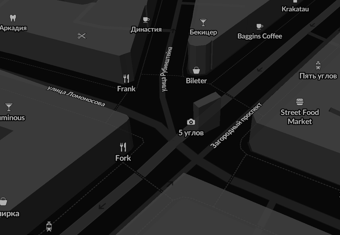
And we have thousands of open notes from StreetComplete with signs of establishments. It would be nice to add tags to the object in a couple of clicks that ChatGPT could recognize. Or build this function directly into some editor.


What kind of work would you put AI to?

Who is OSM for?

Posted by TrickyFoxy on 21 August 2023 in English.

To start editing OSM, a new user needs to go through a cluttered registration form.

At the same time, vandals easily register thousands of new accounts.


One vandal with an army of bots can paralyze the work of hundreds of mappers in an instant.

At the same time, only the gradual careful work of one person can correctly correct a damaged map.


The project is 19 years old, it’s time to grow up.

Fresh Sentinel-2 in your editors. With QGIS, but easier

Posted by TrickyFoxy on 2 August 2023 in English. Last updated on 3 August 2023.

It seems that there is only one instruction for getting fresh Sentinel-2. It tells you quite well how to prepare images, but it is difficult to explain how to use them in OSM editors. So after step 7, you can do

without GeoTIFF and tile server

  1. Select in QGIS: Processing->Toolbox->Raster Tools->Generate XYZ tiles (MBTiles)
  2. Set the parameters:
    • to Extent of the map area you need.
    • Maximum Zoom is most likely 15.
    • In Output Path, specify where to save the tile file
  3. Click Run and wait for rendering to finish.
  4. Install the mbtiles plugin in JOSM
  5. Open the file you received in step 3.

By the way, recently Guru Maps learned how to tear off MBtiles https://gurumaps.app/blog/2023/06/14/mbtiles


But if you still want a tile server, you can do without tileserver-php from the instructions. And without the QTiles plugin, it will also work faster!

Classic tiles with a web server

  1. Select in QGIS: Processing->Toolbox->Raster Tools->Generate XYZ tiles (Directory)
  2. Set the parameters:
    • to Extent of the map area you need.
    • Maximum Zoom is most likely 15.
    • Set Output Directory. You can immediately select the directory of your web server.
  3. Click Run and wait for rendering to finish.
  4. Start your web server. If you didn’t use Nginx or Apache, open the folder with your tiles in the terminal and try using the web server in Python: python -m http.server 80 or PHP: php -S 127.0.0.1:80
  5. In JOSM, open Preferences->Layers->+TMS
  6. Enter a URL like this: http://localhost/<tile folder name>/{zoom}/{x}/{y}.png
  7. Get closer to the desired area in JOSM and select your new layer from the Layers menu.

p. s. I used QGIS 3.32.1-Lima.


upd: method from @maraf24

Classic tiles for JOSM without a web server

Instead of starting the web server, specify the following URL in JOSM: file://<absolute path to the folder with tiles>/{zoom}/{x}/{y}.png

Кажется существует единственная инструкция по получению свежих снимков Sentinel-2. Она неплохо рассказывает, как подготовить снимки, но сложно объясняет, как использовать их в редакторах OSM. Поэтому после шага 7, можно обойтись

без GeoTIFF и тайлового сервера

  1. Выберите в QGIS: Processing->Toolbox->Raster Tools->Generate XYZ tiles (MBTiles)
  2. Задайте параметры:
    • в Extent нужную вам область карты.
    • Maximum Zoom скорее всего вам нужен 15.
    • В Output Path задайте куда сохранить файл с тайлами
  3. Нажмите Run и дождись завершения рендеринга.
  4. В JOSM установите плагин mbtiles
  5. Отройте файл полученный на шаге 3.

Кстати, недавно Guru Maps научился отрывать MBTiles https://gurumaps.app/blog/2023/06/14/mbtiles


Но если вы тайловый сервер всё-таки хочется, то можно обойтись без tileserver-php из инструкции. И без плагина QTiles, что будет ещё и быстрее работать!

Классические тайлы с веб-сервером

  1. Выберите в QGIS: Processing->Toolbox->Raster Tools->Generate XYZ tiles (Directory)
  2. Задайте параметры:
    • Задайте в Extent нужную вам область карты.
    • Maximum Zoom скорее всего вам нужен 15.
    • Задайте Output Directory. Можно сразу выбрать директорию вашего веб-сервера.
  3. Нажмите Run и дождись завершения рендеринга.
  4. Запустите ваш веб-сервер. Если вы не работали Nginx или Apache, то откройте в терминале папку с вашими тайлами и попробуйте использовать веб-сервер в Python: python -m http.server 80 или PHP: php -S 127.0.0.1:80
  5. В JOSM откройте Настройки->Слои->+TMS.
  6. Введите URL вида: http://localhost/<имя папки с тайлами>/{zoom}/{x}/{y}.png
  7. Приблизьтесь к нужной вам территории в JOSM и в меню Слои выберите ваш новый слой.

p.s. я использовал QGIS 3.32.1-Lima.


способ от @maraf24:

Классические тайлы для JOSM без тайлового сервера

Вместо запуска веб-сервера в JOSM можно указать URL вида: file://<абсолютный путь до папки с тайлами>/{zoom}/{x}/{y}.png

Если вам срочно нужны свежие карты для Organic Maps (OM), то:

  1. Выберите на https://extract.bbbike.org нужный вам регион
  2. Укажите почту, на которую вам придёт выгрузка
  3. Запросите выгрузку и дождись письма. Следить за статусом выгрузки можно здесь: https://download.bbbike.org/osm/extract/ В принципе, с этой страницы тоже можно скачать выгрузку
  4. Скачайте полученный архив и распакуйте его.
  5. Найдите на телефоне папку Android/data/app.organicmaps/files/<дата из шести цифр>/ Для iOS: подключите iPhone к макбуку->Finder->File Sharing найдите папку organicmaps
  6. Переместите в неё файл из архива заканчивающийся на .mwm
  7. Дайте ему имя вида: Russia_Lipetsk Oblast.mwm. Чтобы точно узнать имя файла сначала скачайте карту этого региона через OM. Запомните имя, удалите файл и переименуйте перемещённый файл

⚠️ Иногда карты могут быть не совместимы с последней версией OM. Тогда может помочь перемещение карт в папку карт прошлого месяца.

⚠️ Могут возникать и другие проблемы, это не официальный способ от разработчиков

Актуальную инструкцию, но на английском можно найти здесь https://extract.bbbike.org/extract.html