
better-osm-org 0.8: ⚡️📸🏃♂️💬🫂🛰⌨️
Posted by TrickyFoxy on 31 January 2025 in English. Last updated on 2 February 2025.Today I will talk about the new version 0.8 of userscript that adds several useful features to osm.org.
You can view existing features of the script and install it on GitHub or in the OSM Wiki
⚡️ Faster rendering
My first PR was merged to openstreetmap-website code, and now the Map Data layer loads instantly. Be sure to try it. Thanks to the maintainers for help!
For the script, this means a huge acceleration in rendering large relations and GPS tracks (yes, tracks, read more!):
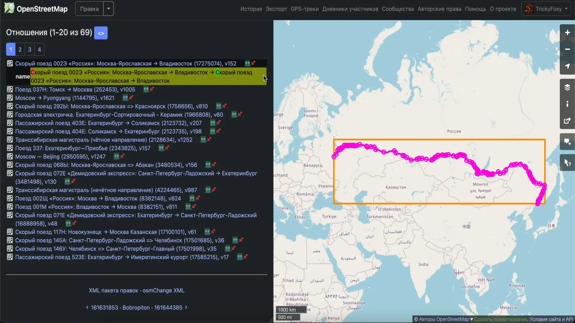
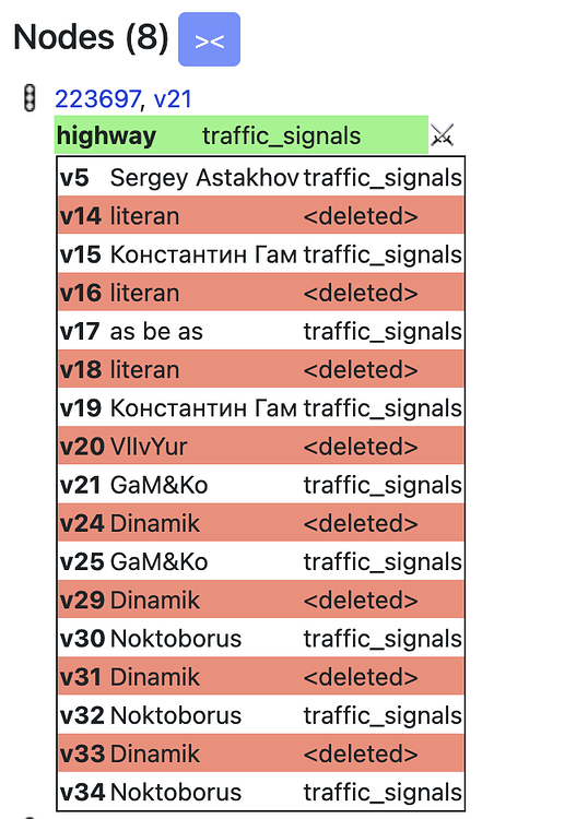
icon 👥 near relations is clickable 😉
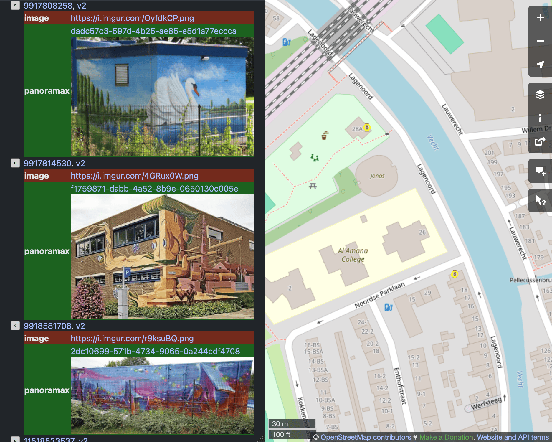
📸 Photos from Panoramax, StreetComplete, Wikipedia Commons
Now they are displayed directly on the website. In notes, in tag history, and in changesets.
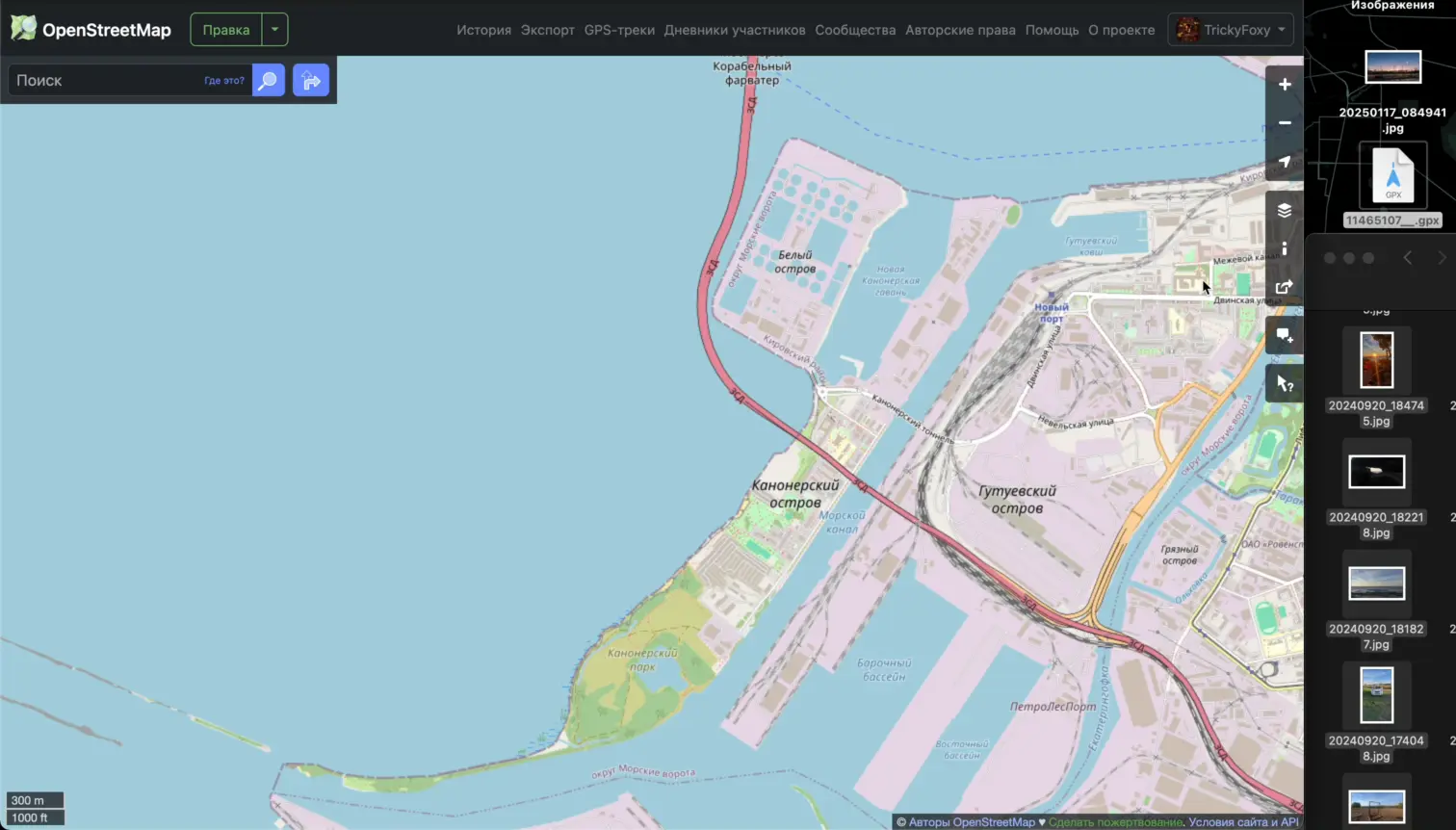
🏃♂️ Rendering of GPS tracks
Finally, by opening the starting coordinate of the track, you will be able to see the entire GPX track on the map:

Let me remind you that the Z key allows you to fit an object on the screen.
The track is also drawn when opening notes from StreetComplete
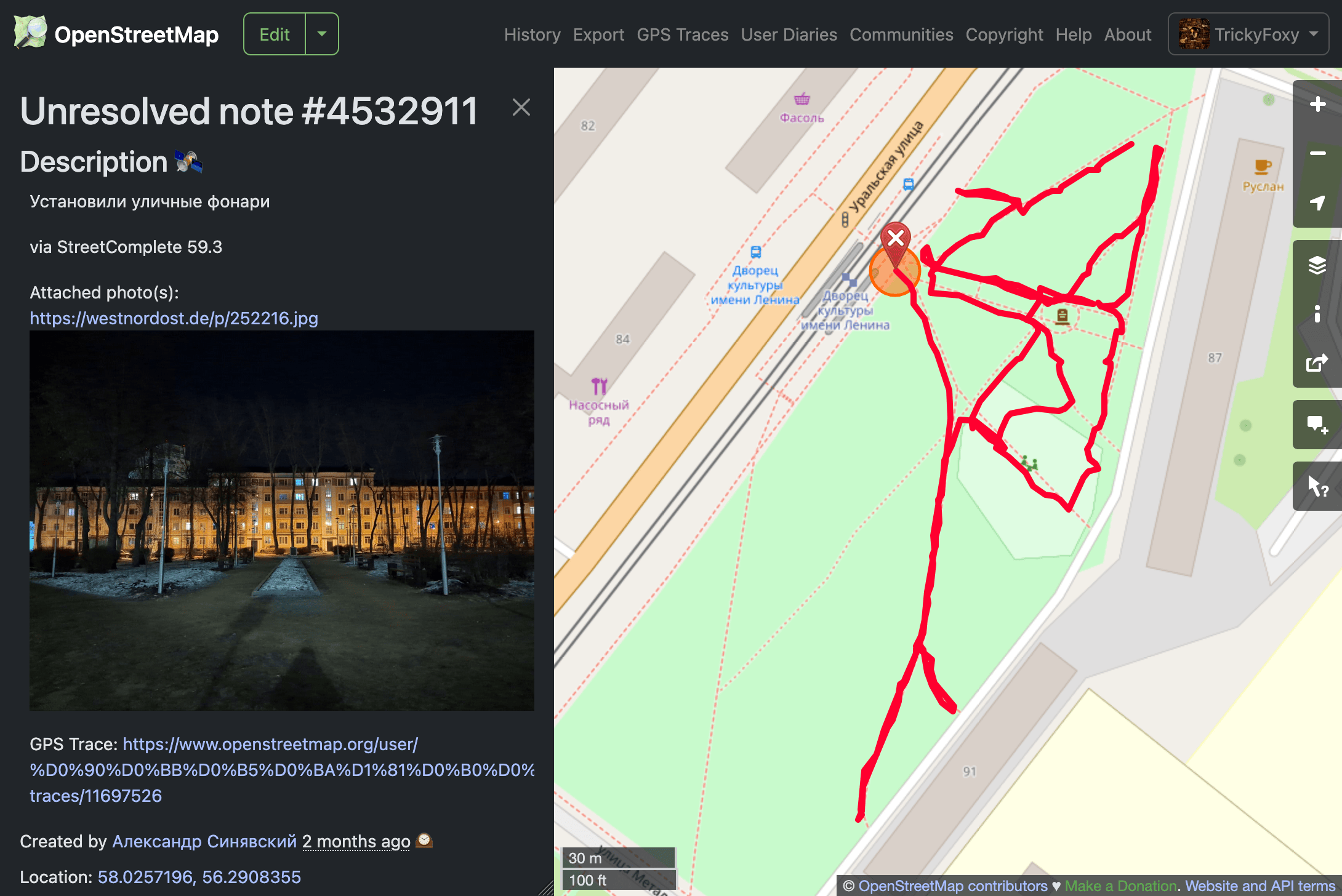
The rendering of tracks is still very simple, if you have any examples of successful visualizations, please share them.
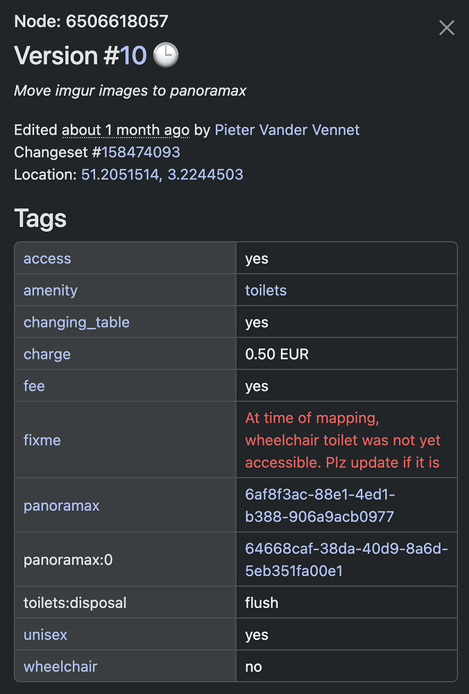
💬 Comments on changesets
Now you don’t have to open the changesets to understand if there is an interesting discussion or if this is another revert of vandalism.
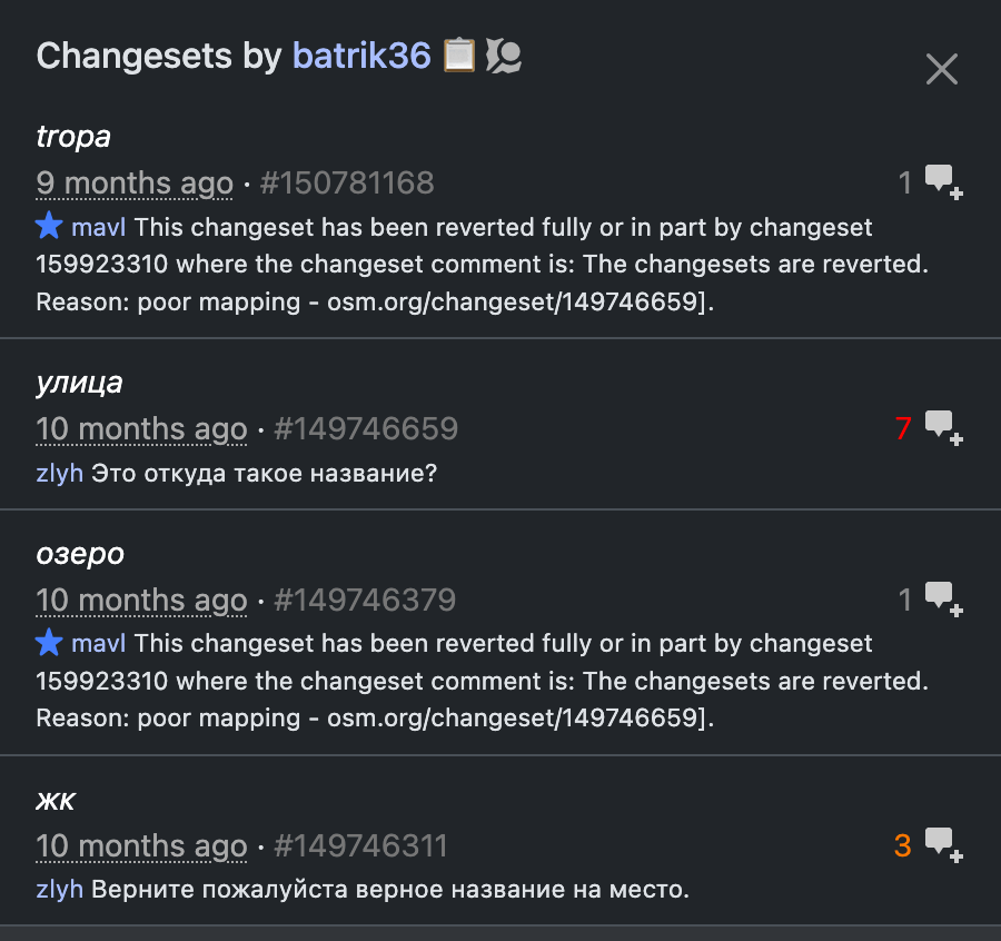
by the way, long links like *.openstreetmap.org replaced by *.osm.org
🫂 Edits of friends
upd: this feature was recently renamed to Followings. Now there are no friends in OSM (:
Did you know that OSM has a friends feature? You can even follow their edits here: osm.org/history/friends
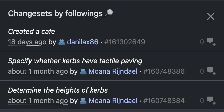
better-osm-org can now filter changesets on this page. The script also tries to show around the username that it’s your friend.
Let’s be friends :) osm.org/user/TrickyFoxy/follow
🛰 Satellite image Switch (Firefox only)
Satellite images could be switched using the S key, or using the button on the side of the note.
But what about Firefox for Android? And how do I find out about S? Now there is a button in the right panel for this.

Pressing the Shift key will show you the ESRI Beta images. But be patient, because they take longer to load.
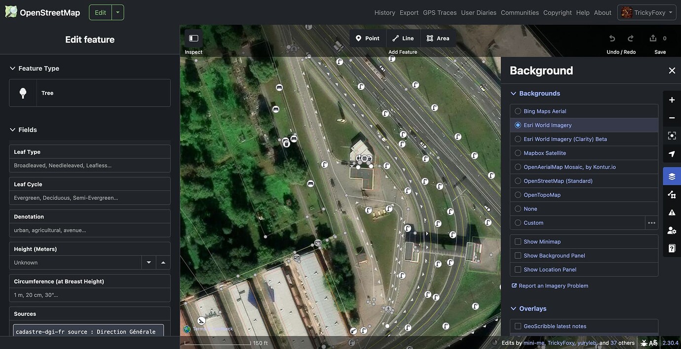
📄 Experimental files viewer for geotagged photos, .gpx and .geojson files
If we can now quickly render data, then why not be able to open it from files? Just drag them onto the map:
p.s. for now, it’s more of a PoC, feel free to suggest your ideas.
⌨️ Hotkeys
Where without them? :)
`— hide the geometry of the changeset from the mapT— toggle between compact and full tags diff modeF— filter changesets- Hotkeys on user profile Page (
H— user changesets history,T— tracks,D— Diary,C— comments,N— notes) U— open user profile from changeset, note, …Shift+U— open your profile
By the way, do you know about the new feature of the site? osm.org/user/SomeoneElse/changeset_comments
As well as about the previous versions that I wrote about on the forum.

v0.7: 📝 Templates for comments on changesets and notes

so that you have the necessary link from the wiki at hand:) Buttons for commenting on changeset will only add text to the input field, without submitting.
🔍 In the list of relation members, you can now see ways on the map
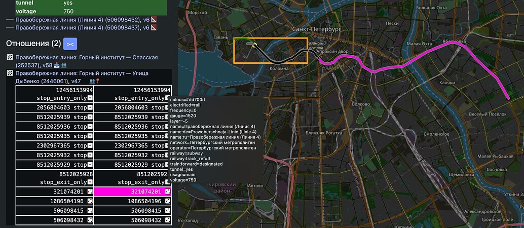
In order not to clutter the map, relations are shown only on hover. Now the relation can be pinned.
Other
- shift + Z to zoom to bbox without taking into account relations
- Q key to close the sidebar
- C key open changeset from object version
- In the settings, you can enable overzoom for the Map Data layer
0.6.1: ⏬ Display intermediate versions for ways
Now, when you click ⏬ on the way history page, all changes will be displayed, including in the tags and coordinates of nodes of the way
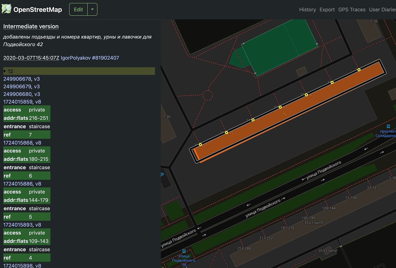
If there are too many versions, you will see the versions filter. The K/L combination also works, but I recommend you try it ScrollAnywhere to navigate through the map with the middle mouse button
⚠️ there may be problems if some nodes are hidden by moderators.
Other
- When you hover over the tag table, the number of tags is now displayed
- Improved HDYC colors in the user profile (thanks @LouisXIV)
- Fixing the color of human-readable wikidata extension cells in a dark theme
- More tooltips
- A small Easter egg. Try to find a New Year’s tree in your city (or map it!) (It’s open only on New Year’s holidays)
v0.5.7: 🔦 Dark theme for iD
⚔️ Edits wars detector
#️⃣ Clickable hashtags in comment of changesets

🔗 Clickable links to Panoramax and Mapillary, as well as highlighting fixme=
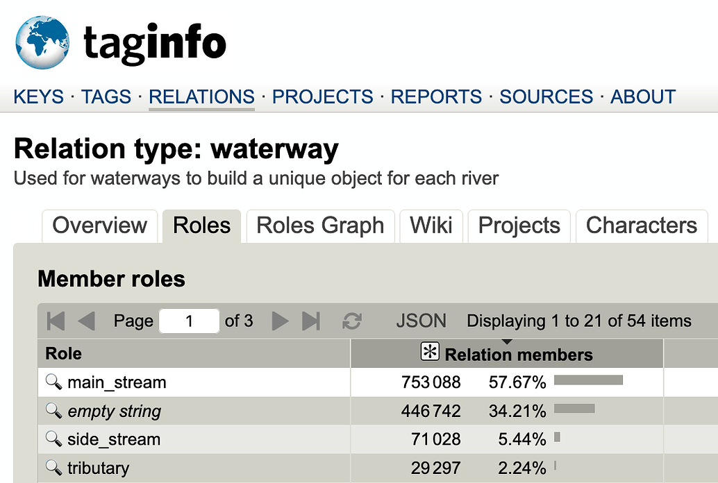
🔍 More Overpass links in Taginfo
https://taginfo.openstreetmap.org/relations/waterway#roles https://taginfo.openstreetmap.org/reports/key_lengths#keys
p.s. The script also fixes broken links to Overpass Turbo on https://taginfo.geofabrik.de, if there is a space in the country or region name.
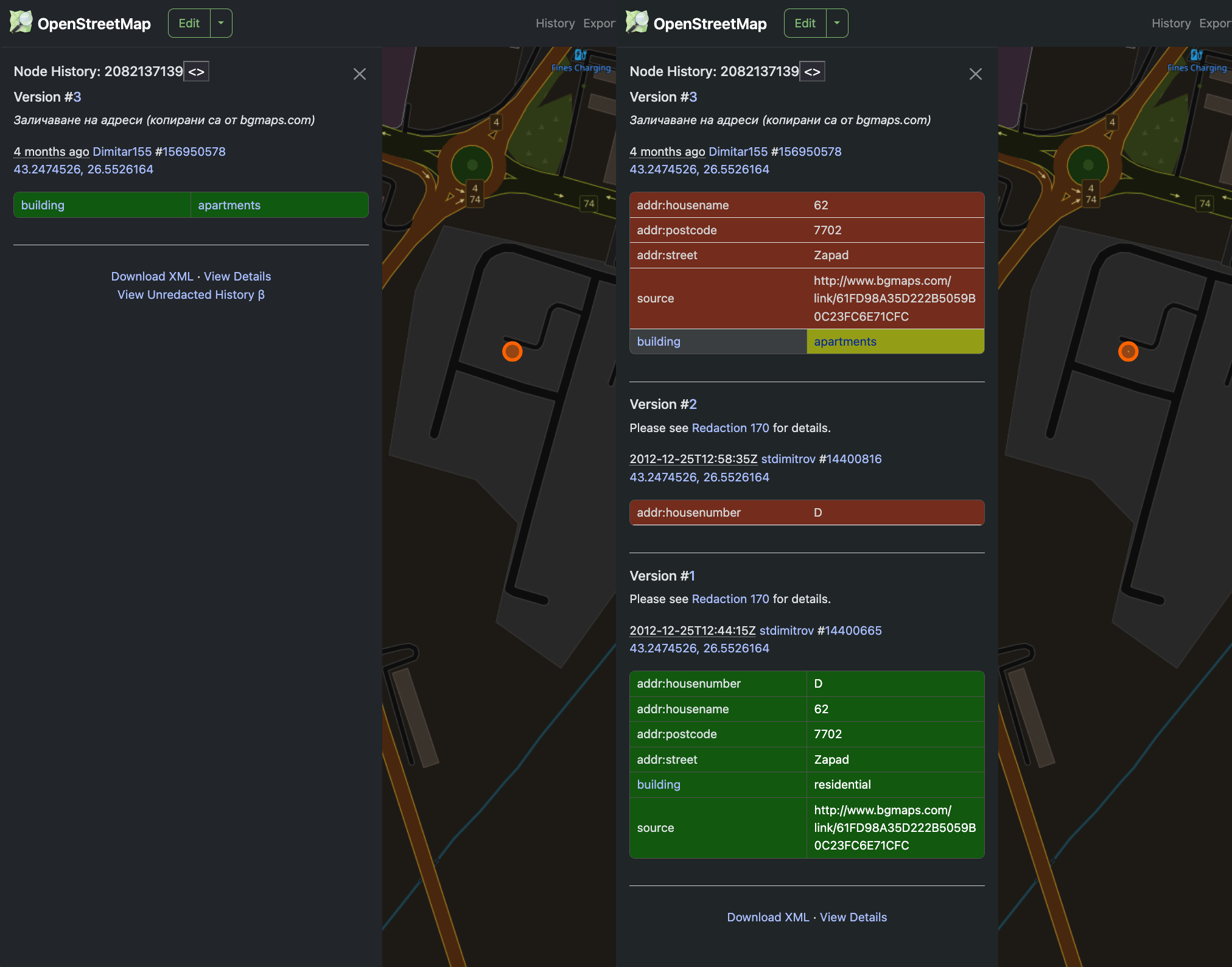
👁 Redactions bypass
Bypass Redactions (so far only tags) (even for edits before 2012! Data that is hidden is uploaded to GitHub https://github.com/deevroman/better-osm-org/issues/54
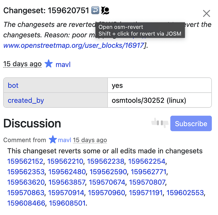
↩️ Shift+click for revert via JOSM. And clickable IDs in comments:
⌨️ New hotkeys:
shift+L— go to your locationshift+N— create new note (if some object was opened, his link wound prefilled in note text)
Discussion
Comment from fantomas on 2 February 2025 at 07:41
Hi. This is very interesting. Thank you.
No. “Friends” don’t exist anymore. For example, if you open “My Dashboard”, you will see “Followings” instead of “Friends”.
Comment from TrickyFoxy on 2 February 2025 at 08:28
Yes, you’re right, that changed three weeks ago: https://github.com/openstreetmap/openstreetmap-website/commit/2b7a48029bff06c190544f91c5969b09aeae552b However, some localizations still have the same label.