The problems with "highway=path" in England and Wales
Posted by SomeoneElse on 20 November 2024 in English.Recently, there’s been quite a lot of discussion about the problems with using the tag “highway=path” in the forum. See for example threads here, here, here, here, here, here, here, here, here, here, here, here, here, here, here, here, here, here, here, here and here - and that’s only the last month or so!
It’s not descriptive
On it’s own, “highway=path” doesn’t really say anything other than it’s somehow possible to get from one end to the other. Have a look at the pictures in the wiki - all of those are regularly tagged as “highway=path” in some regions.
There are some really bizarre examples out there. Up the Hillary Step to get to the top of Everest? highway=path. A scuba diving route? highway=path.
While it is possible to add extra tags to say a bit more about the feature being mapped, often this simply isn’t done.
A data consumer (map maker, routing app creator or even just a human deciding whether to go for a walk somewhere) can’t tell what they’re going to find.
It’s impossible to tag the legal situation properly
The idea is that you can tag a path for pedestrians as “highway=path; foot=designated” and one for cyclists as “highway=path; bicycle=designated”.
The problem here is that “foot” and “bicycle” are “access” tags, and these aren’t always “yes” or “no”. Valid values might be “customers”, “destination”, “permissive” amongst others. If the “foot=designated” on a “highway=path” implies “foot=yes”, what should the tagging be if only customers are allowed?
In countries with some form of allemansrätten (much of Scandinavia, some other places in Europe, including Scotland) this is less of an issue. If you know you can go pretty much anywhere you don’t need to explicitly tag “foot=yes” on everything, and tagging “highway=path; foot=designated” isn’t a problem.
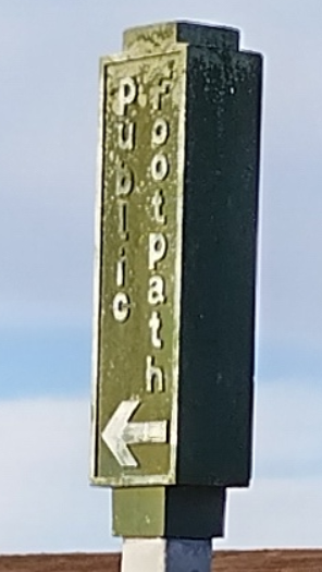
In England and Wales it absolutely is a problem. We do have the “designation” tag for public footpaths  and other rights of way, but we also have other examples of allowed access including CRoW Act Access Land, rules for the New Forest, and (for an area of land not far from me), “Strensall Camp Military Lands byelaws 1936”, “Strensall Common byelaws 1972”, “Strensall Common (use for military purposes) regulations 1971” (and previously the revoked “Strensall Common and land adjoining or near it byelaws 1936”, “Strensall Common and land adjoining or near it byelaws 1927”, “Strensall Common Rifle and Revolver Practice general regulations 1938”, “Strensall Common Rifle and Revolver Practice general regulations 1933” and “Strensall Common Rifle and Revolver Practice general regulations 1926”). There’s an actual copy of “Statuary Instruments 1972 no 246, The Strensall Common Bylaws 1972” at the entrance that you can read before letting Colin off the leash. It’s complicated, and being able to tag
 foot=yes makes things much simpler.
So what to do?
In England and Wales, if at all possible, try and use some other “highway” tag in place of “highway=path”. That might be “highway=footway” or it might be something else, depending on what it is most like. If literally nothing else fits, it might still be “highway=path”, but please do try and add more tags to describe the thing as much as possible.
Wherever you are, you can try and identify potential problems and add more tags to mitigate them. I created a QA page for myself. Those are just overpass queries and can be moved anywhere you like and saved as bookmarks.
Happy mapping! 
Discussion
Comment from RobJN on 20 November 2024 at 20:20
It’s the additional tags that really make the difference (e.g. surface, lit tags). Just switching out a highway=path for a highway=footway doesn’t really tell you much more, if anything.
Comment from Wynndale on 20 November 2024 at 21:02
Regarding the New Forest, a web search led me to https://www.verderers.org.uk/information-for-solicitors/ and then to http://www.verderers.org.uk/app/uploads/2019/10/Commons-Registration-Act-1965-the-New-Forest.pdf, which refers to an access land boundary differing from the national park boundary that is in OSM, but could be useful in addition if we can find it. The reference to the perambulation on older maps may include some now available on the NLS site:the 1966 map of the New Forest and the 1971 editions of one-inch-to-the mile maps 179 and 180.
Comment from SomeoneElse on 20 November 2024 at 23:14
@RobJN I agree that it absolutely makes sense to add tags like that. It’s also true that “footway” in England and Wales is used on a wide variety of “ways you can walk from A to B” (see osm.org/way/839038651/history , the discussion on osm.org/changeset/135293564 and links from there for discussion about “difficult” footpaths). It’s not been used for things like the “scuba path” though, and the incident where cyclists were told they could cycle along footpaths in royal parks wouldn’t have happened had
footwaybeen used instead ofpath.Comment from TheSwavu on 22 November 2024 at 08:56
Don’t forget Richard’s plea for sanity from 2013.
Comment from SomeoneElse on 22 November 2024 at 10:46
Some of the discussion history from even earlier is also worth a read - for example here and here.