OpenStreetMap

pedrito1414's Diary

Recent diary entries

There is a really amazing video (Turkish with English subtitles) from Dr Uçum on the critical role that OpenStreetMap data has played in ensuring high quality public health programming in one of the tent cities for displaced people in Turkey as part of the earthquake response.

The video was originally published by Yer Cizenler.

Have also pasted below the English translation (thanks, once again, to Yer Cizenler) …

Well, hello everyone. I’m Doctor Mehmet Faruk Uçum.

I am the responsible physician in the largest tent city in Kahramanmaraş the KAFUM tent city. It is also known as New Ataturk Park and Kahramanmaraş Fairgrounds.

Here, as the responsible physician, I provide coordination in terms of health, we have set up the family health tent and we continue to vaccinate there. I also do public health work in the field.

During this process, with my friends in the OpenStreetMap community and my friends in Istanbul, we worked together and as a result of this work, we created a map.

I used this map especially during the vaccination process to find out which tent was where, because we really lacked data in this regard. We didn’t know the location of the tents, or which number was where, so we were not able to navigate to the right tents.

Recently again, I have used it to inspect and verify alleged scabies cases within the tents. I have, for example, some tent numbers that are said to have scabies but some of them may be seen wrongly or it is possible that the wrong number is given to us but I found them on the map and took the necessary action.

In public health, we used it again to identify outbreaks… the focus of outbreaks, that is. After marking the tent numbers on the map, we determined which areas had problems, especially for acute gastroenteritis, for example. Again, if there is a problem with viral rash diseases tomorrow, this map will be used for isolation and quarantine activities.

The authorities have asked me for this map I was using and I gave it to them, and they used it to plan the power lines that needed to be installed for the lighting in the tents. The army has used it for public order and it is also used for logistics.

If I am able to complete it during my stay here, we will try to use it for emergency referrals.

So, we used this map for every kind of planning you can think of… for health, for administration, for public order, and it was really one of the most important things I could have done here.

For this, I thank the OpenStreetMap contributors very much, I thank the community very much, I’m glad you exist.

Thank you very much. Take care of yourselves.

Ruben Martin and I discuss recent highlights and what’s coming up in the humanitarian open mapping community.

What’s covered this week in brief?

Syria & Turkey earthquake response // Activations in Malawi and Ethiopia // International Women’s Day catch up // Bolivia YouthMappers // Mapping journeys to impact // Ruwa project completion // What’s coming up? // Mappy quote of the week

What’s happened this week?

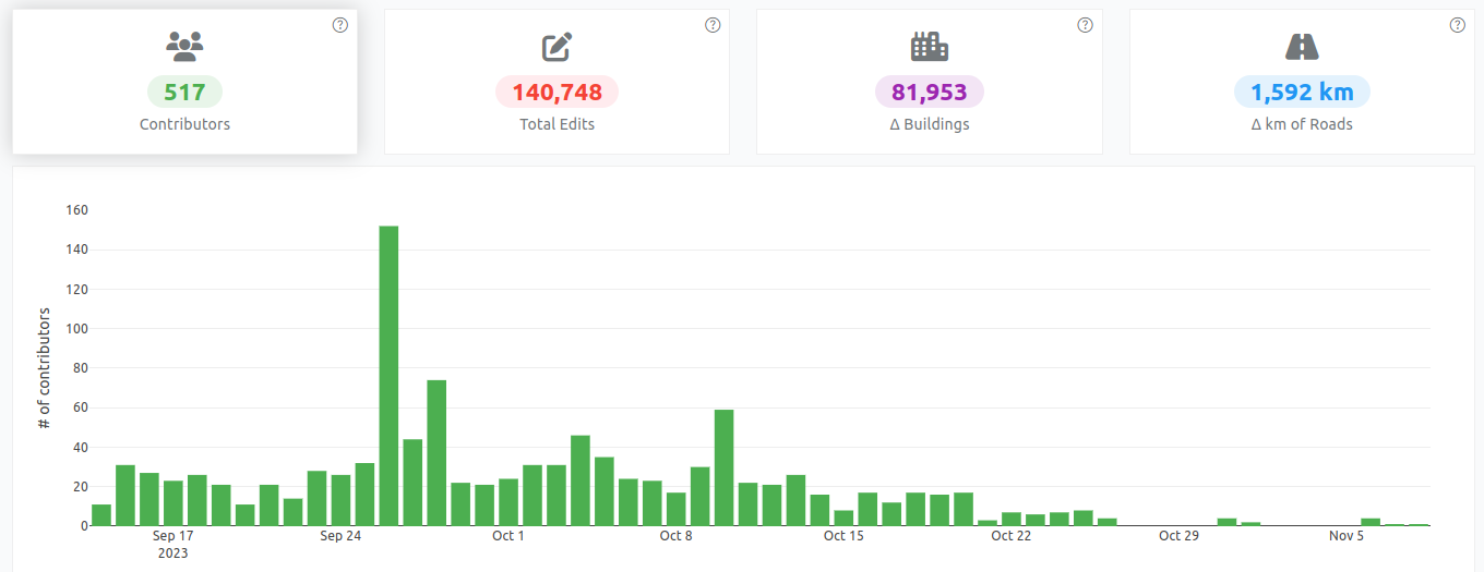
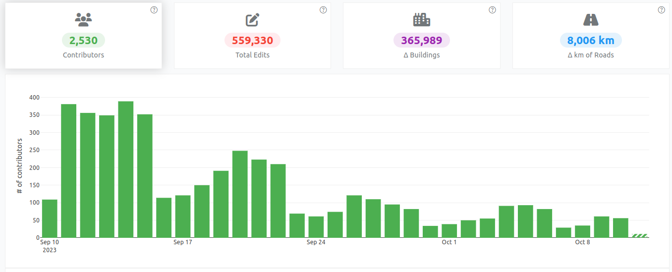
Syria / Turkey earthquake response: The Turkey / Syria earthquake activation continues to progress — tasking manager projects are being finished off and and the validation is catching up. ~ 9,000 mappers have contributed over 2 million buildings and more than 83,000 km of roads so far. We also published this blog to try and provide insight into where the data is going and what it is being used for

There is also this brilliant testimony from Dr Mehmet on his use of OpenStreetMap data for public health programming in the tent cities where people displaced by the earthquake are housed.

Activations in Malawi and Ethiopia: Additionally, the OSM Malawi community has activated to support the data needs for responders following Cyclone Freddy in Malawi — you can support them with mapping, here. OSM Ethiopia are also still mapping in response to the drought and food crisis in Ethiopia, which is drastically affecting people in the region of Oromia — you can contribute here.

International Women’s Day: There was loads of stuff to catch up from from International Women’s Day this week, too… My recommendations…

Encourage you to watch and listen!

Bolivia YouthMappers: Really enjoying following the YouthMappers UMSA chapter from Bolivia. They seem to be on such a roll; developing connections and collaborations, flying drones and doing lots of mapping!

Mapping journeys to impact: Excited to see the insights start to emerge from Rubén’s conversations with people and organisations that have been using open map data for flood resilience, and advocacy for improved services and planning for communities in informal settlements. The goal is to try to expose the knowledge, tools and support that people trying to solve similar challenges need to give them the motivation and means to use open mapping and OpenStreetMap to take action.

Ruwa project completion: Lastly, the closing event of the Ruwa project, which focuses on open mapping and access to water in Niger, is taking place this week. There are trainings, sharebacks and lots more planned by the Open Mapping Hub — West and Northern Africa and their partners. More to come, soon!

What is coming up?

The OSM Africa mapathon is this month focusing on Namibia and hosted by our friends from the Shack Dwellers Federation and OSM Namibia.

There is also a Community Working Group webinar coming up in a couple of weeks, focusing on the women’s participation in OpenStreetMap research mentioned in last week’s weeknotes. Morte details to come!

Mappy quote of the week:

There are so many this week (the recordings and podcast above are full of them!), but this one is from my colleague, Nama (HOT’s regional director — Asia Pacific) and taken from his appearance on the geomob Turkey & Syria earthquake response podcast episode

“OpenStreetMap is a great project and disaster after disaster we continue to demonstrate that we can work together to produce something useful for people on the ground!”

Ruben Martin and I discuss recent highlights and what’s coming up in the humanitarian open mapping community.

What’s covered this week in brief?

Syria / Turkey earthquake response // Community Working Group mentorship programme // OSM Ethiopia community-led activation // Community research on barriers to women’s participation in OSM // International Women’s Day // Month activites and events // Mappy quote of the week

What’s happened this week?

Syria / Turkey earthquake response: The response to the Turkey Syria earthquake has continued, with more than 8,500 mappers contributing to the data.

The validation of the data is still a heavy task, and the validation team is working so hard to keep up with the volume of mapping. Please be careful with your mapping and make sure the data that you create and they review is as good as it can be! This video from Becky Candy should help you if you are new to mapping.

Also want to congratulate Said for receiving UN Mapper of the Month for his role in coordinating the data response in the days following the earthquake.

March 2023 mapper of the month poster

Community Working Group: The Community Working Group mentorship program is developing well, following the pilot programme last year. The programme is designed and will be published soon and recruitment for mentors and mentees is expected to open in early April.

Ethiopia community-led activation: Important to remember that the recent earthquakes aren’t the only crises people are facing and so want to highlight OSM Ethiopia’s efforts to support the humanitarian response to the climate crisis in Ethiopia and to amplify their call for mappers to come and join them.

OSM Ethipia banner

Community research: Benedicta from the HOT community team has launched a piece of research looking at the barriers for women’s participation in the OpenStreetMap community, and we want to encourage as many people as possible to fill out the survey and share it with their networks as well as attending the associated webinar later in the month (details to come).

What is coming up?

There are events and activities related to International Women’s Day (IWD) / Month happening throughout March across the OpenStreetMap / open mapping ecosystem.

Find information here on the HOT IWD scoller and here on the OSM blog (alongside a nice profile of Geoladies Philippines) and here on the Geochicas’ map.

Mappy quote of the week:

We have been reviewing the HOT unSummit programme pilot and this quote from Carrol Chan jumped out at me (she was talking about the Pacific GIS Conference and thanking the organisers)…

“There’s something genuine about the connections formed in OSM and grassroots geospatial commmunities, and these tend to transcend boundaries.”

tweet from Carrol https://twitter.com/cmhc23/status/1597546997304524800?s=20

A week ago, my colleague Can (who works at HOT and is part of Yer Çizenler) got a message from Dr Çevik, a Turkish surgeon treating people injured by the earthquake in Turkey.

Message from the doctor to Can

It said: On the first day I went to Rehaniya, when Google Maps was not working, Organic Maps guided us. The importance of such tools is enormous. Good luck to you, Can. 🔥 organic maps 🔥

Can asked him to explain and he did… You can find the video here and the transcript below.

Screenshot from Dr Çevik's video

Hi, I’m Dr Bilgehan Çevik. I’m an orthopedic surgeon working in Ankara, Turkey.

I went to work in the earthquake area a few hours after the earthquake in Kahramanmaras on February 6th.

Ten other volunteer doctors and I went by plane to Adana from Ankara. And from there we set out for Antakya, where the earthquake caused the most damage.

We didn’t know the roads and routes of the region, so we tried to use the online map services we were all using before. Unfortunately, the services didn’t work because there was no network.

In this case, Organic maps came to the rescue and we reached our destination by creating our route with organic maps.

So thank you all, you are doing really great work.

Please keep supporting the response though mapping, validating, organising and everything else you are doing… The data is being put to use in a lot of different ways!

Ruben Martin and I discuss the recent activities and what’s coming up for the humanitarian open mapping community.

What’s covered this week in brief?

  • Response to the earthquake in Syria and Turkey
  • Milestone for URBE LATAM and the Preventório favela mappers in Brazil
  • Sharebacks of the Mapping for Resilience Initiative in Hoima, Uganda
  • OSM Community Spotlights at Community Working Group
  • Events coming up
  • Mappy quote of the week

What’s happened this week?

Over the past few weeks, the OpenStreetMap community has mobilised in response to the devastating earthquake that hit Turkey and Syria. More than 7,500 mappers have contributed to the response so far, and 221 validators have validated over 5,870 tasks in Turkey alone — the contribution of this relatively small number of validators has been phenomenal, trying to ensure high data quality for the relief efforts.

The data produced is being used in the field and has been utilised in various platforms, including the MSF geo portal and the humanitarian data exchange (HDX), the preeminent data platform for humanitarian responders. Despite the ongoing challenges of the response, the community’s response has been amazing, and we, at HOT, are proud to be a part of it.

The response to the earthquake will continue, with data needs changing as the response progresses. For example, Turkish mapping NGO, Yer Çizenler, has introduced tagging for buildings that have been damaged, and other datasets such as pharmacies and medical providers are being integrated.

The message… please keep mapping (go here if you want to know how) — the data is being used everyday to support the response.

Really happy to see that the URBE LATAM team spent last week with their Preventório favela mapping community colleagues and visiting other communities, discussing the results of the mapping and how the data is, and could be, used, as well as meeting with the Mayor of Niterói to discuss future solidarity, economic and public policy projects.

People looking at the maps together

Staying with informal settlement mapping, also great to see the Mapping for Resilience Initiative in Uganda has been doing sharebacks of their mapping work with the residents of Hoima, Uganda, discussing how the mapping can support the assessment of facility distribution & negotiations for better services.

It’s also been fantastic over the past three weeks to have three OSM Community Spotlights (a new feature) at the community working group meetings. The workig group members have hosted OSM Malawi, Togo and Kenya, with really interesting discussions on community evolution, challenges and new initiatives. Check the working group forum for notes and discussion.

What is coming up?

There are a lot of earthquake solidarity events coming up, organised by OSM communities — the best way to find a community mapathon to join is through the OSM wiki or on the OSM calendar.

There is also an exciting webinar being organised by the Community working group tomorrow on the future of field mapping, featuring a demo of the prototype Field Mapping Tasking Manager (sessions in French and English)

Poster for the webinar event

Mappy quote of the week:

Mikel Maron on OpenStreetMap (in conversation on the geomob podcast):

I think it’s amazing that [OSM] works… I’m still astounded that, everyday, this is the way that the fundamental geospatial data set of the world is created. And, it works and continues to work!

Mikel Maron

Since 06 February when the first earthquake struck Turkey and Syria, more than 6,500 mappers have mobilised to contribute to the response through the creation and improvement of OpenStreetMap data.

On 09 Feb, I wrote a diary post about whether the OSM data being contributed by mappers and validators in Turkey and Syria was helping anybody. This one builds on that theme…

Below is a selection of maps and map products being used by responders that incorporate OpenStreetMap data (gathered through searching data sources on maps and data products on ReliefWeb, the MSF Geo Centre and through what people are reporting on the HOT disaster-mapping slack channel). Click through the links to explore the maps yourself…

Map from REACH: Northwest Syria --- Earthquake Exposed Communities

☝️Map from REACH: Northwest Syria — Earthquake Exposed Communities

Map from REACH: Northwest Syria --- Earthquake Exposed Dams

☝️ Map from REACH: Northwest Syria — Earthquake Exposed Dams

Maps and infographics from CrisisReady: Population Density Change Report

☝️ Maps and infographics from CrisisReadyPopulation Density Change Report

Map from MSF: North East Syria Reference Map

☝️ Map from MSFNorth East Syria Reference Map

Map from MapAction: Damaged Buildings and Needs Assessment

☝️ Map from MapActionDamaged Buildings and Needs Assessment

Map from AKUT (photo): being used for coordination in the field

☝️ Map from AKUT (photo): being used for coordination in the field

Map from AFAD (photo): being used for coordination in the field

☝️ Map from AFAD (photo): being used for coordination in the field

Big shout out to Yer Çizenler for continuing to lead this ‘activation’ (HOT word for disaster response) and a huge thanks to all of you mappers and validators who are contributing. Please keep going — there are still many unmet needs in terms of open geo data!

In case it’s useful to anyone reading, there are >40 key datasets, related to the earthquake response, on HDX from UNOSAT, OCHA, HOT (mostly OSM data) and more…

Want to map to show solidarity with those affected by the quakes? Head to the HOT tasking manager.

Short update to the previous post on whether mappers are really helping anybody in a disaster situation

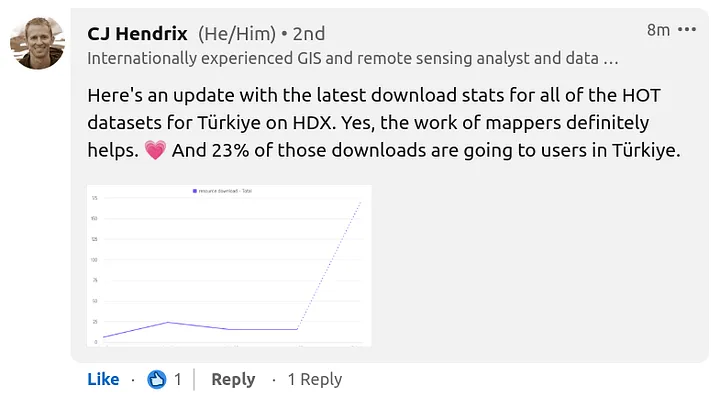
CJ Hendrix from OCHA reached out and shared statistics on the downloads of all of the OSM datasets for Turkey, provided by HOT through HDX

Message from CJ Hendrix

Download statistics for OSM datasets for Turkey provided by HOT through HDX

23% of those downloads are also apparently going to users in Turkey.

Re: Is what I am doing really helping anybody in a disaster situation?

Posted by pedrito1414 on 9 February 2023 in English (English). Last updated on 10 February 2023.

I received this question through the HOT feedback form today. Here is my response in case anyone else wants to know.

Re: Is what I am doing really helping anybody in a disaster situation?

The short answer is yes, we think so - the tasking manager projects have been created based on requests from organisations who plan to use the data.

The long answer is that in the immediate aftermath, everyone is looking for resources, including data, but we get very little feedback initially as to who exactly is using it.

People and orgs are busy responding. This info usually surfaces a little later and we will update when it does. In previous disasters such as the Haiti earthquake in 2010, Philippines typhoon Yolanda in 2013, and Ebola outbreaks in West and Central Africa, we have observed that responding agencies often begin using the map data a few weeks into the response, after the initial rush to establish the basics is done. This is only possible if we start early, so that by the time responders need it the data actually exists.

One proxy we do have is that the downloads of OSM datasets provided by HOT through the HDX platform are spiking. There is a lag on the reporting (so latest numbers are from 06 Feb) but we do see them going up. HDX is a key data source for humanitarian responders.

Screenshot from HDX showing the spike in downloads for OSM road data package in Turkey Screenshot from HDX showing the spike in downloads for OSM road data package in Turkey, 10 Feb 2023

Thanks to the mapper who sent in the question and a huge thanks to all of you who are mapping and validating in solidarity.

Please keep an eye on HOT channels for more specific info in the coming days…

HOT Community Weeknotes: 6 / 2023

Posted by pedrito1414 on 9 February 2023 in English (English). Last updated on 10 February 2023.

Ruben Martin and I discuss the recent activities and what’s coming up for the humanitarian open mapping community.

What’s covered this week in brief?

Earthquake response in Turkey and Syria // The first OSM diary from State of the Map Tanzania // Thank you packs received by top performing validators // An interview with OSM Somalia // Advances in the OSM contribution decline analysis and research // OSM Malawi @ community working group // Mappy quote of the week

This week we were excited by…

Earthquake Response

This is not ‘exciting’, but very significant… The open mapping / OpenStreetMap community have responded in numbers to support people affected by the earthquakes in Turkey and Syria.. Just yesterday, over 1200 people contributed to mapping tasks in Turkey. New projects have also been published for Syria. The response in Turkey is being coordinated locally by mapping NGO, Yer Çizenler, who are working to connect local partners with the data.

Infographic of earthquake impact and mapping projects

OSM Diary — SotM Tanzania

Jemima published the first OSM diary about State of the Map Tanzania. It was great to read about her experience at the conference, what she learned and who she met.

Thank You Packs for validators

HOT sent out swag packs to top performing validators. The swag packs include a special t-shirt, notebook, and other items. Great to see people tweeting about receiving their gifts.

Tweeted thanks from a happy validator

Interview with OSM Somalia

OSM Somalia travelled to State the Map in Tanzania and presented on their experience mapping in ahigh humanitarian context. The talk was well received and they have now been interviewed on the OpenCage blog. It’s great to see them getting more exposure and telling their story.

Members of the OSM Somalia community at SotM Tanzania in January 2023

Members of the OSM Somalia community at SotM Tanzania in January 2023

OSM Contribution Decline Analysis and Research

The HOT community team is advancing the OSM contribution decline analysis and research and starting to get some granular data. In Latam, for example, there was not a decline in contribution during 2022, and in other areas where there was a decline, there has been an increase in the number of facilities, buildings, and roads. The team is working with HOT regional Open Mapping Hubs to better define the research questions.

OSM Malawi at the community working group

OSM Malawi came and presented their evolution and their challenges around community mobilisation at the community working group this week and it was a good discussion. But, there’s more to talk about. The notes are on the community working group forum, and people can continue to discuss and give advice, tips and share their experience.

What is coming up!

The community calendar is dominated by mapathons organised in solidarity with those affected by the earthquakes. Events are spinning up fast and the best place to keep track of them is OSM Cal. There are events organised by the Open Mapping Hub — Asia Pacific, OSM Uganda, community groups in Mexico and Brazil, UN partners and others. If you want to join, follow the links at osmcal.org.

Mappy quote of the week

Comes from Tsion Taye, OSM Ethiopia volunteer ❤️

Mapping is beautiful! What could be more meaningful than contributing to saving lives, minimising the destruction that hazards cause, and letting others have a serene environment to live in?

Tweet with original quote

Stay tuned for more updates……………………

Also cross-posted on medium

Sharing with you again some of the things that Ruben and I have been excited about, and some of what’s coming up, in the HOT community and across the humanitarian open mapping movement.

Things that have excited us this week…

Congrats to the HOT training working group who had an impressive 52 participants at the advanced JOSM training last weekend!

Chisom Okwuchi shared a lovely OSM diary of her experiences as a Community Working Group mentorship lead

… and, the organising group for the mentorship program is now planning for the next phase and will be looking for mentors and mentees in the next few months!

Shout out to Kraan46, one of HOT’s global validators, who has now validated on 360 days out of the last year — an impressive feat and huge contribution!

Contribution timeline for Kraan46

Contribution timeline for Kraan46!

Kudos to OSM Uganda, who have established a new MOU with the Terego district on integrating OSM learning into schools.

Cool to hear that the Suza YouthMappers have just started working with the Jane Goodall Institute for forest monitoring through community mapping.

The State of the Map Africa logo was launched to the public and is really nice! The event is in December this year in Cameroon.

New state of the map africa logo

Ruben Martin also shared that he’s been digging deeper into the research on declining contributions in 2022 and is seeing some upward trends too (in the numbers too at a more granular level). Full report to come once the research is done…

The Open Mapping Hub — Asia Pacific has published an approach for improving OpenStreetMap data quality in the region.

Lastly, at the OSM Africa mapathon, hosted by OSM Angola recently, the mayor of the town being mapped turned up and addressed the mappers directly! Very cool…..

What’s coming up?

The Llamitas Mapeadoras YouthMappers chapter released the schedule for the Tambomachay project, which looks like a very exciting, collaborative mapping project in Peru. Also, they have the best logo 😎👌🔥

Lalamitas mapeadoras logo

The 28 of 28 campaign from OSM Ghana is taking place in February again with a prize for the winner. Get involved!

Following a successful pilot, the HOT Summit Working Group proposed to the senior management team to evolve the unSummit concept over the next two years as core programming and it was unanimously supported. The working group is now moving into planning to make it bigger, better, and more impactful.

We’ll be continuing work on replacing the HOT website in order to provide a better experience and resources, help people find the right path to solve problems through open mapping and discover others who have been solving similar issues.

As always, we hope this update helps you keep up with some of what’s going on. We’re just trying this out to see whether a weekly digest like this is useful to people across the community… If you have any questions or want to suggest something that should be in here but isn’t, feel free to reach out in the comments!

These weeknotes are cross-posted on Medium

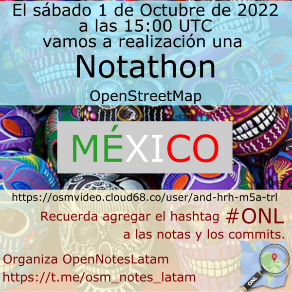
I really like the ‘notathon’ concept, so just posting a translated version of AngocA’s original diary entry (which was in Spanish).

On Saturday 1 October 2022, a notathon was held, as is customary one week after the Latam meeting. This time it took place in Mexico, and was coordinated by BigBlueButton - OSMVideo, where several people participated.

Notathon Mexico

This time DAMN-project was used to divide the areas. For the division of areas we filtered by only the notes created from the Maps.me application. This is the task of DAMN: https://client.damn-project.org/?area=2407

We showed how to use the JOSM plugin, which automatically downloads the notes, and this allows to work in several areas, without having to leave the editor.

In total 63 notes were solved, with participants mainly from Mexico (alex_mayorga, Mapeadora, Sandra, among others), but there were also attendees from Venezuela (risturiz), Argentina (Manuel Retamozo) and Colombia (AngocA).

This activity has allowed us to work as a region, supporting each other, and each one contributing from their experience. We learned about tree mapping, humanitarian mapping strategies, among other things.

There were also very good questions, and we are going to create a couple of tickets in DAMN and OSM. For example: the OSM API should not create a note with the same coordinates on top of an existing, open one; instead, it should add a comment to the existing one.

If you want to see what happened at the Mexico Notathon, you can relive it at: https://youtu.be/oXmOmT8GT7Y

Inspired by Gustavo’s diary on his SotM experience, I am putting some of my thoughts down on paper…

This was only my second in-person State of the Map (first in Belgium) but it felt like I’d been many times - people were so welcoming and open, the organisation and volunteers were great and there were a lot of familiar faces (and usernames).

On Friday my main track highlights were Martijn on 10 years of MapRoulette and Kristen on Entry Level Mobile Mapping.

On the Friday afternoon (also World Humanitarian Day), I hosted the HOT unSummit Humanitarian sessions (which you can watch again here) and we heard fantastic stories and insights and saw some great maps, data and tools from 12 different speakers, all relevant to humanitarian open mapping and from all corners of the world. Kudos to the speakers for being so well prepared and to the audience for being so engaged and curious. It was a really great afternoon.

Presenters from the HOT unSummit Humanitarian Sessions at SotM 2022 receiving questions

Presenters from the HOT unSummit Humanitarian Sessions at SotM 2022 receiving questions

Presenters from the HOT unSummit Humanitarian Sessions at SotM 2022 receiving questions

In the evening, HOT hosted a social event to mark World Humanitarian Day and the role that OSM plays in humanitarian response and development work. By chance it happened before a live gig, so our speakers did look like rock stars on the stage with a booming PA and a bank of lighting above them! It was really interesting to hear them all reflect on OSM and humanitarian open mapping from such interesting angles (Nama and Tyler from a HOT perspective, Sarah as a GIS professional at MSF), Guillaume from an OSMF perspective and Zola from MapMalawi who brilliantly crowdsourced her remarks.

On Saturday my main track highlights were Florian on How to kill OSM? Above all, change nothing and Ana, Silvia and Natalia on Women Leadership in Mapping Riverside Communities in the Amazon Forest Using OSM

Also, a shout out to my colleague Arnalie for her online presentation on Localization as an inclusion and participatory enabler research. This is a topic she has been keeping front and centre in HOT and it was great to see her present it to the wider OSM community and sparking interesting discussion and insights in other platforms subsequently.

Arnalie presenting at SotM

Saturday’s SotM social was, of course, fantastic :D

On Sunday, I didn’t get to see many presentations but one that really stood out for me was Anne Lee’s Mapping crises, communities and capitalism on OpenStreetMap: situating humanitarian mapping in the (open source) mapping supply chain in the Academic Track. This was fascinating and impressive. Someone commented afterwards that they had long thought that OSM deserved an anthropologist in residence. I second that sentiment!

Aside from the conference itself, it was great to meet such a dynamic group of HOT scholars (and some HOT colleagues for the first time) as well as hang out with the YouthMappers ambassadors (special mention to those from Latin America who taught me so much in 90 minutes about the huge challenges of building community whilst speaking with such passion for the topic).

Lastly, huge thanks to… the organising committees for the event itself but also for collaborating with HOT on the humanitarian sessions in such a great way…. whoever was behind the SotM Telegram group - that was really fun and engaging… and to the event volunteers - legends!

The SotM 2022 family photo

Location: Le Masse di Sotto, Quartiere 5, Serpiolle, Florence, Metropolitan City of Florence, Tuscany, 50131, Italy

You may have heard people talk about ‘priority countries’ in relation to HOT’s work and the regional Open Mapping Hubs (the Asia Pacific hub for example).

HOT has committed to furthering its longer-term vision across 94 countries through 2025. Initial priority countries were selected based primarily on disaster risk and acute deprivations needs (measured through the multidimensional poverty index).

I just wanted to flag that if you ever need to know which countries they are or the process for updating the list, there is now a page on the OSM wiki at https://wiki.openstreetmap.org/wiki/Humanitarian_OSM_Team/Priority_countries.

Please let me know if there is any information missing that you think should be there…

At HOT’s ‘all staff meeting’ today, we held live finals of the 2021 HOT Staff OSM FIGHT Heavyweight Championship!

2021 HOT Staff OSM FIGHT Heavyweight Championship poster

For those that don’t know, OSM Fight is a website that allows two OSM mappers to compete against each other based on a number of different metrics.

We had started a few weeks ago with team ‘group stages’ and then entered a knock out competition phase. Only the semi-final and final were left to play…

2021 HOT Staff OSM FIGHT Heavyweight Championship tracker

It was really fun and included pretend betting and ‘ringside’ interviews with the new champion, “Road Wrestler” ramyaragupathy and the defeated “Changeset Champion” clairedelune

Screenshot from https://osmfight.neis-one.org/?u1=clairedelune&u2=ramyaragupathy - final of the HOT staff OSM FIGHT competition

More importantly, it gave us a really good excuse to talk about aspects of OpenStreetMap that don’t come up that much in HOT, especially for staff without experience outside of remote mapping and / or humanitarian mapping…

For example, when interviewing the valiant loser, clairedelune, post-fight, we got to discuss what OSM notes are and how you can see them, add them, resolve them etc…

When interviewing our new heavyweight champion, ramyaragupathy, we asked her how she had mapped in so many different countries and it was a great excuse to talk about MapRoulette and how different tools support different types of contribution.

I have always really loved OSM Fight and this was an interesting and fun way to leverage it to help people explore different aspects of OSM… Highly recommended! (and thanks as always, Pascal Neis :D )

We (community working group) have been compiling a list of OSM-related events inspired by International Women’s Day / Month or the 2021 theme #ChooseToChallenge.

Find them on the wiki here!

Please add any that we have missed!

Posting this here as volunteer translators did great work translating this OSM blog post to Swahili, but there have been some issues in the communications working group adding it as a new language to the blog platform (which will be fixed soon). Didn’t want the effort to go to waste!

Mwaka 2020, kwa mara ya kwanza tulifanya mkutano wa hali ya ramani mtandaoni! Mwezi Julai mwaka huu, Mkutano huu (SotM 2021) pia utafanyika mtandaoni (tarehe rasimi zitatangazwa katikatu ya mwezi february).

Sura ya SotM ni, kwa kweli, nembo yake: kipengee cha picha kinachotambulika ambacho kinawakilisha uhai na hali ya mkutano wa ulimwengu wa mwaka huo. Kwa sababu hii, tunahitaji msaada wa akili nyingi za ubunifu katika jamii kutengeneza nembo (logo) mpya ya SotM 2021!

State of the Map image

Nembo pia ni muhimu kwa kuelezea muundo na rangi ya tovuti rasmi ya SotM na mtindo wa vitu vilivyomo kwenye mkutano katika majukwaa yote ya OSM. Itatumika pia kwenye vitu tofauti kwenye mkutano kama fulana, stika, nk, na kufanya mkutano uwe na kumbukumbu nzuri zisizisahaulika.

Kutoka kwa wataalamu wenye uzoefu hadi ubunifu wa kawaida na wapenzi wenye utashi, kila mtu anaweza kushiriki na kutoa mawazo yake kwa jamii!

Mwongozo wa Shindano

Ubunifu wa nembo inapaswa:

  • kuwa mchoro halisi (original)
  • rejea OpenStreetMap (OSM), na State of the Map (SotM)
  • zingatia hisia za jamii ulimwenguni na maadili yake ya msingi
  • kutambulika kwa urahisi
  • leseni ya wazi: CC BY SA au inayohusiana
  • kuwasilishwa Jumapili tarehe 14 Februari 2021 23:59 UTC (03:59 PM EAT)

Jinsi ya kuingia Tafadhali wasilisha pendekezo lako la nembo kupitia barua pepe kwa sotm@openstreetmap.org, ukiambatanisha faili ya muundo katika fomati ya PNG na muundo wa faili unaoweza kuongezwa au kupunguzwa (kama PDF au SVG).

Uchaguzi wa mshindi Sanaa/nembo zilizowasilishwa zitakaguliwa na kikundi kinachofanya kazi cha SotM, na nembo ya ushindi itaamuliwa kupitia kura. Nembo rasmi itatangazwa baada ya mkutano wa SotM katikati ya mwezi Februari.

Je unatafuta msukumo au mwangaza? Angalia logo za mikutano ya SotM iliyopita. Kama una swali lolote, jisikie huru kuwasiliana na kikundi kazi cha SotM kupitia barua pepe: sotm@openstreetmap.org.

Mkutano wa hali ya ramani (State of the Map conference) ni mkutano wa kila mwaka, wa kimataifa wa OpenStreetMap, ulioandaliwa na OpenStreetMap Foundation. OpenStreetMap Foundation ni shirika lisilo la faida, iliyoundwa nchini Uingereza kusaidia Mradi wa OpenStreetMap. Imejitolea kuhamasisha ukuaji, ukuzaji na usambazaji wa data ya kijiografia ya bure/huru kwa kila mtu kutumia na kushiriki. OpenStreetMap Foundation inamiliki na inadumisha miundombinu ya mradi wa OpenStreetMap na unaweza kuiunga mkono kwa kuwa mwanachama.

Kamati ya uandaaji ya State of the Map ni moja katu ya vikundi kazi vyetu vya kijitolea

I want to share a community investment initiative HOT Is piloting in collaboration with OMDTZ (OpenMap Development Tanzania).

Over the next five years, HOT aims to support a movement of individuals and communities who create and use OpenStreetMap data to improve local lives and livelihoods in places vulnerable to crisis or experiencing multidimensional poverty. The strategy for using the Audacious project funds to achieve this centres around moving decision-making, resource allocation, support and engagement closer to these places. Partly, this is through the launch of four regional mapping hubs, but we also want to try and innovate in other ways.

HOT’s microgrants programme has proved successful over the years but we know that our reach in many places is limited and that, despite a diverse community panel for selecting winners, we cannot have a deep understanding of the context (and therefore the challenges, opportunities and constraints) in every one of 94 countries.

For this reason, we are piloting a devolved community investment programme, where we can pass on the budget for multiple grants to a trusted partner (in this case, OMDTZ) to design and implement a programme at a national level. With a few caveats (around principles, objectives, diligence and reporting requirements), we want OMDTZ to be free in designing a programme of community support and investment that works for Tanzanian contributors, communities and organisations.

We hope that by doing this the funds will be more accessible and have greater local reach, that the funded work will have greater local relevance and impact and that we (HOT) and others can learn from OMDTZ’s successes and failures and improve our own programme.

We also hope that, if the pilot is successful, we are able to replicate or adapt a similar strategy in other countries with strong OSM community organisations. In fact, if you think this is something that could work where you are, we’d love to hear from you.

The details of how the Tanzanian programme will work, what it will be called and what the timelines are are currently being developed and I’ll leave it to OMDTZ to communicate that in the near future. If you are interested and want to know more, you can find them on twitter or contact them through their website or by email at omdtanzania@gmail.com.

Why OMDTZ?

OMDTZ team. Photo by Chris Morgan, World Bank and taken from OMDTZ website

To pilot this programme, we wanted to partner with an established organisation within the 94 focus countries with a significant focus on leveraging OpenStreetMap data to improve lives and livelihoods. The organisation needed to have other sources of funding and the capacity (depth of relevant experiences and skills) to support contributors, communities and organisations nationally. OMDTZ was not the only organisation to meet these criteria and, we hope, is only the first that we will work with on this initiative.

The humanitarian OpenStreetMap Community Working Group has taken the decision to revisit our scope and purpose.

We want to better serve…

  • OSM communities in places vulnerable to humanitarian crisis or experiencing multidimensional poverty
  • Communities or orgs that use (or want to use) OSM for social impact
  • People that want to show solidarity with these communities through collaboration and support.

…and be less focused on the Humanitarian OpenStreetMap Team (HOT) specifically.

Draft community definitions

In order to work out how to evolve, we would like to invite interested people to join us in one hour workshops to try and understand what scope, principles and objectives will serve this new purpose. We would love to have a diversity of people and perspectives inform this work.

The insights from these workshops will be used to inform a draft of the working group’s new terms of reference, which will be published in advance for consultation.

It does not matter if you have engaged with the working group in the past or whether you plan to in the future (although you are always more than welcome).

There are two one-hour workshops available if you would like to share your perspectives:

If these times available aren’t convenient for you, but you would like to give your opinion, please feel free to leave a comment or email me at pete.masters @ hotosm.org and we can organise an alternative.

The humanitarian OpenStreetMap community working group is looking for interesting panellists for a webinar mini-series on Colonialism in Open Data and Mapping. Do you have any suggestions?

This is the explainer for the webinar:

“And while maps may be missing from digital platforms and social networks, we are still here.”- David Garcia, 2020

Maps and digital data have played crucial roles in humanitarian aid eg. disaster response. Although it is of best interest to help local communities through generating data and features on the map, humanitarian actors and mappers should take note that we are not only mapping features (houses, roads, waterways, etc), but also mapping the land, oceans, and communities who live and are stewards of that space. With this webinar, we want to examine and discuss this balance (community <> digital information), decolonising open data and open mapping, and representation and power in humanitarian mapping, among others.

There will be two events in this series that hopefully accommodate interested people in different timezones : 26 Feb 2021 at 06:00 & 16:00 UTC.

Our panel so far for the 06:00 UTC event are:

And, for the 16:00 UTC event:

We are looking for one more panellist for each event. If you would like to suggest someone, please feel free to get in touch via the comments or the community-wg slack channel or via email at pete.masters @ hotosm.org

For more info on the webinars that the WG organises, there is a wiki page, here.

For more info on the working group, there is a wiki page, here.

Esta entrada del diario se publicó por primera vez en inglés y se tituló: Potential HOT tasking manager improvements to help new and existing contributors collaborate more effectively.

En los últimos meses, he hablado con algunas personas diferentes sobre la fricción que puede existir cuando grupos de nuevos colaboradores se comprometen con OpenStreetMap en áreas donde ya existe una comunidad activa. Si bien el impulso para escribir esta entrada del diario ha sido temas recientes en Panamá (entre un capítulo local de YouthMappers (YM) y un pequeño grupo de mapeadores locales activos), el contenido no es específico sólo de esa situación y ha sido informado por múltiples personas en múltiples continentes (así como mi propia experiencia).

El tema en sí mismo tampoco es en absoluto nuevo - si bien recuerdo, a partir de 2014, cuando iniciamos el proyecto de Missing Maps. Lo que es nuevo es que ahora trabajo en el equipo de la comunidad de Humanitarian OpenStreetMap Team (HOT) y en realidad es mi trabajo tratar de averiguar cómo hacer crecer la comunidad de OSM de una manera que respete el pasado y el futuro del proyecto y de la comunidad.

Se preguntarán qué tiene que ver la situación en Panamá con HOT y creo que hay dos respuestas a esto.

En primer lugar, llevamos la instancia HOT del Tasking Manager (TM). Vemos al TM como un activo de la comunidad y, aunque no originamos todos los proyectos que hay allí (por ejemplo, en 2020, HOT originó el 17% de todos los proyectos publicados), sí desarrollamos y mantenemos la tecnología, así como proporcionamos los flujos de trabajo y la incorporación de personas que quieren crear y gestionar proyectos específicos. Por ejemplo, la mayoría de los capítulos de YM (YouthMappers) contribuyen mediante el mapeo a través de el TM (incluido el capítulo de Panamá que organizó proyectos locales que se establecieron en colaboración con el equipo mundial de YM).

En segundo lugar, la misión de HOT es aumentar radicalmente las contribuciones de calidad de los mapas locales y los colaboradores de 94 países de África, Asia y América Latina y el Caribe durante los próximos cinco años como parte del proyecto Audacious. Tenemos que ser buenos en asegurarnos de que los nuevos mapeadores (no estoy seguro de cómo traducir mejor “mappers” en español, pero tuve un interesante intercambio en twitter aquí sobre ello y usaremos “mapeadores” en este post del diario) se basen en lo que ya existe en colaboración con las personas y comunidades que ya participan activamente en el proyecto OSM y que sean bienvenidos en esas mismas comunidades.

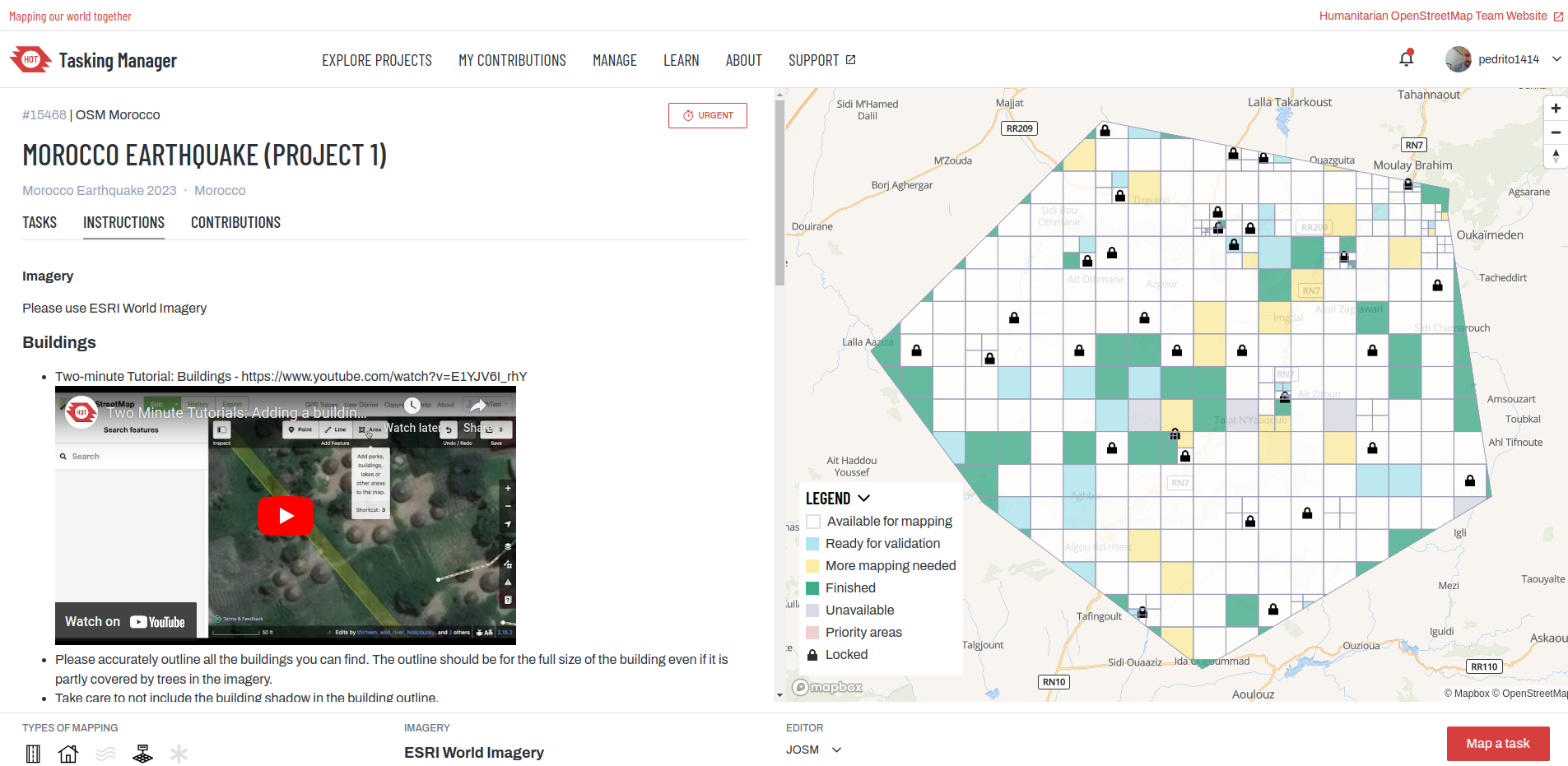
Así pues, este diario trata de identificar algunas formas específicas en las que HOT podría mejorar los flujos de trabajo del Tasking Manager (algo que está firmemente dentro de nuestra esfera de influencia) para ayudar a mejorar la forma en que traemos nuevos colaboradores a OSM (y especialmente aquellos, para los que el TM es una de sus primeras experiencias con OSM) y la forma en que interactuamos y colaboramos con ellos como contribuyentes y comunidades experimentadas.

Posibles cuestiones a tratar / aspectos a mejorar

Lo que sigue no son soluciones, sino una lista de cuestiones que, si se abordan, tal vez puedan contribuir a resolver algunos de los problemas planteados. Por favor, ¡siéntate libre de añadir ideas adicionales en los comentarios (y hacer preguntas / críticas constructivas)!

Conocimiento y comprensión del Tasking Manager (¿y documentación?)

Está claro que hay malentendidos sobre qué es el TM y cómo es el proceso de mapeo a través de él. Existen múltiples conceptos erróneos sobre el origen y la propiedad de los proyectos, a quién sirve la herramienta y cuán accesible es. También hay una falta de comprensión en torno a (o de aceptación de) las dos etapas del proceso (mapeo -> validación), ya que surgen frustraciones en torno a las nuevas ediciones del mapeador (incluidos los datos que se eliminan / los cambios que se revierten) antes de que un proceso de validación haya tenido tiempo de llevarse a cabo. Esto no sólo puede desalentar a los nuevos cartógrafos, sino que también puede impedir que se lleve a cabo un importante proceso de aprendizaje.

Transparencia del Tasking Manager - creadores de proyectos

Cuando el TM estaba completamente abierto a que cualquiera pudiera construir proyectos, había un grave problema con la calidad de los datos, ya que algunos proyectos estaban mal descritos y/o carecían de instrucciones y orientación adecuadas para los mapeadores. HOT ajustó la política de TM de manera que las organizaciones y grupos tuvieron que registrarse y completar el “onboarding” para poder convertirse en creadores de proyectos (es decir, poder publicar un nuevo proyecto). Ahora, a través del Tasking Manager, cualquiera puede encontrar al creador de un proyecto y enviarle un mensaje. Un problema con la situación de Panamá fue que un miembro del equipo global de YM está manejando todas las tareas de YM (actualmente sirve a más de 200 capítulos). Esto dificulta la transparencia a través del TM, ya que los contribuyentes de OSM sólo saben quién implementó técnicamente el proyecto, no quién lo solicitó o lo está administrando localmente.

Espacio para la mejora de la “responsabilidad social” en la orientación inicial a los creadores / gestores de proyectos

El principal objetivo del “onboarding” de los creadores/gestores de proyectos es la ejecución técnica de los proyectos, esencialmente tratando de asegurar que se cumplan las normas y que los cartógrafos puedan hacer lo que se les pide de manera eficaz. La integración abarca las expectativas y aptitudes en torno a: la participación de las comunidades locales y los colaboradores, la respuesta a las preguntas y solicitudes de información, el cierre de los proyectos, la documentación en el wiki (en el caso de la edición organizada), etc. Pero está claro que este aspecto de la integración podría desarrollarse y reforzarse.

Clasificación de las áreas de interés (para los nuevos mapeadores)

Un tema que surgió a través de la situación de Panamá fue que una zona urbana fue categorizada como un proyecto para principiantes. La actual incorporación y orientación para los creadores de proyectos no les ayuda a asegurarse de que el entorno que se va a cartografiar sea acorde con la experiencia del grupo de mapeadores, especialmente cuando es probable que haya muchos principiantes.

La documentación del proyecto no está bien integrada / enfatizada

Independientemente de la calidad de la documentación del proyecto en el wiki de OSM (una convención establecida en las directrices de edición organizadas), la plantilla del proyecto de TM / proceso de incorporación no hace énfasis en la importancia de la documentación ni en el vínculo con ella si está disponible.

Los proyectos del TM no siempre se cierran

Los proyectos inactivos (o apenas activos) pueden “quedarse” en el TM durante mucho tiempo, lo que significa que los datos en el OSM pueden ser incompletos en toda el área de interés. Esto también puede causar problemas si otros trabajos de edición se inician en las mismas áreas / superpuestas. Además, cuanto más tiempo esté abierto un proyecto, más difícil será encontrar a las personas que participaron en la solicitud / creación del mismo.

Los proyectos del TM pueden superponerse (entre sí o con proyectos en otras instancias de TM)

Actualmente no hay forma de saber o comprobar eficazmente si otros proyectos del HOT TM o en otras instancias del TM se superponen a un área de interés. Esto significa que es teóricamente posible (y ocasionalmente ocurre) que múltiples proyectos traigan a diferentes grupos de mapeadores para que aporten datos para la misma área (básicamente diciendo a los mapeadores, “esta área necesita ser mapeada” cuando potencialmente está siendo / ya ha sido mapeada).

Comentarios a través del TM

Aunque esto es posible, no es fácil o intuitivo (y esto se aplica a la retroalimentación / preguntas dirigidas al creador / gerente del proyecto o al propio HOT).

Encontrar mapeadores activos locales a un proyecto no es fácil (especialmente para los nuevos mapeadores)

En la actualidad, se necesitan importantes conocimientos tácitos para poder encontrar colaboradores locales e interactuar con ellos. Aunque se trata de una cuestión más genérica en la que nos gustaría profundizar en un futuro próximo (hay, por supuesto, múltiples herramientas y métodos disponibles para hacerlo), hay poco espacio para ello dentro del propio TM. Sabemos que para algunos mapeadores, el TM es una de sus primeras experiencias en OSM, por lo que ayudarles a integrarse o colaborar con los colaboradores o comunidades existentes dentro de la plataforma podría ser potencialmente beneficioso.

¡Se agradecen opiniones y comentarios!

Por favor, añada cualquier cosa que haya pasado por alto y corrija cualquier error. Una vez que hayamos hecho un poco más de consulta sobre este tema, nosotros (en HOT) podemos mirar si / cómo podríamos tratar lo anterior y cuáles deberían ser las prioridades.

Por cierto, un gran agradecimiento a todos los que me hablaron de esto y me ayudaron a identificar y articular lo anterior, pero especialmente a Rory y Mario por ayudarme a entender los temas específicos de la situación de Panamá. Su tiempo fue muy apreciado.