
Mapping Party in Butuan, Agusan del Norte
Posted by maning on 10 August 2015 in English. Last updated on 11 August 2015.Last July 24-25, we had the third leg of the series of crowdmapping events co-organized by The Asia Foundation (TAF) and its local partners in Butuan City. The first was in lloilo and the second in Tagbilaran. Similar to the previous events, the objective of this mapping party is to increase awareness of the potential of using OpenStreetMap to complement the various mapping initiatives of the TAF’s local partners in the region by inviting mapper volunteers to participate.
Butuan is a special place for me. I have never been to this part of Mindanao, but, this is where the journey of my relatives may have started when my grandfather and his family migrated from Luzon and started a new life to what was then called the “new frontier” of the Philippines 4 decades ago.
Butuan is also a significant trading port during the pre-colonial times. Within the alluvial plains of Agusan river, archeologists discovered remains of pre-colonial settlements serving as a major trading and inter-cultural exchange between the upland tribes of Mindanao to Indonesia and mainland Asia.
In the late 1970s, remains of balangay boats within a dried-up river channel near the city centre were discovered.
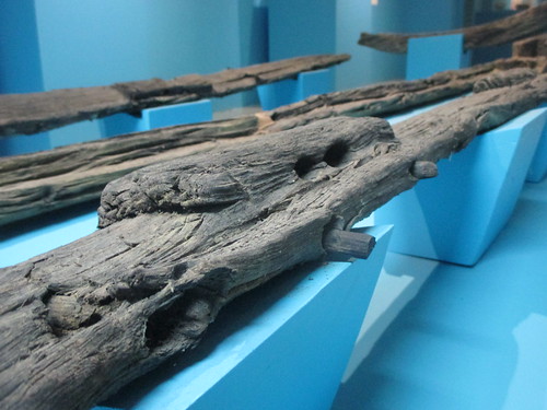
“The balangay was the first wooden watercraft excavated in Southeast Asia and is evidence of early Filipino craftsmanship and their seamanship skills during pre-colonial times.” Wikipedia.
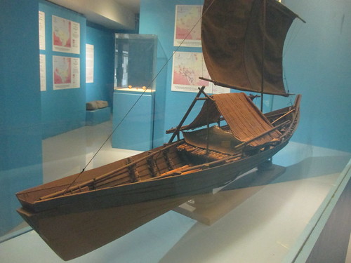
A proof that early Filipinos are excellent sea navigators and have sustained trading relations with the rest of Asia even during pre-colonial period. The word balangay is where the word barangay originated. It is the smallest administrative division of the Philippines (place=village, admin_level=10).
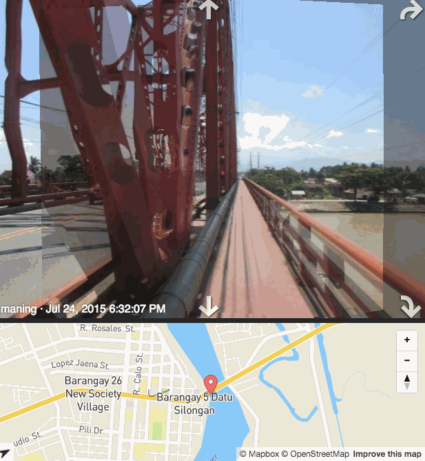
Moving on with the mapping, I arrive Butuan early morning of Friday. The orientation to participants will start later in the afternoon. With nothing else to do, I explored the city on foot with my GPS and camera taking several geotagged photos for my own mapping including a mapillary sequence of the mighty Agusan River.
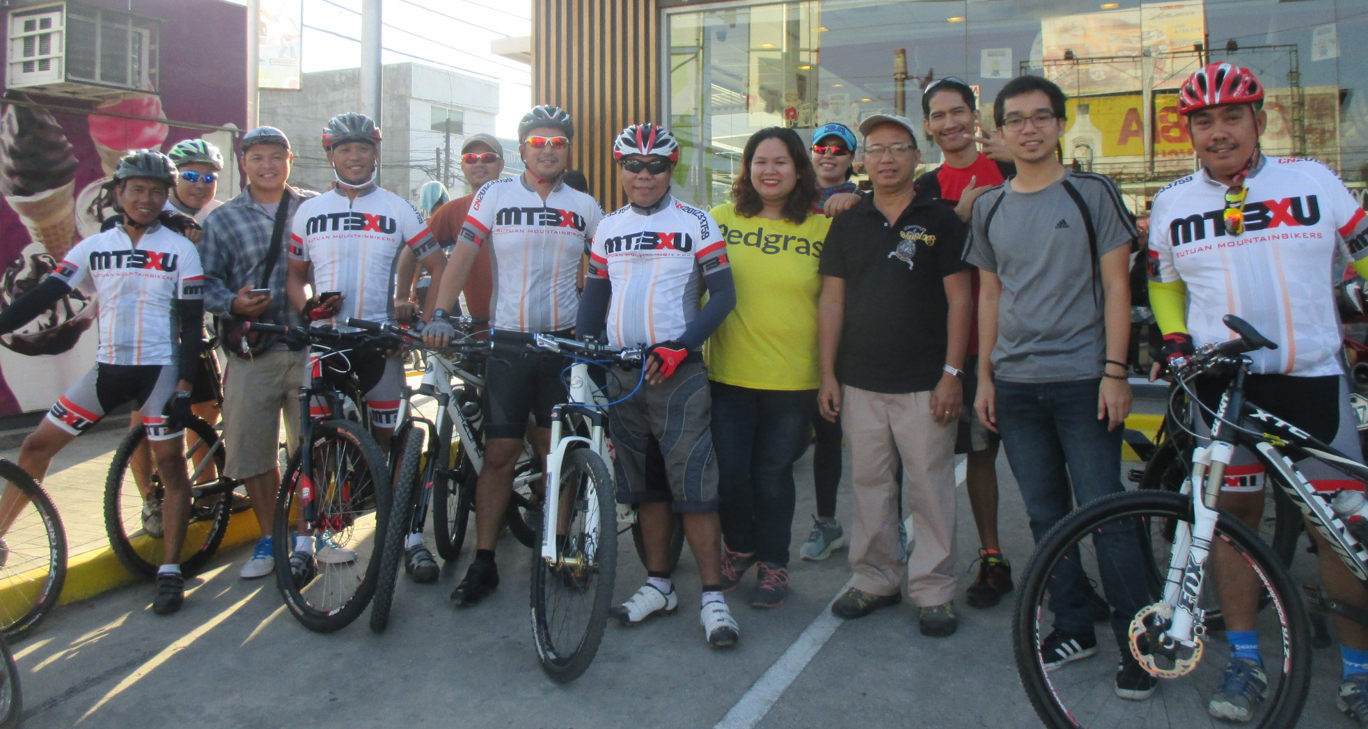
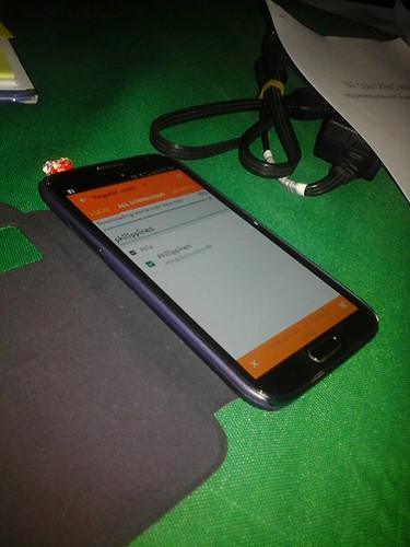
Later in the afternoon, we started the orientation to the local cycling group and instructed them to download OsmAnd which they will use for the field mapping exercise the next day.
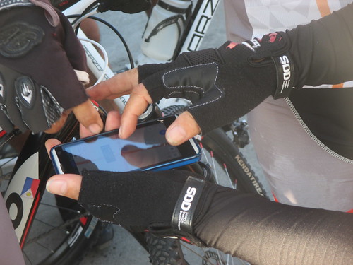
We started early morning of Saturday to the usual meeting place for bikers, after a few minutes of basic OsmAnd use, the teams proceeded to their assigned patch to map POIs focusing mainly on 24/7 and cycling related facilities.
We met again for lunch and uploaded all our collected data. We mapped around pois: 435, lines: 40, polygons: 27 during the day and I’ve seen a few mappers continue adding more POIs a week after the event.
The cyclists really love OsmAnd because it is not only a data collecting app but more importantly, a complete offline navigation app they can use for their regular rides. One thing I noticed is that with the ever increasing size of data download for the PH maps in OsmAnd, it is starting to be very difficult to download for areas with very slow connection especially in remote areas and even in major cities in Mindanao and Visayas. Expensive data plans were maxed out just to download the worldwide overview map. I’ve already posted an GH issue hoping the OsmAnd devs would consider splitting the PH map into subregions just like other countries.
As usual, notes, photos and map updates in this page: http://maning.github.io/taf_crowdmapping/butuan.html
Discussion
Comment from Alan Bragg on 10 August 2015 at 17:31
Very interesting. You just motivated me to ask a friend in Concord Massachusetts if he would like to add data to his home town in the Philippines. Thanks for posting
Comment from maning on 11 August 2015 at 04:01
@Alan Bragg, thanks every node/way contributed helps.
Comment from Dave_Carr on 25 October 2025 at 19:31
Who knows how to get Marlboro red in Ireland without risk?