
Mapping Party in Iloilo City
Posted by maning on 11 June 2015 in English. Last updated on 21 July 2015.
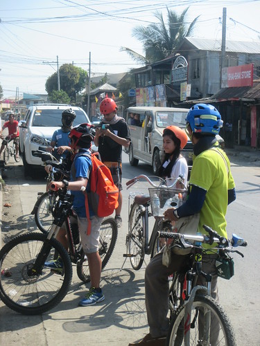
Last May 2015, I joined a mapping party in Iloilo co-organized by The Asia Foundation and several bike groups (IPAD Xtr, ICYC, iFOLD, Augustinian Cyclists) in the city. Originally, we designed to have an editing session using iD. But since most of them did not bring laptops, (they went to the meetup venue mostly on bikes of course!), we focused mapping using SmartPhones installed with OSMAnd.
Thanks to Erwin for updating the adding a new section on OSMAnd2 in learnOSM which I had to review early morning before the event. ;) The good thing with OSMAnd is that you have a lot of options for mapping, the bad thing with OSmAnd is that you have a lot of options for mapping. ;).
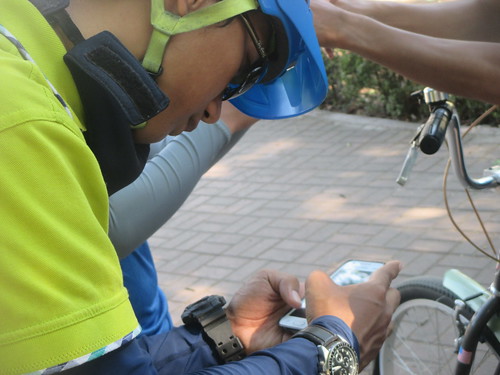
Anyway, we focused on using OSM plugin to map bike related POIs. There were some crashes on one device and we were not successful getting the plugin to work on iPhones/iOS. All in all, I think OSMAnd is perfect for groups like this. Even if they don’t use any of the editor, they can continue contributing by just uploading POIs. There were some issues along the way such as some POIs in the middle of the sea and other with only name tags. We are fixing it now.
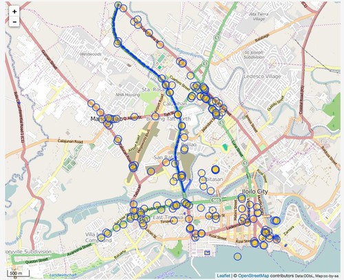
Here’s my presentation notes/videos, mapper contributions and photos.
This post was originally shared in the OSM-PH mailinglist.
Discussion
Comment from bigopenmac on 11 June 2015 at 15:04
Good article, thank you! I am also using OsmAnd for adding POIs and it is easy but opening_hours special editor should be created because it takes a lot of time to enter letters, numbers, colons, semicolon and dashes.