Seen on my (virtual) travels 3. Old Windmills on Anglesey
Posted by SK53 on 6 March 2023 in English.I started drafting this after b-unicycling’s report on her trip to Anglesey as it reminded me that when mapping solar power on the island, I’d noticed a lot of old windmills.

In most of Wales there were abundant sources of water power. So water mills were common before steam engines were available. Many were corn mills, but woollen mills were also common. There was even a tidal mill at Carew.
The only one of these Anglesey windmills I knew about beforehand was the one on Parys Mountain. The stump of the tower is visible from afar. It was used for pumping water out of the copper mines (at one point the largest in the world).

Given that I’d noticed several, most of which could be found marked explicitly as windmills on old maps, I wondered if I could search for others more systematically. Fortunately, the Cymru 1900 project had transcribed text from old maps around the start of the 20th century. In fact the original project, an initiative of the National Library of Wales and other heritage organisations, was expanded to cover the whole of Great Britain. Searches of specific terms can be made from the NLS website, or the whole database can be used..
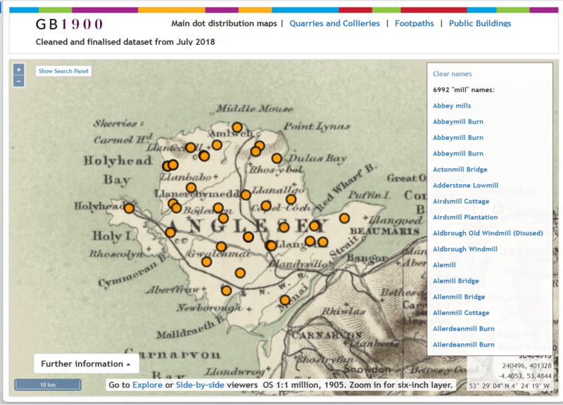
I downloaded the windmills data (as csv) and loaded it into Josm. Selecting just those in Anglesey gave a simple set of targets to check with the To do plugin.
A few are still working, but most have been converted to residential accommodation, or the tower has been secured (as at Llangefni).

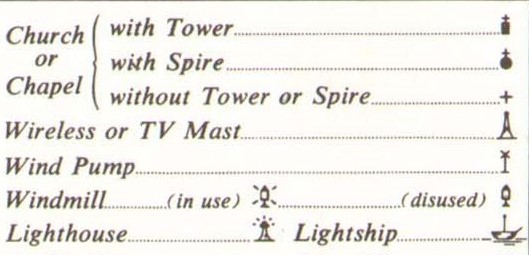
I’ve been a bit naughty in tagging these with disused=yes rather than using a life cycle prefix. The main reason for doing so is to ensure visual feedback whilst editing. (It would be very nice if one of the OSM renderers offered a disused windmill icon ( as the Ordnance Survey did in their 7th series map).
Anglesey has always been grain-growing country, so the presence of corn mill’s makes sense. A maritime climate, allowing growth in the winter months, and a relatively benign topography, particularly compared with the rest of North-West Wales, undoubtedly helped. To the mapper, scrutinising buildings on aerial imagery, cattle farming is actually more apparent these days.
Undoubtedly the text extracted from the old maps from 1900 can be of use in searching for other features, and not just those of historic interest.
The OSM-UK has previously discussed using “F.P.” as a means for locating potential and actual public rights of way. Christian places of worship (those of other faiths were thin on the ground in 1900, although the first mosque in Britain already existed), for instance may help filling the mapping gap for places of worship (the quarterly project for Q4 this year).
I don’t know if they’ll be any help for b-unicycling’s quests for crannogs, tumuli or duns. That is for her to find out!
Discussion
Comment from b-unicycling on 6 March 2023 at 22:40
So it was you who mapped all the solar power. We noticed that alright. Interesting diary entry as well, thanks!
Comment from SomeoneElse on 8 March 2023 at 13:51
FFS - you’ll be adding “(closed)” after the name next :)
Ahem:
https://map.atownsend.org.uk/maps/map/map.html#16/53.1671/-8.0244