OpenStreetMap

ChristianA's Diary

Recent diary entries

Gear for MTB mapping

Posted by ChristianA on 17 September 2018 in English.

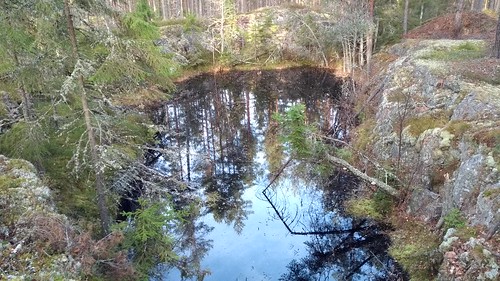
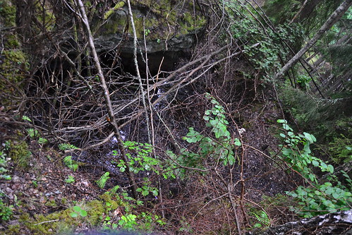
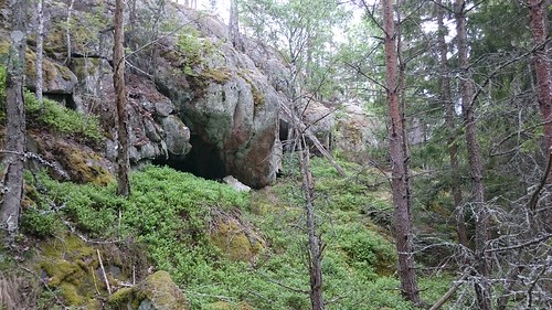
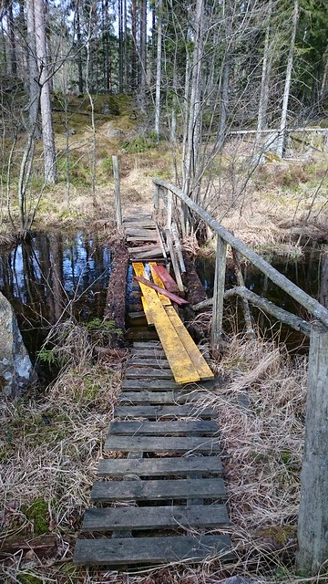
One of my favourite activities is mapping trails and other stuff in the forest, especially when mapping using an MTB. Using a bike allows my to get further quicker than I would by foot, and with the bike I can go more or less anywhere.

Also, it is really fun to ride an MTB in the forests where I live. I try to map the trails that might be useful for others. Another important thing is that other map providers often do not have any information about trails/paths in the countryside.

So I thought it could be interesting to show what stuff I usually pack when going on a trip. Apart from what is shown in the images I also bring some food or snack, such as fruit or a chocolate bar. Then I also keep some backup carbs such as a gel in my pack, just in case I run out of fuel.

Backpack for mapping 
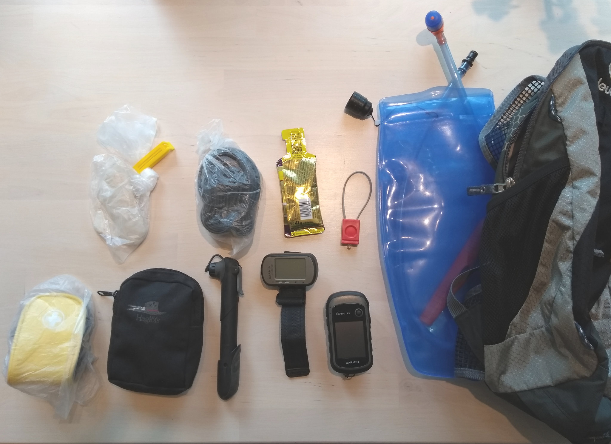
From right to left we have:

  • Backpack and hydration bladder
  • GPS. I usually use an Etrex30, but on longer trips I also bring an old Foretrex as backup
  • Spare bike light. It can’t replace a real light, but it’s small and easy to carry, so it’s good to bring along in case I stay out for too long.
  • Gel or some other form of backup energy. Something that lasts for a long time, so I can keep it in the backpack for a longer period.
  • Reserve tube. I switch size depending on the bike I will use.
  • Bike pump
  • A little toilet paper in a plastic bag. The plastic bag can serve many purposes, the toilet paper can be used for wounds, and of course it can be used normally as well. When you need it, you’re glad you’ve brought it along! And it only weighs a few grams.
  • Tools in a smaller bag. See the image below.
  • First aid kit. Pretty cheap and light, but contains most stuff one may need. I keep this in a plastic bag as well, so it is clean and dry when it is needed.

Tools In the small bag I have:

  • Multitool for bikes (includes a chain tool)
  • Tyre levers
  • Plastic strips. Useful for many things
  • Spare derailleur hanger. Can save you a long walk home.
  • Some spare bolts. I probably need to add a few more different sizes though.
  • Chain quicklinks. Since I use different bikes I bring one of each for 8, 10 and 11 speed chains.

When I go for a mapping ride, I usually go alone, since my biking friends don’t enjoy crawling through thick forests to find an old quarry, trying small paths just to see where they might end up (often dead ends) or spending 30 minutes looking for an old ruin. So when I ride alone I use the OsMoDroid app to automatically send my position every minute so that my family can find me in case I have an accident or similar.

In the GPS unit I have stored POIs for places that I suspect may hold something interesting I might want to map. In the phone I also keep a planned route and the OsmAnd app, which is really useful.

Of course I also bring clothes to match the weather. What I probably should get is a small pocket knife, since that can be very useful if anything happens in the wilderness.

Note: I don’t endorse any particular brand of gear. All these items I have purchased and paid for myself.

Location: Skogstorp, Norrköpings kommun, Östergötland County, 618 93, Sweden

Öppna Data: Import av Lantmäteriets Terrängkartan och Trafikverkets NVDB

Posted by ChristianA on 13 February 2018 in Swedish (Svenska). Last updated on 14 February 2018.

På senare tid har jag importerat en del data från Trafikverket och Lantmäteriet, eftersom båda har släppt en del data som CC0, vilket gör det möjligt att använda i OSM. Jag tänkte dela med mig av några av de erfarenheter jag har fått detta.

Trafikverket

## NVDB NVDB= Nationella VägDataBasen är Trafikverkets databas över vägnätet i Sverige. Det finns många olika fält och Trafikverket släpper inte all information fri vad jag vet. Men det som finns är ganska omfattande. Jag har endast importerat geometrin och översatt ett par attribut så att vägarna ska bli hyfsat taggade i OSM.

Först laddade jag ner alla län och sedan valde jag ut ett par intressanta filer, som jag slog ihop för hela landet. Sedan rensade jag bort (för mig) ointressanta attribut från shapefilen med QGIS. Jag har använt Vägtyp och funktionell vägklass för att gissa vilken “highway”-tagg som ska användas. Hastigheten går att använda rakt av. Dessutom har jag försökt gissa beläggning efter Vägtyp och funktionell vägklass. För de vägar i tätorter där gatunamn finns har jag importerat dessa. Allt detta har gjorts i QGIS med hjälp av Fältkalkyltorn och ett par rediga CASE-satser. Fördelen med att mappa om attributen redan i shapefilen är att när man sedan importerar denna i JOSM kan behöver man bara kopiera vägarna mellan shapefilens lager och det aktuella OSM-lagret, taggarna finns ju redan på plats, vilket sparar tid. Eftersom JOSM inte kan hantera shapefiler så bra har jag ett litet script som klipper ut det område jag är intresserad av ur filen med hela Sveriges vägnät.

Lantmäteriet

Lantmäteriet har släppt Terrängkartan i vektorform fri. Detta är ju roligt, men inte så roligt som jag hoppades på. Det är nämligen så att informationen är förenklad för att passa en viss skala och för att kartan ska renderas snyggt. Det innebär i praktiken att objekt i Terrängkartan inte alltid ligger på rätt plats jämfört med verkligheten. Detta gör det lite knepigare att importera direkt utan att korrigera positionen för varje enskilt objekt, vilket ju tar en del tid.

Vägar från Trafikverket och Lantmäteriet Var är vägen? Det skiljer upp emot 10 meter mellan NVDB och Terrängkartan.

För Terrängkartan gjorde jag ett script i Bash som (med hjälp av ogr2ogr) delar upp lager i underlager och byter taggar för att passa med OSM. Dock visade det sig att detta inte alltid var så bra, eftersom man ofta får lappa ihop saker manuellt i JOSM när man tex tar vattendrag och våtmarker från separata lager.

Djävulska multipolygoner

Skog och åkermark har jag tyckt varit svårt att importera från Terrängkartan. Anledningen är att Lantmäteriet har dessa lager som riktigt maffiga multipolygoner, som är lite för stora för att vara praktiskt hanterbara i JOSM. För mig går det fortare att bara rita av dessa områden från satellitbilder. (Se även om aktualitet nedan). Någon mer kompentent karterare kanske fixar det bättre än jag dock. Skog-lagren innehåller dock info om skogtyp (barr eller löv) vilket ju vore trevlig att kunna importera.

Tidens tand (Aktualitet)

Ett annat problem med Terrängkartan är att datat inte alltid är uppdaterat. Detta gäller nog främst på landet, men det hjälper ju inte mig som främst karterar landsbygd. På bilderna nedan visas en bild på lagret “öppen mark” ovanpå Ortofoto från 1975. Uppe till höger i bilden kan man se ett område med öppen mark som inte finns kvar på nyare bilder, som den från Google nedanför. I båda fallen kan man även se att objekten i Terrängkartan ligger något förskjutna mot verkligheten så som nämnts ovan.

Gammalt ortofoto Gammalt ortofoto med “Öppen mark”.

Nyare satelitbild. Bakgrund från Google Nyare satellitbild med “Öppen mark”. Notera området uppe till höger som ej längre verkar vara öppen mark.

Möjligheter

Finns det då inget man kan använda Terrängkartan till? Jodå, det finns en del användbart. Jag har tex använt vattenlinjer, traktorväg (resten av vägarna tar jag från NVDB), kraftledningar, eljjuspår, gruvor, fornlämningar mm. Så undersök gärna datat och se vad du kan få användning av!

Guldgruvan

En riktig guldgruva för den som karterar på landsbygden är för övrigt Ekonomiska Kartan (vars upphovsrätt har gått ut). Den har namn på sjöar, gårdar, byar, torp, skogar, berg och massa annat. Visst har en hel del ändrats sedan kartan gjordes, men namnen är ofta fortfarande aktuella. Dessutom kan man använda kartan för att hitta saker som inte riktigt finns kvar, tex banvallar från nedlagda järnvägar.

Location: Katrineberg, Björsäter, Åtvidabergs kommun, Östergötlands län, Sverige

The little cape made out of slag

Posted by ChristianA on 26 November 2017 in English.

Yesterday morning I went on a short bike trip. Since the mountainbike conditions are not very good at the moment, I took a ride on my cyclocross bike. As the temperature had been a few degrees below zero, the gravel roads were perfect (like sandpaper glued to concrete!) so the ride was very enjoyable.

The "Slag cape" in Stavsjö

I checked out a few paths and small logging roads that I had not mapped before. I also visited “Slaggudden” (meaning “The Slag cape”) in Stavsjö. In lake Stavsjön it is a small piece of land that consists mostly of discarded slag from the ironworks that started in this village in 1666. The ironworks in this small village was the largest producer of cannons in Sweden, during the time of the Swedish empire.

Anyway, I tagged the place as “natural=cape”, though it is not really natural.

Slag

Slag

Location: Björkebo, Stavsjö, Nyköpings kommun, Södermanland County, 618 95, Sweden

The joy and sadness of open data

Posted by ChristianA on 10 November 2017 in English.

When I started out with OSM (around 2011) there were no satellite data I could use with OSM around where I live. If I wanted to map something it always meant going out in the field, and often estimating distances between things in order to get a fairly complete picture of, say, a residential area. I would add a mark in my GPS where a residential area started, and estimate how “deep” the gardens were, in order to be able to draw the residential area in JOSM.

As the years have gone by, OSM have become more popular, both in terms of mappers but also in number of end-users. At the same time there has been an ongoing trend to publish more geographical data as open data. So one day I found fairly decent satellite imagery in JOSM for my main mapping area. I was glad to see that my guesswork was, on average, not too bad.

Recently both the swedish road administration and the land survey has released vector data as CC0, making it possible to use import it into OSM. This in itself is a good thing. However, for me the mapping work has more and more become armchair mapping; drawing areas on top of satellite imagery or editing shapefiles to match OSM tags. Though I like to see the results after having uploaded a large edit, I must admit that it makes the mapping work a bit boring. It’s a bit more like administration, which I have always found a bit dull. Or like being stuck indoors a beatiful summer day…

So, my dear mapping friends, don’t forget to go outside and map the real world. Grab your GPS, put on your walking (or biking!) shoes and boldly go where someone probably has been before, and discover and map all that the world has to offer! The mapping adventure is just outside the door!

Location: Häradsgården, Krokek, Norrköpings kommun, Östergötland County, 618 30, Sweden

More mapping of old quarries

Posted by ChristianA on 2 November 2017 in English.

I’ve been busy lately and haven’t had time for much OSM mapping. But yesterday I went on a mt bike trip. I had planned the route so that I could check out some old quarries and a couple of possible paths as well.

The temperature was a couple of degrees above 0, but there was still ice on the small pools of water on the trail. Sometimes the ice was so thick that the bike would not simply go through but first skid on the ice and then go through. It was also very muddy and wet, so the biking conditions were quite tough. But if you go mtb-biking in Sweden in november, these conditions are pretty normal.

The first quarry had not been used for some time, but it was quite easy to find. It was used for stone material, not any metal extraction. Stora Mossen

Shortly after visiting the first quarry, I put the bottom half of the bike inside a lake, to remove some of the mud from the gear. When I continued, the bike broke however. The bolt that hold the saddle to the seatpost broke. Of course I did not have a spare bolt with me, so I had to decide whether to call it a day or not. But since I don’t often get the time to go out biking/mapping, I decided to continue even though it meant biking standing up for more than 20 km.

I could not go as fast as before, but it worked quite ok. After a while I found the second quarry. This was a granite quarry, and had been open in the 80s. The nice thing about it was that there were still lots of large blocks of stone stored inside the quarry, as can be seen on the pictures. I climbed a couple of the to take pictures, but did not stay very long.

Hjälmarsö

Hjälmarsö

On my way back home I mapped 2 paths I hade planned for some time. But the last kilometers in the forest were quite hard since I was quite tired after biking standing up. Especially the technical climbs were tough since it was difficult to maintain the right torque so that the bike would get up the climb without losing grip on the wet roots and rocks.

Even though I was a bit disappointed in the bike braking down, I was quite content with the mapping, and happy that I had decided to carry on anyway….

Location: Jakobsberg, Kvillinge församling, Norrköpings kommun, Östergötland County, Sweden

A trip to Dwasieden castle ruins

Posted by ChristianA on 29 July 2017 in English.

So we’re on Rügen; the beatiful island on the coast of Germany. This used to be a part of DDR during the cold war. Of course there are still many things left from this period. One such thing is the Dwasieden castle. There is no english wikipedia page for it, unfortunately, but at least a short german one: Dwasieden on german wikipedia

Ruins among the trees

In short, the castle was used by the Kriegsmarine during WWII. After the war, the Red army destroyed most of the castle but used the area for military purposes. There are industrial buildings (more or less ruins) left in the area, what seems to be bunker entrances and many remnants from military and industrial activitivies. I would love to know more about it, but it seems hard to find info in english.

Second floor

Anyway, most of the buildings and roads in the area are quite well mapped, so when I arrived it seemed there was not much for me to add. However, the actual castle did not have any outline in OSM, just a single node. I did not have much time for my visit, but I traced one lap around the ruins, and walked a bit on what was left of the second floor in the southwest wing.

Section of (partly destroyed) first floor

When I got home I used the blueprint found on Wikimedia commons and tried to adjust it to my gps track, using JOSM. Unfortunately my track was not very accurate, but I tried anyway. Since the blueprint had a scale ruler on it, I could at least adjust the scale of the image fairly accurately in JOSM.

JOSM screendump

Probably someone may improve this work, but it was a very interesting visit. One could spend days there mapping things.

Location: 18546, Buddenhagen, Sassnitz, Vorpommern-Rügen, Mecklenburg-Vorpommern, Germany

So, it’s vacation time. Lots of time to do some mapping. Well, not really when one has a house that needs attention, and 4 kids that can’t be left alone for too long.

Today I had some time, but it was raining. But the two oldest kids wanted to come along for some evening mapping of old quarries. The areas surrounding our village has plenty of old quarries. Some are marble, while the older ones are most often iron or copper. Over the years it has sort of became a separate hobby to find and map them all.

I had seen the quarries on an old orienteering map, so I knew were to go. Lots of fallen trees over the quarry

The second hole was a little scary since it was quite far to the bottom in one end. Deeper hole

The last three holes were quite small and also quite shallow Kids in a quarry

Afterwards, we went to a nearby location to look for two more small quarries. All in all, 7 quarries in about an hour. Still there are probably at least 20 more quarries left to find. I need a long vacation…

Location: Nya Holmtorp, Norrköpings kommun, Östergötland County, 618 32, Sweden

Yesterday my brother came by for a visit. He wanted to go for a short walk in the forest. So we drove to a place that we had planned to check out for some time. According to some an old quarry map, there was supposed to be a quarry for black granite in a forest area. The exact location was quite uncertain, and it was not entirely clear if the thing existed at all.

So we parked the car were the road ended and started walking along an road created by forestry machinery. We searched but could not find any trace of any quarry. Finally we gave up, but on our way back to the car we decided to try another old forestry road. After a few hundred meters we spotted an bare rock surface that looked interesting. It did not have any quarry, but instead several cave entrances. The caves were quite small, but still! These caves did not exist in the swedish cave database, which made them a very nice find!

Caves!

Then we decided to walk a few hundred meters further, since my “slope map” showed that there could be something interesting nearby. Then we saw an old road that was constructed of “skrotsten” (discarded stones from quarries or mines)!

Old road in the forest

Then we saw a large pile of discarded stones. We had found the quarry! Continuing on through the trees that had grown on top of some of the stones, we found the actual quarry hole as well. Most of it is waterfilled. Unfortunately I did not bring my camera, since it was a spontaneous trip, so I could only use my cell phone.

Waterfilled quarry

The final interesting thing we found was the ruin (concrete foundations) of an old building, close to the quarry hole. What it’s purpose had been, we could not figure out.

Ruin

All in all, we found several interesting things during our short walk. As a bonus we also saw a very beatiful fox, which was quick and shy for taking pictures of, however.

Location: Norrtorp, Norrköpings kommun, Östergötland County, Sweden

Ruins of another sawmill

Posted by ChristianA on 2 June 2017 in English.

So I found the ruins of another sawmill in a forest. OK I had known about it for some time, though I was not sure it was much left or not. On an old map from the 40s (Ekonomiska kartan) it was visible and on an orienteering map from the 80s it was marked as a ruin. So I figured there might be something interesting there.

Ekonomiska kartan

Orienteering map

On my last mtb tour I went to look for it. I started to look for the path that was supposed to be through the forest. This turned out to be a mistake. There were note many signs of any path and I more or less had to carry my bike through parts of the forest. When I reached the water I finally saw an old path. I started to cycle on it, but after perhaps 50 meters it disappered again. Then the terrain got worse; wet mud combined with high grass with old dead trees on the ground. I was about to give up several times but always thought that if I would have given up, the whole thing would be for nothing. So I kept going.

Finally the ground became smoother and I found myself on an old road of sorts. And after a few meters I saw a pile of old broken bricks. Then I saw concrete foundations sticking out among the trees; I had found it! There were not much apart from the concrete foundations. And since there were so many mosquitoes trying to feed on me I did not want to stay for too long. I wanted to search for any old railway tracks, but the high grass made that difficult.

Fancy looking ruins

I took a few pictures and tried to outline the concrete structure with my gps. Then I followed the nice and even road out from the forest. I plan to go back someday, during autumn when there is not so much grass and mosquitoes. Then I will use the road directly and save myself 20 minutes of bike carrying.

The final result

Location: Norrköpings kommun, Östergötland County, Sweden

Last week I went twice to visit (and map!) the ruins of an old sawmill, called Älsebo såg in swedish. There were two POIs on openstreetmap, but I wanted to check it out to see if I could map some areas also, and perhaps roads as well.

The first time I was out biking and mapping in the forest. I knew from studying an old map that there was supposed to be an old disused road in the forest. These are among my favourite things to map and so I was very happy to find the road in the forest. Unfortunately there was a stream crossing the trail, and the bridge was more or less nonexistent:

Not the best bridge I've crossed

It was possible to cross but very difficult to also get my bike across at the same time. I considered throwing the bike, but since it is only two months old I’d rather get wet instead. But I managed to get across.

Anyhow eventuelly I arrived where the old sawmill was supposed to have been, and I immediately discovered both ruins and another old road in the forest. Älsebo såg

The ruins were pretty easy to find, though one side of the stream had many trees lying over the actual ruins. Älsebo såg

Close to the sawmill I also saw the ruins of what probably was an old residential building, probably related to the sawmill.

Älsebo såg

Since I was out biking and still hade a long way back home, I decided not to stay very long. Instead I went back two days later, bringing my kids along. They played in the stream while I went around and took pictures and GPS traces. The kids love this kind of places; they can play as much as they like and they can stay for a long time. I really enjoy combining hanging out with my kids in the forest and mapping.

Since the main sawmill buildings were inside the river canyon and had high buildings around them, the GPS traces were not very reliable, so it was quite difficult to trace the outline of the ruins, but I tried anyway.

I also followed another old road close to the sawmill; this had probably been used at the same time as the sawmill. It connected to both lake Ämten and the other old road I found earlier. All in all I am quite happy with the results, though there may still be more interesting things in the area to map.

Location: Älsebo, Kvillinge församling, Norrköpings kommun, Östergötland County, Sweden

I like mapping by going out in the field, especially in the forest. Finding new (for me) trails and roads is very fun.

For mapping in Sweden I often use an old (expired copyright) map called Ekonomiska Kartan, by adding is as a tile layer in JOSM. It has names for farms, hamlets, mountains, forests, lakes and so on, which is often hard to come by otherwise. However, since it is old many things have changed on this map. I use this map together with Mapbox satellite images in JOSM, which is more recent.

Sometimes it is hard to determine if an old road, or similar, still exists, bu purely looking at Ekonomiska Kartan and Mapbox satellite. Recently I made a tile layer (just for the area where I live) that consists of DEM from SRTM, together with slope data from the Swedish forestry administration (Skogsstyrelsen). While this data is “open data”, it has a license that is incompatible (I think) with OSM. So I just use this tile layer to figure out where to go with my GPS to map in the field.

One such example is shown below. Ekonomiska kartan (the old map) Ekonomiska kartan show a road traversing the railroad track in the center of the picture.

DEM/slope

It is clear that some parts of the old road still remains. So I went there as part of a recent mapping/biking tour, and found a nice path on both sides of the railroad tracks.

And the final result is

Final map

Location: Grindstugan, Nyköpings kommun, Södermanland County, 618 95, Sweden