OpenStreetMap logo OpenStreetMap

Users' Diaries

Recent diary entries

Introducing PowerShell.Map v1.0.0

I’m excited to share PowerShell.Map - a new module that brings interactive OpenStreetMap visualization to the PowerShell command line!

What it does

PowerShell.Map opens interactive maps in your browser directly from PowerShell commands:

# Display multiple locations
Show-OpenStreetMap Paris, London, Rome

# Show routes with turn-by-turn directions
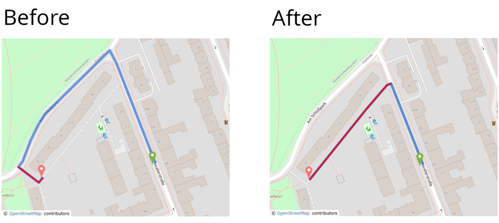
Show-OpenStreetMapRoute -From Tokyo -To Osaka

# Create animated tours
Start-OpenStreetMapTour Tokyo, Kyoto, Osaka -Duration 2

Use cases

PowerShell.Map brings OSM’s powerful features to the command line:

  • Zero setup: Interactive maps with a single command - no web development needed
  • Scriptable: Automate map generation from CSV, databases, or any data source
  • AI-powered: Let Claude Desktop create maps via natural language

Technical stack

This project is built entirely on OpenStreetMap’s ecosystem:

  • Leaflet.js for interactive map display
  • OSM tiles for base maps
  • Nominatim for geocoding
  • OSRM for routing and directions
  • Built-in HTTP server for seamless browser integration

Thank you to the OSM community for providing these excellent services!

AI integration

PowerShell.Map integrates with Claude Desktop via PowerShell.MCP, enabling natural language map visualization.

First, tell Claude to set up the module:

“Show me some fun map demos using the PowerShell.Map module”

Then simply ask for what you want:

  • “Show me a tour of famous temples in Kyoto”
  • “Create a route from Tokyo Tower to Senso-ji Temple”
  • “Show me a walking tour of cafes in Paris”
  • “Plan a hot spring tour across Japan with routes between locations”

Claude translates these requests into PowerShell.Map commands and displays the interactive map instantly.

Links:

Installation

See full entry

Are you tired of mapping only highways and buildings?

Come with us and let’s map the World together 🌎


I am very happy to tell you about the initiative that was coordinated by me and promoted by my company, IVIDES DATA™. We organized three online meetings in September and October 2025, where I taught about mapping with the iD and the JOSM editors, from simple features, such as paths, to complex features, such as multipolygons, and also validation with JOSM, OSMCha, Osmosis and OSM Inspector.

With this initiative, we could note that people are not very familiar with editing something different of buildings and highways, which is part of countless campaigns promoted by other private companies and international NGOs operating in Brazil, where I live. To understand this movement in my country, you can read the chapter that I wrote in my last book.

I really hope these training sessions can help more people to understand the power behind the OpenStreetMap project… Yes! It is a 21 years old global project and not only a platform. Please, do not miniaturize the OSM, reducing it to its website.

And I would like to emphasize that this material is not only useful for teaching activities, but can be also a useful resource for you to apply to your projects and to inspire you to create more and better projects!


Training Session #1 - Mapping ways in OpenStreetMap with iD editor


At this session, I show how to map other type of ways, like waterways or sidewalks, with iD, the easiest editor for OSM. And some of the golden mapping rules for this kind of mapping and conceptual content to prepare you to the other two lessons.

See full entry

A LATAM community with new energy, and the SotMs have a lot to do with it

I am very happy to observe and participate in a trend that, since 2024 in Belém (Brazil), has been moving forward: a very positive streak in the OSM Latam community —the community where I am most active— around people who have managed to mobilize more people and remain united and cohesive up to the next regional State of the Map, which has already been chosen together with our Mexican community to take place in the historic center of Mexico City, in the wonderful historical building of the Antiguo Colegio de San Ildefonso.
A very good alliance and a very good omen with the Instituto de Geografía of UNAM, a historical debt for the OSM Mexico community.

I have always been convinced that the regional level in Latam has the greatest potential to share its impactful experiences and to strengthen deeper dynamics, as seen at different times in its history. And we are precisely in one of those moments.
This same community is the one that gave birth to another of my dearest communities, Geochicas. For me, it is a nursery where important things emerge.

So it really gives me great joy to see us growing around the organization of these State of the Maps, and to see how it has happened since Belém, now in Medellín, and that it also looks promising for Mexico — a true regional collaboration, and not just a responsibility assumed by the host country.

It’s also been some time since this community used to have frequent tensions, leading to frustration and resignations caused by exclusionary visions. Curiously, a time of calm and novelty has arrived, and it feels VERY good.

For me, the State of the Map Latam Medellín has been the reaffirmation of something that could already be felt for about a year or a little more.

SotM Medellín

See full entry

Location: Comuna 12 - La América, Perímetro Urbano Medellín, Medellín, Valle de Aburrá, Antioquia, RAP del Agua y la Montaña, Colombia

Una comunidad LATAM con nueva energía, y los SotM tienen mucho que ver

Estoy muy feliz de observar y participar en una tendencia que, desde 2024 en Belén (Brasil), se ha movido: una racha muy positiva de la comunidad OSM Latam —la comunidad donde más activa soy— en torno a personas que han sabido movilizar a más personas y seguir siendo unidas y cohesionadas hasta el próximo State of the Map regional, que ya ha sido elegido con nuestra comunidad mexicana para suceder en el centro histórico de la Ciudad de México, en el maravilloso edificio histórico del Antiguo Colegio de San Ildefonso.
Una alianza muy buena y un muy buen augurio con el Instituto de Geografía de la UNAM, una deuda histórica para la comunidad OSM México.

Siempre he estado convencida de que el nivel regional en Latam es el que más potencial tiene para compartir sus experiencias de impacto y impulsar dinámicas de fondo, como se ha visto en diferentes momentos de su historia. Y estamos en uno precisamente. Esta misma comunidad es la que ha dado nacimiento a otra de mis comunidades queridas, Geochicas. Para mí, es un vivero donde surgen cosas importantes.

Entonces, me genera realmente un gran agrado vernos crecer en torno a la organización de estos State of the Map, y ver cómo ha sucedido desde Belén, ahora en Medellín, y también pinta para México una real colaboración regional, y no una responsabilidad esencialmente asumida por el país anfitrión.

Ha pasado también un tiempo desde que esta comunidad tenía tensiones frecuentes, desembocando en frustraciones y renuncias por visiones excluyentes. Curiosamente ha llegado un tiempo de calma y de novedad, y se siente MUY bien.

Para mí, el State of the Map Latam Medellín ha sido la reafirmación de algo que se podía sentir desde hace un año o un poquito más.

SotM Medellín

See full entry

Location: Comuna 13 - San Javier, Perímetro Urbano Medellín, Medellín, Valle de Aburrá, Antioquia, RAP del Agua y la Montaña, 050033, Colombia

Με τη βοήθεια της ιστοσελίδας του Σκλαβενίτη, έκανα ένα πέρασμα από τα καταστήματα σε όλη την Ελλάδα εκτός της περιφέρειας Αττικής που ούτως ή άλλως είναι σε πολύ καλό επίπεδο χαρτογράφησης. Ήθελα να βρίσκω τη διεύθυνση σε κάθε κατάστημα που έχει συνήθως και σταθμό φόρτισης για να την περνάω και σε κάθε σταθμό.

Σημείωση, ότι υπάρχουν και επιπλέον καταστήματα “Franchise Σκλαβενίτης” που δεν εμφανίζονται στην ιστοσελίδα του Σκλαβενίτη. Σε αυτά κρατάμε το brand αλλά έχω δώσει τη σωστή ονομασία που είναι εμφανής έτσι και αλλιώς σε κάθε κατάστημα Franchise.

Σύνδεσμοι

I am so excited to have Unique Mappers RSU chapter virtual event taking off today for the next 3 days. I am also excited to have Favour and Adanna anchoring this event as part fo their internship program task

Prof .P Ede of Geography Dept and Dr . Erefama of Geology was in attendance along with so many others .

Cheers to Unique Mappers Nigeria

Posted by Mikhail Kuzin on 13 October 2025 in English. Last updated on 14 October 2025.

Good day, friends!

We’re excited to announce the official launch of our OSM editor.

OSMPIE — OSM Perfect Intersection Editor

This specialized editor helps users efficiently add and correct road and intersection data.

hero-img5

The application enables you to:

  • Visualize roads and intersections based on the OSM semantic model.
  • Verify tags and road structures — inaccuracies and inconsistencies are instantly visible.
  • Share links to your edits for discussion and review before uploading data to OSM.
  • Export render data to GeoJSON.

The OSM semantic model is almost perfect but lacks a few elements for creating truly flawless intersections. OSMPIE provides several specific tags and extensions for existing ones. Their syntax and application are detailed in the documentation, which includes compelling examples.

Explore the key features:

See full entry

Posted by VMPanes on 13 October 2025 in English.

It’s been a week since the State of the Map (SOTM) 2025 and this edition of State of the Map actually had a lot of firsts, it’s the first to be held in Asia and it was actually the first that I’m attending. I’ve been to a fair share of conventions and conferences but this is really my first time going to a one specifically about mapping and OpenStreetMap.

upd

See full entry

Location: UP Campus, Diliman, 4th District, Quezon City, Eastern Manila District, Metro Manila, 1101, Philippines
Posted by liums on 13 October 2025 in English.

I am currently trying to properly import bus stops data into OSM (see here for the details). I did tests upload on the dev server, but I didn’t find a way to revert a changeset : the osm-revert-scripts can get a changeset content, and seems to generate a revert changeset (the log list all created nodes and say it will delete them) but at the end don’t delete anything.

I found some tools than can act on the prod server but I’d like to test before on https://master.apis.dev.openstreetmap.org … does somenone know a good tool for this ?

Thank !

Posted by Justinebaekc on 12 October 2025 in English. Last updated on 13 October 2025.

The State of the Map (SOTM) conference in Nairobi gave me a great opportunity and motivation. From that experience, I realized that even a small contribution can create a huge impact. Since attending SOTM Nairobi, I have amplified my involvement in mapping contributing More than one million edits before attending SOTM Manila.

SOTM Manila

After the Nairobi conference, I was deeply inspired to make an even greater difference through mapping. I became more active in Humanitarian OpenStreetMap Team (HOT) projects, trained others to map, and became an advocate for bringing more people onto the OpenStreetMap (OSM) platform. I also participated in several projects in Rwanda, such as tree planting and tree mapping using EveryDoor which is aimed at promoting climate resilience and slope stabilization. Also , I engaged in mapping urban green spaces to support environmental sustainability, Mapping of Health Facilities in Rwanda etc.

See full entry

I create POIs covering permanent buildings by providing addresses, coordinates, categories, photos, and general information in the latest or most updated POIs, based on real-world data from surveys on foot and by motorcycle. Weather conditions play a significant role in POI creation. Heavy rain makes it difficult to create POIs because photos are unclear, and conversely, very hot days make it impossible to take objective photos. I create POI data for OpenStreet Maps. I hope it’s useful for everyone here. I’d be thrilled if I received support from all my friends. You can see the POIs on my OpenStreetMaps profile. Thank you.

Location: Kampungbenteng, Benteng, Ciampea, Bogor, Jawa Barat, Jawa, 16620, Indonesia

I like to enable creating Notes in a MapLibre map. This should be possible both anonymously and while logged in. The following documents the learning steps using plain vanilla JavaScript. Improvements or feedback welcome.

In OpenStreetMap, a note allows users to leave feedback, report missing information, or provide hints directly on the map without editing it themselves. In other words, it serves as feedback or comments that other mappers can see and later act upon.

OAuth and Notes in OpenStreetMap

OAuth

OAuth on OpenStreetMap is a mechanism that allows third-party applications to perform specific actions in a user’s OSM account without requiring the user’s password.

The first step is to create a token.

Creating a Token

  1. First, I log in to my account or register if you do not have one: https://www.openstreetmap.org/login
  2. Then I go to the OAuth application management page:
https://www.openstreetmap.org/user/<your_username>/oauth_clients/new
  1. Enter the application details.

A form with several fields appears, as shown in the image below. It is important that the redirect URL exactly matches the one used in your application. Special attention is required: it must match the registered app exactly, including the trailing slash. For local testing, 127.0.0.1 can be used; unlike localhost, HTTPS is not enforced here.

See full entry

Posted by b-unicycling on 11 October 2025 in English. Last updated on 13 October 2025.

EDIT: I had to rename the tag due to the more common UK usage, but I’m leaving the title of the diary entry: historic=tyring_platform

[On with original text:]

There is a strange site in Thomastown, Co. Kilkenny where you have a circular stone and several iron hoops in the ground, and I’ve often wondered what it is, and presumed it had something to do with tying up horses.

This week, I bought Deirdre O’Neill’s excellent book “Remnants of Our Past” (which I’m incidentally acknowledged in and which has quite a few overlaps with topics I have covered in my videos). And lo and behold, now I know! It was the site of a smithy or forge (marked on old Ordnance Survey maps), and the circular stone is a “binding stone”. Those stones, often recycled millstones were sunk into the ground near the smithy, a cart wheel placed on top with the hub in the centre depression of the mill stone, and a new iron rim placed around the wheel that way.

Obviously, I will have to make a video about them and get other people to map them. I have mapped the one in her book which is in the courtyard/ bailey at Parke’s Castle in Co. Leitrim and has a wheel placed on top permanently. I might go there in November and take a better photo.

I think the car is “conveniently” parked on top of the one I know here in this Panoramax imagery: https://panoramax.openstreetmap.fr/?s=fp;s2;p7d10fd92-62d3-4760-956c-4feca8ca6642;c64.16/-17.89/0;m18.93/52.5221343/-7.1369549;vd;bs

See full entry

Location: Kilmore, Sramore ED, Manorhamilton Municipal District, County Leitrim, Connacht, Ireland
Posted by aselnigu on 10 October 2025 in English. Last updated on 12 October 2025.

In Leaflet, I really enjoy using Leaflet.Control.Layers.Tree and find its possibilities amazing. That’s why I’ve named the control I describe here Layertree. For now, I want to start small and document the learning steps I’ve taken with vanilla JavaScript. Since I don’t have much experience yet, feedback or suggestions for improvement are very welcome! I hope this post will be helpful to others who are learning as well.

Layertree Control

Base Layers

A base layer is the lowest map layer that provides the general background or geographic context — things like:

  • Streets, buildings, rivers, landscapes
  • Satellite imagery or simple map drawings

It serves as the foundation on which other data can be displayed as overlays (e.g., markers, routes, thematic layers).

There is already an official control, maplibre-basemaps, which, however, only supports raster sources. I want to make it possible to use vector sources as basemaps as well.

Here’s a simple code example showing how to create a custom basemap layer switcher in MapLibre GL JS to switch between different base maps (layers) — whether vector or raster.

See full entry

Posted by Hevy Upon Ye on 10 October 2025 in English. Last updated on 13 October 2025.

About a week ago, I was thinking about the height of the buildings of my campus from above, especially in relation to the relatively flat terrain and skyline around Daytona Beach. Other then Embry-Riddle and the speedway, the only other ‘tall’ buildings are literally just hospitals that I can see two of from my sixth-floor dorm.

I had figured that the OSM state of the map seemed pretty good from a first glance, but looking at the F4map Demo showed me that some the 3D data was scuffed, for lack of a better term. Think: flat buildings and parking garages, ghost buildings in place of flat terrain, etcetera. I figured I could go in and correct some heights and roof shapes during class. While I was doing this, I noticed that a bunch of the building footprints were also misaligned (and some were just straight inaccurate), so I figured it wouldn’t hurt to fix those in later changesets.

My first changeset that involved actually editing the shape of buildings was my first polish pass on New Residence Hall 1. This dorm, along with New Residence Hall 2, has two rather obvious wings that are connected via a hallway bridge on every floor other then the first, where the main entrances are. The F4map had this missing for both the dormitories, and the editor revealed that NRH1 was being represented by two different buildings that shared a wall each with the bridge, which was also its own building, for some reason. It was relatively easy to delete two of the ‘buildings’ and extend the third to cover NRH1’s full footprint, and using building part tags to denote the wings and bridge seemed to do the trick for the 3D map. It was also around this time that I started switching often between Bing Aerial, Esri World, and Esri Clarity as my imagery source; some of these buildings were tall enough to obscure the sidewalks and bike parking nearby.

See full entry

Location: Daytona Beach, Volusia County, Florida, United States