
Mapping Changing Street-Names in Nottingham City :: 1900 to current
Posted by alexkemp on 26 November 2022 in English. Last updated on 1 January 2023.- Foreword + Summary
- Details:– Early to 1199
- Details:– 1200 to 1399
- Details:– 1400 to 1599
- Details:– 1600 to 1799
- Details:– 1800 to 1899
26 November 2022
The last page in this sequence of diary entries used to be “1800 to current”. It became so large as to become unreasonable, so I have broken it up into two pages: the original first half is now 1800 to 1899, whilst the second (this page) is now “1900 to current”.
Details:– 1900 to current
- 1900s early
- 1900
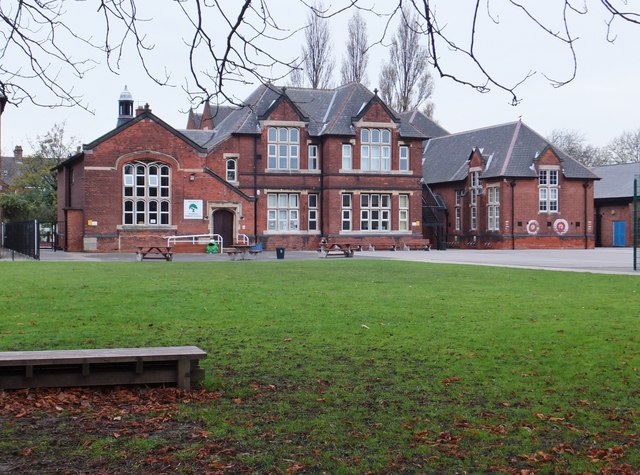
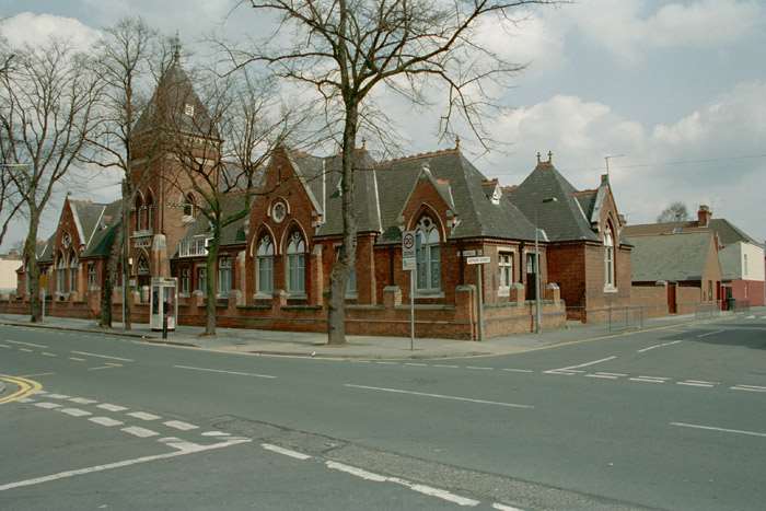
- Jan: Foundation stone laid for a permanent St Bartholomew’s Church (see also 1886). Service of consecration 24 June 1902. The parish was formed 1903 from bits of surrounding parishes. A vicarage was dedicated on 24 April 1921, though the building (222) is much the same age as neighbouring terraces (1883), with a tall, thick victorian wall running east-west on the southern boundary. The church was demolished in the 1970s clearances; it existed between the 2 current Wickens Walk off Bluebell Hill Road.
- Feb 26: Parliamentary Labour party is formed at Farringdon Street, London.
- May 24: GCR + Great Northern Railway (GNR) jointly opened the Victoria railway station (pulled down in the 1970s & replaced by the Victoria Shopping Centre). GNR also built the low-level London Road Station.
- Start Date for [Rock Cottage Museum (former Nottingham Corporation Waterworks) (Grade Ⅱ listed)] Castle Boulevard.
- Start Date for Victoria Embankment & Promenade with Arthur Brown as the City Borough Surveyor and Engineer in charge of this river frontage building work.
- 1901
- January 1: The Commonwealth of Australia Act came into force. It had been passed as an Act of the British Parliament in 1900. This was the beginning of the federation of the former British colonies.
- May 9: Prince George (later to be George Ⅴ - see 1910) opened the 1ˢᵗ Australian Parliament.
- July 23: Electric Tram services began.
(existing horse-tram firms — see also 1877 + 1897 — rapidly began to shut down). - New Power Station constructed on St Ann’s Well Road to power the trams.
- 1902
- Bulcote Corporation Model Farm designed & constructed by Arthur Brown. This is an industrial farm intended to spread sludge from the Stoke Bardolph sewage farm (see 1878) & involved laying 150 miles of drains in addition to constructing the entire farm. It is now operated by STW & continues to operate in similar fashion (Grade Ⅱ listed).
- Apr 30: Last horse-drawn tram service (the Forest Route) shuts down.
- Gedling Colliery opened.
- 1903
- Start Date for [26 Green Cottage] Village Road, Clifton.
- 1904
- The 2ⁿᵈ MR rail station replaced with a grander design featuring a Porte-cochère entrance constructed on a bridge straddling the tracks below; this is the same as the current Grade Ⅱ*-listed station; in constructing buildings on platform 4 & 5 they had to be built around the piers of the GCR bridges.
- E.M. Lacey-designed homes built on Clumber Road East: [3a Willoughby House (note: number in wiki is wrong)].
- 1905
- The former Rifle Range is laid out as Coppice Recreation Ground.
- 1906
- Lawrence Bright-designed homes built on Huntingdon Drive: [5] [6] [7] [8] [9] [10] (all completed 1908).
- Nottingham Corporation Tramways (see 1901) began operation of 3 motor buses to replace horse-trams previously operating on Carlton Road (a long-haul route).
- 1908
- Lawrence Bright-designed homes built on Lenton Road: [Barton House (the wiki uses the historical address of ‘1 Huntingdon Drive’)].
- Lawrence Bright-designed homes built on Huntingdon Drive: [2].
- Nottingham Corporation Tramways got Parliament approval to replace 3 long-haul horse-trams with electric-tramcars (to Beeston, Arnold and Carlton). The 3 motor-buses obtained in 1906 had proven unreliable, with continual mechanical breakdowns. The last bus ran on 15 June. A replacement horse-tram was put in place whilst the electric infrastructure could be installed. As the council insisted on twin-tracks that meant some property destruction + road-widening.
- 1909
- Arthur Richard Calvert-office built on Lenton Road: [7a Park Estate Office (Grade Ⅱ listed)].
- The former Trough Closes is laid out as Sycamore Recreation Ground.
- 1910
- May 6, 11:45pm: Edward Ⅶ died very suddenly at the end of bouts of severe bronchitis from March, then heart attacks in May. Aged 68, he had been known as a “Playboy Prince” when young. He was the eldest son of Queen Victoria, and spent 59 years as Prince of Wales. Sentiment turned around completely once he ascended to the throne in 1901, but — whilst not his fault — he left one of the greatest constitutional crises (re: the power of the unelected House of Lords) in the balance for his son to resolve after his death.
- May 6: At the age of 45, George Saxe-Coburg and Gotha became King of the United Kingdom and the British Dominions, and Emperor of India on the death of his father Edward Ⅶ. George was Duke of York, meaning that he was a second son & thus in normal times next in line to the throne after his brother; look at 1936 to see a repetition of this with his own sons. George took the name George Ⅴ on his ascension to the throne. George insisted that the the most offensive anti-Catholic phrases in his Accession Declaration be removed (an Act of Parliament effected that).
- Ernest A Sudbury-designed homes built on Clumber Road East: [3 Westwood House].
- 1911
- Aug 18: The constitutionally important Parliament Act was signed into law. It removed the right of the House of Lords to summarily veto financial legislation, changed the Lords veto on other bills to a delay for a max 2 years, and reduced the Parliamentary term from 7 years to 5. This was the beginning of confirming the primacy of the House of Commons over the (unelected) House of Lords and had considerable impact on the next constitutional crisis, which was Home Rule.
The convention at that time was that, whilst the Lords had the right to veto legislation, they kept their hands out of any finance bills. In spite of that convention the Lords opposed the 1909 “People’s Budget”, put forward by the Liberal leader & Prime Minister Asquith but opposed by the Conservative leader Arthur Balfour. The general election of January 1910 was a hung parliament, which left the nationalist Irish Parliamentary Party with it’s thumb on the balance. The Irish wanted Home Rule (which the Lords opposed) and so backed Asquith. The budget passed in April 1910.
Attention now turned to a Parliament Act. There was vigorous opposition from the Lords which blocked all attempts at reform. Events reached November 1910 without resolution, and the Liberals asked the new king to dissolve parliament (which meant a fresh election in December). They also asked the king to swamp the Lords with new peers if necessary to get the measure passed (which was how the 1832 Reform Act got passed). In the end the latter was not necessary, and the veto got removed. - John Loverseed-designed homes built on Pelham Crescent: [18].
- Aug 18: The constitutionally important Parliament Act was signed into law. It removed the right of the House of Lords to summarily veto financial legislation, changed the Lords veto on other bills to a delay for a max 2 years, and reduced the Parliamentary term from 7 years to 5. This was the beginning of confirming the primacy of the House of Commons over the (unelected) House of Lords and had considerable impact on the next constitutional crisis, which was Home Rule.
- 1912
- Apr 11: Asquith introduces the Government of Ireland Bill into Parliament. To say that this was controversial is understating the matter. It took two years before the bill was passed.
- St James Church (parish of The Park, see 1807) was united with that of St John the Baptist (parish of The Marshes, see 1843). This lasted until 1933.
- 1913
- Nottingham Corporation Bill gives general powers to the council for motorbus operation within the city boundary.
- 1914
- July: George Ⅴ calls a meeting of all parties at Buckingham Palace to try to avoid civil war in Ireland due to Asquith having introduced Home Rule legislation into the House of Commons (but not yet signed into law). The meetings break up after 4 days without settlement, but that is immediately overtaken by international events.
-
Aug 4: Britain declared war on the Triple Alliance (soon to be the Central Powers) in what later became known as World War Ⅰ (or: WWⅠ), but which at the time was called the “Great War” & also the “War to end all Wars” (sic).
This particular series of Diary Entries has listed significant dates affecting Nottingham, and has covered 2,000 years. Throughout that time Europe has squabbled & fought amongst itself in every single century. Those squabbles became more & more serious as the years passed & mankind honed it’s tools of war.
At that time, Europe, Scandinavia & the Baltic nations were comprised of a collection of Monarchies, and the Kings/Queens of all those countries essentially were one extended family. In addition to the sympathies/antipathies of race & religion, Europe itself had become two competing blocks, with treaties & alliances to hold each block together:– - This was the count-down to worldwide slaughter:–
- 1914 June 28: The Austro-Hungarian heir is assassinated in Serbia by a Bosnian Serb (small spark ignites giant fire).
- July 28: Austria-Hungary declares war on Serbia; Russia comes to Serbia’s defence.
- Aug 4: The Triple Entente faces off against the Triple Alliance (although Italy remains neutral).
- Nov: The Ottoman Empire + Bulgaria (each are Muslim nations) join the Triple Alliance to become the “Central Powers”.
- 1915 Apr 26: Italy (+ Serbia) join the Triple Entente to become the “Allies”.
- 1915 - 1918: 1.5 million Armenians are estimated to have been murdered during the Ottoman Genocide.
- 1915 - 1922: 1 million Assyrians and Greeks were murdered during what was possibly the same policy of Ottoman concurrent Genocide.
- 1917: Up to 12 million civilians died during the Russian Civil War.
- 1917 Apr 6: The USA entered the war on the side of the Allies. The British Fleet possessed a technological advantage against their German opposition, so the German Empire innovated with submarines. The methods deployed by those ‘Unterseeboot’ (U-Boats) meant predation upon non-combatants, and that brought the USA into the war.
- Sep 18: The Government of Ireland Act is signed into law. On the same day a Suspensory Act is passed which puts this & the Welsh Churches Act into limbo, initially for 12 months, due to the outbreak of World War. The outbreak of Civil War in Ireland meant that the bill never got put into effect.
- Goose Fair was cancelled after the outbreak of WW1 on July 28 and did not resume until after cessation on 1918 11 November.
- 1915
- Start Date for [22 Pinfold Cottage] + [24] Village Road, Clifton.
- 1916
- Apr 24 (Easter Monday): Easter Rising launched in Dublin, Ireland by the Irish Republican Brotherhood. Internecine squabbles are the worst, and this one was about as bad as it gets. It was hundreds of years in the making, and affects everyone in the UK right up to the current day; here are the major hi- (or) lo-points:–
- 664: The Synod of Whitby decides to adopt Rome rather than the Celtic churches as the national Faith.
- 1169: Norman invasion of Ireland.
- 1177: The Pope endorses the Norman Invasion by creating the Lordship of Ireland for Henry Ⅱ, destroying the ancient High Kingship of Ireland in the process.
- 1297: First sitting of the Parliament of Ireland.
- 1315: Invasion from Scotland by Edward Bruce. The year was also notable for an extensive famine that Europe did not fully recover from until 1322.
- 1500: Oppressive measures deployed by the English government had caused “The Pale” (territory governed by The Crown) to shrink to a small area around Dublin.
- 1542 June 18: Irish Parliament passes the Crown of Ireland Act, which adds “King of Ireland” to Henry Ⅷ’s titles.
- 1798 May 24: Irish Rebellion, including a French expeditionary force which lands in County Mayo in August. The Rebellion continued until 12 October.
- 1800 July 2: Twin Acts of Union create the United Kingdom of Great Britain and Ireland (this was all of Ireland).
- 1920 Dec 23: Government of Ireland Act gives rise to the Ulster counties of Northern Ireland parliament in June 1921.
- 1921 Dec 6: Anglo-Irish Treaty signed. This creates the Irish Free State + Northern Ireland.
- Nottingham Suburban Railway closed to passenger traffic (killed by trams & motorbuses).
- Apr 24 (Easter Monday): Easter Rising launched in Dublin, Ireland by the Irish Republican Brotherhood. Internecine squabbles are the worst, and this one was about as bad as it gets. It was hundreds of years in the making, and affects everyone in the UK right up to the current day; here are the major hi- (or) lo-points:–
- 1917
- Mar 15: Russian Tsar Nicholas Ⅱ abdicates. A Provisional Government is formed, dominated by the nobility. Grassroots community assemblies (called “Soviets”) are formed in reaction to that.
- Apr 9: The Sealed Train: in the most astonishing act, Germany arranged to inject a virulent virus into Russia. This was Vladimir Lenin, leader of the Bolshevik party, his wife & 30 other Russian citizens sent in a sealed train, with blackened windows, from Switzerland to Petrograd, Russia via Germany, Sweden & Finland. They boarded the train in Zürich on April 9 & arrived at Finland Station on April 16. Immediately the Bolsheviks and multiple other organisations competed for power.
- An 8 min clip from a documentary by BBC-Russian is here (no subtitles).
- Extract from the Michael Person book The Sealed Train:
“Lenin was so crucial to German war policy that the German government would shortly invest more than 40,000,000 gold marks in him — by modern standards hundreds of millions of dollars.” - Lenin… The Train (Ben Kingsley as Lenin; Leslie Caron as Nadia), a film on YouTube: [Part 1] [Part 2]
- The Berlin terminus from Geneva was Potsdam Station. However, Stettin Station (renamed North Station) was the terminal for the line north to Sassnitz, and then the boat to Sweden, so the train made a wide detour around Berlin between the two Terminii. Everyone remained on the train until the last station in Germany (but I’m not certain which of those three it was). The story is that one of the men left the train to obtain a newspaper and, that was the only town in Germany that became Communist.
- July 17: At a time of heightened anti-German feelings, George Ⅴ changed the name of the British royal house from “House of Saxe-Coburg and Gotha” to “House of Windsor”.
- Nov 7: The Bolsheviks had gathered a “Red Army” which organised an armed insurrection in Petrograd (now Saint Petersburg, and then the capital) which took power in Russia. Because Russia was still using the Julian Calendar, for them this was the October Revolution. The country now descended into a 6 year Civil War with Red Armies matched against White and all the worst excesses of internecine warfare, and quite a few new ones tossed in there as well. This was also Russia effectively backing out of the “Allies”. The German efforts in April were successful.
- Nov 8: The Titles Deprivation Act was signed. George Ⅴ had many German relatives with British peerages who had fought on the German side. This law made it possible for those titles to be revoked (enacted 1919). In addition, any Garter Flags within St. George’s Chapel, Windsor Castle of the same relatives were removed.
- 1918
- March: Spanish Flu broke out in an Army camp in Kansas, USA, and it is estimated that one-third of the world’s population became infected. Only Spanish newspapers did not suppress these reports (Spain was neutral during WW1). At almost the same time a second pandemic (Sleeping Sickness) was reported worldwide; the numbers of infections were less, but were still in the millions worldwide.
Personal report: my father was the youngest child in his family (7 brothers, 3 sisters). Uncle Bernard was the next-older brother, and he & my father were inseparable when young. Bernard caught Sleeping Sickness as a young lad. He recovered, but not really, and was unable to ever function normally again. - Jul 17: Tsar Nicholas Ⅱ & his wife, children & retainers are murdered at Yekaterinburg. The following year, George Ⅴ arranges for Nicholas’s mother, Marie Feodorovna, and other members of the extended Russian imperial family to be rescued from Crimea by a British warship (but George refused to save his cousin Nicholas).
- Sep 29: Central Powers begin to collapse; Bulgaria signs an armistice.
- Oct 31: Ottoman Empire signs an armistice.
- Nov 3: Austria-Hungary signs an armistice.
- Nov 9: Kaiser Wilhelm of Germany abdicates.
- Nov 11: The new German Government signs an armistice, signalling the end of WW1.
The monarchies of Austria, Germany, Greece, Russia and Spain had fallen to revolution and war, with their Kings & Queens murdered and/or abdicated. This is also far more countries & territory than you may at first think. “Austria-Hungary”, in particular, was the rump of the Holy Roman Empire, and it’s King was the ruler of 42 separate countries stretching from Austria to (what is now) the Ukraine. See March 1919 for more on that. - Inflation was considerable; see 1921 for specifics in the Weimar Republic.
- Chalers Lane / Cowe Lane renamed to Clumber Street & widened by 16′ (4.88m) following a gift of land from Duke of Newcastle. This street is considered to have the highest shopper footfall in Britain.
- March: Spanish Flu broke out in an Army camp in Kansas, USA, and it is estimated that one-third of the world’s population became infected. Only Spanish newspapers did not suppress these reports (Spain was neutral during WW1). At almost the same time a second pandemic (Sleeping Sickness) was reported worldwide; the numbers of infections were less, but were still in the millions worldwide.
- 1919
- March: George Ⅴ arranges personally for Emperor Charles Ⅰ to be escorted safely to Switzerland. Charles Hapsburg was Emperor of Austria, King of Hungary & more than 40 other titles. Charles had become Emperor when Franz Joseph Ⅰ had died on November 1916. The day after the 1918 Armistice of 11 November Austria declared the Republic of German-Austria. Finally, on April 1919 the Austrian Parliament formally dethroned the Habsburgs and banished Charles from the German-Austrian Republic for life. Across the next few years every one of the scores of territories that this Imperator had previously been ruler of rejected his rule & detached from the monarchy. He finally died on 1 April 1922 on the Island of Madeira from respiratory failure.
- British Waterways Warehouse, behind Wilford Street, built (Grade Ⅱ listed).
- 1920s
- Old-town slums cleared. Housing stock in the area of The Marshes was reduced to less than two hundred.
- A Parliament Bill granted powers for motorbus routes outside of the city.
- 1920
- Dec 23: Government of Ireland Act (aka Fourth Home Rule Bill — the first was 1886) was given Royal Assent. It was intended to partition Ireland into Northern Ireland (the 6 counties of Ulster, exactly as they currently exist in 2022; the parliament first sat on June 1921) and Southern Ireland (26 counties), each preserved as part of the UK. “Southern Ireland” never worked. Home Rule had been denied for so long that the country now insisted on independence.
- 1921
- Sept 8: Unveiling of statue of Captain Albert Ball VC (Grade Ⅰ listed). Captain Ball VC was 20 years old, a native of Nottingham and considered to be the foremost aviator & fighter of his age. He died in action on 7 May 1917. Per Ardua Ad Astra.
- Dec 6: Anglo-Irish Treaty signed by Lloyd George (on behalf of Britain) & Michael Collins and Arthur Griffith (on behalf of the Irish Republic). This creates the Irish Free State (implemented 6 December 1922 as a dominion of the British Empire) + Northern Ireland.
- Inflation that affected the entire world following WW1 became Hyperinflation within the Weimar Republic:–
- 1914 Aug 4: Germany suspends gold standard, funds war by borrowing.
- Exchange rate steadily devalues from 4.2 to 7.9 marks / dollar
- 1919 June 29: Victors declare Germany will have to settle war reparations of (later revised to) 112 billion marks (US$26.3 billion).
- 1919 late: Exchange rate slumps to 48 marks / dollar.
- 1921 mid: Exchange rate is 90 marks / dollar.
- 1921 June: 1ˢᵗ reparation payment made (in hard currency, not paper marks).
Exchange rate is 330 marks / dollar. - 1921 Aug: Germany buys foreign currency at any price so that it can settle reparations.
- 1922 June: An international conference in the US fails to produce a solution; inflation in Germany erupts into hyper-inflation.
- 1922 Dec: Exchange rate is 7,400 marks / dollar
- 1923 Oct 13: Monetary reform decrees are passed. These create a new bank (the ‘Rentenbank’) controlled by new German Finance Minister Hans Luther, which will issue a Rentenmark (“mortgage mark”). At the same time, a gold bond was issued indexed to the market value of gold. Rentenmarks were not redeemable in gold, but were indexed to the gold bonds.
- 1923 Nov: Exchange rate is 4,210,500,000,000 marks / dollar. Germany’s central bank (the Reichsbank) is now printing 50 trillion (50×10¹²) mark paper banknotes.
- 1923 Nov 12: The Reichsbank is prevented from issuing any more paper marks.
- 1923 Nov 30: The Rentenmark is introduced to replace the worthless Reichsbank paper marks. Twelve zeros were cut from prices, and prices in Rentenmarks remain stable.
- 1924 Aug 30: Legislation introduced to allow exchange of a 1-trillion paper mark note to a new Reichsmark (identical to a Rentenmark). The Exchange rate becomes 4.2 Rentenmarks / dollar.
- Personal Comment: My mother was born in 1929 in Austria. Her earliest memory as a child was of playing on the living-room carpet with a king’s ransom in (worthless) paper money. The classic tale at the worst of the hyper-inflation was of folks using wheel-barrows to transport sufficient money into shops to buy food. A tale from a forum thread on this issue was a family tale of a father reaching pension age, collecting his pension payout from 30 years of saving, and immediately walking around the corner; he just had enough to buy two loaves of bread.
- 1922
- Dec 6: Partition implemented in Ireland (see Government of Ireland Act, 1920 for the creation of Northern Ireland, and Anglo-Irish Treaty, 1921 for the creation of the Irish Free State).
- Severe competition from motorbuses caused Nottinghamshire and Derbyshire Tramways Company to reduce fares.
- The Royal Navy ship HMS Calypso is sent to Greece to rescue Prince and Princess Andrew of Greece and Denmark. Andrew had a substantive (rather than honorary) role in the army & had narrowly avoided being shot after a military coup in Greece on 24 Sep (11 Sep in the Julian calendar then in use in Greece). Edward Ⅶ was his uncle-by-marriage, so he was related to the then-English-king George Ⅴ, but I cannot work out what that relationship was! The ship took the family to exile in France.
This incident would be more-than-usually significant for the UK since Prince Philip of Greece and Denmark (later Philip Mountbatten) was their son, born 10 June 1921 in Greece. From France Philip was sent to school in Britain, where he was brought up by his mother’s British relatives. In 1934 he met Princess Elizabeth. In 1939 he was 18 & joined the Royal Navy, serving with distinction during WW2. In the same year he began a correspondence with Elizabeth, in 1947 he married her, and in 1952 she became Queen.
- 1923
- After a long period of churn, Nottingham & Beeston Canals were owned by GNR.
- 1924
- Jan 22: 1ˢᵗ Labour party government is appointed by George Ⅴ.
- Trent Bridge widened from 40 foot to 80 foot (completed 1926).
- 1926
- May 4: The TUC call a General Strike in the UK (lasts 9 days until 12 May).
- 1927
- Gunthorpe Toll Bridge (see 1873) replaced.
- Apr 10: A Trolleybus System began to replace the existing Tramway network in Nottingham City.
- 1928
- Goose Fair moves from Old Market Square to the Forest Recreation Ground.
- 7ᵗʰ Duke of Newcastle died & his son Henry Francis Hope Pelham-Clinton-Hope became the 8ᵗʰ Duke & owner of The Park Estate.
- Notts. & Derbys. Traction Act enabled the tramways to be abandoned & replaced with trolleybuses.
- 1931
- New Castle House, Castle Boulevard (Grade Ⅱ listed) started (completed 1933).
- 1932
- Sir Evan Owen Williams designed building D10 at Boots Factory Site on Main Road, Beeston (Grade Ⅰ listed).
- 1933
- City boundary extended by addition of Bilborough & Wollaton, parts of Bestwood Park & Colwick, and part of Beeston Urban District.
- St James Church (parishes of The Park & The Marshes — see 1912) was united with St Peter’s Church, becoming St Peter and St James, St Peters Gate (Grade Ⅰ listed) when St James closed in 1935 (only the streetname remains).
- 1936
- Jan 20: George Ⅴ died in his bed at Sandringham House, Norfolk (see also 1952). He was 70 & had gone to his bed 5 days earlier with a cold. He kept drifting in & out of consciousness. Finally his doctor administered two fatal injections.
- Jan 20: Edward Windsor became the second monarch of his House on the death of his father, and adopted the title Edward Ⅷ (“King of the United Kingdom and the Dominions of the British Empire and Emperor of India”). He was 42, unmarried & had become notorious for very public, sexual affairs with numerous married women.
- Sept 6: The last tram service (to Arnold) is replaced with motorbuses; all remaining trams are sold off, most to Aberdeen.
- Dec 10: Edward Ⅷ signed instruments of abdication at Fort Belvedere in the presence of his younger brothers: Prince Albert, Duke of York (next in line for the throne); Prince Henry, Duke of Gloucester; and Prince George, Duke of Kent. He had wanted as king to marry the twice-divorced American Wallis Simpson, but political resistance in the UK & Dominions plus opposition from the Church of England left no other choice than to abdicate. He was king for just 326 days.
- Dec 11: Albert Windsor becomes “King of the United Kingdom and the Dominions of the British Commonwealth & Emperor of India” following the abdication of his brother Edward. As king he adopts the name George Ⅵ.
- 1937
- GNR abandoned the section of the Nottingham Canal from Lenton to Langley Mill.
- City of Nottingham replaced gas with electric lighting. The Park Estate chose to remain gaslit; that is still it’s state today (220 lamp posts), and may be unique in England.
- 1938
- The Park Estate was sold by the 8ᵗʰ Duke to Nuffield Trust, which in turn passed it on to Oxford University Chest. Most of the plots on The Park had been acquired on 99 year leases, and those leaseholds were now coming near their end, which meant falls in property values. For his part, the Duke had inherited a vast fortune via his wife (including The Hope Diamond), yet was a spendthrift with little income.
- 1939
- Sept 3: War declared by the British Empire and most Commonwealth countries on Nazi Germany. The Republic of Ireland (does NOT include Northern Ireland) declared a policy of neutrality.
- 1940
- June 10: War declared by the Kingdom of Italy on the UK & France.
- Sept: Japan, Italy and Germany sign a Tripartite Pact which unites them as Axis Powers against the Allies.
- Nov: Hungary, Slovakia and Romania formerly join the Axis Powers.
- 1941
- May 8 + 9: St John the Baptist church (see St James in 1933) destroyed during a German air raid. What remained of the building was subsequently demolished. 4,500 houses were destroyed in just one night, and hundreds of people killed & injured.
- June 22: Axis Powers invade the Balkans & Russia without warning (Operation Barbarossa). This resulted in the slaughter of horrific numbers of Russian soldiers & people, yet the relentless Nazi war machine was unable to progress beyond the outer suburbs of Moscow. In the end, the icy scythes of a Russian Winter finished them off.
- Dec 7 (USA time-zones): Without warning the Empire of Japan launches simultaneous attacks on Pearl Harbor, the Philippines, Guam, Wake Island, Malaya, Thailand and Hong Kong.
The entire world (almost) now swings into one of two blocks, each in all-out war against the other. The USA & China (in concert with the Allies) declare war on Japan, whilst the Axis Powers declare war on the USA. Russia, however, maintains the neutrality agreement that it had previously signed with Japan.
- 1943
- July 9: Western Allied forces invade Sicily.
- July 12: Russian armies begin to drive west through German lines.
- September 3: Western Allies invade the Italian mainland.
- 1944
- 1945
- USA forces in Pacific find themselves fighting island-by-island towards Japan.
- Mar: Western Allies cross the Rhine north & south of the Ruhr.
- Mar: Russian armies reach & capture Vienna, then immediately turn north towards Berlin.
- Apr 25: American & Russian forces meet at the Elbe River.
- Apr: Russian troops capture Berlin.
- Apr 29: German forces surrender in Italy.
- Apr 30: Reichstag captured (military defeat); Hitler commits suicide.
- May 2: Berlin garrison surrenders.
- May 7/8: Total, unconditional surrender signed by German authority, effective end 8 May.
- June: USA forces reach Okinawa.
- July 26: Allied leaders demand unconditional surrender of Japan — rejected.
- Aug 6: An Atomic-Fission Bomb (“Little Boy”) was dropped on Hiroshima. The Japanese Prime Minister continued to reject surrender.
- Aug 9: An Atomic-Fusion Bomb (“Fat Man”) was dropped on Nagasaki.
- Aug 9: Russia declares war on Japan, invades Japanese-held Manchuria & quickly defeats the Japanese army.
- August 15: Japan surrenders to the Allies.
- Sept 2: The Japanese government signs an Instrument of Surrender, ending the war.
- Bridge Estate (pdf) registered as Charity 220716.
- 1947
- July 18: Royal assent is given to the Indian Independence Act which partitions British India into the two new independent dominions of India and Pakistan. This came into being on 15 August and the religious division (India is majority Hindu and Sikh, whilst Pakistan is majority Muslim) caused terrible violence and vast transfers of people in both directions.
- 1948
- June: George Ⅵ relinguishes the titles Emperor of India + Dominions of the British Commonwealth and instead adopts the new title Head of the Commonwealth.
- University College (see 1881) granted a royal charter & becomes the University of Nottingham.
- British Transport Commission (later British Waterways) took over responsibility for the canal; commercial traffic was in terminal decline.
- 1951 Further boundary extension as Clifton & Wilford added.
- 1952
- Feb 9: George Ⅵ died aged 56 from a coronary thrombosis. He had died in the night at Sandringham House, Norfolk, and was found dead in his bed the next morning.
- Feb 9: Elizabeth Ⅱ became “Queen of the United Kingdom and other Commonwealth realms” on the death of her father George Ⅵ. Elizabeth Windsor & her husband (and 2ⁿᵈ cousin) Philip Mountbatten had set out only 6 days previously for a tour of Australia and New Zealand by way of the British colony of Kenya. It was at Sagana Lodge, Kenya that the news was broken to her.
- Park Estate leaseholders became entitled to buy their freehold.
- 1953
- June 2: Coronation ceremony of Elizabeth Ⅱ at Westminster Abbey is televised for the 1ˢᵗ time ever. Her coronation gown is embroidered with floral emblems of each Commonwealth country.
- 1954
- Nottingham Suburban Railway closes completely.
- 1955
- The City Council bought the section of Nottingham Canal from Lenton to the city limits and began filling it in.
- 1960
- nottshistory.org (pdf) maintain a PDF of a c1960 Burrows Street-Map of Nottingham. That means that it predates the many changes made to the Nottingham street-plan across the next 10 years.
- 1963
- Start Date for Maid Marian Way. As in my home town of Hull, this was the local council conducting civic vandalism; they constructed a 2-lane motorway through the old Town, slicing across the middle of all the old streets and demolishing many ancient buildings in the process.
- 1969
- Jul: Nottingham Council establishes the Castle Conservation Area, Clifton Village Conservation Area + The Park Conservation Area; this is 1, 2 + 3 of 174 Conservation Areas in Nottingham. These particular protected areas are centred on the Castle, Clifton Village + The Park Estate.
Nottingham has always been a Gemini as a town, with one tribe centred on The Castle & the other tribe centred on The Lace Market (the two tribes would meet & conduct common business within Market Square). The Park is firmly within the Royalist camp, being positioned close to The Castle.
- Jul: Nottingham Council establishes the Castle Conservation Area, Clifton Village Conservation Area + The Park Conservation Area; this is 1, 2 + 3 of 174 Conservation Areas in Nottingham. These particular protected areas are centred on the Castle, Clifton Village + The Park Estate.
- 1970
- Worst of the 1845 Inclosure houses are demolished in slum-clearance. However, some of the best Nottingham houses are also demolished as part of those same clearances.
- 1983
- Feb: Nottingham Council establishes the Nottingham Canal Conservation Area; this is 4 of 174 Conservation Areas in Nottingham. This particular protected area is centred on central section of Nottingham Canal.
- 1986
- Oxford University surrenders it’s remaining rights in The Park to the newly formed Nottingham Park Estate Limited (the management company run by the residents).
- 1990
- May: Nottingham Council establishes the Station Conservation Area; this is 5 of 174 Conservation Areas in Nottingham. This particular protected area is centred on Nottingham Station.
- 1996
- The Magistrates Court opened at canal-side off Carrington Street.
- 1997
- June: Nottingham Council extends the Clifton Village Conservation Area (original declared in 1969); this is 2 of 174 Conservation Areas in Nottingham. This particular protected area is centred on Clifton Village.
- 1998
- The Nottingham Post transferred from Forman Street to Castle Wharf House (then again in 2012 to 3rd Floor of City Gate East on Tollhouse Hill).
- The Canal Museum within the Grade Ⅱ listed Fellows, Morton and Clayton warehouse was abandoned when it was closed.
- 2020
- Mar 11: The COVID-19 pandemic, caused by the SARS-CoV-2 virus, began infecting people throughout the UK early in the year. It was first detected in Wuhan, China in 2019. It was declared to be a pandemic by WHO on this date.
- March 23: 1ˢᵗ confirmed deaths. A national lock-down was introduced (stay at home; wear masks outside the house).
- December: Vaccination program begun, starting with the most vulnerable.
- 2022 February: All UK restrictions lifted.
- 2022 December 9: more than 648 million cases and 6.65 million confirmed deaths worldwide, making it one of the deadliest in history.
- Goose Fair was cancelled in this year due to the outbreak of the Coronavirus Pandemic, and also in 2021.
- June 3: Nottingham Council establishes the Old Meadows Conservation Area; this is 6 of 174 Conservation Areas in Nottingham. This particular protected area is centred on the Meadows suburb.
From Nottingham Conservation Areas (map-pages), established under Section 69 of the Planning (Listed buildings and Conservation Areas) Act, 1990:
- Conservation areas are parts of the city/county where special planning controls apply. Within conservation areas, there are tighter restrictions on the work that can be done without planning permission, and we must try to “preserve or enhance” the character of the area when we take decisions about whether or not to grant planning permission.
- Mar 11: The COVID-19 pandemic, caused by the SARS-CoV-2 virus, began infecting people throughout the UK early in the year. It was first detected in Wuhan, China in 2019. It was declared to be a pandemic by WHO on this date.
- 2022:
- Sep 8: Elizabeth Ⅱ died at Balmoral, Scotland from “Old Age” (she was 96). She ascended to the monarchy in 1952 & reigned for 70 years and 214 days; that was the longest verified reign of any female monarch in history. She was queen regnant of 32 sovereign states during her lifetime (15 at the time of her death).
- Sep 8: Charles Ⅲ ascended to the British monarchy on the death of his mother Elizabeth Ⅱ. Aged 73, Charles Windsor was the oldest person ever to accede to the British throne. He thus became the “head of state of the United Kingdom, the Crown Dependencies and the British Overseas Territories”.


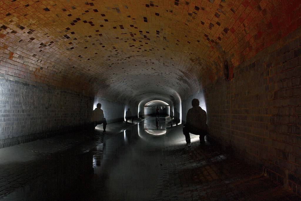 The picture above is of the
 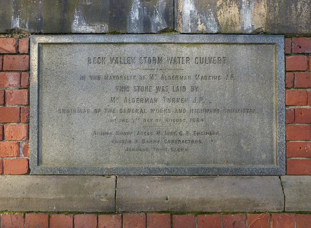 Beck Valley Storm Water Culvert foundation stone
  (Picture obtained from & ©
  The image above is of a Greek physical insult known as
 Above is part of the
  Above is the
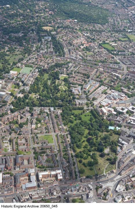


