Libya Floods 2023 activation debrief and after action review
Posted by pedrito1414 on 6 December 2023 in English.Activation info:
Activation: Libya Floods 2023
Activation Declared: Sep 14, 2023
Activation Concluded: Nov 9, 2023
Debrief Conducted by: Pete Masters, HOT, Activation Lead
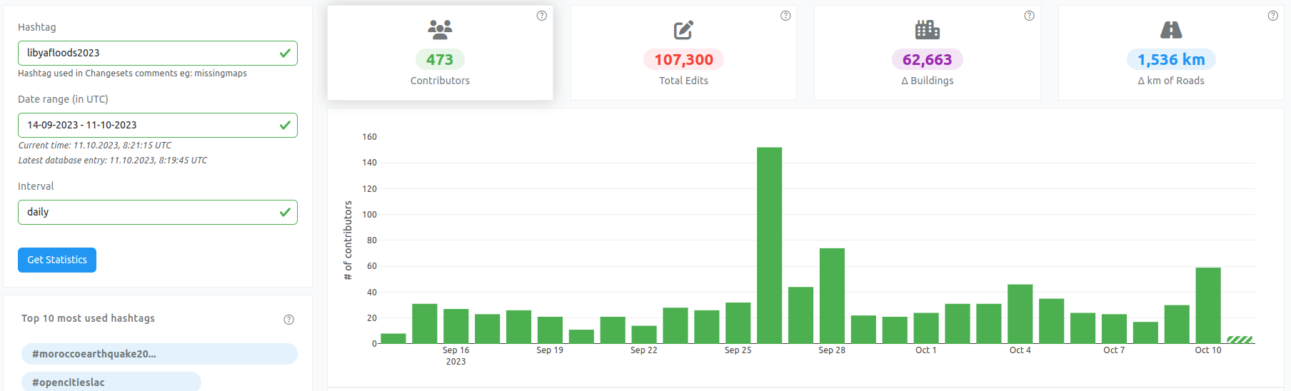
Relevant statistics
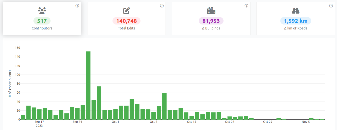
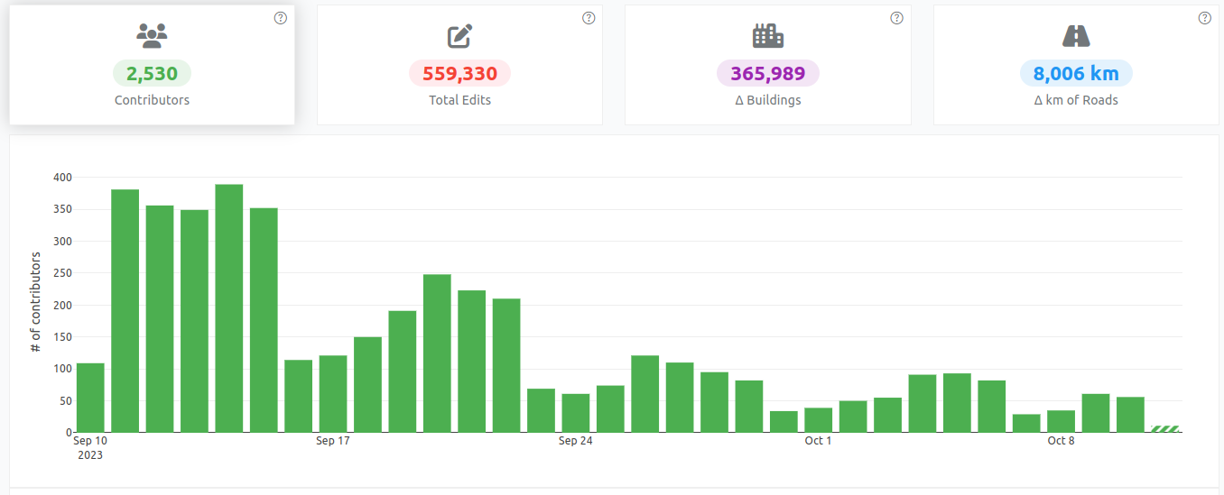
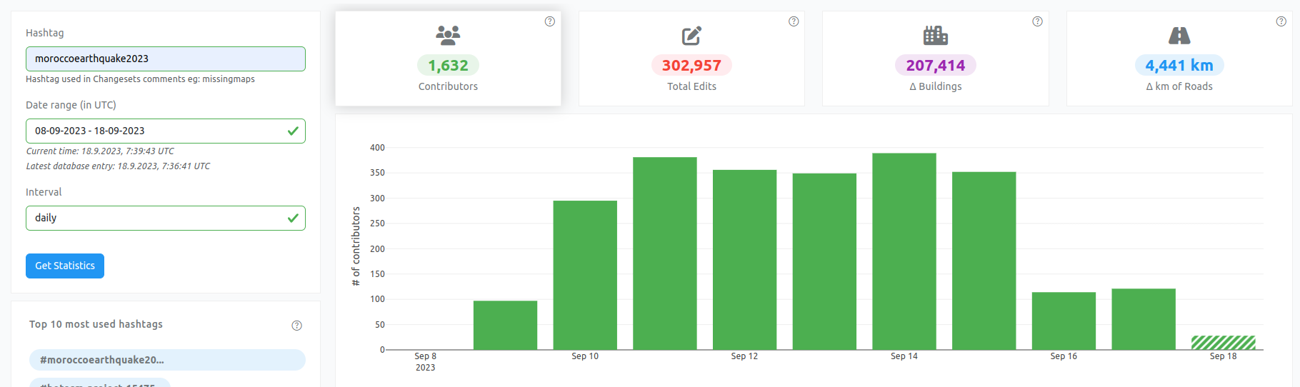
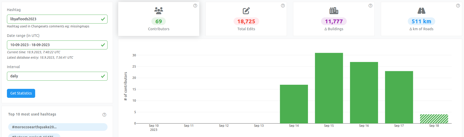
Contributor statistics over the lifetime of the activation
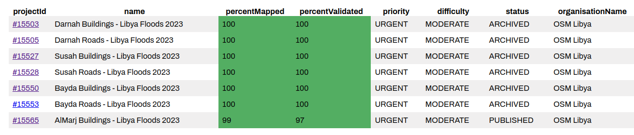
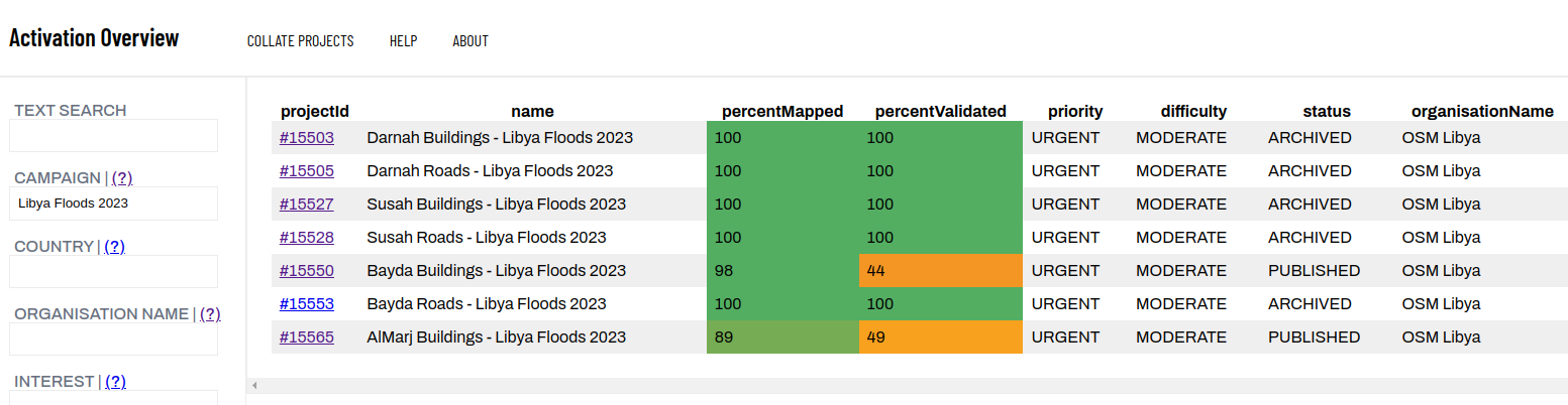
Tasking Manager project statistics for the activation
Narrative summary:
In collaboration with OSM Libya and supported by UN Mappers a HOT activation was declared to map areas affected by floods following Storm Daniel, with a specific focus on Dernah due to the collapse of the dams in the city. As the activation unfolded, priority areas were added (areas for which were prioritised by OSM Libya) as projects on the HOT Tasking Manager for urban areas including Bayda, Susah and Al Marj as well as the rural area surrounding Al Marj after (unconfirmed) reports from UNDAC of damage to a third dam. As the priority areas are now well mapped and validated (the last building project is 99% mapped and 97% validated), the Activation is now concluded.
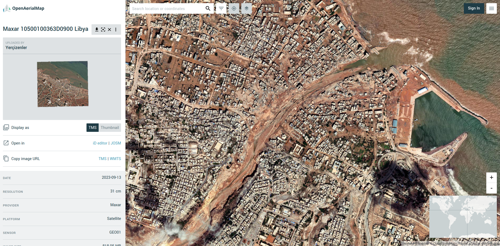
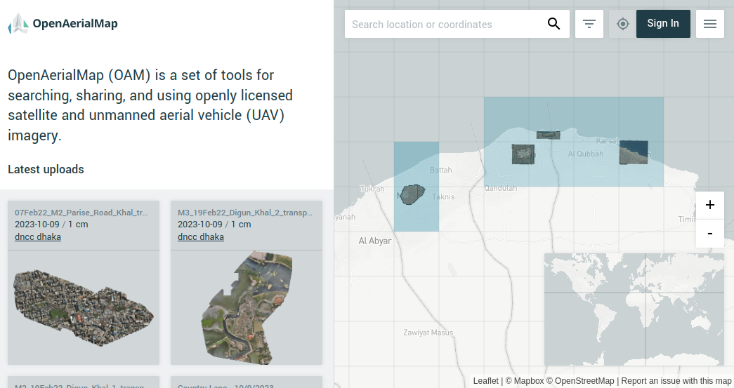
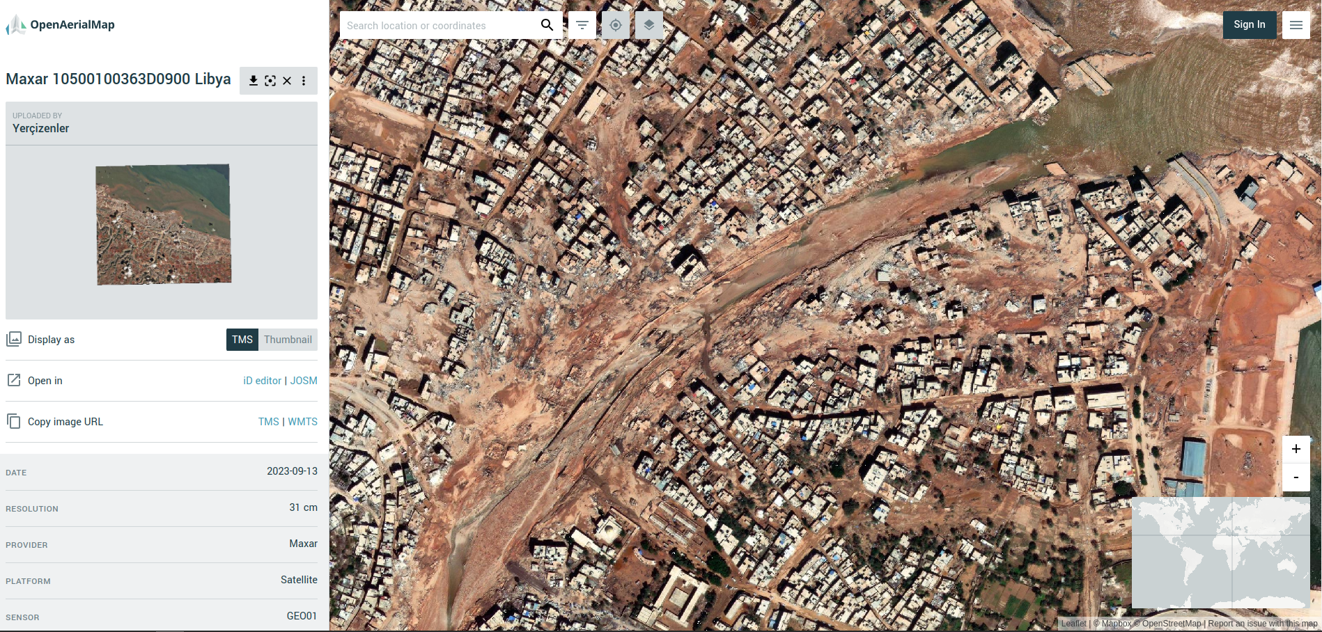
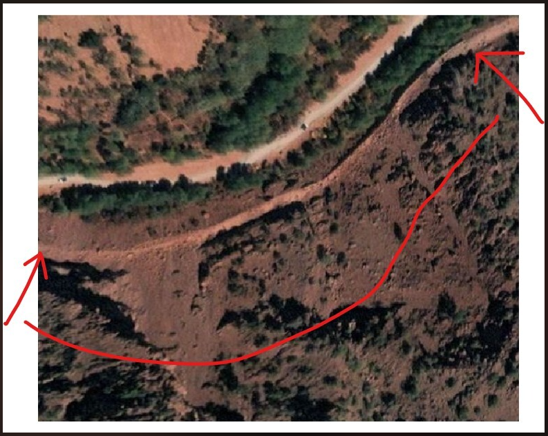
Dernah post-floods on openaerialmap
During the activation, in addition to the tasking manager mapping, the MapSwipe community completed four projects (see example) as part of a collaborative effort with MapAction to identify all affected settlements (unfortunately, MapAction ceased their activities before this could be concluded). The MapSwipe data was subsequently used to optimise tasking manager projects.
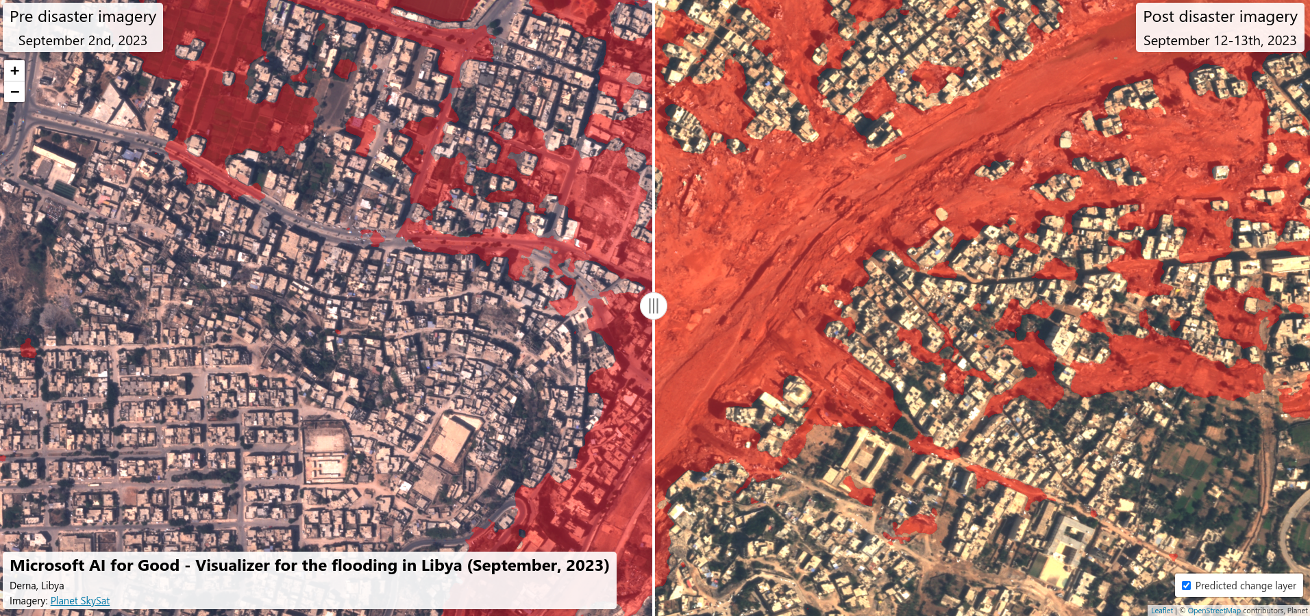
Open aerial imagery was also requested and received through the Maxar Open Data Programme. This imagery was hosted on OpenAerialMap and used by mappers to ensure up-to-date data and also by a UNDAC Dam specialist (introduced to HOT through the MapAction connection) in an attempt to validate reports of damage to the third dam. The analysis of the imagery was used to inform a Joint Environment Unit report on the dams.
Communications could have benefited from a more timely central comms approach in that shares and amplification sometimes lagged the response so the info shared was already out of date. The HOT website was underutilised (the response used social media, community channels and OSM diary as vehicles for mapper mobilisation and partner engagement).
A special mention for validators for this activation as the validation kept pace with the mapping throughout and we saw amazing commitment from the HOT Global Validator Team and OSM Libya in this regard.
The conclusion of the activation is a collaborative decision with OSM Libya. They will continue to lead on mapping to support recovery activities and HOT has supported through the integration of MapSwipe data into their existing tasking manager projects in order to help mappers prioritise their efforts. OSM Libya will also compile a comprehensive report detailing all activities undertaken in the past two months since the activation’s launch in collaboration with HOT to be shared with the broader community and potentially offer insights to other communities facing similar disasters to that experienced by Libya.
Successes, issues and lessons learnt
[SUCCESSES] What went well?
- Clear coordination between central and hub team (WNA) - HOT internal
- Collaboration with OSM Libya throughout (launching activation, defining priorities, technical support)
- UN Mappers collaboration on launch
- MapSwipe to tasking manager workflow for rural areas
- Good quality tasking manager projects (right size, constrained to priority features)
- Great validation progress (core group of validators has been thanked!)
- Wiki page kept up-to-date and coordination good in disaster mapping channel
- Maxar responsive through Open Data Program
[ISSUES] What could have gone better?
- Confusion over Libya responsibility (in a HOT priority region, but not a HOT priority country)
- Activation ‘could have’ started 2-3 days earlier (UN Mappers feedback)
- OSM Libya upgrading existing general projects to urgent as a response not ideal (projects too big and unspecific)
- Neglected HDX update until it was flagged by a partner
- Discussions with OSM Libya on activation didn’t happen in a publicly accessible forum (live chat) so OEG compliance tricky
- HOT comms around the activation was sometimes lacking / lagging
- Need a better process for working with responders. They don’t necessarily use slack or want to.
- Should we have methodology for requests like consolidated settlement layers?
- Hard to know to what extent HOT has capacity for technical GIS / data analysis requests.
- Didn’t make use of the karta view data for Dernah
[SUGGESTIONS] What lessons should influence how we activate in future?
- Smaller tasking manager projects (less tasks ~700 per project worked well for this activation) that focus on one feature each
- MapSwipe affected rural areas immediately
- Tasking manager activation projects should be reviewed asap and support provided for improvements
- Project creator role to answer queries / do problem solving, especially early on
- Need to think about how we engage orgs like Digital Egypt (did a lot of damage mapping)
- Need a clear view / publicly available list of possible service offers for responders
- We need to think about the recovery and the map - updating to post-event data
- We don’t have great arabic language capacity in our core community and networks - something to develop?
- Mechanism to alert or at least ask to local communities if mapping is needed in the case of a natural disaster event, by monitoring in real time natural disasters happening across the globe (UN Mappers)
Follow up:
If you have questions and / or comments related to the activation or this documentation, please contact Pete Masters at HOT


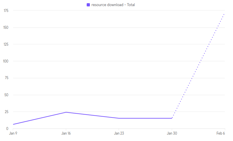
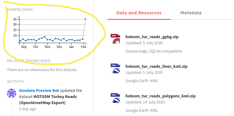 Screenshot from HDX showing the spike in downloads for OSM road data package in Turkey, 10 Feb 2023