
 Photo taken from wikipedia
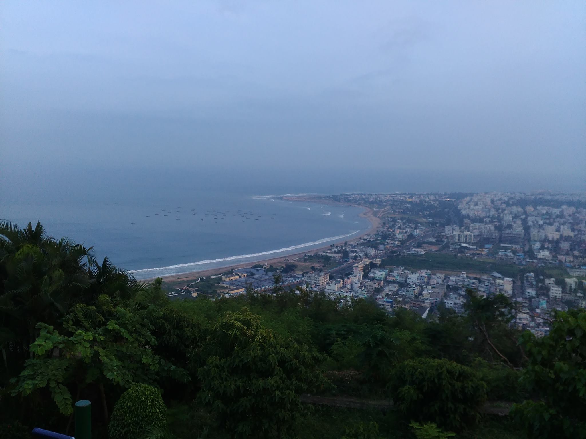
విశాఖపట్నం సుందరమైన దృశ్యాలకు ప్రసిద్ధిగాంచింది. అందుకు దానిని “గమ్యపు నగరం” అని కూడా అంటారు. సాగర తీరాన ఉన్న పార్కులు,రిసార్ట్ లు కనులవిందు చేస్తాయి. అనేకమంది తీరాన్ని వీక్షించడానికి వస్తారు. నాకు సాగర తీరం వద్ద బంధుమిత్రులతో అనేక మధుర జ్ఞాపకాలు ఉన్నాయి. నేను నివసించే ప్రదేశం మహారాణిపేట, అది జగదాంబ సెంటర్ కి చాలా దగ్గరగా ఉంటుంది . ఈ సెంటర్ బట్టల దుకాణాలతో, సినిమా హాళ్ళతో , రెస్టారెంట్లతో నిండి ఉంటుంది. కావున ఎప్పుడు జనాలతో రద్దీగా మరియు సందడిగా ఉంటుంది.
మా ప్రదేశం తీరానికి చాలా దగ్గర ఉండడం వలన, ఉషోదయ సంధ్యా సమయాలలో ఆహ్లాదకరమైన వాతావరణం ఉంటుంది. దేశీ మరియు విదేశీయ పర్యాటకుల కోసం వసతి గృహాలతో నిండి ఉండి నిత్యం పర్యాటకులతో కిటకిటలాడుతూ విశాఖపట్నంకు చాలా ఆదాయం తెస్తుంది. నేను నాకు తెలిసిన ప్రాంగణాలను బట్టి కొన్ని కట్టడాలను మరియు వీధులను మాపింగ్ చేశాను. కట్టడాలు ఇరుక్కుగా ఉండడం వాళ్ళ వాటిని మ్యాపింగ్ చేయడం ఇబ్బంది అనిపించింది. అందువల్ల అవసరాన్ని బట్టి, బింగ్ లేదా మ్యాప్ బాక్స్ సాటిలైట్ ఇమెజరీ వాడటం ముఖ్యం. కొన్ని ప్రాముఖ్యమైన కట్టడాలు, వీధులు మ్యాప్ చేయబడలేదు, వాటిని నేను నాకు ఉన్న అవగాహనతో మ్యాప్ చేశాను. మరికొన్ని చేయాల్సి ఉన్నాయి. ఓపెన్ స్ట్రీట్ మ్యాప్ అందరికి అందుబాటులో ఉంటుంది. అందుకే భవిష్యత్తులో మ్యాప్ లో కట్టడాలు ,వీధులను మెరుగు పరచాలని అనుకుంటున్నాను .
Visakhapatnam, The City of Destiny, is known for its beauty. The parks along the coast are of utmost scenic beauty and has attractive resorts for all kinds of people across the world. I have lots of wonderful memories with my family and friends spending time along the beach. My locality, Maharanipeta, is near Jagadamba Centre which is the best place for shopping in Visakhapatnam and is known for its busy streets.
My neighbourhood is near to the coast hence heavily populated with major amenities, businesses and residential buildings. I mapped some buildings and a few major amenities with local knowledge. Since the area is centre for all businesses, the buildings are closely packed making it difficult to trace. Alternating between Bing and Mapbox Satellite imageries is helpful at times. Some of the minor roads are missing or needs improvement along with some major shops and schools. The boundaries of amenities and points of interests vary on the ground.
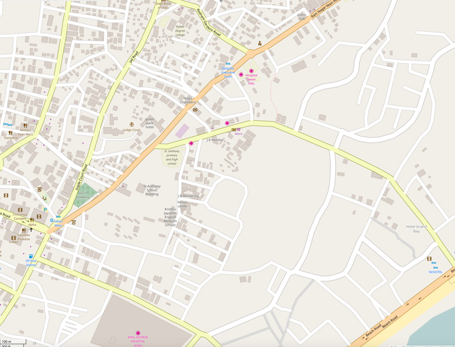
OpenStreetMap is an open source data available for all users, I would further like to improve the streets and mapping the buildings which are very few on the map.
Discussion