OpenStreetMap

marthaleena's Diary

Recent diary entries

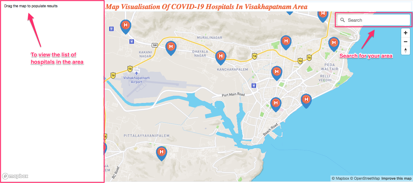
Map Visualisation - Covid Hospitals Visakhapatnam

Posted by marthaleena on 11 November 2020 in English. Last updated on 12 November 2020.

Image

Image

What's this data about?

Initially the Department of Health, Medical, & Family Welfare of AP Government has released an active list Covid hospitals in 3 categories based on the services provided. We have considered the hospitals in Visakhapatnam and checked with Existing OSM data. We modified and created hospitals which aren't available on OSM based on local knowledge and official sites.

Who & why did we do this?

As there was enough time with family due the global pandemic (thankfully ended up with family during the difficult times :) ). Being GIS enthusiasts me and my sister started contributing to OSM to improve the data in our locality. We realised that the hospitals in Visakhapatnam have been imported by a non local, though the data seems to be nearly accurate while some needed corrections. Considering the statistics of cases arising in Visakhapatnam we wanted to explore the hospitals coverage and visualise the results. As Mapbox GL JS has been a personal interest and has a huge scope of learning, this opportunity has been utilised to explore its capabilities and improve our skills with collective learning.

What could we do with this data?

Firstly, Data collection of all the matching hospitals of the list with OSM. Added and corrected the locations of multiple hospitals on OSM. Finding a hospital based on a simple area description was indeed a task but indeed my Dad and Uncles helped in figuring out the hospital poi location on Map. Although not every hospital had a official website of its own we did try adding all the accurate information available.

Secondly, Data formatting The OSM point data was converted in a geojson and also compiled with attributes such as Hospital category, address, phone number, website, OSM id etc. A simple overpass helped to export in geojson and compilation of attributed did involve some additional effort from QGIS.

Thirdly, Designing a page :O For a beginner Mapbox GL JS would be a good start. The documentation is very informative and understandable. The examples solved the majority of the key features we've wanted to have in the page.

Check the Github link

Key Learnings
  • The coverage of map data (POI & Building) needs to be improved in Visakhapatnam
  • Lots of scope to learn with Mapbox GL JS.
  • Create more interactive featured maps.

Buildings Mapping

Posted by marthaleena on 3 March 2020 in English. Last updated on 27 October 2020.

Recently have been mapping a few building near Minot using Bing imagery. The buildings tool of JOSM has been really helpful in mapping them. It took me around 2.5-3hrs to map ~438 buildings.

Map View image


I would like to share a few simple shortcuts which can be helpful for beginners:

  • B - Enabling Building Plugin
  • X - Extrusions and Intrusions
  • I - Select connected buildings
  • Shift + J - Merge the connected buildings to one
  • Shift + C - Curved way ( Need to have a 3 point way)
  • Shift + O - Circular way ( Need to have a 2 point way)
  • O - Makes the way Circular
  • C - Combine ways
  • Shift + Option - Rotate the object
  • Ctrl + Option - Slanting height when used while extrusions
  • Cmd + C - Copy buildings
  • Cmd + V - Paste Buildings

(Copy and paste buildings is only helpful when the building are similar is shape and size.)
One can always present the data contributed by designing their own map using Mapbox Studio and publish for other users as well. For other data visualizations Mapbox GL JS is a great start.

Location: Minot, Ward County, North Dakota, United States

Mapping my Hometown Visakhapatnam

Posted by marthaleena on 14 June 2017 in English.

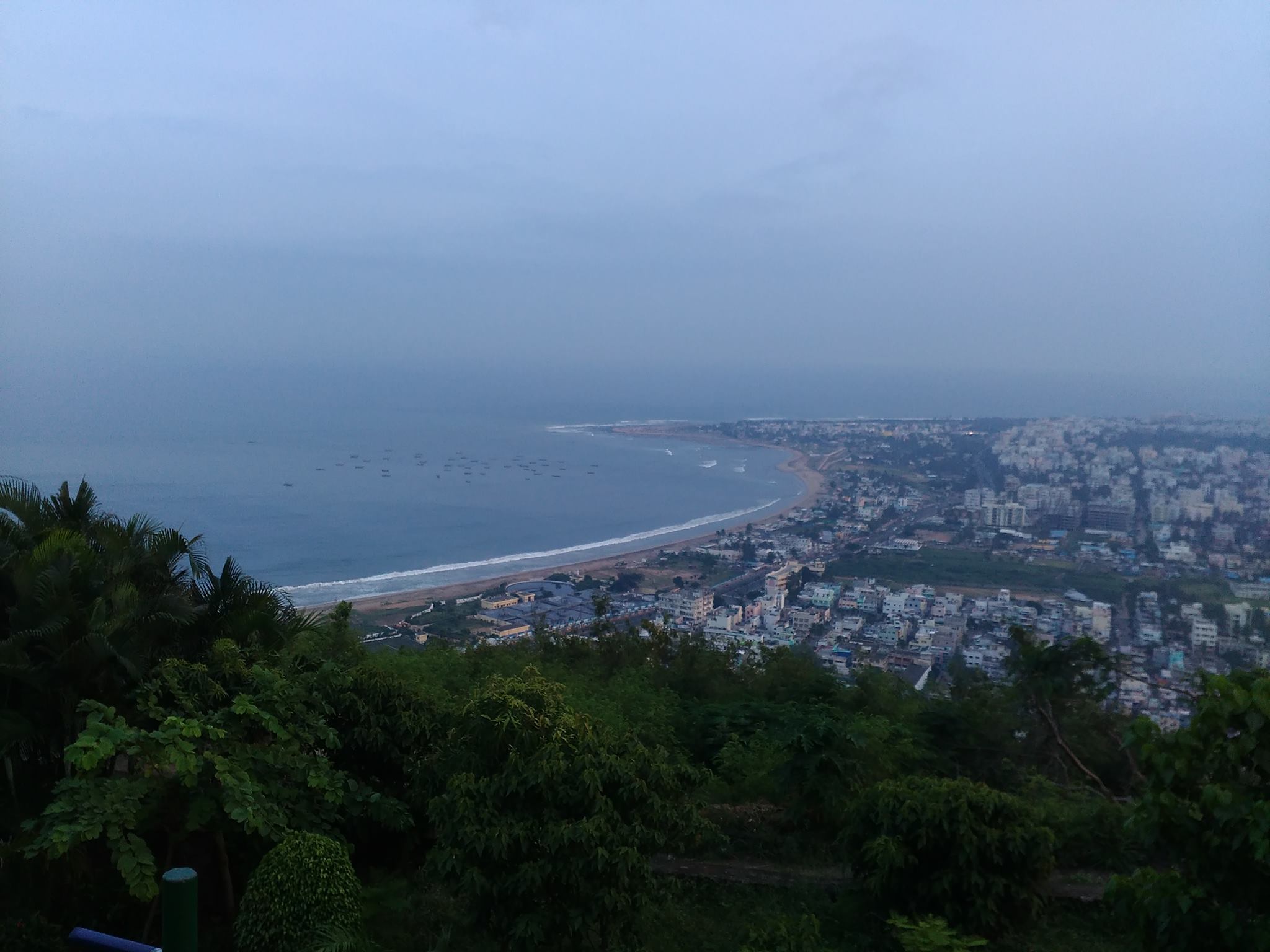
vizag_city_aerial_view Photo taken from wikipedia

విశాఖపట్నం సుందరమైన దృశ్యాలకు ప్రసిద్ధిగాంచింది. అందుకు దానిని “గమ్యపు నగరం” అని కూడా అంటారు. సాగర తీరాన ఉన్న పార్కులు,రిసార్ట్ లు కనులవిందు చేస్తాయి. అనేకమంది తీరాన్ని వీక్షించడానికి వస్తారు. నాకు సాగర తీరం వద్ద బంధుమిత్రులతో అనేక మధుర జ్ఞాపకాలు ఉన్నాయి. నేను నివసించే ప్రదేశం మహారాణిపేట, అది జగదాంబ సెంటర్ కి చాలా దగ్గరగా ఉంటుంది . ఈ సెంటర్ బట్టల దుకాణాలతో, సినిమా హాళ్ళతో , రెస్టారెంట్లతో నిండి ఉంటుంది. కావున ఎప్పుడు జనాలతో రద్దీగా మరియు సందడిగా ఉంటుంది.
మా ప్రదేశం తీరానికి చాలా దగ్గర ఉండడం వలన, ఉషోదయ సంధ్యా సమయాలలో ఆహ్లాదకరమైన వాతావరణం ఉంటుంది. దేశీ మరియు విదేశీయ పర్యాటకుల కోసం వసతి గృహాలతో నిండి ఉండి నిత్యం పర్యాటకులతో కిటకిటలాడుతూ విశాఖపట్నంకు చాలా ఆదాయం తెస్తుంది. నేను నాకు తెలిసిన ప్రాంగణాలను బట్టి కొన్ని కట్టడాలను మరియు వీధులను మాపింగ్ చేశాను. కట్టడాలు ఇరుక్కుగా ఉండడం వాళ్ళ వాటిని మ్యాపింగ్ చేయడం ఇబ్బంది అనిపించింది. అందువల్ల అవసరాన్ని బట్టి, బింగ్ లేదా మ్యాప్ బాక్స్ సాటిలైట్ ఇమెజరీ వాడటం ముఖ్యం. కొన్ని ప్రాముఖ్యమైన కట్టడాలు, వీధులు మ్యాప్ చేయబడలేదు, వాటిని నేను నాకు ఉన్న అవగాహనతో మ్యాప్ చేశాను. మరికొన్ని చేయాల్సి ఉన్నాయి. ఓపెన్ స్ట్రీట్ మ్యాప్ అందరికి అందుబాటులో ఉంటుంది. అందుకే భవిష్యత్తులో మ్యాప్ లో కట్టడాలు ,వీధులను మెరుగు పరచాలని అనుకుంటున్నాను .


Visakhapatnam, The City of Destiny, is known for its beauty. The parks along the coast are of utmost scenic beauty and has attractive resorts for all kinds of people across the world. I have lots of wonderful memories with my family and friends spending time along the beach. My locality, Maharanipeta, is near Jagadamba Centre which is the best place for shopping in Visakhapatnam and is known for its busy streets.

My neighbourhood is near to the coast hence heavily populated with major amenities, businesses and residential buildings. I mapped some buildings and a few major amenities with local knowledge. Since the area is centre for all businesses, the buildings are closely packed making it difficult to trace. Alternating between Bing and Mapbox Satellite imageries is helpful at times. Some of the minor roads are missing or needs improvement along with some major shops and schools. The boundaries of amenities and points of interests vary on the ground.

image

OpenStreetMap is an open source data available for all users, I would further like to improve the streets and mapping the buildings which are very few on the map.

Location: Ram Nagar, Visakhapatnam, Visakhapatnam (Urban), Visakhapatnam, Andhra Pradesh, 530001, India