SomeoneElse's Comments
| Post | When | Comment |
|---|---|---|
| Importing data in Mexico City | The original mapper osm.org/user/inserteunnombreaqui has requested that their edits in Mexico be reverted due to the licence of the data being incompatible with OpenStreetMap. Depending on how old these changes are, that may not be straightforward - we don’t want to make the situation worse. If anyone has any comments please leave them here email data@openstreetmap.org with a subject line of “[Ticket#2026050710000312]inserteunnombreaqui”. El usuario que realizó el mapeo original (osm.org/user/inserteunnombreaqui) solicitó que se revirtieran sus ediciones en México debido a que la licencia de los datos es incompatible con OpenStreetMap. Dependiendo de la antigüedad de estos cambios, esto podría no ser sencillo; no queremos empeorar la situación. Si alguien tiene algún comentario, por favor envíelo aquí: envíe un correo electrónico a data@openstreetmap.org con el asunto “[Ticket#2026050710000312]inserteunnombreaqui”. |
|
| Wasn't it just yesterday that Android 13 was shiny and new? (Missing backgrounds on Android devices) | Android 13 is no longer referenced in the latest Android security bulletin, either: https://source.android.com/docs/security/bulletin/2026/2026-03-01 . |
|
| ChangesetMD | I’ve made changes to the Debian 13 README to make build there easier. See https://github.com/SomeoneElseOSM/ChangesetMD/tree/Debian_13 . I’ve also made index dropping and creation more robust, and added a “number of iterations” argument for minutely updates, |
|
| Setting up an Overpass API server - how hard can it be? | @Kai thanks - I will move the current server (which hasn’t fallen over or filled its disk yet!) to a new one, and will try and apply changes “properly” (from a forked github repo rather than copied from various places) so that if there is anything useful I can feed back I’ll be able to do it without guesswork. |
|
| Teaching AI to Understand OpenStreetMap Tags |
Ha, if only such a thing existed :) There are a few “obvious” cases but lots of exceptiosn. Even a “building” might not be one. |
|
| Setting up an Overpass API server - how hard can it be? | Thanks (on all counts)! The scripts at https://github.com/b1tw153/Overpass-API/tree/kai/improve-shell-scripts have “meta=yes” and no attic, which is similar to what I’m doing (I’m actually doing actually meta=no). I probably need to fork that and start adding changes for e.g. using a different source of .osc files, and automating the setup of replicate_id. Re I’m aware of compression but haven’t tested it yet - I’m letting the update process continue until I need to do something about disk space, so that I’ve got a baseline to compare against. It’s up to 63% so far. I also need to set up log rotation. Re minutely diffs, I’m actually looking for “Britain and Ireland” data so OSM FR’s extracts alas don’t work for me, but for most people I’m sure they would. |
|
| Things you only find in OSM no 94... | There are a bunch of companies doing this, and a few of them have pretty identifiable in-pub shots of their wares that I bet a bit of sleuthing would be able to track down. I did try and persuade the Sheffield Tap last week that they needed one and got the memorable response that they were “Nothing to do with the station”! |
|
| Things you only find in OSM no 94... | Ah - I see what you mean. The tricky bit might be “recording the absence of something that isn’t very common, and doesn’t usually occur with that object anyway”. |
|
| Things you only find in OSM no 94... | @mmd If there’s a pub, and there’s a railway real-time departures board there, where do you think the pub is likely to be? :) |
|
| In order to get my business location on the map do i need to add it to bing maps | There’s no review needed in OSM. I can see it already at https://map.atownsend.org.uk/maps/map/map.html#23/53.34999/-6.24903 :
|
|
| Trackers? | Could you perhaps provide a few more details? What, exactly happened? |
|
| নাগা বাজার–মৌলভীবিভা সড়ক সংলগ্ন গ্রামীণফোন টাওয়ার ম্যাপিং অভিজ্ঞতা | Hello NagaBazar, I have hidden your latest diary entry as (yet again) it was written in Bengali but posted with a language of “English”. Please post it again, but this time set the language to Bengali. Best Regards, Andy, from OSM’s Data Working Group. হ্যালো নাগাবাজার, আমি তোমার সর্বশেষ ডায়েরিটি লুকিয়ে রেখেছি কারণ (আবারও) এটি বাংলায় লেখা হয়েছিল কিন্তু “ইংরেজি” ভাষা ব্যবহার করে পোস্ট করা হয়েছিল। দয়া করে আবার পোস্ট করুন, কিন্তু এবার ভাষাটি বাংলায় সেট করুন। শুভেচ্ছান্তে, ওএসএমের ডেটা ওয়ার্কিং গ্রুপ থেকে অ্যান্ডি। |
|
| From Mapping to Validation: My Growth Journey in the ESA validation Fellowship | Hello - just in case you’re not aware, this diary entry got a mention at https://community.openstreetmap.org/t/unite-inspire-innovate-my-transformative-journey-at-state-of-the-map-asia-2024/123580/6 . You might want to pop in there and say hello! |
|
| Growing Through Validation: My ESA HOTOSM Fellowship Journey | Hello - just in case you’re not aware, this diary entry got a mention at https://community.openstreetmap.org/t/unite-inspire-innovate-my-transformative-journey-at-state-of-the-map-asia-2024/123580/6 . You might want to pop in there and say hello! |
|
| MY ESA VALIDATION FELLOWSHIP JOURNEY | Hello - just in case you’re not aware, this diary entry got a mention at https://community.openstreetmap.org/t/unite-inspire-innovate-my-transformative-journey-at-state-of-the-map-asia-2024/123580/6 . You might want to pop in there and say hello! |
|
| From Doubt to Data Quality: My Journey with the ESA Hub Fellowship | Hello - just in case you’re not aware, this diary entry got a mention at https://community.openstreetmap.org/t/unite-inspire-innovate-my-transformative-journey-at-state-of-the-map-asia-2024/123580/6 . You might want to pop in there and say hello! |
|
| নাগা বাজার–মৌলভীবিভা সড়ক সংলগ্ন গ্রামীণফোন টাওয়ার ম্যাপিং অভিজ্ঞতা |
|
|
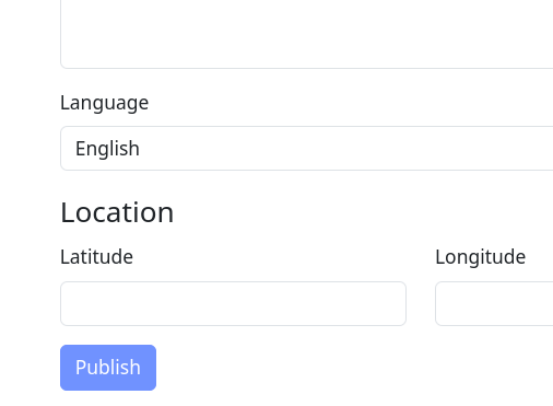
| নাগা বাজার–মৌলভীবিভা সড়ক সংলগ্ন গ্রামীণফোন টাওয়ার ম্যাপিং অভিজ্ঞতা | Below the diary entry you write there is a field “Language”. You MUST change that to match the language you have written your diary entry in so that people looking for that language will see it. আপনার লেখা ডায়েরির নীচে “ভাষা” নামক একটি ক্ষেত্র আছে। আপনার ডায়েরির এন্ট্রিটি যে ভাষায় লেখা হয়েছে তার সাথে মিল রেখে আপনাকে অবশ্যই এটি পরিবর্তন করতে হবে যাতে সেই ভাষা খুঁজছেন এমন লোকেরা এটি দেখতে পান। |
|
| Proposal - Ratify OSM Bunker/ Pillbox nodes, using external data sources | Yes, this should be discussed in the UK forum. With any import like this, conflation is the key. Where there are discrepancies either side here could be correct, and given that this can be fairly hidden, a survey will often be needed to resolve. I’d also suggest that your proposed tagging seems to miss one very important thing - whether a bunker is in active use by the military or not! An overpass search here finds a bunch that surely are active and a bunch that surely are not. Not all the inactive ones are tagged as such, and where they are OSMers have used a wide range of tagging. I’d instead suggest perhaps |
|
| A Shortbread map style that looks a bit less beige | @Zverik OK, fixed. https://map.atownsend.org.uk/vector/index_osmf_shortbread.html#17.59/59.389977/24.717497 looks more sensible now. There are a couple of other bugfixes that could do with merging into this style too; I’ll do that as time permits in the coming days. |