A fully documented Garmin map style - using taginfo
Posted by SomeoneElse on 24 July 2023 in English. Last updated on 6 June 2026.For many years I’ve used Garmin devices for both for navigation and for collecting data for OSM. As well as lots of premade maps in different styles it’s actually pretty easy to tinker with the map style yourself, although the OSM wiki makes it seem much more complicated than it actually is. It’s also pretty easy to see what OSM keys map to what values - there’s a file for points, one for lines and one for polygons that shows what OSM key and value corresponds to what Garmin feature.
I also maintain a web map style that tries to be much more inclusive than other web maps in terms of what it shows (have a look around the map legend for that), and thought that it’d be great to do the same for Garmin maps too. The web map style uses a lua script to preprocess OSM data before the CartoCSS code deals with it, which makes the latter much, much simpler. It turns out that exactly the same approach works when creating Garmin maps too, as described on this page.
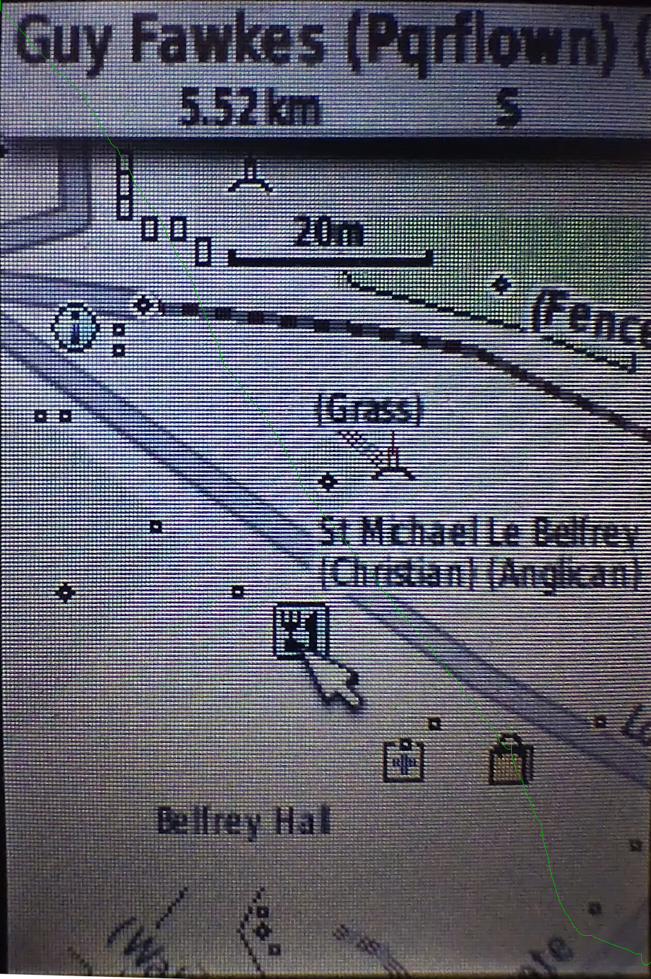
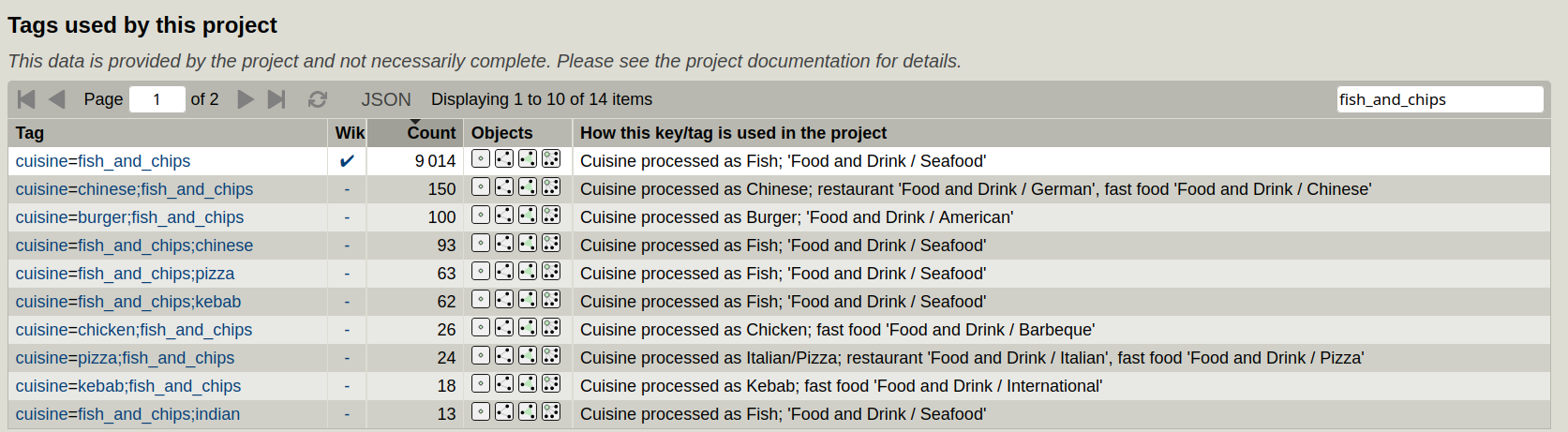
The resulting map style includes data from around 250 OSM keys and over 2000 OSM values, and browsing 3 text files to see what is shown as what is no longer an option. However, all of the OSM keys and values used by this project have been uploaded to taginfo, so we can use that for documentation. This page shows all the tags used. In each case, the “How this key/tag is used in the project” column has been updated with what extra processing happens to the item and which Garmin search menu it appears in. For example, if you search for shop=shoes you’ll see “shown in brackets; ‘Shopping / Apparel’”. “Shown in brackets” means the OSM tag value (“shoes”) is appended to the name on the devices so that it appears as e.g. “Clarks (Shoes)”; “Shopping / Apparel” means it’s on the “Apparel” submenu on the “Shopping” main menu (the one you get to by pressing “Find” on the device). You can also search “tags used by this project” for either keys or values. See for example the search for “fish_and_chips” below, and see how all matching values are shown, and also that in some cases the search menus to use vary depending on whether the object is fast_food or a restaurant:
The other side of the coin to this is “for each Garmin menu item, which OSM keys and values appear on it”. That is listed in tables in a map legend here. As an example, you can see that the “Fast Food” submenu below “Food and Drink” is used for “Pie-led fast food”, which means “amenity=fast_food” and a “cuisine” value of any of “=pasties”, “pasty”, “cornish_pasty”, “pie” or “pies”.
That document also describes the special processing used for e.g. public footpaths, long distance hiking routes, quality control information (“is this road lit” etc.) and more.
Currently a build (of maps for Great Britain) is done every week, but producing maps for other areas is simple, given that the file to process is downloaded from Geofabrik at the top of the script - no other code changes.
Discussion