A recent discussion on the osm-gb IRC channel was about how to map chapels within crematorium buildings.
I thought it was worth summarising some of that discussion. These notes pertain to crematoria in England and Wales. I have attended a funeral at that in Geneva, but that was twenty years ago.
One of the difficulties is that most visits to a crematorium are likely to be to attend a funeral service. This is not conducive to any kind of sophisticated micromanaging, but does allow a decent amount of basic observation. In addition I’m not aware of well-developed tagging standards for various features, as may become apparent by looking at some of my examples
In general
In the UK crematoria started to be built after WW1 by local authorities. Burial space was scarce in larger towns and cities, especially in historical cemeteries and burial grounds. Initially, new large cemeteries were created by buying undeveloped land on the edge of the urban area. These included a central building containing the crematorium and one or more funerary chapels. Landscaping often created memorial gardens close to the building, and extensive tree planting (usually formal: avenues etc ) throughout the burial areas. The chapels are often recognisably religious type buildings (Landican).
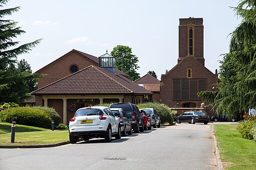
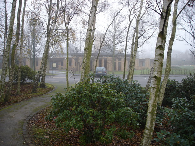
Since about 1970 more standalone crematoria have been built, also by local authorities. By then older sales of burial plots were not providing adequate income for maintenance of cemeteries, and consequently a more sustainable financing was required. A number of private cemetery companies folded around this time including some of the “Magnificent Seven” in London. The response was to encourage more cremations and only lease burial plots for a number of years. Crematoria from this period tend to have more informal landscaping, more parking and more intricate traffic flow. The building itself is usually low and discrete rather than an obvious focal point.
Since 1990 quite a few more crematoria have been built, mainly by private firms (Denbighshire, Gedling). These tend to be in more rural districts, and may be more remote from urban development, and have less extensive grounds. The chronological listing compiled by the Crematorium Society shows this pattern clearly .
Other countries have quite different development patterns, for instance Carhaix-Plougher, which opened in 1988, was only the fourth crematorium in France. Now there are nearly 200.
Location & Directions
Crematoria are usually well-signposted from major roads. This is obviously necessary as visitors may be unfamiliar with the area. Some rural ones (Wrexham, Colwyn Bay) are located off quite minor roads. Others may be on a main road and do not allow access which crosses the carriageway (turn restrictions) as funeral corteges would disrupt traffic.
Older ones on the edge of town are likely to be directly accessible by public transport, but newer ones may require a walk from the nearest bus or tram stop, or just be difficult to access on foot (Gedling, Wrexham). Ensure that nearby public transport stops are marked, and map any pavements (sidewalks) along access roads. Where pavements are lacking consider adding verge tags.
The same roads should also have the most useful tags for good cycle routing added (any cycleways, cycle lanes, maxspeed, lanes, etc).
Access & Parking
The roads within the Crematorium site should be highway=service. Modern sites usually have a one-way system. These days there are roads which lead directly to the chapel entrance & exit (see further below), and these are solely for hearse and cortege (I’ve tagged them motor_vehicle=no, hearse=yes, but motor_vehicle=private works as well).
Foot access in newer crematoria is usually separate from motor traffic (Wrexham), but this is not true for older sites (Canley). I don’t know if any separate bicycles from motor traffic.
Parking is pretty much as one might expect, but take care to map accessible parking. Many funeral attendees will be aged and infirm. Some may have distinct parking areas for each Chapel, in which case name them. Older sites may just have parking along the main service roads (Landican, Canley), use https://wiki.openstreetmap.org/wiki/Tag:parking=lane.
Footpaths from the parking area to provide access to Chapel entrances & exits should be mapped. Try to identify any steps (Bangor, Geneva) and provide info on step_count, surface, tactile_paving and handrails), and alternative step-free routes of possible. These latter are most likely on older sites.
Crematorium building
Most crematoria are built as a single composition containing chapel(s), offices, mortuary area and cremation facilities.
At Landican however the three chapels tower above the low connecting structures, with the cremation facilities behind the central chapel. This type of arrangement may be better represented by several buildings. At the very least distinct building:part elements can be used. For others the internal elements are best represented by use of simple indoor tagging (SIT).
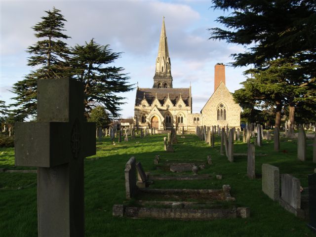
There are also crematoria in much older cemeteries (Kensal Green, West Norwood, Cheltenham). At Cheltenham the crematorium is integrated with the original Victorian mortuary chapels; elsewhere these are on new sites withing the grounds.
Chapels*
Chapels can be mapped as place_of_worship with https://wiki.openstreetmap.org/wiki/Tag:religion=multifaith. In most cases a node can suffice. Additionally, https://wiki.openstreetmap.org/wiki/Tag:funeral_hall=yes can be used.**
Typically a chapel will have a waiting area, most modern ones with toilets. This may be an anteroom (Bramcote) or opposite the chapel entrance (Canley). Some anterooms have TV screens which may allow the room to be used as an overflow area if the funeral is well-attended (one can add capacity to each chapel). The chapel entrance is to the rear of the chapel. It should be marked on the anteroom if it exists).
Usually there will be a notice board outside the chapels listing which funerals are taking place that day (tourism=information).
Map toilet facilities elsewhere and any restrictions on access (e.g., Radar key holders at Landican). From this perspective it is quite useful to map nearby hospitality locations (cafes, bars, pubs) which could be used by people travelling from afar. (This similarly applies to places of worship used for weddings and funerals).
Usually a roofed area (building=roof) protects mourners arriving in the cortege and may be used by other mourners.
The chapel exit is usually to one side at the front of the chapel, and leads outdoors. Usually another canopy protects mourners as they convey condolences to the immediate family. Often there is an adjacent area for the display of wreaths and floral tributes (Wilford Hill). At Canley this is slightly removed from the main building and not protected from the weather (no available tag). The exit from xxx Chapel is away from the road and a covered arcade leads back to the cars.
Once entrances & exits are mapped the Chapel needs to be mapped as an area, either using S3DB or SIT. The choice depends on whether the chapels can be identified externally, and any need to map associated toilets and anterooms.
IIRC, the chapels at Geneva Crematorium are all accessed from a common hallway, and there is none of the detailed entrance/exit infrastructure.
Grounds
It is worth mapping various other features in the grounds around the buildings: notably other paths, hedges, but particularly benches. I have also mapped a substation (Canley).
A detailed survey of the grounds of even a small crematorium is a significant undetaking. There will be various memorial gardens, walls, hedges etc, with paths and benches. Do these first.
Trees
The biggest challenge will be the trees. In most locations the tree collection will be significant and contribute greatly to the overall ambiance. Crematoria and cemeteries often contain many unusual and interesting species and varieties of trees (see Steven Falk’s volumes on the Trees of Warwickshire for accounts of Canley & London Road). There are often lots of conifers, some of which may be hard to identify, and many Weeping forms of broad-leaved trees. If possible see if you can obtain access to the tree register for the location as this largely reduces mapping of trees to a verification exercise (say 30 secs per tree or tree_row, versus 2-3 minutes a tree without). Avoid mapping apparently closed canopy areas as natural=wood : this is nearly always wrong, often it just represents a few mature trees in a park-like environment.
Cemeteries in Nottingham have around 40 trees per hectare, which might provide a reasonable rule of thumb for estimating survey effort. Of these trees about a fifth are evergreen and one eighth conifers. I don’t have equivalent figures for a dedicated crematorium site.
Closing
This account is very much based on attending funerals over the past 20 years, often with elderly relatives with restricted mobility. It is very much a UK-based perspective, as Geneva is the only non-UK location I have visited as a mourner, and that 20 years ago. If you have a non-UK perspective, please take time to add remarks in the comments.
Equally, I’ve probably missed some things pertinent for UK sites. Please let me know.
Appendix : Sites Mentioned:
- Bangor*. A crematorium with a single chapel at the centre of a municipal cemetery built between the wars.
- Colwyn Bay (Bron y Nant). Crematorium and small cemetery tucked away under a hill. Despite being close the A55 Expressway access is not obvious.
- Wrexham (Pentre Bychan). A modern crematoriumwith a single chapel set in parkland dating from the 19th century, which is why I chose to use
https://wiki.openstreetmap.org/wiki/Tag:leisure=park. A beautiful setting. - Kensal Green. One of London’s “Magnificent Seven” Victorian cemeteries. Created on open fields in the 1830s and therefore home to many plants which would not have survived either modern agriculture or urban development. The Western part of the cemetery, an extension, is still in use and a fairly modern crematorium is in use. Run by a private company, the General Cemetery Company. The original funerary chapels are located in the Eastern half of the cemetery, whilst the 1939 crematorium is in the extension.
- West Norwood. Another of the “Magnificent Seven”, but a municipal cemetery. As with Kensal Green, still in use for funerals and with a 20th century crematorium.
- Cheltenham. A crematorium was added adjacent to the original two funerary chapels. This closed recently and a new crematorium was opened in 2019 at the Eastern edge of the cemetery.
- Wilford Hill. A crematorium with two chapels at the centre of a 1930s cemetery built by Nottingham Council, but outside the borough boundary. The cemetery has a formal design.
- Bramcote. A modern (late 1970s) crematorium in its own landscaped grounds (developed from farmland). Current tagging raises the issue as to whether one tags the whole grounds (because cemetery tags are not appropriate) or the building.
- Canley. A mid-century cemetery with a crematorium at the centre. The cemetery is laid out mainly on a grid with many straight avenues, although close to the crematorium memorial gardens have a more informal layout. Numerous interesting trees.
-
New private crematoria. Gedling and Denbighshire
- Carhaix-Plougher. A modern crematorium adjacent to the municipal cemetery.
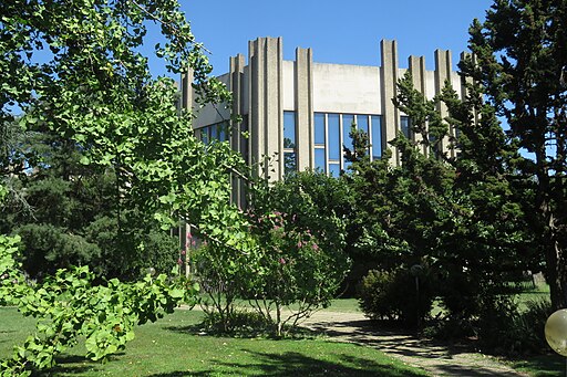
- Geneva. The crematorium forms part of a large funerary complex and includes 4 chapels, and mortuary rooms. It is in the SE corner of the large St Georges cemetery. Currently mapped as several buildings when perhaps these are better as
building:part.
* This seems to be the word in use in both the UK and Switzerland, even though they are used for both non-christian and Humanist funerals. I’m a bit reluctant to call them funeral halls as this may conflate culturally distinct funerary rites.
** Note that whether to call these https://wiki.openstreetmap.org/wiki/Tag:amenity=place_of_worship may well be culturally dependent.


Discussion