
Mapping for Impact: OpenStreetMap Activities in Timor-Leste (July to September 2023)
Posted by Ponsyano on 18 September 2023 in English. Last updated on 19 September 2023.Hello, fellow mapmaking enthusiasts! Today, we're excited to celebrate the remarkable success achieved in the past three months. This success story revolves around the passionate youth mappers of G-SIG Timor-Leste, who have embarked on an inspiring journey into the world of community mapping. Join us as we share our experiences and accomplishments, and together, let's continue to work towards mapping excellence in our beloved country Timor-Leste:).
Introduction
In the picturesque landscapes of Timor-Leste, the past three months have seen a flurry of mapping activities that are transforming the way we perceive and utilize geographical data. From empowering students and volunteers to conducting specialized disaster management training, our OpenStreetMap (OSM) community in Timor-Leste has been fervently engaged in expanding the horizons of open mapping. In this OSM Diary entry, I am delighted to share the details of our endeavors during the months of July to September 2023.
 Figure 1: Association G-SIG certificate distribution in collaboration with PBI Dili, July 2023, (photo credit media G-SIG).
Mapping Skills Workshop: July
In July, we organized a dynamic workshop with theme "Mapping Skills Using OpenStreetMap." The event was attended by over 80 enthusiastic participants, including university students, youth, and volunteer associations in Dili. During this engaging session, we shared valuable insights into mapping using OSM, introduced participants to Map Roulette, and demonstrated how to visualize OSM data in uMap and QGIS.
One of the highlights of this workshop was the post-event video sharing, where we interviewed one of our participants, Gil da C. Soares. Gil emphasized the importance of OSM in contributing essential data related to infrastructure, land use, and land cover in Timor-Leste. He stated, "OSM is very important for us to contribute data, and this data can benefit our government and researchers for various purposes. OSM also provides us with free access to valuable data contributed by users worldwide".
 Figure 2: Association G-SIG conducted 3rd workshop about OSM in PBI-Dili Timor-Leste During a day, (photo credit media G-SIG).
Weekly Training Sessions: July to Mid-September
Following the success of our workshop, we embarked on a journey of knowledge-sharing with a series of weekly training sessions conducted over two months. These sessions were aimed at engineering students, health students, and even some farmer students from various universities in Dili. More than 20 participants successfully completed the training, earning certificates of appreciation from our association, G-SIG Timor-Leste.
We took this opportunity to gather insights from two of our training participants, Francisco Preto and Jordania Moça Linda. Francisco, an Engineering Geology student from the National University of East Timor, highlighted the significance of OSM for academic purposes. He emphasized how OSM data, contributed by users worldwide, can be invaluable for research and various academic endeavors, "OpenStreetMap (OSM) plays a pivotal role in academic endeavors by providing a rich source of data contributed by OSM users worldwide. This invaluable resource enables researchers to access data that significantly enhances their research initiatives and opens up a world of possibilities" Francisco Said. Jordania, a student specializing in Geology and Petroleum Engineering at the National University of East Timor,, underlined the importance of OSM in disaster management. She described “OSM as a First Aid resource, particularly for emergency response and disaster management. Updated OSM data can be a lifesaver for disaster managers in responding to disaster events and crises effectively”.
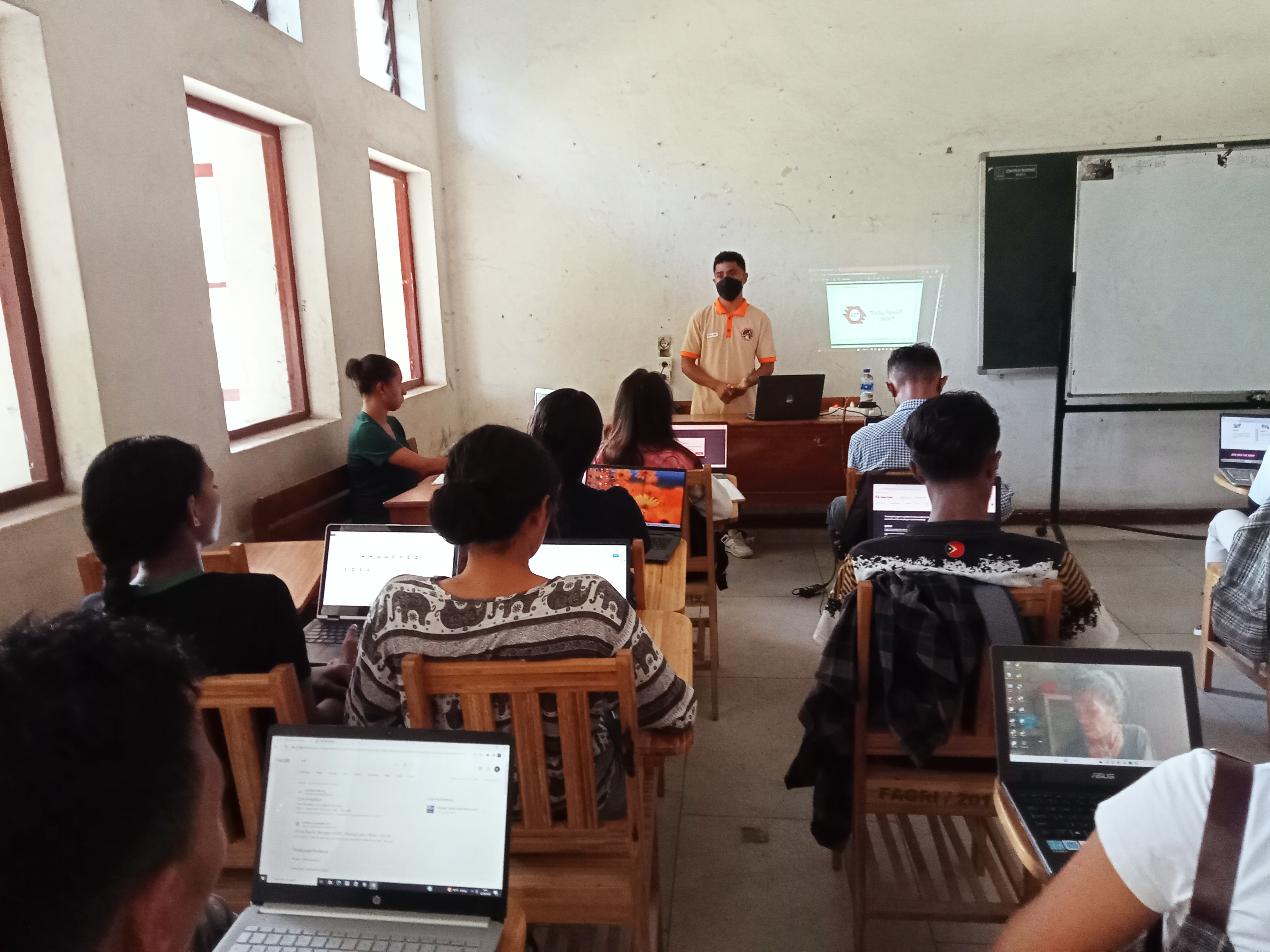 Figure 3: Association G-SIG conducted weekly training with engineering and health students from variety of universities in Dili, (photo credit media G-SIG)..
Conclude Training for Association of Women Engineering: August
In August, we committed ourselves to empower women in the Association of Women Engineering in Timor-Leste through a specialized training program tailored to harness the capabilities of OpenStreetMap (OSM) for disaster management and preparedness. This comprehensive three-day training encompassed an extensive array of subjects, spanning from the basics of creating OSM accounts to advanced topics like digitalization, data collection techniques, and the art of data visualization using powerful tools like QGIS and uMap. A highlight of this training was the in-depth exploration of leveraging OSM data for precise disaster analysis, facilitated seamlessly through the application of the InaSAFE plugin within the QGIS environment.
 Figure 4: Association G-SIG provided training to Women in Engineering in Dili, (photo credit media G-SIG).
Sharing Our Milestone on National TV in Timor-Leste: August
In August 2023, we were honored to receive an invitation from the National Media of Timor-Leste to share insights into our tireless efforts in the fields of GIS and OpenStreetMap activities in Timor-Leste. Our dedicated volunteer initiative has been steadfastly committed to harnessing the transformative power of geoscience, GIS technology, and collaborative mapping through OSM. We firmly believe that these tools are catalysts for positive change in Timor-Leste.
Our mission is multifaceted. We aim to facilitate informed decision-making processes by providing comprehensive geospatial data. This data serves as a foundation for diverse applications, including urban planning, disaster preparedness, and infrastructure development. Moreover, our commitment extends to promoting community engagement, ensuring that local voices and insights are integrated into development initiatives.
In the spirit of sustainable development, we've embraced OSM as a dynamic resource for mapping and sharing geographical knowledge. Through initiatives like Mapathons and workshops, we're empowering Timor-Leste's citizens with the skills and tools needed to contribute to open mapping efforts.
The invitation from National Media allowed us to spotlight these contributions and reiterate our unwavering dedication to advancing geospatial understanding and technological empowerment in Timor-Leste. We're committed to building a brighter future for our nation through open mapping and GIS initiatives.
 Figure 5: General coordinator shares OSM and GIS activities in Timor-Leste with GMNTV, (photo credit, gmntv_dader_kmanek_program).
Conclusion
Our journey from July to September 2023 has been marked by collaborative learning, skill development, and a growing awareness of the immense potential of OpenStreetMap in Timor-Leste. As we look ahead, we are committed to furthering our mission of making geographical data accessible and valuable for our community, government, researchers, and disaster responders in Timor-Leste. We are proud of what we've achieved, but we're even more excited about the potential that lies ahead. Timor-Leste's map is a canvas waiting to be filled with information and stories, and we invite everyone to join us on this incredible mapping adventure. OpenStreetMap isn't just about maps; it's about empowerment, resilience, and making a difference in the world.
For more information,contact us:
Facebook: G-SIG Timor-Leste
Linkedin: G-SIG Timor-Leste
E-Mail: geopetrountl2019@gmail.com
Discussion
Comment from mikko_tamura on 19 September 2023 at 13:42
WOOOOOW Kudos! Ponsy and OSM in Timor Leste! Very nice documentation <3