
Pyongyang Skyscrapers, a Wikidata-OSM-Commons synergy
Posted by Koreller on 1 November 2023 in English.In May 2023, I discovered the existence of two websites : “The Skyscraper Center” and “Skyscraper Page”, presenting skyscrapers from all over the world and especially… skyscrapers from Pyongyang!
I took this opportunity to enrich several free projects on which I’m active: Wikidata with the creation of the elements in the first instance, combined with images from Wikimedia Commons in the second instance, to place them and link them with the OpenStreetMap data in the final instance!
Creating the skyscrapers in Wikidata
Wikidata is a database that can be very useful for the OSM project. In my case, it was very useful for tracking each skyscraper.
And it’s very well suited to adding all the skyscrapers that existed in The Skyscraper Center and Skyscraper Page for Pyongyang city.
Wikidata has a number of “properties” (PXXX) which can be used to provide a whole range of information:
- where each building is located (P625)
- when they were built (P571)
- their height (P2048)
- the number of floors (P1101), etc…
This was the longest step and took me two days to complete!
Commons image cropping
Once I’d finished creating all the elements in Wikidata, I wanted to illustrate as many skyscrapers in the city as possible, so I went hunting for free images of those buildings.
I immediately thought of using the Wikimedia Commons images. I identified the areas of Pyongyang offering the best panoramas, hoping to find the city’s skyscrapers, and then I searched in the relevant Commons categories.
I found two categories:
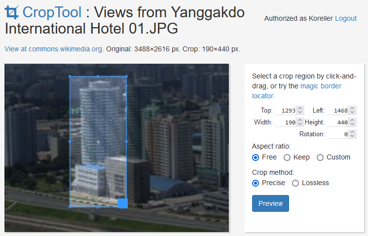
This allowed me to crop a lot of images to illustrate the skyscrapers (with the use of the CropTool tool from Commons !)
There are still a lot of buildings without pictures, but Pyongyang isn’t a city that can be photographed everywhere!
Add information to OSM
Once the Wikidata elements had been created and the Commons images had been cropped and linked to their Wikidata elements, the simplest part was left to me: adding the information to OSM.
There’s a lot of useful Wikidata information for OSM, including: the location, the name in English and Korean (name=*, name:en=*, name:ko=*), the height (height=*) and the number of floors (building:levels=*). So I manually added each of these pieces of information and the wikidata=* tag.
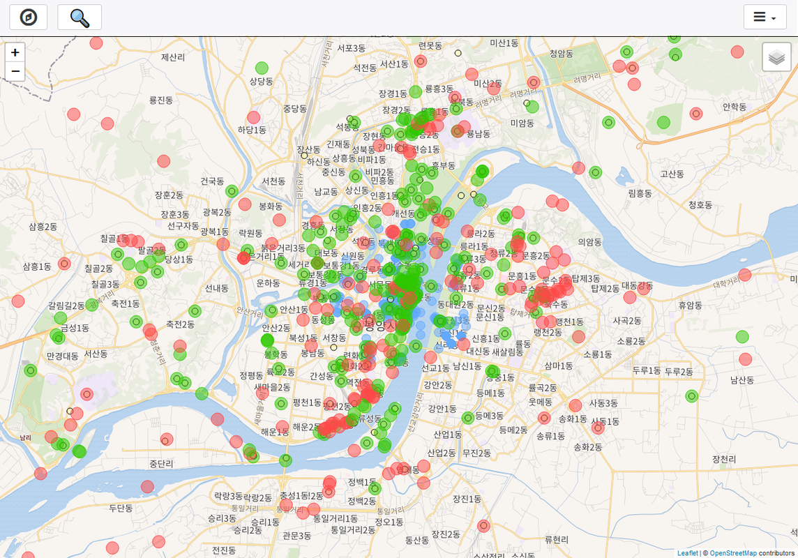
I also took the opportunity to link all the Wikidata elements in Pyongyang to the OSM objects using the website Wikishootme on Pyongyang (Wikishootme displays all geolocalised Wikidata elements and geolocalised Commons images, on an OSM map)
Results
All this work took me 3-4 days, and in the end here are the results for each project:
-
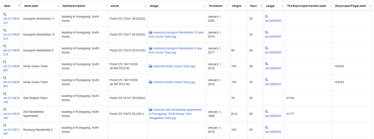
Wikidata: A whole set of Wikidata elements for skyscrapers were created and correctly filled in. See the SPARQL query
-
Commons: Many images have been cropped on Commons, then classify in different categories and linked with the Wikidata element; see the different Commons categories Apartment buildings in Pyongyang and Skyscrapers in Pyongyang
-
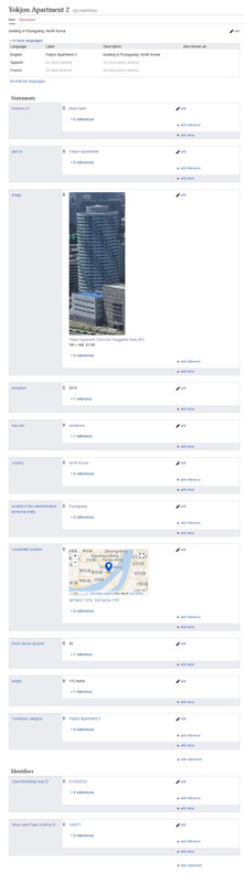
OSM: Wikidata elements have been added in OSM with the help of Wikishootme, to add information manually, mainly the name of the building, the height, the number of floors, and the wikidata tag! Example of an OSM map where is located the Yokjon Apartments
In short, I’m happy of the work I’ve done and with the result: the map is more accurate, it will be easier for me to estimate the approximate height of Pyongyang’s buildings and I’m getting closer to a good 3D rendering of the city !
Discussion
Comment from ivanbranco on 1 November 2023 at 10:56
This is the beauty of OSM, well done!