
HOT-Philippines participates in SoTM 2020's Poster Exhibit
Posted by feyeandal on 5 July 2020 in English.In cooperation with the UP Resilience Institute (UPRI), the Humanitarian OpenStreetMap Team (HOT) – Philippines has completely mapped and validated building footprints in Quezon City, Metro Manila on OpenStreetMap as part of the response we are doing to end COVID-19 (#endcov). Quezon City is one of the most densely populated and hardest hit municipalities in the Philippines by COVID-19. The OSM building footprints were used by UPRI to develop a data-driven analysis and recommendation to the local government unit of Quezon City for the city’s pandemic response. This is also part of the PhilAWARE project to map the critical infrastructures across the Philippines.

The mapping initiative started on 20 April 2020 through the HOT’s Tasking Manager (#8385, #8386).
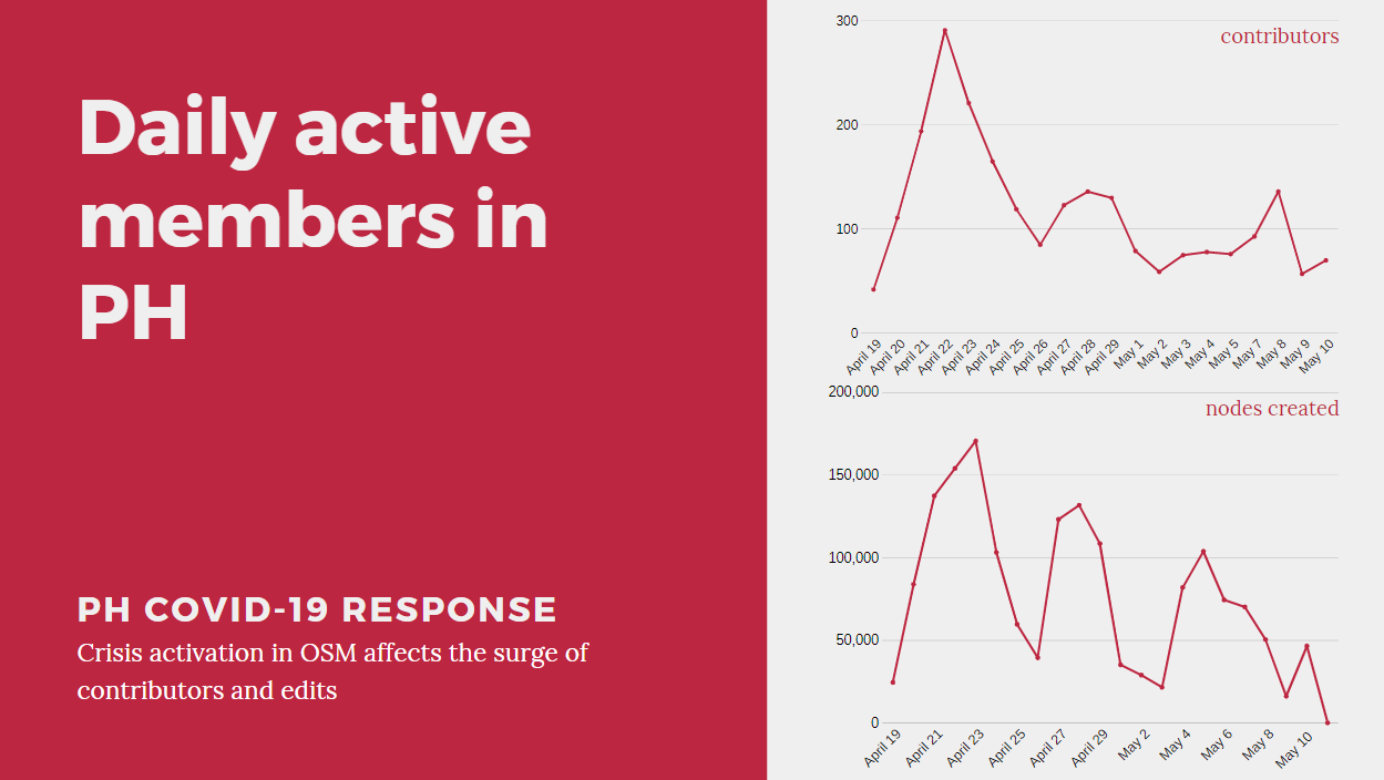
Daily active members and changesets in the Philippines from 20 April
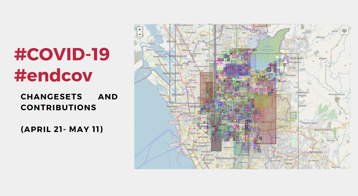
Changesets and contributions in Quezon City from 21 April to 11 May
Through the help of 644 contributors around the world, 317,325 building footprints were added and validated to OSM in 62 days.
In behalf of HOT-Philippines, I would like to take this opportunity to thank our amazing mappers, validators, and volunteers who tirelessly work on creating and maintaining the data quality in OSM that would surely help the local communities in our campaign to #endcov.
Check out all the posters at the SoTM website!
Discussion
Comment from jenjereren on 18 July 2020 at 11:08
uwian na. may nanalo na! <3