OpenStreetMap

Users' Diaries

Recent diary entries

With Comforttechsac.com, stay cool! Our skilled specialists offer prompt and dependable air conditioning repair services to maintain year-round comfort in your house. Today, discover the difference that makes Comforttechsac.com!

https://comforttechsac.com/

Address :- 10427 Perrin Beitel, San Antonio, TX 78217, United States

Posted by rtnf on 29 April 2024 in English.

One of the most rewarding aspects of being an OpenStreetMap contributor is the surprise of discovering where your contributions will be displayed next.

“I put that obscure, forgotten place back on the map, and now they’re everywhere!”


Researching toponyms is fun because I have to analyze the daily conversations among the locals and try to triangulate the place name centroid based on this conversations. Bonus point if my centroid triangulation somehow coincides with ancient, forgotten, historical maps.

Traces of Sepatan, Djati, and Rawa Roko can still be found on old historical maps, circa 1900. Locals still use these toponyms right now, despite the government’s refusal to acknowledge their existence in the official addressing system.


It’s ‘forgotten’ in the sense that the local government over here has simplified the toponym system too much. Some toponyms have been upgraded to official administrative region names (and are now embedded in the official addressing system), while the rest have been left behind. People still use these ‘left-behind’ toponyms daily to refer to certain places, even though the government has somewhat ‘discouraged’ their use. (The colonial administration did it better, though. When I consulted the archives and library for old maps, all of these ‘left-behind’ toponyms were actually mapped quite well in the past.)

And this situation has led to mass confusion for people. Government-mandated addresses often don’t reflect reality. People still use all those ‘left-behind’ toponyms in their daily activities, yet they don’t appear on official, government-mandated maps and addressing systems.

That’s one of my personal missions right now: to put all those ‘left-behind’ toponyms back on the maps.

Location: Kp Rawa Roko, Babakan, Bekasi, West Java, Java, 17116, Indonesia

OpenStreetMap (OSM) ist ein kollaboratives Projekt, das es Nutzern ermöglicht, Karten und geografische Daten frei zu bearbeiten und zu nutzen. Dieses „Wikipedia der Kartenwelt“ bietet detaillierte Informationen zu geografischen Standorten und lokalen Ressourcen, die von einer aktiven Gemeinschaft aus freiwilligen Kartografen ständig aktualisiert werden.

Verbesserte Sichtbarkeit für Arztpraxen

Einer der größten Vorteile von OpenStreetMap ist die erhöhte Sichtbarkeit, die es Arztpraxen bietet. Durch die Registrierung ihrer Praxis auf OSM können Ärzte und Ärztinnen sicherstellen, dass sie von potenziellen Patienten leicht gefunden werden. Dies gilt für allgemeinmedizinische Hausärzte ebenso wie für spezialisierte Fachärzte wie Zahnärzte, Hautärzte, Gynäkologen, Urologen, Chirurgen, Psychiater, Neurologen, Augenärzte, Kinderärzte und sogar Tierärzte.

Routenplanung und Erreichbarkeit

Für Patienten ist es oft eine Herausforderung, den Weg zur nächsten Arztpraxis zu finden, besonders in unbekannten Gegenden. OpenStreetMap kann hier Abhilfe schaffen, indem es genaue und benutzerfreundliche Karten zur Verfügung stellt, die nicht nur die Lage der Praxis zeigen, sondern auch Informationen zu öffentlichen Verkehrsmitteln, Parkmöglichkeiten und barrierefreiem Zugang bieten. Dies verbessert die Erreichbarkeit und Patientenfreundlichkeit enorm.

Lokale Vernetzung und Community-Support

OpenStreetMap fördert nicht nur die individuelle Sichtbarkeit, sondern unterstützt auch die Vernetzung innerhalb der lokalen medizinischen Community. Praxen können leichter Kooperationen und Überweisungsnetzwerke mit benachbarten Fachärzten aufbauen, was insbesondere für spezialisierte Disziplinen wie Neurologen oder Psychiater von Vorteil sein kann.

Katastrophenhilfe und Notfallsituationen

In Notfallsituationen oder bei Katastrophen kann OpenStreetMap lebensrettend sein. Durch präzise Karten können Rettungsdienste schneller den Ort einer Praxis erreichen. Ebenso können Praxen wie die eines Kinderarztes oder eines Tierarztes in Krisenzeiten wichtige Anlaufstellen in der Gemeinde sein.

Marketing und Patientenakquise

Die Präsenz auf OpenStreetMap kann auch als kostengünstige Marketingstrategie dienen. Indem Arztpraxen auf OSM erscheinen, können sie ihre Sichtbarkeit gegenüber neuen Patienten erhöhen, ohne in teure Werbekampagnen investieren zu müssen. Dies ist besonders für neu eröffnete Praxen oder solche in stark umkämpften Gebieten wie bei Zahnärzten oder Hautärzten von Bedeutung.

Fazit

Die Nutzung von OpenStreetMap bietet für Arztpraxen eine Vielzahl von Vorteilen. Von der verbesserten Sichtbarkeit und Erreichbarkeit bis hin zur Unterstützung durch die lokale Gemeinschaft und effizienter Notfallhilfe – die Vorteile sind vielfältig. Ob Allgemeinmediziner oder Spezialist, die Integration in OpenStreetMap kann maßgeblich dazu beitragen, die Qualität der Patientenversorgung zu verbessern und gleichzeitig die Praxis besser in der lokalen Gemeinschaft zu verankern.

Location: 32429, Dützen, Minden, Kreis Minden-Lübbecke, Nordrhein-Westfalen, Deutschland
Posted by ivanbranco on 28 April 2024 in English.

[Semi-automated translation of the Italian diary entry]

On OpenStreetMap, a tree can be represented as a natural=tree node.

Leaf type 🌿

leaf_type is the most common tree-related tag in the database, this is because it is easily verifiable and is supported with a quest by StreetComplete. The values are broadleaved and needleleaved. Some argue that palms should not be tagged as broadleaved but with a value of their own, =palm.

Leaf cycle 🍂

This tag describes whether a tree is deciduous or evergreen. Most needleleaved tree species are evergreen, but this is not always the case, so do not infer this value automatically. You can add this value easily if you know the species, or more simply if it is autumn/winter. If not, you can try to see if satellite or street-level imagery taken at those times are available.

Genus and species 🌳

If you are not an expert, there are tools that can help you recognise the genus/species of a plant, such as Pl@ntNet and iNaturalist, both of which also exist as mobile apps. On OpenStreetMap there are many trees with species (or species:wikidata or species:xx) that do not have leaf_type or leaf_cycle. These values are of course identical for each species (and also for many genus) and can therefore be easily deduced. There are two lists on the OSM wiki that contain these values for genus and species.

MapComplete has a dedicated tree theme that can be used to enter the species while SCEE has a dedicated quest (“What is the genus or species of this tree?”).

Monumental trees 🏛️

Monumental trees can be mapped adding denotation=natural_monument. In Italy they are recorded by the Ministry of Agriculture, Food Sovereignty and Forests (Masaf) with annual updates. You can map them by adding ref:masaf, which is a unique code assigned by the ministry.

The Black Poplar of Tronzano Vercellese

In Poland they are recorded by the ‘Generalna Dyrekcja Ochrony Środowiska’ (GDOŚ) (you can find many of them with a query natural=tree+ref:inspire=*), in Serbia many zapis (sacred trees) are mapped with ref:zapis while b-unicycling has recently documented the place_of_worship=sacred_tree tag to map rag trees in Ireland and Scotland.

Rendering 🎨

Trees are rendered on Carto as green circles with a brown dot in their centre, regardless of their attributes. Rendering of Carto trees

The Straßenraumkarte Neukölln renderer shows the trees differently according to leaf_type, circumference and diameter_crown. However, the web map only works for the Berlin district of the same name.

F4 Map and Streets GL (no longer updated) are 3D renderers that use the height tag. F4 Map distinguishes trees by foliage type and also supports some values to differentiate palm trees. Esri also has a 3D map that uses OSM data, and which should support height and also some genus values.

On the IMAGICO.De blog, there is an interesting article that goes into detail on possible renderings to highlight the various attributes.

QA 🛠️

There are more than 20,000 mapped trees, but QA tools are still few. That is why I created this MapRoulette project: Tree Validation.

There are challenges that compare values in the database with the largest values ever recorded in nature, for example trees taller than Hyperion. Other challenges concern uncommon or incorrect values of denotation, species, genus, leaf_cycle or leaf_type.

The hope is that in the future more and more tools will check on tree tagging. For now there is at least one open issue for Name Suggestion Index and one for Osmose/JOSM.

If you want to discuss trees on OSM, you can use the “tree” tag on the OpenStreetMap Community Forum.

Have fun mapping!

Posted by ivanbranco on 28 April 2024 in Italian (Italiano).

Su OpenStreetMap, un albero può essere rappresentato come un nodo natural=tree.

Leaf type 🌿

leaf_type é il tag maggiormente valorizzato nel database, questo perché é facilmente rilevabile (basta un’occhiata) ed é supportato con un’apposita quest da StreetComplete. I valori sono broadleaved (latifoglia) e needleleaved (aghifoglia). C’é chi sostiene che le palme non debbano essere taggate come latifoglia ma con un valore tutto loro, =palm.

Leaf cycle 🍂

Questo tag descrive la caduta fogliare, cioè se un albero é caducifoglio o sempreverde. La maggior parte delle specie di alberi aghifoglia sono sempreverdi, ma non é sempre così, non inferite quindi questo valore automaticamente. Questo tag é facilmente compilabile se conoscete la specie, o più semplicemente se é autunno/inverno. In caso contrario potete provare a vedere se sono disponibili immagini satellitari o foto a livello stradale scattate in quei periodi.

Genus e species 🌳

Se non siete esperti, esistono degli strumenti che possono aiutarvi a riconoscere il genere/specie di una pianta, come Pl@ntNet e iNaturalist, entrambi esistono anche come app mobile. Su OpenStreetMap esistono moltissimi alberi con species (o species:wikidata o species:xx) che non hanno leaf_type o leaf_cycle. Questi valori sono ovviamente identici per ogni specie (e anche per molti generi) e quindi possono essere facilmente deducibili. Sulla wiki di OSM esistono due liste che contengono questi valori per genere e specie.

MapComplete ha un tema dedicato agli alberi che può essere utilizzato per inserire la specie mentre SCEE ha una quest dedicata (“What is the genus or species of this tree?”).

Alberi monumentali 🏛️

Il Ministero dell’agricoltura, della sovranità alimentare e delle foreste (Masaf) ha censito (con aggiornamenti annuali) gli alberi monumentali d’Italia. Potete mapparli aggiungendo loro il tag denotation=natural_monument e ref:masaf. Quest’ultimo é un codice univoco assegnato dal ministero.

Il Pioppo Nero di Tronzano Vercellese

Solitamente un albero monumentale dovrebbe avere tutti i seguenti tag valorizzati: ele,species,species:wikidata,height,circumference,leaf_type e leaf_cycle. Questa query Overpass mostra gli alberi monumentali mappati al momento ed evidenzia quelli il cui tagging potrebbe essere migliorato: link

All’estero anche la “Generalna Dyrekcja Ochrony Środowiska” (GDOŚ) in Polonia censisce gli alberi monumentali (potete trovarne molti con una query natural=tree+ref:inspire=*), in Serbia molti zapis (alberi sacri) sono mappati con ref:zapis mentre b-unicycling ha recentemente documentato il tag place_of_worship=sacred_tree per mappare i rag tree in Irlanda e Scozia.

Rendering 🎨

Gli alberi sono renderizzati su Carto come dei cerchietti verdi con un puntino marrone al loro centro, a prescindere dai loro attributi. Rendering degli alberi di Carto

Il renderer Straßenraumkarte Neukölln mostra gli alberi in modo differente in base a leaf_type, circumference e diameter_crown. La web map funziona però solo per l’omonimo quartiere di Berlino.

F4 Map e Streets GL (non più aggiornato) sono renderer 3D che utilizzano height per visualizzare l’altezza degli alberi. F4 Map distingue gli alberi per tipo di fogliame e supporta anche alcuni valori per differenziare le palme. Anche Esri ha una 3D map che utilizza dati OSM, e che dovrebbe supportare height e anche alcuni valori di genus.

Sul blog di IMAGICO.De esiste un interessante articolo che approfondisce possibili rendering per evidenziare i vari attributi.

QA 🛠️

Esistono più di 20.000 alberi mappati, ma gli strumenti di QA rimangono ancora pochi. Per questo motivo ho creato questo progetto MapRoulette: Tree Validation.

Ci sono challenge che confrontano i valori nel database con i valori più grandi mai registrati in natura, ad esempio alberi più alti di Hyperion. Altre sfide riguardano valori poco comuni o errati di denotation, species, genus, leaf_cycle o leaf_type.

La speranza é che in futuro sempre più tool proporranno check di vario genere sugli alberi. Per ora esiste almeno una issue aperta per il Name Suggestion Index e una per Osmose/JOSM.

Se volete discutere di alberi su OSM, potete utilizzare il tag “tree” sull’OpenStreetMap Community Forum.

Buon mapping!

Posted by matthewsheffield on 28 April 2024 in English.

I’ve finished (for a second time!) mapping all the paths in my local cemetery. The first time another mapped decided that concrete or gravel ways designed for walking on weren’t “paths” and deleted them all. He also seemed to have strong feelings about people cycling in cemeteries, which is odd as The Greater Metropolitan Cemeteries Trust actually endorse it as a use of their land. As my daughter is buried in the cemetery I feel some ownership of the place, and do love it and Merlynston creek that flows through it. I’m hoping no one vandalises my work again.

Location: Hadfield, Melbourne, City of Merri-bek, Victoria, 3046, Australia

I received a request to update my previous list of people who map every single day. The top 3 places remain the same, with Aurimas Fišeras passing the 10 year mark of non-stop mapping! Congratulations on an amazing accomplishment, and a big thank you to all of these dedicated mappers!

Consecutive Days First Day of Streak User
3672 2014-04-03 Aurimas Fišeras
2810 2014-08-09 vichada
2687 2016-10-22 ika-chan!
2256 2018-02-17 LidaCity
2106 2018-07-17 Algebre gama
1943 2018-06-02 thetornado76
1943 2018-12-27 hendrik-17
1894 2014-06-15 roschitom
1860 2017-04-13 looniverse
1837 2019-04-12 bxl-forever
1828 2019-04-21 JJIglesias
1755 2019-07-03 Sammyhawkrad
1674 2019-09-22 Zrop
1631 2019-11-04 mstock
1629 2018-06-26 phiphou
1583 2018-10-06 fx99
1544 2018-10-29 BCNorwich
1501 2014-06-26 RoadGeek_MD99
1467 2017-11-04 dvdhoven
1450 2018-02-16 alkushi
1392 2019-10-25 marczoutendijk
1346 2017-10-28 piotrS
1336 2020-08-25 NieWnen
1318 2020-09-12 Strubbl
1305 2020-09-25 mindedie
1292 2017-12-11 vincent_95
1291 2020-10-09 Leonius_Bad
1286 2020-10-14 Grass-snake
1259 2020-11-10 SekeRob
1240 2020-11-29 seattlefyi
1211 2015-01-28 lodde1949
1159 2017-02-05 futurumspes
1153 2019-02-10 jmapb
1149 2021-02-28 MJabot
1092 2019-03-21 mmahmud
1070 2016-06-15 mindedie
1064 2018-08-12 ikiya
1063 2017-12-02 下り専門
1055 2019-07-22 Nesim
1031 2021-06-26 vincent_95
1026 2015-09-25 Nesim

SotM Latam 2024 - Belém/Pará - Brasil.

The State of the Map Latam 2024 will take place in the city of Belém, Brazil, from December 6 to 8, 2024 at the Instituto Federal do Pará, this being the sixth edition of the ‘Latin American OpenStreetMap Conference’ and aiming to promote the use of OpenStreetMap (OSM), and the integration of OSM mappers, developers, open data communities, free and open source software communities, students, researchers, geoinformation professionals, non-governmental organizations, companies and public institutions.

SotM Latam 2024 After the voting period for choosing the SotM Latam 2024 logo has concluded, I am pleased to announce that the chosen option is 1.

You can see the results and voting details in the document shared above: https://docs.google.com/document/d/15Kbotyc6UCcWQ2K7apPOnfqXSSDFfvlDQtZxM_Nkag4/edit

Website: http://2024.osmlatam.org

https://wiki.openstreetmap.org/wiki/ES:LatAm/Eventos/State_of_the_Map_Latam_2024

You can see the voting results and details in the previously shared document: https://lnkd.in/dQcDDFCv

an organization of UMBRAOSM Union of Brazilian mappers from Openstreetmap, Latam Community and Foss4g

SotM Latam 2024 organizing committee

Contact: state@osmlatam.org

http://www.umbraosm.com.br

Location: Marco, Belém, Região Geográfica Imediata de Belém, Região Geográfica Intermediária de Belém, Pará, North Region, Brazil

A Empresa Metropolitana de Transportes Urbanos de São Paulo (EMTU) anunciou um aumento significativo nas operações intermunicipais, adicionando 41 novas viagens em dias úteis em cinco linhas que servem diariamente cerca de 14 mil passageiros. A partir de 22 de abril de 2024, os usuários das regiões de Santana de Parnaíba, Francisco Morato, Jandira, Franco da Rocha e São Paulo experimentarão uma melhoria significativa na frequência dos serviços.

Detalhes da Ampliação do Serviço pela EMTU

As linhas metropolitanas que receberão os incrementos são operadas pela concessionária Anhanguera. Esta expansão inclui a adição de cinco novos ônibus, configurados para aumentar o conforto e a eficiência do transporte público nessas rotas.

A decisão de expandir as viagens foi baseada em um monitoramento contínuo e análises do Centro de Gestão e Supervisão da EMTU, que acompanha em tempo real a demanda e as operações dos ônibus.

Como Acessar os Novos Horários

Para os passageiros que desejam consultar os novos horários, a EMTU disponibiliza atualizações através de seu site oficial e pelo aplicativo para dispositivos móveis, disponível para iOS e Android.

Linhas com Incremento de Viagens

Sobre a EMTU

A EMTU, vinculada à Secretaria dos Transportes Metropolitanos do Governo de São Paulo, é responsável pela regulação e fiscalização do transporte intermunicipal nas cinco regiões metropolitanas do estado, que incluem São Paulo, Campinas, Sorocaba, Baixada Santista, e Vale do Paraíba / Litoral Norte. Com um serviço que atinge aproximadamente 2 milhões de passageiros por dia, a EMTU desempenha um papel crucial no desenvolvimento do transporte público eficiente e sustentável.

The eTrex 20x

Years ago when searching for a viewpoint from an old photo where I wanted to do rail photography I managed to locate the exact cliffside overlook and discovered a somewhat hidden gem of trail network in the process.

Though there is an official dirt road in the canyon below and a few desire paths offshooting from it the hills above remained relatively unmapped not showing up in the otherwise void of an area.

With the understatement of the local forecast for the afternoon/evening I packed my beloved eTrex 20x in the camera bag along with my trusty Nikon D700 planning to take in some of the views while there in between tracing runs expecting no more than some cloudiness and a light sprinkling.

The Overlook

I had originally planned to do some averaging as well to mark down 3 of my favorite spots on the cliff to photograph the scenery below but just as I reached the overlook the light rain that had accompanied me on most of my journey up started to thicken and become slanted. Just as I positioned myself on the side of the ledge for my first point reading spot the wind had picked up considerably to near constant 70kph gusts. The eTrex wobbled fiercely atop the perching rock and I had to scrap my plans of more photos just to hold it still for fear it may fall to it’s death below as my other hand clinged to the rockface hoping to avoid a similar fate.

After 5 minutes to allow a good average I quickly hit save and climbed back up to grab my gear bag and make my way back down the path for the second tracing run in the opposite direction to help iron out anomalies when mapping from the trace. As I set off the steadily increasing rainfall now started to turn to almost sideways hail from every direction as the many rockfaces perturbed the wind. Though hectic as it may seem the eTrex managed to maintain it’s nice 8 foot accuracy throughout most of the trip and likewise I was similarly high spirits.

In an almost serene state of mind while walking the trails my attention drew to the contrast between the dramatic weather and environment and the life which springs forth from otherwise dead plains because of it. Many cacti once shriveled from the dry winter were now stuffed with water, their beautiful flowers blooming brightly pink which would soon bear fruit. The normally tan plains dead with brush now teeming with fluorescent wildflowers of all colors in every direction. In that moment I remembered who I was when escaping here 11 years ago, hurt and tired of the chaos and sterility of the urban design seeking to hide from the world and in the process discovering a new one all to myself.

All in a day's mapping

It’s these things the fuel my passion for exploring and desire to document what’s around me, the eTrex always at my side as a faithful companion for so long now. The amount of memories and many long adventure it holds being priceless to me.

Posted by FargoColdYa on 26 April 2024 in English.

Summary: What if AI creates the Changeset Comments? We could send locations, tag types, and quantities to get an output. AI would have to be run locally with small models for cost and be validated by the user.

Problem 1: Time I assume that 1,000 users create 2 changes in 1 day. We assume that each change set takes 3.5 seconds. 1000 users *2 changes * 3.5 seconds per change = 7000 seconds. OSM Users spend about 1.9 hours per day.

Problem 2: Skill Outsourcing Users should spend time on the things AI can’t do.

Problem 3: Server Side Peer Review 
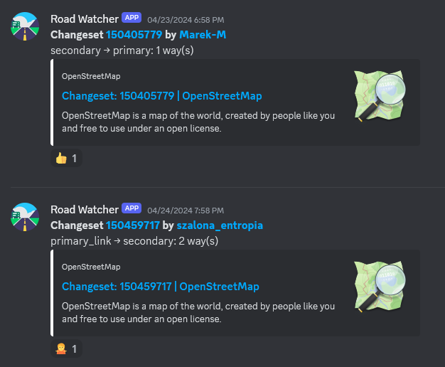
We have human generated changeset comments. We could create AI generated changeset comments. We could ask the AI, “are these 2 changeset comments so different that it looks malicious”?

General AI Inputs: 1. Location: Where did the user map? 2. Feature Types: What tags did the user use?

AI Prompt: “You are an AI system. A user made edits in OpenStreetMap, a collaborative mapping project. They mapped locations[Mappleville, MN, USA; Bobville, MN, USA] with tags[50xSidewalks, 20xMarkedCrossings, & 10xReligous Areas]. You will create a changeset comment that concisely tells human reviewers what this changeset was about in 3 sentences or less. Exact numbers are not important. Changesets describe changes, so don’t request anything. Don’t mention anything that is common across all changesets.”

AI Response (https://www.meta.ai/): “Added sidewalks, marked crossings, and religious areas in Mappleville and Bobville, MN. Improved pedestrian and accessibility mapping. Enhanced local community information.”

Specific AI Inputs for Locations: 1. Cities[1 to 5], States[1 to 5], Countries[1 to 5]. 2. Is this a place with unclear boundaries? (What if somebody maps the ocean) 3. What is the size of the bounding box for this edit in KM?

Specific AI Inputs for Feature Types: Tags[1 to 6] & corresponding Quantities

Algorithms: 1. Sort the following tags by how frequently each was used in descending order and a limit of 5. 2. For each city, how often was each tag used? Create a table unless the table is huge.

Complexities of the process: 1. Disputed Boundaries: This was the changeset that changed the boarder. 2. Large Edits: Do not run this edit over changesets larger than 500 edits. 3. Malicious Inputs: Somebody named a building tag after a war crime. The AI received that as an input. What does the AI say? 4. Resource Allocation: Developer Time could be better spent doing something else. 5. Irregular Edits: I will use every tag in OSM only once. I will map an area the size of a continent.

Complexities of AI in general: 1. Uncommon Languages: Are these things only good at the 5 biggest languages? 2. Edit Safety: The user mapped religious areas in 2 different nations that share a disputed boarder and are in a war. 3. Money: Laptops with TPU’s are not common in 2024 (but will be in 2030). Mobile Editors with TPU’s are not common in 2024 (but will be on high end phones in 2030). Running AI costs money. Who will pay for it?

Solutions: 1. AI runs locally on a TPU. 2. If you use the outputs of an AI for changeset comments, you are responsible for safety.

Disclaimers: 1. I don’t work in AI. 2. I describe what I don’t have the resources to build. 3. I assume that developer resources should focus on high priority tasks.

Expected Development Difficulty: 1. Web to TPU is hard: Graphics have standard libraries (OpenGL). AI TPU’s are not common and don’t have standard libraries. 2. This can create giant tables if you are not careful.

The benefits of manual changesets: 1. Spam is harder to create in bulk. 2. Self reflection is encouraged. 3. Individuality is good to see. 4. Changesets are the alternative to the Change Approval Board (CAB meetings). It is supposed to take effort.

TLDR: OpenStreetMap (OSM) edits could be aided with AI-generated changeset comments, potentially saving users 1.9 hours daily. AI could analyze edit locations and feature types to generate concise comments, freeing users to focus on tasks that require human expertise. However, implementing AI-generated comments requires addressing complexities like disputed boundaries, TPU libraries, and malicious inputs.

Location: Rose Creek, Fargo, Cass County, North Dakota, United States

There are some object categories in OSM whose exact classification is often a matter of contention and edit wars. Main highways are one of the most prominent examples. There was a small edit war in Poland which resulted in no less than 4 blocks, but I did not let that crisis go to waste:

Behold road-watcher, a quick Python project that regurarly queries Overpass API for highway=secondary and above within a specified boundary and then detects any classification changes, sending them to a Discord channel (though it’s trivial to substitute it with another means of notification).

obraz.png

OpenStreetMap (OSM) hat sich als wertvolles Tool für viele Branchen erwiesen, darunter auch die Hotelbranche. Die Integration von OSM in die Online-Strategie eines Hotels kann dessen Sichtbarkeit und Suchmaschinenoptimierung (SEO) erheblich verbessern. In diesem Artikel erkunden wir, warum OpenStreetMap für Hotel-SEO wichtig ist und wie Hotels von dessen Einsatz profitieren können.

Erhöhte Online-Präsenz für Hotels

Einer der größten Vorteile der Nutzung von OpenStreetMap ist die verbesserte Online-Präsenz. Hotels, die auf OSM gelistet sind, erscheinen in einer Vielzahl von Map-Anwendungen und Diensten, die OSM-Daten nutzen. Das schließt beliebte Apps für Navigation und Reiseplanung ein, welche täglich von Millionen Nutzern verwendet werden. Diese erhöhte Sichtbarkeit kann dazu führen, dass ein Hotel von potenziellen Gästen leichter gefunden wird, was die Wahrscheinlichkeit von Buchungen erhöht.

Lokale SEO-Optimierung für Hotellerie

Lokale Suchmaschinenoptimierung ist für Hotels besonders wichtig. Wenn Ihr Hotel auf OSM gut repräsentiert ist, verbessert es die lokale SEO, da die Plattform von verschiedenen Kartendiensten und Suchmaschinen zur Datenverifizierung genutzt wird. Eine korrekte und detaillierte Darstellung in OSM hilft Suchmaschinen zu verstehen, wo sich Ihr Hotel genau befindet und welche Dienstleistungen es bietet. Dies ist entscheidend, wenn Nutzer nach Hotels in einer bestimmten Region oder Stadt suchen.

Kostenfreie und bearbeitbare Plattform

Im Gegensatz zu vielen anderen Kartendiensten ist OpenStreetMap kostenlos und von einer Community getrieben. Hotels können ihre eigenen Einträge hinzufügen oder bestehende aktualisieren, um sicherzustellen, dass die Informationen immer korrekt und auf dem neuesten Stand sind. Diese Aktualität und Genauigkeit der Daten ist für die SEO-Performance entscheidend. Durch regelmäßige Updates können Hotels ihre Sichtbarkeit in lokalen Suchergebnissen verbessern und sich positiv von der Konkurrenz abheben.

Integration mit Websites und Apps

Hotels können OSM-Karten auf ihren eigenen Websites integrieren, um Besuchern eine visuelle Darstellung ihrer Lage zu bieten. Dies verbessert nicht nur die Benutzererfahrung, sondern stärkt auch die SEO, indem es die Verweildauer auf der Website erhöht und die Bounce-Rate senkt. Interaktive Karten, die den Gästen zeigen, was in der Umgebung des Hotels zu finden ist, können ein entscheidendes Element für die Entscheidungsfindung der Gäste sein.

Verbesserung der Glaubwürdigkeit und des Vertrauens

Ein korrekter Eintrag in OSM kann auch die Glaubwürdigkeit und das Vertrauen in Ihr Hotel stärken. Nutzer, die eine konsistente Information über verschiedene Plattformen hinweg sehen, fühlen sich eher dazu veranlasst, eine Buchung vorzunehmen. Die Transparenz durch genaue und umfangreiche Informationen schafft Vertrauen und kann eine wichtige Rolle in der Kundenentscheidung spielen.

Fazit

Die Bedeutung von OpenStreetMap für die Hotel-SEO kann nicht hoch genug eingeschätzt werden. Die Plattform bietet eine kostengünstige Möglichkeit, die Sichtbarkeit zu erhöhen, die lokale Suchmaschinenoptimierung zu verbessern und letztendlich mehr Gäste anzuziehen. Hotels, die OSM aktiv nutzen und ihre Einträge pflegen, setzen sich in einem konkurrenzreichen Markt durch und verbessern ihre Online-Präsenz signifikant.

Durch die Nutzung von OpenStreetMap können Hotels nicht nur ihre SEO verbessern, sondern auch ein umfassenderes und benutzerfreundlicheres Erlebnis für potenzielle Gäste schaffen. Es ist an der Zeit, die Chancen, die OSM bietet, voll auszuschöpfen.

Weitere Informationen zum Thema finden Sie auf (https://www.mario-vogelsteller.de/seo-hotels/).

Location: 32427, Hahlen, Minden, Kreis Minden-Lübbecke, Nordrhein-Westfalen, Deutschland

OpenStreetMap (OSM) ist mehr als nur ein Kartendienst im Internet: Es ist eine globale Gemeinschaft, die daran arbeitet, freie und editierbare geographische Daten für die ganze Welt bereitzustellen. Als leidenschaftlicher Verfechter der Bedeutung offener Daten und der Gemeinschaftszusammenarbeit möchte ich in diesem Blogartikel teilen, warum ich mich für OSM engagiere und warum ich glaube, dass auch Sie es in Betracht ziehen sollten.

Freie und Offene Daten

In einer Welt, in der geographische Informationen zunehmend kommerzialisiert werden, bietet OSM eine kraftvolle Alternative: Eine freie Karte, die von jedermann verwendet und bearbeitet werden kann. Diese Offenheit fördert nicht nur Innovation und Kreativität, sondern stellt auch sicher, dass diese wichtigen Daten dort verfügbar sind, wo kommerzielle Anbieter vielleicht kein Interesse haben zu investieren. Indem ich zu OSM beitrage, unterstütze ich ein Modell, das Wissen und Ressourcen demokratisiert, was meiner Überzeugung nach für eine gerechtere Welt unerlässlich ist.

Community und Zusammenarbeit

OpenStreetMap ist das Produkt einer engagierten Gemeinschaft von Freiwilligen rund um den Globus. Diese Gemeinschaft ist vielfältig: Sie umfasst nicht nur Kartographen und Geografen, sondern auch Menschen aus allen Bereichen des Lebens, die ihr lokales Wissen einbringen. Durch meine Beteiligung an OSM habe ich nicht nur die Möglichkeit, zur Karte beizutragen, sondern auch von anderen zu lernen und dauerhafte Verbindungen aufzubauen. Diese Zusammenarbeit auf globaler Ebene stärkt mein Gefühl der Zugehörigkeit und zeigt mir, dass meine Beiträge, egal wie klein sie sind, einen Unterschied machen.

Bildung und Empowerment

Die Arbeit mit OSM hat auch einen starken Bildungsaspekt. Indem Menschen lernen, wie sie Karten lesen und bearbeiten können, erwerben sie wichtige technische Fähigkeiten und ein tieferes Verständnis ihrer Umgebung. Diese Fähigkeiten sind besonders in Entwicklungsländern von unschätzbarem Wert, wo Zugang zu präzisen Kartenmaterialien das Potenzial hat, das tägliche Leben und die Entwicklung der Gemeinschaft zu verbessern. Mein Engagement bei OSM ermöglicht es mir, Teil dieses positiven Wandels zu sein.

Resilienz und Katastrophenhilfe

Ein vielleicht weniger offensichtlicher, aber ungemein wichtiger Aspekt von OSM ist seine Rolle bei der Katastrophenhilfe. Freiwillige aus der OSM-Community haben wiederholt gezeigt, wie schnell sie auf Naturkatastrophen reagieren können, indem sie aktuelle, detaillierte Kartendaten bereitstellen, die für Rettungs- und Hilfsaktionen entscheidend sind. Diese Kapazität zur schnellen Reaktion macht OSM zu einem unverzichtbaren Werkzeug in Krisenzeiten. Indem ich mein Wissen und meine Fähigkeiten beisteuere, fühle ich mich als Teil einer globalen Anstrengung, Leben zu retten und Gemeinschaften wieder aufzubauen.

Einladung zum Mitmachen

Meine Erfahrungen mit OpenStreetMap sind durchweg positiv und erfüllend. Ich lade Sie herzlich ein, sich uns anzuschließen, egal ob Sie ein passionierter Kartograph sind oder einfach nur Interesse daran haben, Ihre lokale Gemeinde auf der Karte sichtbar zu machen. Jeder Beitrag zählt und hilft, die Welt ein bisschen besser zu verstehen und zu gestalten.

Ich engagiere mich für OpenStreetMap, weil ich glaube, dass offener Zugang zu geographischen Informationen die Welt transparenter, gerechter und vernetzter macht. Wenn auch Sie an diese Vision glauben, würde ich mich freuen, Sie in der OSM-Gemeinschaft willkommen zu heißen. Lassen Sie uns gemeinsam die Welt kartieren!

Location: 32427, Hahlen, Minden, Kreis Minden-Lübbecke, Nordrhein-Westfalen, Deutschland

Am 24.04.2024 fand für die Touristiker des Saarlandes der zweite Teil eines Seminars zum Thema Route 3.0 & OpenStreetMap statt. Auf Einladung durch Klaus Wallach von der Tourismus Zentrale Saarland nahmen mit Barthwo und mir auch zwei saarländische Mapper an dem von Thomas Froitzheim durchgeführten Seminar teil. Motiviert wird das Seminar durch die neue Richtlinie Route 3.0 des Deutschen Tourismusverband (DTV).

Ziel des Seminars war es, die Touristiker mit dem Konzept OpenStreetMap bekannt zu machen und zur Kontrolle der richtigen Hinterlegung von Wander- und Radtourrelationen in OSM zu schulen. Dabei konnten die Touristiker sehen, dass sehr viele der Routen bereits von fleißigen Mappern in OSM hinterlegt wurden. Im Rahmen der Schulung kamen Tools wie BRouter-Web, GPX Viewer sowie WayMarkedTrails zum Einsatz. Anhand dieser Tools können die Touristiker nun:

  • die aktuellen .gpx-Dateien bestehender Routen aus ihren Datensystemen mit den Relationen in OSM vergleichen, um fehlende oder fehlerhafte Relationen zu identifizieren, sowie
  • ohne Vorerfahrung mit wenigen Klicks .gpx-Dateien erstellen, die bei kurzzeitigen temporären Umleitungen den Touristen zur Verfügung gestellt werden können.

Die meisten Touristiker kamen im Rahmen des Seminars zum ersten Mal mit der Datenstruktur von OpenStreetMap in Kontakt. Da das Anlegen oder Modifizieren von Relationen durch unerfahrene Nutzer viele Risiken birgt, wird eine Lösung unter Zuhilfenahme der Mapper-Community benötigt, anstatt den Touristikern das recht komplexe und zeitaufwendige Thema Relationen aufzubürden.

So stellte Thomas Froitzheim auch eine uMap vor, die von der Mapper-Community der Mittelweser- und Minden-Region erarbeitet wurde und bei den lokalen Touristikern auf reges Interesse stieß. Die uMap bietet ein benutzerfreundliches Kommunikationswerkzeug, über das Fehler in Relationen gemeldet werden können, ohne dass die Touristiker fortgeschrittenes Wissen in OSM-Relationen haben müssen. So können erfahrene Mapper aus der Region die Relation basierend auf Meldungen der Touristiker, die in der uMap eingetragen werden, überarbeiten. Umgekehrt herum können auch Mapper Rückmeldungen zu Beschilderungen oder Schäden der Wege als Medien in die uMap eintragen. Diese können dann wiederum von den Betreibern genutzt werden, um die Qualität der Wege selbst zu steigern. Darüber hinaus lassen sich Gegebenheiten durch die Farbgebung optisch gut hervorheben und über den uMap-Link leicht mit den Gemeinden teilen, so Thomas Froitzheim. Es ergibt sich eine Win-Win-Situation für alle Beteiligten.

Die saarländische Mapper-Community strebt an, in Zukunft enger mit den Touristikern des Landes zusammen zu arbeiten und eine ähnliche uMap für das Saarland zu entwickeln. Es sind sehr schöne Entwicklungen, dass OpenStreetMap im Tourismus mittlerweile als Standard etabliert ist.

The SMCoSE YouthMappers Chapter, renowned as one of Tanzania’s largest mapping communities, hosted a transformative mapathon on April 14, 2024, at the esteemed Sokoine University of Agriculture. This event marked a pivotal moment of collaboration, extending invitations to other YouthMappers chapters in Morogoro, thus amplifying the inclusivity and impact of the initiative. Central to the mapathon’s objective was the concerted effort to contribute to Project #15530 within the HOT Tasking Manager, focusing on mapping cities across the Eastern and Southern Africa Region. By leveraging the power of open data, participants aimed to craft detailed base maps crucial for diverse applications, ranging from urban planning to efficient disaster response strategies.

Amidst an atmosphere described as “fantastic,” the event witnessed a remarkable accomplishment, the successful mapping of approximately 25,000 buildings. This feat not only underscores the collective dedication of the participants but also showcases the tangible outcomes of community-driven endeavors. Moreover, the mapathon served as a platform for new mappers to acquaint themselves with essential mapping tools such as ID Editors and JOSM, empowering them to contribute meaningfully to the OpenStreetMap ecosystem.

Special recognition is duly owed to the Open Mapping Hub Eastern and Southern Africa (OMHESA) for their unwavering support, notably through the prestigious Spatial People Award. This acknowledgment not only highlights the significance of collaborative partnerships but also accentuates the pivotal role of organizations in facilitating impactful mapathons and community initiatives. In essence, the event epitomized the ethos of collaboration, learning, and contribution inherent within the mapping community, further advancing the cause of open data dissemination and spatial awareness in the region.

In conclusion, the SMCoSE YouthMappers Chapter’s mapathon stands as a testament to the transformative potential of collective action in harnessing the power of mapping for societal benefit. It exemplifies how collaborative efforts can foster tangible change, driving forward the agenda of open data accessibility and spatial literacy within Tanzania and beyond. “We don’t just build maps, we build Mappers”

Location: Mazimbu Darajani, Morogoro Municipal, Morogoro Region, Coastal Zone, 67000, Tanzania

Theatro da Paz, Belém/Pará - Brasil

O Theatro da Paz foi fundado em 15 de fevereiro de 1878, durante o período áureo do Ciclo da Borracha, quando ocorreu um grande crescimento econômico na região amazônica. Belém foi considerada “A Capital da Borracha”. Mas, apesar desse progresso a cidade ainda não possuía um teatro de grande porte, capaz de receber espetáculos do gênero lírico. https://www.theatrodapaz.com.br/

Credito da Foto; Wikipedia, https://pt.wikipedia.org/wiki/Wikip%C3%A9dia:Wiki_Loves_Par%C3%A1#/media/Ficheiro:Teatro_da_Paz_3.jpg Theatro da Paz, Belém/Pará - Brasil

Mais um ponto turístico da cidade de Belém atualizada na plataforma OpenStreetMap https://www.openstreetmap.org/changeset/150449820 através do projeto #MapeaiaBelem, https://projetomapeiabelem.my.canva.site/home que tem como objetivo disponibilizar dados atualizado para todos a comunidade local e também para aqueles que estarão presente aos grandes eventos que acontecerá entre 2024 e 2025, #SOTMLATAM #FOSS4G #COP30 sem contar que esses dados poderá ser utilizado por todos através de APPs como OsmAnd entre outros apps.

2024, SotM_Latam2024, FOSS4G 2024 , Belém, Cop30Belém

Projeto MapeaiaBelem,

Site do Projeto Mapeia Belém. https://projetomapeiabelem.my.canva.site/home Objeto mapeado no Openstreetmap, https://www.openstreetmap.org/changeset/150449820

esse é mas um projeto da UMBRAOSM - União dos Mapeadores Brasileiros do Openstreetmap

site: www.umbraosm.com.br

Instagram: https://www.instagram.com/umbraosmbrasil/

E-mail: contato@umbraosm.com.br

Location: Campina, Belém, Região Geográfica Imediata de Belém, Região Geográfica Intermediária de Belém, Pará, North Region, Brazil