OpenStreetMap

scruss's Diary

Recent diary entries

I read about the Ogimaa Mikana project in The Globe and Mail last week (“How my neighbourhood looks and sounds in Ojibway”). Given that we have the name:* tagging scheme, OSM already supports indigenous language naming.

ISO 639-[1,2,3] has many ways of tagging in Ojibway. The two letter code is oj. The three letter codes are more complex; the macro language is oji with seven individual languages related to it.

I don’t know if I did this even remotely correctly, but — welcome to Gichi Kiiwenging!

Location: Entertainment District, Spadina—Fort York, Old Toronto, Toronto, Golden Horseshoe, Ontario, M5V 1J5, Canada

The Power tagging scheme went through quite a bit of thought in 2013. Unfortunately, living on only a couple of OSM mailing lists, I didn’t get to see any of the discussion. While most of the suggestions are pretty reasonable (if occasionally requiring improbably levels of system knowledge likely only known to employees) one part confuses me: generator:source vs generator:method.

For wind power, there’s only one source: generator:source=wind; but then, what new information does generator:method=wind_turbine add? It seems to be wholly redundant.

The Wind Farm Tagging Thing

Anyway, while adding a small wind farm near where I grew up, I noticed a rather neat convention for grouping turbines into a wind farm: using a relation, as in:

  <relation id='4515485'>
    <member type='node' ref='3308390472' role='generator' />
    <member type='node' ref='3308390473' role='generator' />
    <member type='node' ref='3308390474' role='generator' />
      <!-- … more member nodes, one for each turbine -->
    <tag k='name' v='Middleton Wind Farm' />
    <tag k='site' v='wind_farm' />
    <tag k='type' v='site' />
  </relation>

(real link: Middleton Wind Farm)

This is a tidy way of grouping turbines, as many wind farms aren’t clearly enclosed. You could have all sorts of roles for transmission lines, control rooms, visitor centres, …

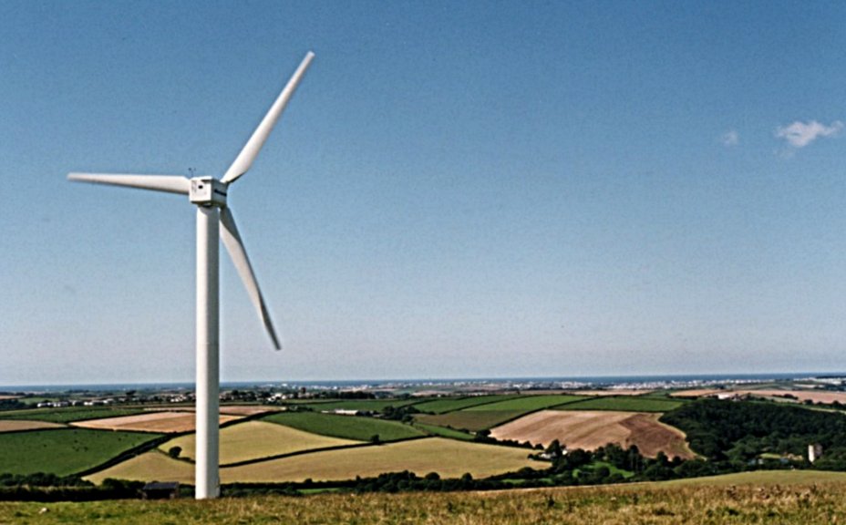
I’m pleased to see that the tagging scheme seems to be informally named after Carland Cross wind farm. Carland Cross was the first wind farm I worked on. Here’s a view over to Newquay, as it looked to me in the summer of 1993: We thought 400 kW turbines were huge in those days ...

Location: Neilston, East Renfrewshire, Scotland, G78 3NJ, United Kingdom

I go to the Toronto OpenStreetMap Enthusiasts group. So does mmather.

It turns out that mmather’s grandfather, and my great-grandfather, were colleagues at the Royal Technical College in Glasgow (now The University of Strathclyde), Scotland. Just recently, my brother found our great-grandfather’s hand-written application to become a member of the Institution of Mechanical Engineers from 1913. There on the page was my great-grandfather’s signature — with mmather’s grandfather’s signature next to it as witness.

Small world indeed.

Location: Pinkston, Sighthill, Glasgow, Glasgow City, Scotland, G4 0LP, United Kingdom

Bike *all* the streets of St Louis ...

Posted by scruss on 13 June 2013 in English.
[MetaFilter](http://www.metafilter.com/ “MetaFilter Community Weblog”) user jjjjjjjijjjjjjj would like some help to finish a project to bike down every street in St Louis. Some of the routing logistics seem a little out of reach for jjjjjjjijjjjjjj, and the city’s streets could always use a little more love from the OSM community.

I’m way out of town and loaded down with my own projects, but I thought some people here might be interested.

Location: Downtown, St. Louis, Missouri, United States

tagging a green roof?

Posted by scruss on 1 June 2013 in English.

I just mapped Warden Hilltop Community Centre. It has a “green roof” — part of the roof has growing turf, and a trail through it (which would explain how I managed to put a gps trail through the building ☺). How would I tag it?

Green roofs are kind of a thing (and not just ‘cos I briefly worked for Green Roofs for Healthy Cities). I can think of some:

Location: Birchmount Park, Scarborough Southwest, Scarborough, Toronto, Golden Horseshoe, Ontario, M1K 0A4, Canada

Navigating by OSM

Posted by scruss on 5 April 2013 in English.

Back in Scotland for a week, and couldn’t be bothered to buy new maps for the Garmin. I thought I’d download TalkyToaster’s FREE* British Isles Maps. So far, the roads and routing have been great. The same can’t be said of my driving on the other side of the road, though …

Location: Fruin, Crookfur, Newton Mearns, East Renfrewshire, Scotland, G77 6HF, United Kingdom

Well, that was quite a stump ...

Posted by scruss on 27 August 2012 in English.

109 waypoints around Elliot Lake in an afternoon teaches you one thing about mapping: it always rains heaviest when you’re furthest from shelter. I got drookit.

Because the town lost its mall early in the summer, the shopping and social focus appears to have moved away from that part of town. I tried to map every shop and facility that I could downtown.

Almost all of the waypoints were captured with my trusty 60CSx, though a couple were done with iLOE. I have to say, I’m not impressed with the iPhone’s GPS. Even when iLOE is reporting ±5m, I’m seeing it place points more than 50m off where my Garmin and Canvec says it should be.

Incidentally, if you ever make it up here, Topper’s Pizza provides epic mapping fuel, and the Java Jolt café next(ish) door has coffee and wireless …

Location: Elliot Lake, Algoma District, Northeastern Ontario, Ontario, Canada

I realised I had a tonne of wind farm survey data I’d amassed over the years, and little of it had been put into OSM. Most of it’s in Ontario, but some is in the UK and elsewhere. Some was just rough locations I’d noted from air surveys and needed cleaning up. Where known, I’ve put in the manufacturer and power rating of each turbine.

I had to make my peace with JOSM, as Potlatch annoyingly tags wind turbines as ‘power_source=wind’, instead of the preferred ‘generator:source=wind’. JOSM’s a pain on the Mac, until you learn the trackpad gestures, and that Paste on Java is Ctrl+V and not Command+V (grr grr grr). Should really also fix the mapnik wind turbine symbol, as the green shaded tower is a registered trademark of ENERCON GmbH.

It was good to finally put projects I’d worked on (like Erie Shores Wind Farm) on the map — even if I had to resort to the dog-slow USGS WMS server and pointen-clicken to do so!

Location: Cliviger, Burnley, Lancashire, England, United Kingdom

In rural southern Ontario, USGS Aerial Imagery is your friend

Posted by scruss on 6 August 2012 in English. Last updated on 7 August 2012.

Rural southern Ontario doesn’t have the best quality Bing imagery, likely due to its low population density. But the USGS does, so if you set your background to be “OSM US USGS Large Scale Aerial Imagery”, you’ll be more likely to map accurately from it.

Not quite sure what to use as the source tag, though. USGS? Updated: Thanks to Sanderd17, it should be source=USGS Ortho.

Note that this imagery doesn’t go very far north into Canada; it’s definitely not available up in Algoma.

Location: Bayham, Elgin County, Ontario, Canada

I got the Triton 400 cheap for work when we needed a GPS in a hurry. I don't really recommend it; I've added some details in the reviews section.

One thing I just found out is that while it can generate track points at 1Hz, tracks are limited to 5000 points, and stop logging when full. That means you've got about 1 hr 20 for each map outing with the Triton ...