Earlier today I had to check an alarm on the servers. The alarm was for a non-issue, but I happened to notice a momentary delay to replication across multiple services and I wanted to investigate.
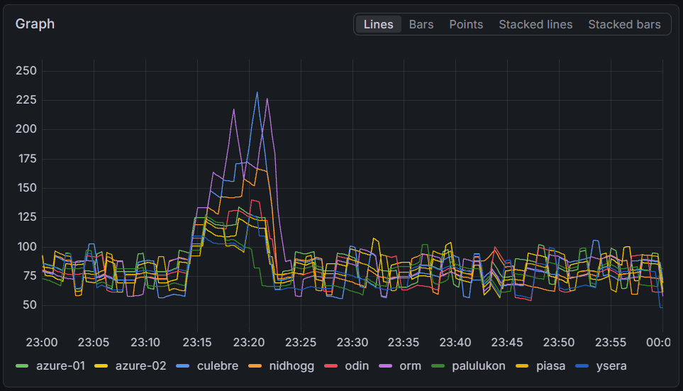
The rendering servers fell up to four minutes behind on some servers, with all servers falling at least a minute behind normal. Interestingly, there does not seem to be a correlation between the delay and the server capacity.