
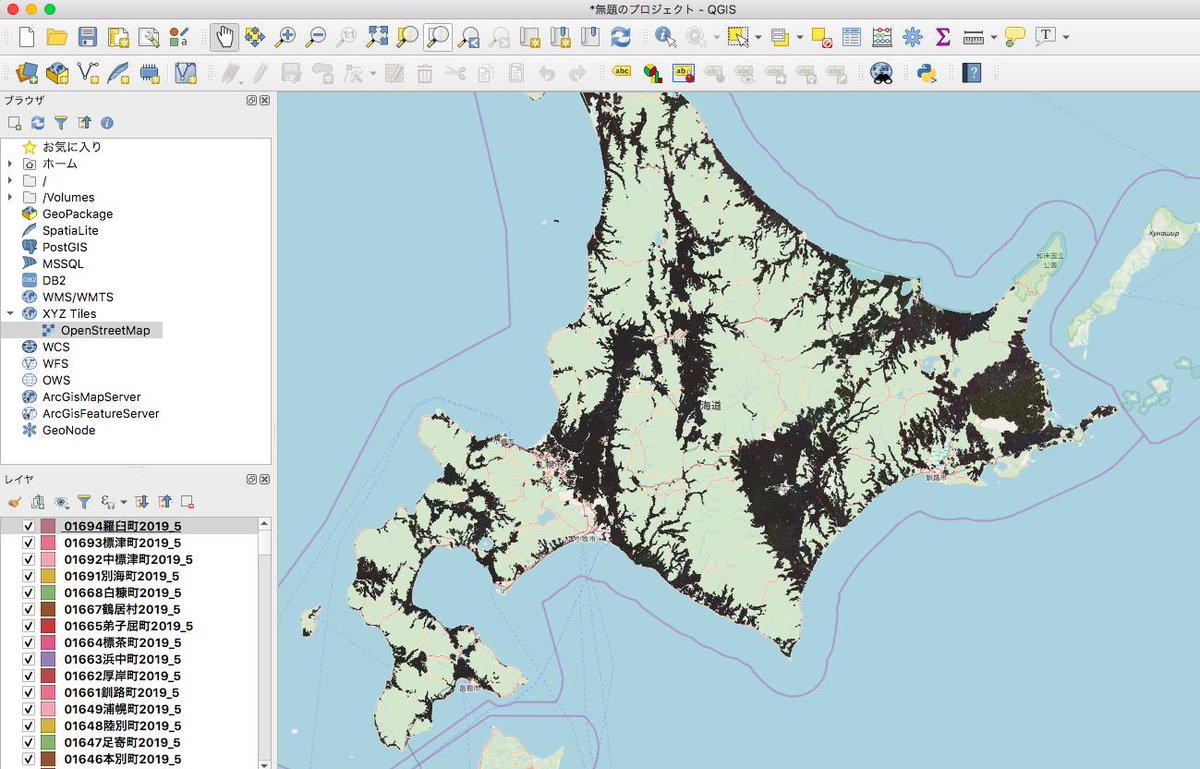
Last week, MAFF (Ministry of Agriculture, Forestry and Fisheries, Japan) has published farmland data for entire Japan.
It is under MAFF original license, but it allows pretty similar to JP Gov’s Open License. (based on JP Gov’s default one, but seems more open) I guess it need to ask them if we could use/import them to OSM, but I hope we have a chance :)
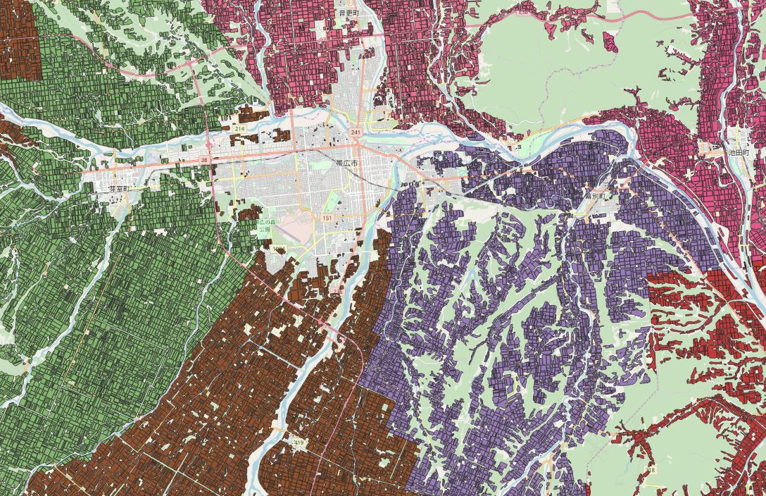
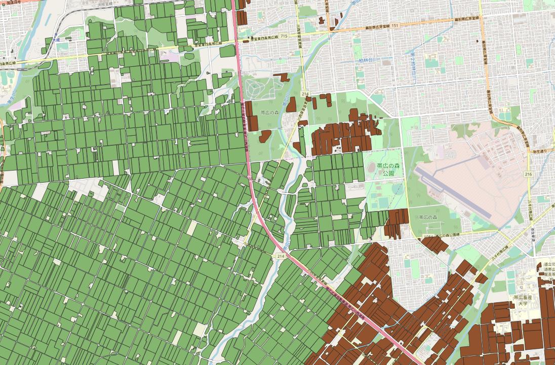
Sample
Accuracy
Details are not available. But seeing some regions, it is quite accurate with GSImap(map from JP government) and OpenStreetMap.
Import?
I guess it could be challenging, at least this time.
Community consensus
- This data has polygon for each farmland. (original usage is farmland cadastra) So some mappers did another way of editing (combining several field as 1 polygon)
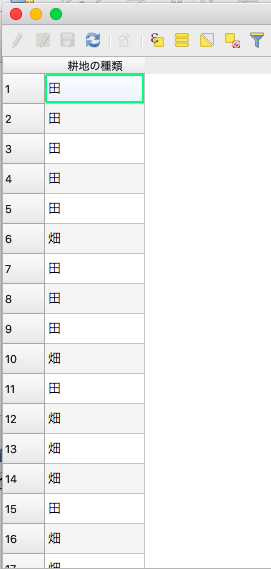
- Tagging. (each polygon has “landuse=farmland”?)
License Compatibility
- Their Clause 3)ウ has “users should announce this term of use for all of he users” could be an issue. Need to ask.
Huge dataset!
- It has 30,951,173 polygons total!
- Geometry alignment with existing data in OpenStreetMap (Country roads in Japanese OpenStreetMap is 1:25000 from old import, and forest data from KS2 old import is also still messy)
But … I’m very excited to see that!
Discussion
Comment from SomeoneElse on 10 April 2019 at 11:25
I’d imagine that trying to import this into OSM will be very challenging, because as you say, there’s a lot of new data and also because of the old somewhat questionable imports in Japan (as you also say “forest data from KS2 old import is also still messy”).
To reduce problems I’d suggest following the rules to the letter, but initially only processing a very small area. That way you can get all necessary permissions and also judge how much work is required for each area to do a good job of merging the data with what’s in OSM already. That way the risk to OSM data in Japan as a whole is less because you’re only going to affect a very small area.
As part of the import discussion you’ll need to say how you’ll handle data that’s already there, and that includes data from the original imports, data modified by locals on the ground and data modified remotely because the original imports were a bit iffy.
Once that’s done successfully, go the import process again for a larger area - this will be quicker as you’ve already got permissions to use data etc., and the community will be able to judge better whether it’s a good idea or not based on who the initial small import went.
Things to avoid are “thinking you’ve got community buy-in when you’ve only been talking to a small subset of people”, “getting approval for a small area and the running the import in other areas” and “deleting what’s already there without looking at it because the new data is assumed to be better”. With a DWG hat on I’ve seen all of these problems happen and it’s a shame, because it creates bad feeling between OSM mappers who are essentially “on the same side” - trying to create the best map.
Finally, best of luck!
Comment from nyampire on 10 April 2019 at 12:22
Thanks, I agree 100% with you.
As you suggested, import action for this dataset is quite risky to several sides. It needs very sensitive discussion to do so.
I’ve leaded several past imports in Japan. (e.g. KSJ2 admin boundary, Urayasu-city building footprint and so on) So I think following the import guidelines are mandatory with highest prioroty.
At this time, I would not like to take some action quickly.
But I think it is nice time to think about if we can handle such a huge dataset for every side of license, tech and community. (if it is impossible to handle, it is good good for me.)
My motivation is not to fulfill the data with import. This is just an output. Mine is to cultivate community’s consensus, skills and togetherness with discussion. Outcome is important, I guess.
Comment from MapMakinMeyers on 26 April 2019 at 14:45
Is there a download page for these? Thanks!!
Comment from nyampire on 28 April 2019 at 23:41
@MapMakinMeyers Not yet. They had announced it will be start at this July (with ID for each polygons).
Anyway, I can share it, so please DM me if you want.