A sensitive mapping of public space, #CallesVioletas (VioletStreets)
Posted by mapeadora on 16 March 2017 in English. Last updated on 17 March 2017.The exercises of mapping from the citizenship, which are the basis of the present introspection, take origin in the work group of #Repubikla. This group, through several projects articulated among themselves, encourages citizens and organized civil society to be empowered by generating robust data for public policies, and forms a framework where all the urban stakeholder are interrelated and aware from their different and complementary perspectives, in an inclusive way. These two objectives serve the central objective that is the construction of an egalitarian and inclusive city, with high participation in its processes, of the whole of the society.
Through the initiatives of #Mapeaton (Mapathon for and by pedestrians) and then #CrucesNegros (BlackCrosses), we have been approaching methods that sharpen our reading of public space, in a fine level of detail, and in its less visible and tangible dimensions, but more practical and perceptive.
Approaches to qualitative and inclusive methods of auditing the public space
Users of the streets that do not have any motor problem, are the majority of the people in charge of directing the walks during which the audits are carried out. What elements of the transit space can a person who walks without difficulty, easily notice? The tip of the iceberg, the most obvious tangible elements, that even a robot could interpret with banks of images of the city. And for this, we can soon leave the task to artificial intelligence systems (#Mapillary and #OpenStreetCam advance in this sense and will be a reality achievable in a few years).


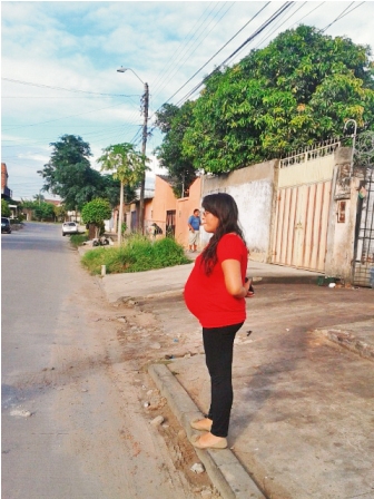
If the recognition of the most obvious problems of the infrastructure is not the main added value, how to reach a more acute level of perception of our environment? And how to express it? To move towards greater sensitivity, the #Mapeaton methodology quickly included models within the exercise. The models are people with any difficulty to move, compared to the user omnipresent in the social representations and also the most attended by public policies: the young man, with good physical conditions, middle class, without any accompanying person. When performing the exercises with a population made invisible, we pretend to have a correct representation of the citizenship that moves in our cities.


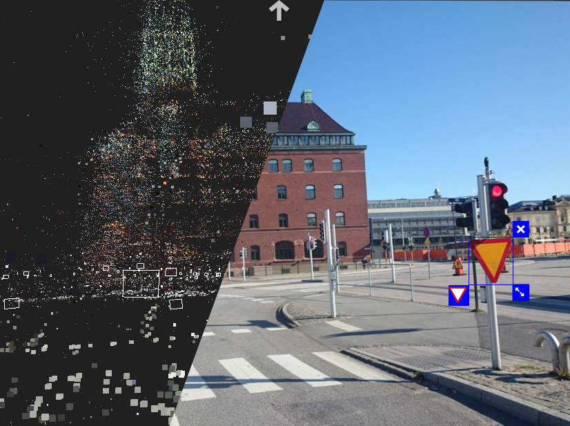
By integrating to the Mapeaton methodology the fine observation of how the models move, with the timely and sequential documentation using #Mapillary, of each rise of the sidewalk, crossing, sidewalk in variable conditions, invaded by infinity of obstacles, it helped with no doubt to see imperceptible dimensions of our space, by having different physical conditions.

 (Mapillary.com)
Evaluate the infrastructure, or perceive the experience of the others?
The visual observation is here the vector to be able to try to transmit the experience of the subject-model. But what happens at the level of experience and interaction between the participants? Other types of mapping projects have helped to understand several things: something not only occurs at the visual level; the physical infrastructure problems, as well as their classification to give a digested result of the direct exercise to the urban designer, are not the only interesting dimension, nor the most important, to be treated as urban public space.
When performing participatory audit exercises, which have a precise practical function, we still loose the most hidden part of the iceberg.
This is how #Mapeaton and its variants have become a window of experimentation towards modes of more sensitive representations of space, where the result is not the only purpose, but also the process. Interaction with subjects who are aware of the problem, not only through observation but through dialogue and testimonies, helps to perceive otherness, to try a different experience from the others’ shoes, and to capture an environment from which we do not have the keys to understand it.
Deconstruction of cartographic practice
Following the Mapeaton methodology, two specific experiences have led us to a more sensitive understanding of the mapping exercise, an exercise at an exploratory level, which we now consider fundamental and * prior * to recognition exercises of physical elements of the infrastructure and their classification for design and public policies.
The first experience was with the project Performance of the Walk by Fabiola Rayas, which represents, with photographic sequences, the last known routes of missing people (a massive phenomenon) in Michoacán, Mexico.
The use of photomapping as a memory support, collective and performative homage with families, and claiming, represents a powerful use of cartography, where the boundary between instrument, support, and message, is much more abstract, as well as the function of the map.
The second is a perceptive mapping of an area of La Merced (popular shopping area of Mexico city downtown) accompanying sex workers, aiming to identify conditions and characteristics of the infrastructure that generate insecurity.
This mapping is the accidental result of a #Mapeaton exercise focused on the vision of women working in public space all day, to help identify the hot spots of these streets, as a participation in the art project Carpa orgánica de La Soledad by Santiago Robles. The uncontrolled conditions of this practice transformed the experience, from an audit of the infrastructure with the eyes of a type of user of the space, to another very perceptive experience of a latent and little tangible violence and balance of power.

Again, the streetview is a medium of expression of an ambient, rather than a medium of identification and classification of physical elements. The streetview “narrates” an itinerary made through streets of La Merced with permanent fear to the eyes of those who control the area, to be seen with strangers, to be seen recording with a cell phone.
#CallesVioletas, a participatory mapping of the hostility of space for women
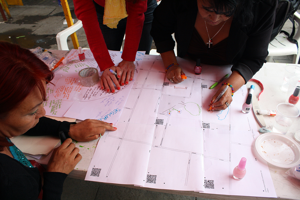
Since the beginning of the Repubikla project, working methods have been experimented to document the violence suffered by women in the public space, with feminist groups and public institutes such as the Institute of Women (InMujeres) of Mexico City, based on web mapping of the hot spots of the city for cyclists, and in photomapping. In the framework of the UN #SafeCities program, the Institute of Women of Mexico City has organized walks in violent areas of almost all the delegations of Mexico City, with inhabitants, officials, and experts, by day and at night. In the process of conceptualization, we have provided methodological advice to systematize the exercise with photomapping.
In this same context, we will carry out other exercises in March and April 2017, with groups of the Peatonal League, integrating the learning described above to achieve an exploratory and sensitive mapping of public spaces according to the perception and experience of women.
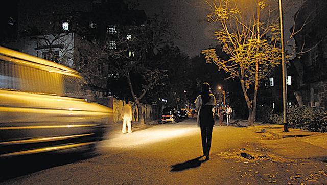
The #CallesVioletas exercise is a sensitive reading, with violet glasses, of anxiety, hostility, fear that can generate the space to the women. It is a previous and independent exercise, to the recognition and classification of tangible elements of the infrastructure.
The method is based on the following points:
- Organization of a walk with one or more groups, exclusive of women, of approximately 10 people, with a majority of inhabitants and users of the place, as well as local officials from different agencies, experts on gender violence, urban planners, mobility experts, etc.
- Guide: a person guides the walk in a slow pace, making frequent stops where she invites the group of inhabitants to express their feelings in this place, day and night, to relate events, to dialogue.
- A person records the stories (audio or text note)
- A person performs a photomapping sequence with the dedicated Mapillary account #CallesVioletas * in front of the group * avoiding to record the group in the photos
- Another person with the same account makes shots of physical elements in case they are mentioned by the group, but without conditioning people to do so (do not give the instruction)

NB: (If the context needs it, other people can take specific pictures with #Mapillary of physical elements of the infrastructure using a pre-built typology, must be separated from the exploratory group dynamics)
The results of the exercise are visible and can be downloaded on the Mapillary.com web platform. Like #Mapeaton, it is important to use the same dedicated account for these exercises, to be able to build a repository of images that can be viewed, analyzed and compared together anywhere in the country or the world. The greater number of projects carried out with the same methodology and visible together on a map, the stronger the message and the impact we can have, documenting the issue and building a debate.
With an open images repository, we also allow analysts, urban designers, researchers, to have a consistent material to analyze and construct proposals that improve cities, with an inclusive approach.
The exercise itself provides a framework for interaction and collaboration between local governments, public safety, planning institutes, local, national and regional level organizations, inhabitants, experts, which can lead to other inclusive participatory experiences.
Related Projects: Repubikla, Mapeaton, CrucesNegros, https://www.openstreetmap.org/user/_atropellado, MoreliaSeMueve, Performance of walking


Discussion
Comment from GOwin on 25 March 2017 at 04:08
Good job! Congratulations for an impressive mapping exercise, with an alternative mapping framework.