
Using NYC Dept of Buildings Building Information Search, part 1
Posted by jmapb on 11 March 2022 in English. Last updated on 18 March 2022.To celebrate NYC Open Data Week, a brief introduction to the NYC Department of Buildings Building Information Search tool.
I’ve spotted a new building in Brooklyn that’s missing in OSM. My goal is to add this building to the map, keeping parity with New York City’s established tagging practices for buildings.
NYC had a full import of building footprints in 2013-2014. In addition to building=yes, all buildings were tagged with height (in meters) and nycdoitt:bin (the city’s Building Identification Number, or BIN for short). Buildings with only a single address were also tagged with addr:housenumber, addr:street, and addr:postcode. For buildings with multiple addresses, a node for each address was placed inside the building perimeter.
The building I found has just one address: 1021 Bedford Avenue, 11205. I’ve added the addr: tags, but I’d also like to know the height and BIN so this building will be as well-tagged as those around it. So let’s look it up in the Department of Buildings Building Information Search (BIS for short), which can be found at the following arcane url:
https://a810-bisweb.nyc.gov/bisweb/bispi00.jsp
Here’s the initial search form:
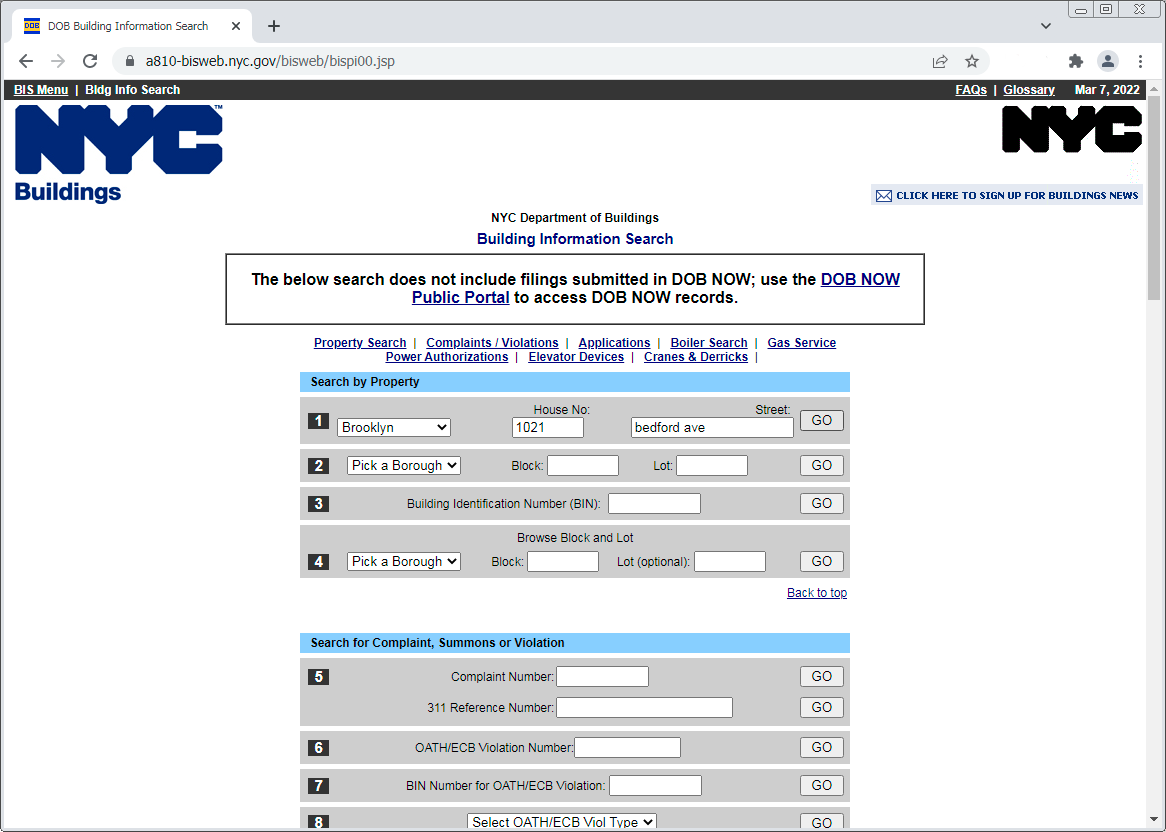
We’ll use property search mode 1, at the top. Select Brooklyn for the borough, enter the housenumber and street, and click Go, and with any luck a “Property Profile Overview” page will appear:
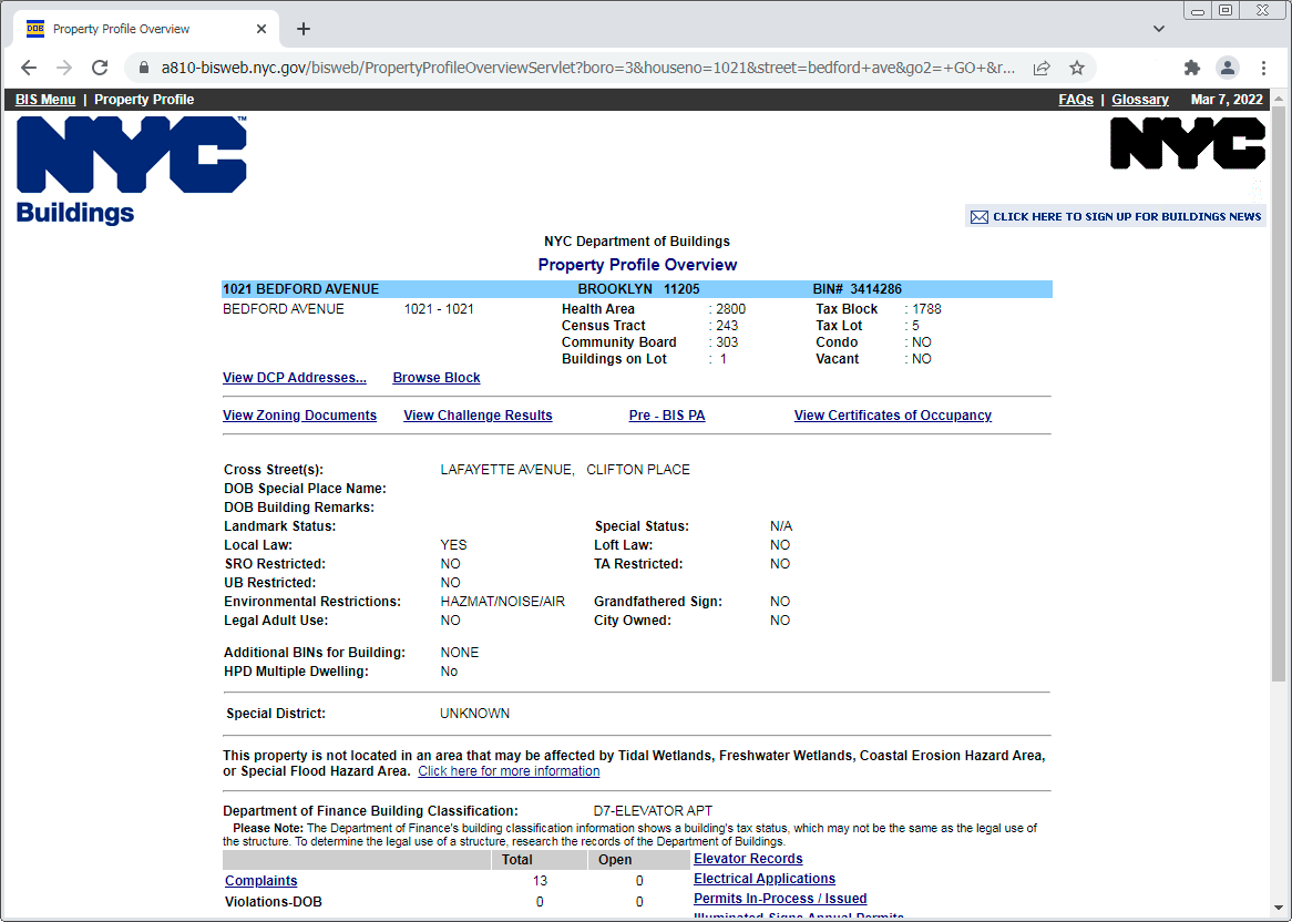
There’s a fair amount of info on this page, but the gold nugget here is the BIN, which is on the right side of the blue bar at the top: 3414286. All we need now is the building height. Unfortunately it’s not listed here; we need to go deeper.
Let’s talk about the elephant in the room at this point… this Building Information Search tool is somewhat clunky. Personally I’d love an API that could digest an NYC address and return info like BIN and height in a single call. (If anyone has one, please spill those beans!) The fact that this takes multiple clicks is all the more frustrating because the BIS server is prone to timeouts and overzealous rate limiting. All this to say that, from this point forward, when clicking further into the Building Information Search, I recommend always opening links in a new tab – because it makes it easier to retry (sometimes hours later) when things fail.
Now let’s keep digging for the building height. Open the “View Zoning Documents” link (in a new tab!) to reveal:
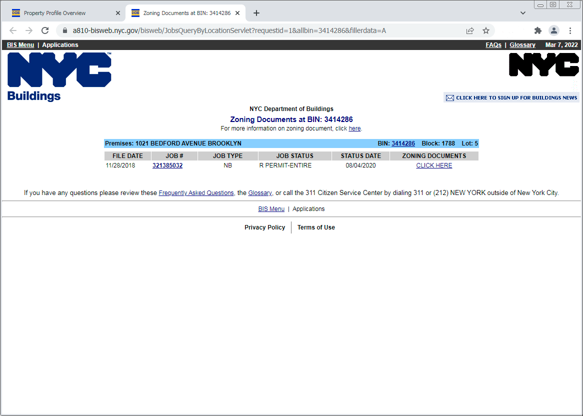
What we find is not quite zoning documents, but instead a list of DOB application job numbers. Usually, as here, it’s not a long list, just a single job. The information we want – the building height – can be found by by opening the job number link, in this case 321385032 (in a new tab, of course):
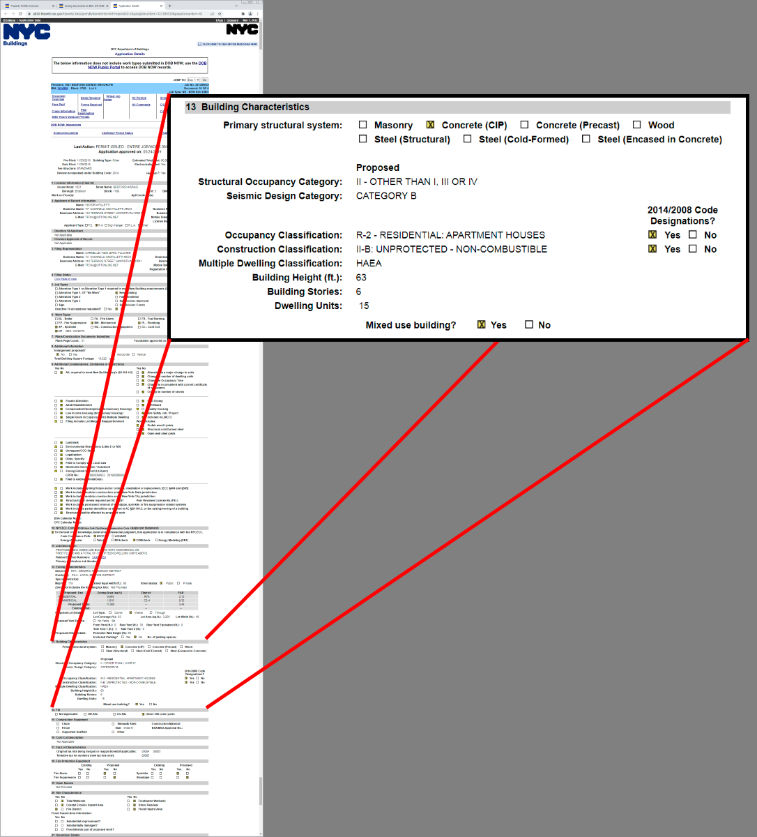
Here are the Application Details for job 321385032, a dense page with a lot of useful info. I’ve zoomed in on section 13 which finally reveals the building height, 63 feet. To be consistent with the rest of the NYC buildings, we convert to meters rounded to the nearest tenth – so height=19.2 and our mission is complete.
The resulting building is way 738676322.
Note that I’ve added building:levels=6 – this is from my own surveyed observations, not from the Building Information Search. (In this case the building stories count on the Application Details page agrees with the survey, but I’ve seen instances where that count did not include the penthouse or ground floor level for some reason.)
I’ve also tagged building=apartments rather than building=yes. I believe building=yes is the correct tag for any building that can’t be unambiguously categorized, but this one is clearly an apartment building. And again, this is my own conclusion from survey, not based on data pulled from the Dept of Buildings.
I’ll describe some other uses for the BIS tool in a later post. Happy Open Data everyone!
Discussion
Comment from Stereo on 12 March 2022 at 22:20
Can the whole database be downloaded? It’d be fun to build the better search tool you mention, and also a tool that detects demolished/new buildings from that database.
Comment from jmapb on 15 March 2022 at 19:32
@Stereo Not sure about downloading the database, but there are many fascinating datasets to explore at https://data.cityofnewyork.us and https://www1.nyc.gov/site/planning/data-maps/open-data.page that might give us some shortcuts.
It looks like the NYC GeoSearch API would get us halfway there. I could have quickly found this building’s BIN with the query https://geosearch.planninglabs.nyc/v1/search?text=1021 bedford ave brooklyn.
In theory, I should then be able to find the height and geometry by using the BIN to query the Building Footprints dataset via its API: https://data.cityofnewyork.us/resource/7w4b-tj9d.json?bin=3414286. Disappointingly, this data is out of date. It describes a small 10-foot-tall building that I assume used to be on this lot.
If there’s an accessible up-to-date public dataset with correct building heights, I haven’t found it yet.
Looking at the DOB Job Application Filings dataset, it might be possible to query by BIN and determine the application job number, and use that to construct the query url so we could go directly to the “Application Details” page in the third screenshot. Querying BIS only once instead of three times would be a definite improvement in workflow. And monitoring new activity in the Job Application Filings dataset might also be a a way to detect new or demolished buildings. But I don’t know how current or accurate this dataset is.