Skyranger 35 + OpenStreetMap Carto
Posted by darkonus on 8 March 2025 in English. Last updated on 9 March 2025.As an OpenStreetMap contributor, I always pay attention to how maps are used in media and various software applications. It is fascinating to see OSM data appear in unexpected places. Previously, I noticed that OpenStreetMap was used in the movie Mission: Impossible.
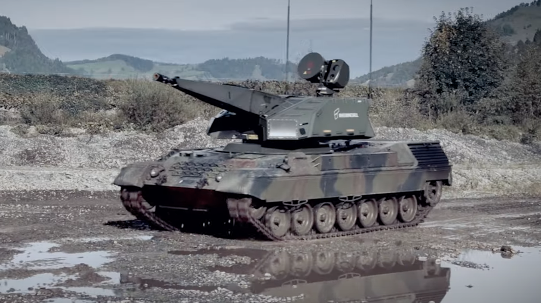
Recently, I came across an example of OSM’s osmCarto style being used in the software of the Skyranger 35, a highly mobile air defense system.
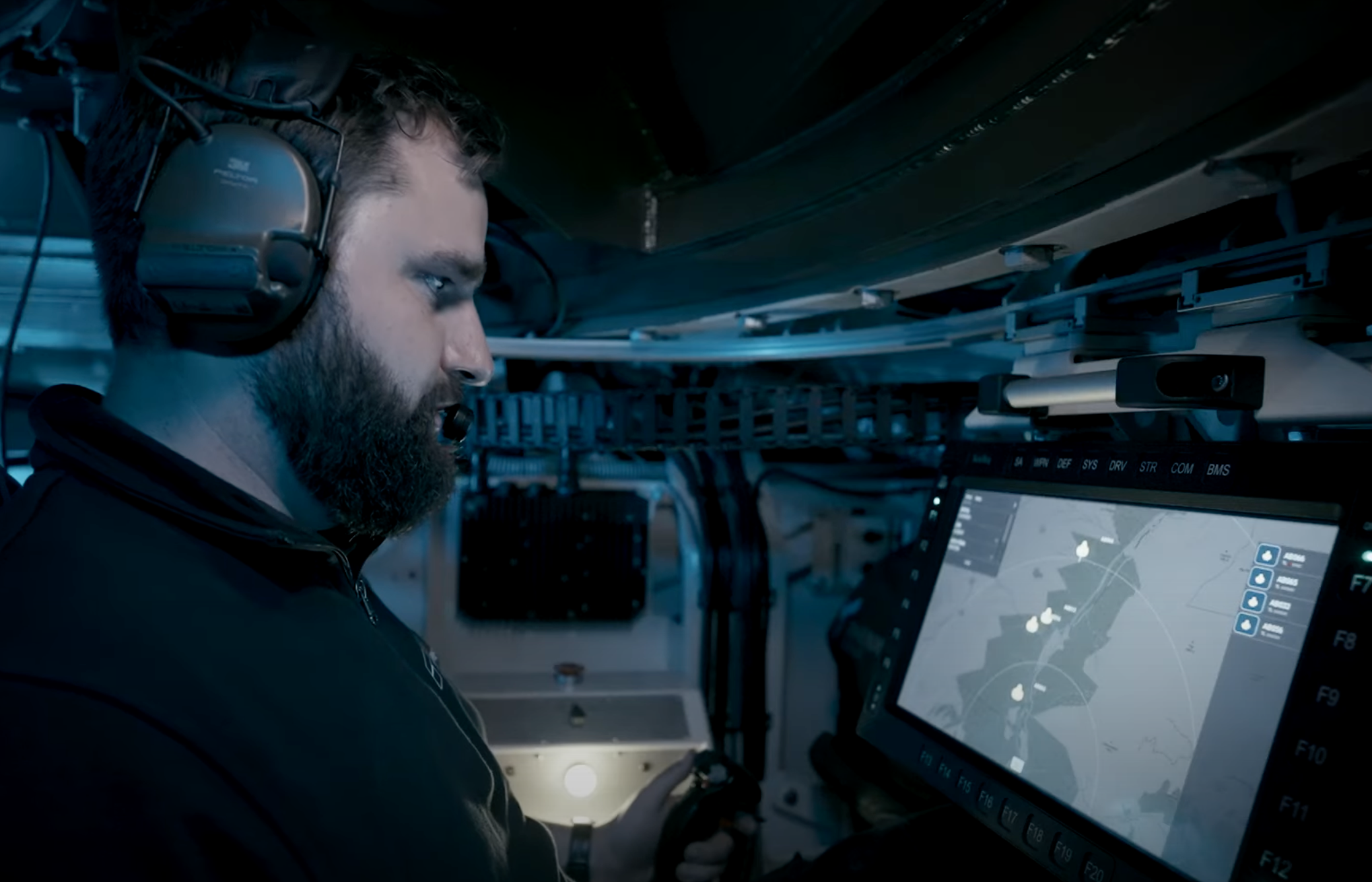
The Skyranger 35 is designed for modern battlefield scenarios, equipped with advanced tracking and search sensors. Its primary function is to detect and engage small, unmanned aerial threats, including drones. This system combines high firepower with rapid targeting capabilities to counter agile and swarming threats.
The fact that OpenStreetMap data is used in such military applications raises important questions. On the one hand, it demonstrates the reliability and quality of OSM data. Governments, private companies, and now even defense contractors recognize the value of our collaborative mapping efforts. This is proof that OSM is not just a hobbyist project but a significant geospatial resource used worldwide.
On the other hand, the involvement of OSM data in military systems may be concerning for some within the mapping community. OpenStreetMap was built with the idea of free and open geographic data for everyone, but its usage in warfare-related applications highlights the reality that once data is public, it can be utilized by anyone—including military.
Discussion
Comment from rphyrin on 10 March 2025 at 05:03
Video link with timestamp : https://www.youtube.com/watch?v=orbzTpqlBok&t=35s
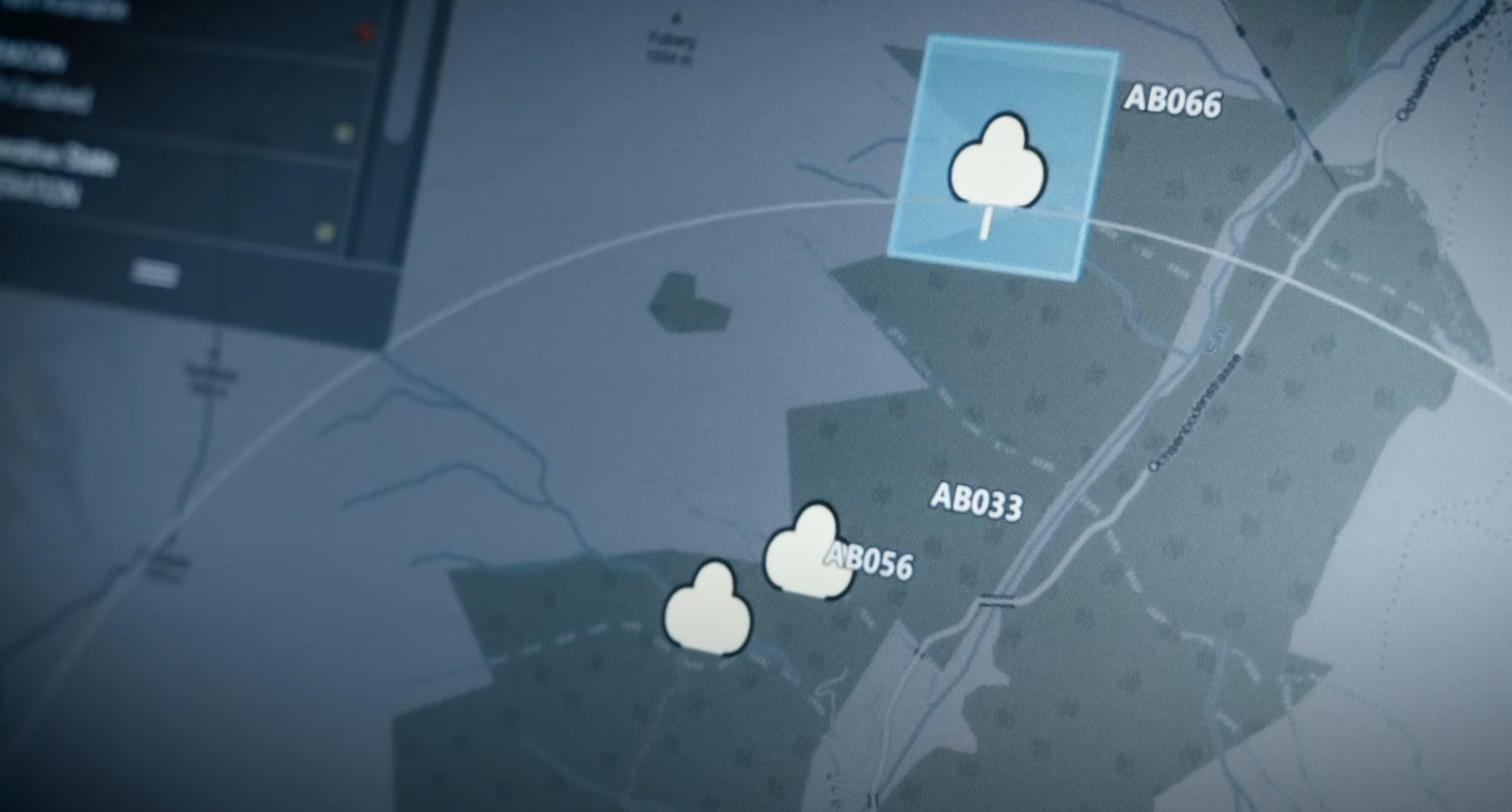
I wonder if anyone can locate the actual location shown on that map using an advanced Overpass query. (I see bridges, rivers, roads, and peaks in the image. Can we create an Overpass query to check for all locations that contain these features nearby?)
Comment from darkonus on 10 March 2025 at 10:29
rphyrin, I think it’s possible, but unfortunately, my OverpassQL skills aren’t strong enough for this. :(
Comment from Marcos Dione on 12 March 2025 at 08:54
Och**enbodenstrasse is the road and F(ul?)berg the mountain.
Comment from rphyrin on 12 March 2025 at 10:07
Found it…
Fulberg & Ochsenbodenstrasse (Unteriberg, Schwyz, Switzerland)
osm.org/way/41145127#map=15/47.03422/8.86283
Comment from Marcos Dione on 12 March 2025 at 11:24
Ochsenbodenstrasse and yes, Fulberg. Found it:
osm.org/#map=16/47.03743/8.86135
The image has North down, so this is probably not osm-carto but a very similar vectorial rendering.
Comment from Jean-Marc Liotier on 16 March 2025 at 14:43
That debate already occurred ages ago and multiple times about many free software projects. Free software is… Free - for all human endeavours, including those some denounce.
Military use of Openstreetmap is nothing new either: with another mapper, I presented Openstreetmap and Qgis to staff officers of the Malian army in Bamako in 2016.
Comment from Jean-Marc Liotier on 16 March 2025 at 14:49
That said, nice find !
Comment from darkonus on 16 March 2025 at 15:49
Jean-Marc Liotier, thank you! Obviously, where there are military, there will be maps, and I guess it will always be that way :)
Comment from Mateusz Konieczny on 16 March 2025 at 16:16
Well, “maybe this may data will be used by invading Russian army” is for me one of very few negative effects of mapping high quality data in OpenStreetMap.
Though I would count “it will make shooting down Russian aircraft marginally more efficient” as a very good thing (on assumption that Russian army is one more time invading someone).
The first cannot be really stopped, in the same way as they cannot be stopped from day using Linux and other open source software. So the second is (for me at least) welcome to balance the first one.
Comment from Mateusz Konieczny on 21 March 2025 at 07:53
note that in this specific case it was used in ad
maybe because it is a proof of concept and actual software is not developed yet or maybe because actual design of interface is a secret, so they replace it with substitute
(though OpenStreetMap is also used in actual military applications, in actual war zones - just it is not such case)
Comment from darkonus on 21 March 2025 at 08:06
I agree with you. We can only speculate.