
Ashgabat's Changing Boundaries
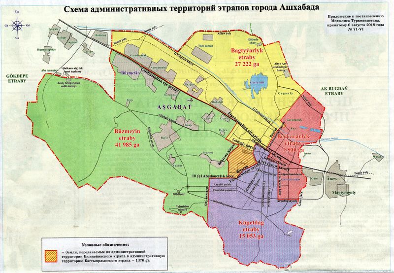
Posted by apm-wa on 7 August 2018 in English. Last updated on 25 May 2019.Today’s newspaper carried news and a map of an internal boundary shift of two of Ashgabat’s boroughs (“etraplar”). About 1,376 hectares of land has been shifted from Buzmeyin etrap to Bagtyyarlyk etrap. More map editing ahead.
The newspaper also said the mayor proposed annexing more territory into the city, which means it is highly likely the outer boundary of Ashgabat will change again in the foreseeable future. Even more map editing ahead!
Discussion
Comment from pattisfood on 4 October 2019 at 06:22
Oh dear! You just made my life easy. I tried to find it on internet for Catering GTA but couldn’t find but thanks to you that you found and shared the map for geography students.