Integration of OSM based participatory mapping into LoGIC Project of UNDP Bangladesh
Posted by aHaSaN on 26 August 2018 in English. Last updated on 2 September 2018.A Brief on LoGIC
LoGIC (Local Government Initiative for Climate Change) is a multi-donor collaborative initiative of GoB, UNDP, UNCDF, EU and SIDA, aims to enhance the capacity of vulnerable communities, Local Government Institutions (LGI) and civil society organisations for planning and financing climate change adaptation solutions in selected climate vulnerable areas. The Local Government Division (LGD) is the implementing lead of the project in partnership with UNDP and UNCDF (for technical and management support) in 7 (seven) districts (Kurigram, Sunamganj, Khulna, Bagerhat, Barguna, Patuakhali, and Bhola) of Bangladesh designed to support roughly 200,000 most vulnerable households in 72 (seventy-two) unions. The benefits are expected to come out of climate change adaptation actions at various levels, scaled up through local government institutions incorporating high quality accountability and participation of the most vulnerable people.
Vulnerable people living in disaster-prone areas of Bangladesh have developed strategies and practices to cope with these natural events; however, they have inadequate empowerment to influence over development planning in their communities. In order to address the vulnerabilities of Bangladesh to climate change, the project envisages the following priority areas of action:
- Building capacities of individuals and households with information, knowledge, skills and technology to adapt to climate change as well as leadership skills to influence the local planning process.
- Build capacity of the local NGOs, CBOs, local institutions and LGIs in climate change integrated planning, budgeting and implementation with high degree of accountability and inclusive practice.
- Provide funds to LGIs and vulnerable households to plan and implement climate resilient activities and interventions at community and household level.
- Generate knowledge and mobilise opinion for shaping a Local Climate Fiscal Framework and enhance readiness of both LGIs and the Local Government Division to utilise national and international climate finance in an accountable way.
These priorities will be addressed through three sets of core actions: capacity building, providing access to climate change funds and policy advocacy. During the planned support period, the proposed project is expected to produce following three key results:
-
Firstly, the capacity of local governments, households and other local stakeholders will be increased enabling them to enhance existing and future local development plans by integrating climate change adaptation solutions.
-
Secondly, a financing mechanism for local governments to implement climate change adaptation solutions will be established; the Performance Based Climate Resilient Grants will be aligned with the current system of fiscal transfers to Local Government Institutions using and improving it. It also covers the design and implementation of a Community Resilience Fund that will provide resources for community and household level climate change adaptation solutions for vulnerable households.
-
Thirdly, it is of upmost importance that the pilot experience gained at the community and local level is informing wider policy and practice and ultimately aim at improving and reforming the planning and financing system of the GoB for CCA at local and community level, ensuring sustainability beyond the project.
OpenStreetMap Integration
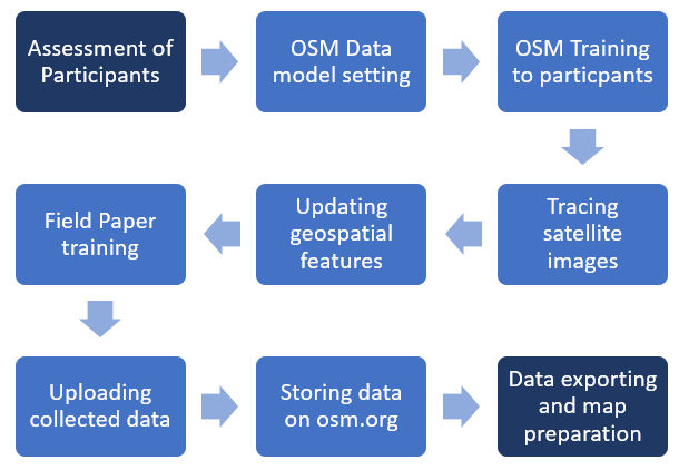
Though LoGIC project is working to establish climate resilience community functions and infrastructure as well as climate resilient households and individuals, it intends to collect geospatial data of Union and produce geospatial map by participatory mapping of its intervention area. As a result, LoGIC project hired Mr. Ahasanul Hoque as a consultant to support in participatory GIS mapping/OpenStreetMapping, updating OSM based geospatial risk data as well as to incapacitate local facilitators on the participatory mapping process. During the Community Risk Assessment geospatial data of Union will be collected and using these data geospatial map will be created. The map will be assumed as the baseline map of the particular Union Parishad. The follow of work will be:
-
OpenStreetMap training to strengthen selected project staff as well as locally recruited volunteers/enumerators to support the participatory GIS mapping process
-
Providing guideline to the local enumerators to embed the participatory GIS to the CRA Social Mapping process
-
Creating OpenStreetMap database for target unions and store database on open source map data portal
-
Uploading the collected field GIS data and updating on OSM portal
-
Accommodating geospatial data into the ATM System of the Project
Methodology
Participatory Mapping and data Collection at Field
The local facilitators selected by LoGIC project in each of 7 target distracts have got the field data collection training. They are collecting the amenities’ location using GPS Logger and field papers along with all CRA information.

Data Team
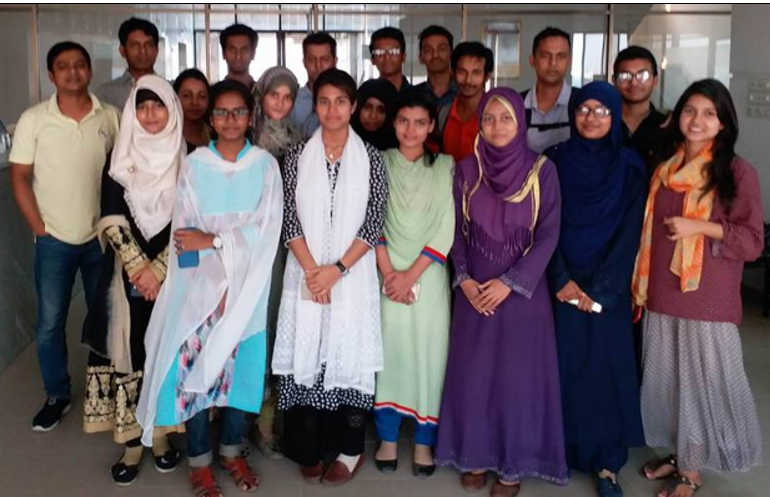
.To create the spatial database for the target area by tracing existing visible features in satellite images on OpenStreetMap editing software (iD Editor and JOSM) a training was given to the LoGIC OSM data team. A mapathon was arranged to trace the target unions of Seven Districts. This data team is responsible for field data cleaning, uploading according to the concerned tags.
OSM Tag used and Data Uploading
- addr:district =
- addr:union =
- addr:union =
- amenity =
- damage =
- description =
- name =
- damage_name =
- source =
- source:date =
- source:name =

Conclusion
The OSM data team of LoGIC project is translating, cleaning all the data coming from the unions of seven dsitricts, uploading the data on OpenStreetMap for public sharing, consultant also preparing the shape files for all concerned unions to the CRA report team for updating their union elements’ maps. The team is working according to the coordinated approach set by the consultant and getting feedback for any issue rises during translation, uploading and editing the features on OSM portal.
Since OpenStreetMap allows users to see locations, events, features, and changes with unprecedented clarity, showing current information with past description, history etc what offer a wide variety of analytical tools to meet the needs of many people, helping them make better monitoring and decisions about the target area/s. Therefore, these LoGIC CRA OSM database could be a vital resources for any other climate change, resilience or disaster projects in the target unions of Bangladesh. This database will also help to complement policy advocacy, resilience for any natural or climate impact, ensure the transparency in resource allocation and better monitoring.


Discussion
Comment from SomeoneElse on 21 October 2018 at 16:48
Hello,
There have been a number of issues with users trying to upload data as part of this project, mostly now to do with mispelt and partial tags such as “damage_dat”. See node/5983656035 for a recent example. Attempts to get in touch with mappers has mostly failed, so I’m adding this comment here.
As I’ve suggested previously to mappers uploading this data you can see what keys are used for certain things by searching https://taginfo.openstreetmap.org/ and osm.wiki/Main_Page . You can also ask questions at https://help.openstreetmap.org/ .
Please do take the time to look for “unusual” keys added by this project and correct them to whatever they should have been in the first place.
Best Regards,
Andy Townsend, from OSM’s Data Working Group
Comment from aHaSaN on 5 December 2018 at 10:22
Dear Andy, Hope you are doing fine. I greatly appreciate your observation and efforts. A big team working behind these data addition and some of them doing mistakes what is difficult to track. Your notifications helping us a lot. Your suggestions are noted and working accordingly. We gonna finish the project this month and will do a through checkup. Still I will appreciate your suggestion and comments.
Best Regards Ahasan ul Hoque
Comment from SomeoneElse on 9 December 2018 at 13:02
Thanks for that. There’s still quite a lot to do - see e.g. changeset/64962722 . It’s actually quite straightforward to keep track of “odd keys” added; just use taginfo and search for the misspelt keys that you are looking for. Best Regards, Andy
Comment from SomeoneElse on 9 December 2018 at 16:33
… and duff data is still being added. See e.g. way/653752764 , added just now.
It would be far better if the people in charge of this data being added to OSM could educate the people adding it rather than a group such as the DWG trying to communicate with these mappers after the event.
Comment from SomeoneElse on 11 December 2018 at 12:42
Hello,
Communication is still not occurring with your team. Regrettably we’ve had to block another user again today in order to try and engage with them - osm.org/user_blocks/2385 .
As the organiser of this work it is your responsibility to ensure that the team actually adding the data know what they are doing and add data that conforms to OSM norms, so that anyone who uses OSM data can make use of it.
Best Regards,
Andy Townsend, on behalf of OSM’s Data Working Group.