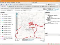
It is odd how rendering data makes people want to add it more. I've found this with the OSM Inspector boundaries layer.
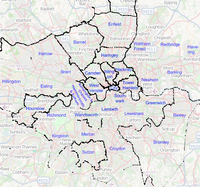
Take London for example, in mid-November, there were several boundary ways scattered across the capital, most with slightly differing tagging schemes. At this time, only my home borough, Sutton had an associating relation.
After a day's work, and a few minor fixes later, we arrived at a state where we had 10 boroughs fully complete and another 7 partially completed.
(#51908 is a 'container relation' for London boroughs, I'm guessing it may eventually morph into some form of is_in, if deemed useful)
More recently, I've made up the Hertfordshire boundary into a relation (the data was already mostly complete), and fixing the (very almost complete) attempt at getting Surrey done by chriscf.
He's also done up Wiltshire, Herefordshire, Shropshire, Rutland, and probably more.
And finally, this week I've been working on South Northamptonshire with Ben, tying together his excellent parish boundary tracings into relations, the OSMI view is now quite impressive, with around 30 of the 79 now complete!


Discussion