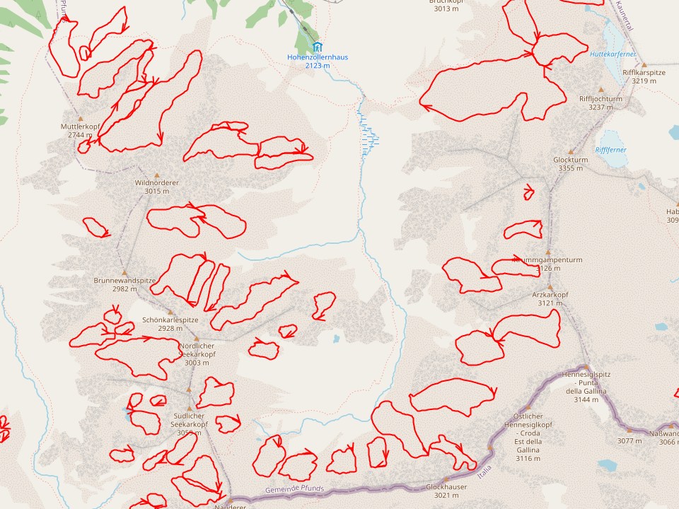
Rock glaciers – a mixture of ice and gravel that very slowly flows down a slope – are not mapped much. So it seems. Let us have a look. They are said to cover 167.2 out of 12.640 km² in the province where I live, so no small feat.
There is an inventory of 5769 polygons for them in mountainous Austria available for free online. Here to the description - https://doi.org/10.17738/ajes.2020.0001 - Here to the data - https://doi.org/10.1594/PANGAEA.921629
As usual, data is BIG. Let us trim it down a bit first: We only want rock glaciers in the narrow sense, of those only the so-called intact ones, and that not so overnoded.
ogr2ogr -simplify 0.01 -s_srs RGs_all_LambertProj.prj -t_srs EPSG:4326 Blockgletscher.geojson RGs_all_LambertProj.shp -where "https://wiki.openstreetmap.org/wiki/Tag:LfState='INT' and https://wiki.openstreetmap.org/wiki/Tag:LfType='rg'"
Resulting Blockgletscher.geojson loads quickly into JOSM. We can now pan and zoom the data smoothly over OSM-Carto background. This goes to show that rock glaciers are in fact mapped! Yet not as one might infer from the name, as natural=glacier, but natural=scree instead, at least, where there is something mapped at all and not just blank space.
 osm.wiki/File:Blockgletscher_Hangschutt.jpg
When browsing the slippy map with the overlay, to my surprise, I learned that I already crossed rock glaciers, not having realised that I was doing so. Wouldn’t it be nice to have this shown on the map? The open-access data is licensed CC-BY, so this prohibits a straight import. It would be a pain too, to carve out the parts from the scree. And then, how to make them distinct? I for one rather not have natural=glacier the base for them, which might achieve that - yet might cause one more surprise for unsuspecting users. Natural=scree at least conveys what the - up to several meters thick - on the ground cover of that geological feature is. And by the way, it’s even one essential constituent in the feature itself.
So, I am fine with this mapping. Now that I learned about the subject I think I can even notice it out there just with open eyes.

Discussion