
An important announcement from last nights meet-up. We're having an impromptu little London hack day TOMORROW (Saturday 13th). Apologies for the short notice. If you do want to come along and hack on OpenStreetMap or related tools, or just chat with some people who are doing so, you'd be very welcome to join us. Wifi and pizza provided! I'm going to aim to be there from 10a.m.
That was one of many super-important discussions we had at last Wednesday's London pub meetup.
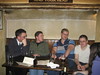
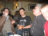

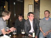


Ye Olde Cheshire Cheese pub on Fleet Street is one of those great old ones, with sneaky cubby holes everywhere. It's one of 49 pubs in London which are currently deemed notable enough to have a wikipedia article. That's how awesome it is! [citation needed]. Knowing that it is quite possible to get lost in this place, I arranged to meet down to the lowest floor, the vaulted cellars, thought to belong to a 13th century Carmelite Monastery which once occupied the site. After experimenting with standing the group of ~10 of us in various positions blocking one way or another we eventually managed to grab some tables where we sat and ate pies. Not as novel as the little scottish pies we had last time, but still pretty good, and served with hi-tech buzzy things.
We talked about the OWL, the OpenStreetMap Watch List tool Matt has been working on. I think he's still refining it, but it has a cool owl graphic :-) It gives a read-out of recent activity in an particular rectangular area. Here's what it shows for activity around the Fleet St/Chancery Lane area. There's some cleverness behind the scenes to do with data "tiles" bucketing the changes coming in from minutely diffs, so that things like the dupe nodes map (about) can be built on top of OWL.
We talked about the Project of the Week thing which Steve set up. We can draw in buildings, and Steve will go map them (put addresses on them). We thought it would be amusing to figure out the worst area of Denver and send him to map there.
We talked some more about the new FCGI map call. Despite extensive testing, somebody somewhere was doing something weird with relations which created a bizarre edge case for which the new map call was returning something different from the old map call. It seems OpenStreetMap is all about the creative and unexpected use of relations. We ranted about overuse of relations.
In fact we ranted a lot on all the our favourite ranting topics: overuse of bots, overenthusiastic importing. We breifly mentioned the pointlessness of is_in tags. That's something we talked about at CloudMade a few times, but I presume it's been debated on the mailing list somewhere too (link?) No reflection of that opinion on the wiki until a few days ago. But ideally we'd have some betters tools and tutorials on how to do spatial look-ups in OSM data properly. We breifly talked about landuse=farm tags, one of my favourite ranting topics. I've recently been wiki commenting on this too. There's a boring discussion about which word is best in the tag (seemingly fuelled by a different german interpretation of the word "farm"), which I'd like to put to bed so that we can move onto more important questions like how the hell are we supposed to draw polygons around all farm land?.
It might have been in relation to relations, that Andy was describing an open OpenCycleMap server problem caused by the expanding dataset. He said there were certain problems he could sort out but he would feel much more inclined to work on them if he was getting more money via the donate button (scroll down) So it's not just to help pay for hosting etc, it's persuading him that the work is worthwhile.
We talked about the haiti mapping, and how the building damage assessment thing was probably a bit pointless. Actually I don't think it was pointless. A zoomed out view has the potential to be useful though we're not really aware of people who have found it useful (unlike the normal street map, which has been used extensively by aid agencies) We managed to get it out there quite quickly along with the basemap, but many different contributors making the highly subjective judgement of whether a building looks damaged or not in a fuzzy aerial photo, seems like a recipe for data consistency problems. Looking at the map now, it seems the bar is pretty low. We've just sprinkled the map all over with damaged buildings and camp symbols. We raised an interesting about question handling deletions. Suppose somebody on the ground was able to report back the information that actually this building is not damaged. Maybe they would delete the node. This is a first class edit with precious information which cannot be gathered from aerial imagery, but at the moment it would be lost in the noise. The node would surely be put back in pretty quickly by an enthusiastic remote mapper. Some way of displaying significant deletions might help (?). In general we'll need to shift our approach to Haiti mapping as we start to get more information from people who are actually out there.
So the next pub meet-up will be in a couple of weeks time. Suggestions? But before that, as I mentioned above. There will be a few of us doing some hacking on OpenStreetMap stuff at the Crisis Camp London TOMORROW (sat). Come join us!
Discussion