
Hack Weekend at the ODI
Posted by Harry Wood on 5 February 2013 in English. Last updated on 13 February 2013.We just had the London OpenStreetMap Hack weekend, and I think I’m right in saying this was the biggest OpenStreetMap hack weekend ever!
Big thanks to the Open Data Institute, who provided the venue, and also sponsored the event. The ODI are funded by the technology strategy board to promote and support open data initiatives, and there are surely non more deserving than our London-born global not-for-profit project. However the ODI are particularly keen on supporting innovation which drives UK economic growth. I’ll be writing on the ODI blog soon, about ways in which OpenStreetMap does this (UPDATE: blog post on the ODI site now)
The ODI is also… my office. I work every day at a desk there doing placr.co.uk open transport data stuff. It was quite exciting holding an OpenStreetMap hack weekend at my place of work, but it did mean I had to get up early to be the first one there.
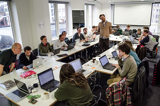
On the Saturday it felt like things got off to a slow/awkward start. I think this format could be improved by somehow unleashing people (those who need inspiration) on some simple hack ideas, but then maintaining lists of simple hack ideas presents a problem for developer engagement in general, which we didn’t really solve yet.
I think it’s true of any hack weekend, that you can get more out of it if you sneakily come along with some already-underway hack idea. Personally I had quite a few ideas, though non already underway as such. I started by working with Dan Stowell on merging in a pull request to XAPI URL Builder to add a ‘Live Query’ tab, which is pretty nice.
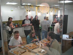
I then tried to order pizza online, and found myself having to hack the HTML form of the pizza website in order to let me submit without filling it in again. Pizza hack!

After pizzas we had “workshops and presentations”. This worked pretty well because the event was well enough attended to make it worthwhile. Having said that, I was hoping to give the event broader reach, with more “OSM outsider” developers coming along to learn more. I gave my opentech presentation on the basics of the OpenStreetMap developer ecosystem with such an audience in mind, but to an audience who didn’t really learn much from it. But hopefully at least if gave some ideas for how to explain OpenStreetMap.
Next Andy Allan gave a workshop on using TileMill. His enthusiasm for cartography rubbed off on a few people, and quite a lot of us installed TileMill and had a play over the course of the weekend. It’s very easy to get started with shapefiles (e.g. osm shapefile downloads). I think Dan Stowell got as far as getting the openstreetmap-carto style running (this requires PostGIS and osm2pgsql)
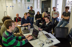
Lots of other hacking went on besides. There’s a list of stuff which got hacked on the wiki. With so many people attending, we found it was quite natural to gather people round for a presentations and show & tell session on the Sunday afternoon. As I’ve said before, the real benefit of these events is in sharing ideas, but in the past we haven’t had sufficient people to create the audience-speaker dynamic. I think it’s really great that we managed to do it this time. Thanks to the cyclestreets guys for kicking that off with an update on their work.
Having said that, the most exciting hacking was by TomH who was keeping himself to himself, while he progressed the ‘Notes’ branch. Having ‘report a problem’ on the OpenStreetMap homepage will be a signficant change when it happens.
The guys from Southampton uni, Chris Baines and Harry Cutts, were beavering away on an interesting hack to help Peace Corps, a large aid agency, to map out health facilities and their catchment areas. They presented their progress at the end. Client-side javascript to process boundary relations fetched from overpass API. We awarded them hi-vis jackets for their efforts!
We also awarded a bottle of Yorkshire beer to Ben Abelshausen, who was over from Belgium for the weekend. He gave a very interesting and impressive presentation on his system ‘OsmSharp’, a routing system for solving travelling salesman-like problems which he has been working for his masters thesis, but also as a project for a company who are now actively using the software to plan delivery routes. Ben is now hoping to do OpenStreetMap consulting work around these kinds of ideas.
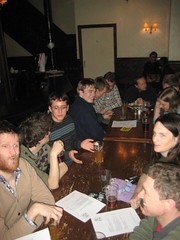
Oh and we all went to the pub …three times
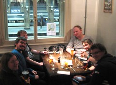

The weekend kicked off on Friday with pub drinks. This was the convening spot for some of our international visitors, and we had a good chat including spending a long time puzzling over how to design a ReCAPTCHA-like system which gets people to solve a useful task for OpenStreetMap, while also (and this is the difficult bit) functioning as a bullet-proof captcha. I had a nice idea involving categorising aerial imagery tiles, but it didn’t present enough answer permutations to be uncrackable through brute force automated requests. Other ideas were too difficult for human users to succeed at quickly. Tricky.
On the Saturday we had a bigger pub session. SteveC generously gave us £50 to get some beers in. It was such a big gathering that this stretched to just less than the first round of beers! The fox is nice, but a bit pricey. That certainly goes for the food too. Clearly I haven’t done my duty and sussed out good cheap pubs around my office, because on the Sunday we resorted to the whetherspoons in Liverpool Street station (which I quite like)
After three nights of pubs and two days of hacking I’ve been feeling pretty exhausted, but it’s such good fun, and triggers so many ideas, I hope we can repeat it again some time soon. Thanks again to the Open Data Institute for hosting and sponsoring.
No rest though. Thursday night is #geomob night at the BCS on the Strand, where there’ll be some OpenStreetMap folks attending and some geotalks featuring OpenStreetMap (Dan Karran’s bombsight.org for sure. I’d guess also Simon Willison’s talk). For more OpenStreetMap events Follow @OSMLondon on twitter
Discussion
Comment from Firefishy on 7 February 2013 at 09:47
‘twas a great weekend.
Comment from Harry Wood on 7 February 2013 at 10:16
Sorry we didn’t manage to solve your challenge Mind you, we were trying (in the pub) to design a solution to the harder challenge of not only making a captcha which uses OpenStreetMap, but a ReCAPTCHA-like system which would gather helpful data for OpenStreetMap. Maybe we should do a more basic thing first.