So out of things I did not expect I’d ever do on OSM, here’s one of them.
I’ve been using OsmAnd to cache OSM data to have with me as a reference while hiking in Bosnia a couple of weeks ago. I noticed that one of the trails in the app goes through what on a paper map I had with me was marked as a suspected minefield - a remnant of the 90s war. I checked with the local mountain rescue service, and indeed they confirmed that there is a danger area there.
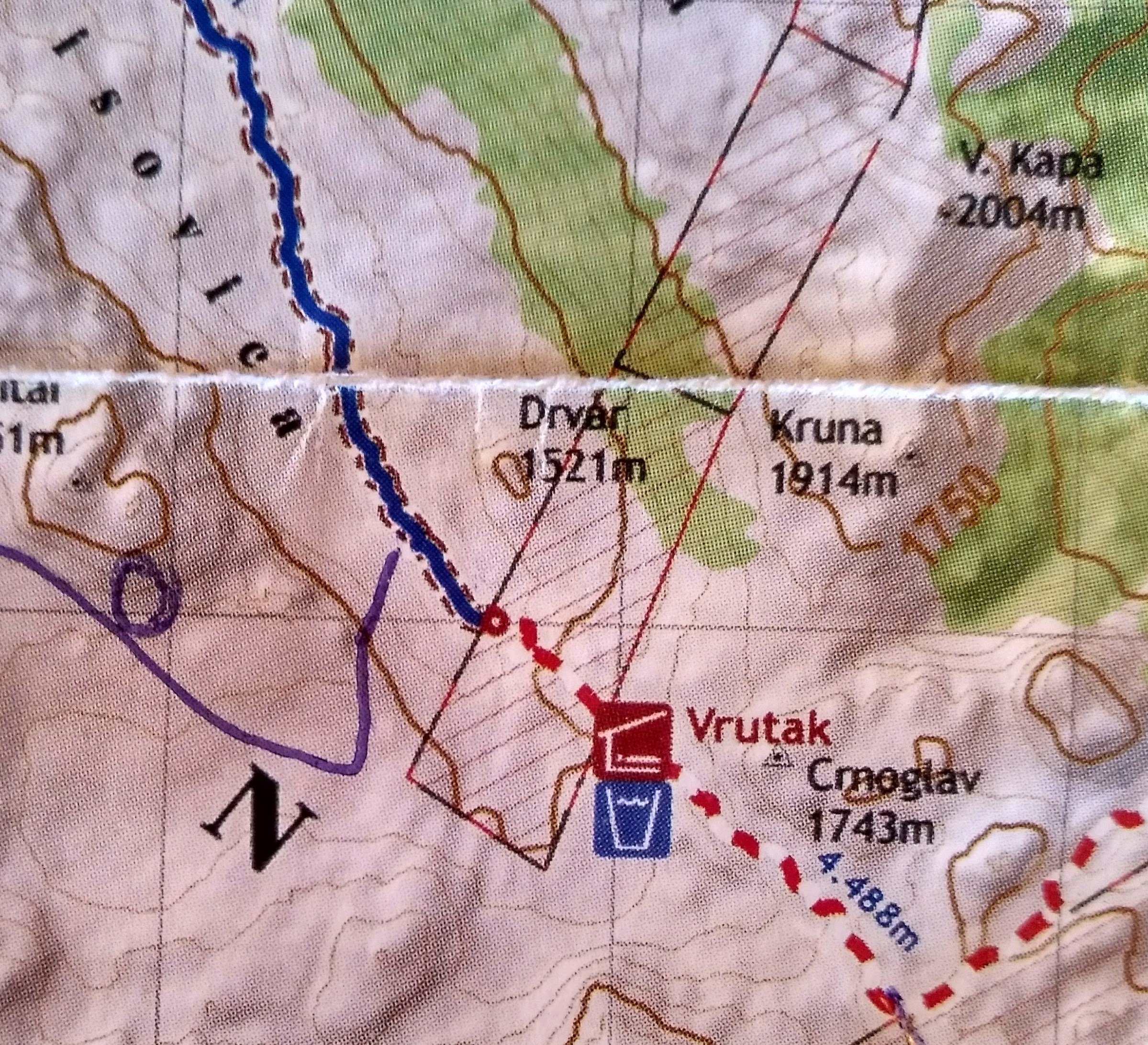
So while I do not have enough data to map out the actual extent of the suspected minefields in these mountains, and I do not want to digitize it from the paper map I have, what I can do is to correct the path that the previous hiker took - and thankfully lived long enough to map - and snap it to my own GPS trace. I followed the hiking trail markers, which I was told was the proper thing to do in the area.
I prefer to not have OSM explicitly or implicitly suggest dangerous behaviour!
https://www.openstreetmap.org/changeset/72868513#map=17/43.56621/17.89029
Discussion
Comment from Warin61 on 12 August 2019 at 23:20
Hi,
Thank you for correcting the path through the minefield!
Unfortunately there are those who don’t like OSM containing data about hazards for various reasons. Land mines in north western Africa for instance. Dangerous suburbs in South America. OSM does not map them. Personally I’d map them. Most of the people who object have not been to those areas. Most of the people who want them mapped have been to those areas. While the extent may not be objective I would simply extend the area to ensure safety. If someone then goes into that area they have a warning which is better than no warning at all.
Comment from michalfabik on 13 August 2019 at 14:40
@Warin61:
> Land mines in north western Africa for instance. Dangerous suburbs in South America.
The obvious difference here is that while the dangerousness of a city quarter if subjective, the fact that an area is marked as a minefield is quite objective. The mapper wouldn’t be speculating whether there are in fact any mines or how densely they are planted - if there’s a red skull-and-crossbones sign saying “DANGER - MINES”, I see no reason why it shouldn’t be mapped. My main problem with mapping minefields is that I usually only see one side of it and don’t go around the whole area to survey its extent and shape. Currently, I’m not aware of a way of saying “there’s a minefield to the left of this road”. How about having a side-aware way (like cliff or retaining wall) and treat is as an unclosed polygon? Sure, it would appear broken and it wouldn’t be very useful for any automated processing but if somebody needed the data and went looking for it, at least there would be something.