
Filled in a few roads in and between March, Christchurch and Upwell
Users' Diaries
Recent diary entries
I have been trying to take advantage of the good weather we've been having in the UK to log some footpaths. Unfortunately, the farmers around here don't seem to be too keen on re-instating the footpaths after the fields have been ploughed and I've had to alter my plans for at least 3 logging journeys.
Rather than trudge 300m in a direction only roughly indicated by a waymarker (and of course I don't rely on the OS map to give a bearing!!), I think I might wait until more knowledgeable locals show the way.
So now I loaded up the first traces to OSM.
To translate NMEA to GPX I had gpsbabel on the list
before, but I want to thank smssm1 and mallok for their
advice.
With gpsbabel -help I found the correct parameters at once
and conversion was no problem. Same with upload of the files to
OSM.
But then I tried to edit my data with JOSM. I should have been
warned. It was called an expert tool. Surely I'm none.
I will have to RTFM before using it.
For my next traces I will reduce the Interval between GPS points to the
minimal time my device allows and keep the antenna looking up in the sky
all time.
Now I have these questions:
a) Is there a direct way to read out data from Royaltek RGM-3800 via USB from Linux? I like to pass Windows whenever possible.
b) Is there a suggestion or convention how to form the filenames and descriptions for the traces and files on upload to OSM?
bye
black_bike

Just to clear up, in Scotland, a road may be maintained by central government but not be a highway=trunk road.

Let's nail this one once and for all. mjd - sorry, but Morwen is right.
Ignore the fact that one is a word beginning with "t" and ending with "k", and another begins with "p" and ends with "y". You can call them "elephant" and "K-12" if you like. Really doesn't matter.
OpenStreetMap is an international website. We have to make our tags relevant across national boundaries.
So in the UK, the green-signed A roads are tagged in OSM as "highway=trunk", and the black/white-signed A roads are tagged as "highway=primary". You cannot blindly assume that there is a particular equivalence to any single UK scheme which is your "accepted version of life", especially as that's probably received opinion rather than anything official. You see, there is actually no current UK scheme which uses "primary" and "trunk" in conjunction - just now-outdated (but still copyrighted!) OS maps. Seriously:
| England/Wales government (statutory) | England/Wales government (public-facing usage) | OpenStreetMap | French government
|
| special road | motorway | motorway | autoroute
|
| trunk | strategic | trunk | voie express
|
| class 1 road (primary route network) | primary A road | trunk |
(no such distinction)
|
| other class 1 road | non-primary A road | primary | route nationale (N)
|
| class 2 road | B road | secondary | route departmentale (D)
|
(It's different still in Scotland, where all green-signed primary roads are, since devolution, "statutory trunk". That's certainly not the case in England & Wales. Go figure.)
And the postscript which is actually more important than the rest of it: OSM is a social mapping project. Convention is defined by what other people do. The majority will of regular OSM map editors is that green-signed A roads are tagged "highway=trunk", black/white-signed is "highway=primary". It may seem confusing to you right now, but believe me, there are plenty more confusing things to discover about OSM. :)
Morwen is confusing, so I should forget all I read about maps and signs and use your authorized version, yes? Or since I am confused I could mark all as unclassified, this could be better as I would not wish to pollute the database with copyright material. Can you, Morwen, explain why your version is so different from the accepted version of life, as it seems to me?
Completed the streets of the village of Liedolsheim north of Karlsruhe. A lot of POIs are still missing. The L602 between Liedolsheim and Rußheim is complete, too. Next tasks are mapping Rußheim, adding POIs in Liedolsheim and mapping the small streets west and east of Linkenheim-Hochstetten, Liedolsheim and so on.
On Friday, 2007-11-02 I started with OSM. The first task was to
get an GPS-device. I decided for a simple GPS-Data-Logger without
display, routing and trackpoints. For the first steps the Royaltek
RGM-3800 should be enough. The price was 60.- Euro. I fetched some
batteries too and charged them.
Saturday, 2007-11-03 I did the first traces in the south of my hometown Ratingen, NRW, Germany. I did it by bike, set the interval of the GPS-points to 10 seconds, mounted the device in front of my and drove about three hours,
tracing the streets. I used the software which was delivered with the device and used (I don't know if its allowed to say it here?) >SAM-ELGOOG< to take
a first look on my results.
On Sunday I set the interval between points to 5 seconds and put the
data logger in my pocked while driving. Now I think the results
look a little bit more inaccurate then those from the day before.
But why? NEVER change TWO parameters at the same time during a test phase!
I set the interval to 10 seconds again and tried it with the data logger
in my backpack.
I traced about 6 hours in the south, centre and east of Ratingen.
After the muscle part I have to begin the brain part now.
I need to translate the Data from NEMEA format to GPX format and then
to learn how to upload the data to OSM and edit the tracks with JOSM
to get real street data.
bye
black_bike
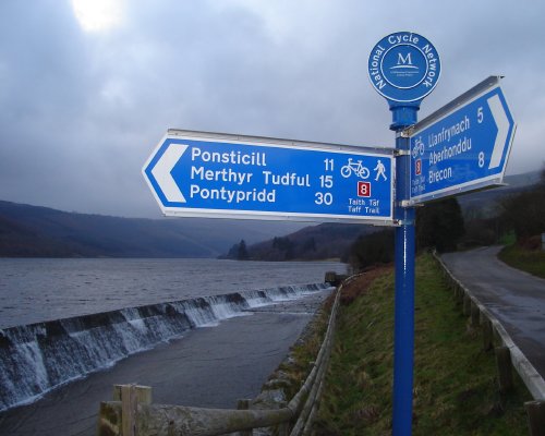
I've added about 40 miles or so to OSM's National Cycle Network coverage this weekend, despite - sadly - not having been out on a bike.
First up was NCN 41 south of Gloucester. We got quite a lot of this a couple of weeks back when we went (by car) for a day out in Gloucester, and decided to take an excursion further down the Severn Vale. NCN 41 seemed to follow us wherever we went, so I made a couple of notes. This track, combined with others' mapping, meant that we had the route most of the way to Saul.
South of Slimbridge it was already mapped, but there was a big lacuna between the two, so when we went to Slimbridge this weekend I requested a slight diversion... and lo and behold, that's NCN 41 mostly complete south of Gloucester. (The route in Gloucester itself is still largely unmapped, though.)
Lichtenberg, Hüchel,...
Habe heute zwei Geocaches ausgelegt. Bei der Gelegenheit habe ich zwei Autobahnparkplätze aufgenommen. Diese "Ausfahrten" fehlen ja quasi noch in der ganzen Republik.

more work on Evington yesterday&today. Evington Park and Shady Lane Arboretum now have some internal features and more accurate boundaries. i found a public footpath going from the Arboretum into the golf course, need to go back and do that at some point. all residential roads east of the parks and south of Whitehall Road/Spencefield Lane done now. also, some footpath detail in Scraptoft/Thurnby/Bushby.
Nachdem ich jetzt hier schon einen halben Landkreis kartografiert hab, schreib ich hier mal rein...
Von Wiehl nach Wied, vom Kölner Dom bis nach Altenkirchen... lege ich mein Mäuschen aufs Armaturenbrett...

Außer einigen Seitenstraßen ist Güssing nun fast komplett gemapped ;)
I made "Svalbard" and the Village "Longyearbyen" known to the system
Completed the missing south-west corner of South Cambridgeshire up to the Suffolk border with a trip around the villages of West Wickham, Horseheath, Shudy Camps, Castle Camps and Bartlow, including the hamlets of Camps End, Cardinal's Green, Mill Green, and Streetly End.
This is a really boring area. The villages have virtually no facilities, other than a school in Castle Camps, and the pubs are shut at lunch time. Not a single shop. Landscape is dull. Why would anyone choose to live in this featureless area? - there's obviously lots of expensive houses.
Anyway, though they're all small villages, they add significantly towards completion of South Cambridgeshire.
Hier wieder eine Unklarheit in Aschheim (das letzte Mal war es Dornach):
Die Alpenstarsse nicht nördlich der Tassilostrasse, sondern leicht südlich! Dies habe ich korrigiert. sigi55; falls Du dies liest, bitte melde dich bei mir. Ich habe auch bemerkt, dass die Wege im Nordöstlichen Quadranten von Aschheim nicht korrekt angelegt werden. Wir sollten uns hier dringend unterhalten.
Ansonsten habe ich einige Fahrradwege neu angelegt.
Have fixed up the mapping for the section of A473 east of Bridgend, S.Wales. The original version was completely missing a roundabout and (mysteriously) was dotted with a lot of unlabelled "points" of data.
The rest of the road to the north-east towards Llantrisant is currently missing though.
Posted by Stefan Weil (Ladenburg) on 2 November 2007 in German (Deutsch).
Last updated on 19 March 2010.
Ladenburg ist offenbar noch kaum erfasst.
Daher habe ich heute damit angefangen, das zu ändern -
zunächst mit einer der kleinsten "Straßen", der Dreckgasse...
Would like to start a project for mapping Curacao.
How do I start a new project in OpenStreetMap?