
Key Takeaways from Open Mapping Hub Support on the Jembrana Flood, Bali 2022
Posted by harrymahar on 19 December 2022 in English.Introduction
In the third week of October 2022, unfortunately, there was a big flooding event in Jembrana District Bali that caused several damages and casualties.
The Support
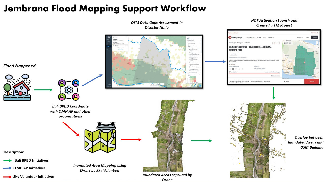
Right after the flood happened, Bali Disasater Management Agency (BPBD) contacted Open Mapping Hub Asia-Pacific (OMH AP) team to give some mapping support in some of the affected areas. Before OMH AP launched the tasking manager mapping to respond to the request, we conducted rapid data gap assessment through disaster ninja to see whether we still need remote mapping support or we can directly support them in the data utilization to create a flood impact map on that area. After we found that there were OSM data gaps on the affected areas, OMH AP created the Tasking Manager Project to support that event.
In the same time, Bali BPBD also coordinated with Sky Volunteer organization to map the inundated area using drones. The data later on was overlaid with OSM data on the area to create an impact map of flood to support Bali BPBD get better information about the flood impact.
The Result
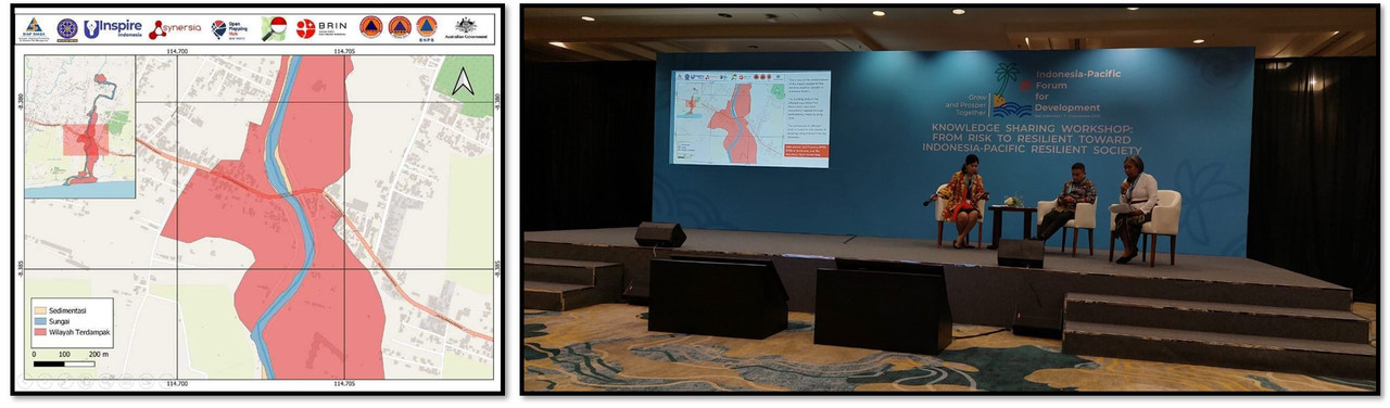
After conducting the disaster response mapping with OSM Mapper and validator for almost 1 month, The Tasking Manager Project was finally 100% mapped and validated which indicated relatively high quality data to be used for the further analysis. On the other hand, Sky Volunteer also finalized their data for the inundated area. These data later overlaid on the QGIS and InaSAFE to create an impact map of the flood on the area and presented in the Indonesia-Pacific Forum for Development event 2022 in December 2022.
The Key Takeaways
- Collaboration with other organizations is essential to complement OSM data to create high-quality analysis of disaster impact.
- Local ownership of the tasking manager for BPBD Bali is needed to ensure the sustainability of the future support.
- Partnership and collaboration with government and other stakeholders is important to make sure the use of the data from HOT activations
- Training of Trainer (ToT) and disaster activation curriculum training are needed to make sure all the HOT activations are more efficient in terms of sustainability and communication.
Discussion
Comment from russdeffner on 20 December 2022 at 13:40
Thank you for the report Harry, always helpful to see the results - and shortcomings - of our OpenStreetMap initiatives!
Comment from martien-176 on 19 January 2023 at 17:10
Thanks Harry, interesting read.