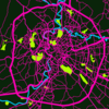
About landuses and landcover, in particular landuse=residential
Posted by dieterdreist on 28 April 2017 in English.Today I was asked by another (very active) mapper via email these questions:
We are currently discussing best practices for landuse mapping in Belgium. Some of the problems:
- do you use multipolygons to avoid overlapping landuse or do you split a residential landuse so you can have smaller landuses ? Or do you just overlay them ? A lot of landuse is already mapped in a rough way, so we typically have large areas of residential landuse.
- Do you include streets in residential landuse or do you exclude them so one can later add area:highway or landuse=highway ?
- I’m in favour of landcover to avoid “forests” in gardens. Which landcover proposal do you follow ? (I believe there are 2).
- what about grass/bushes in towns near highways ?
I wrote some lines how I believe it should be done. Here’s a slightly modified version:
Residential landuse
Regarding the residential landuse, I am since almost 10 years advocating to not include roads but end the landuse at the property borders. Not only does it add more detail, because you can clearly distinguish (even without roads), parcelled land and common land, it will also be easier to add landuse=highway, i.e. the land that is legally a road. It just makes no sense from a legal point of view to add streets to the residential landuse (save maybe those areas where the streets are private). I do include driveways though, i.e. “roads” on the properties.
Clearly, public roads are road landuse, so they must not be included in residential, industrial, commercial, retail or other similar landuse.
why do people often use huge polygons including whole settlements in one landuse object?
IMHO the 3 reasons for people to include roads are
-
lazyness (to draw and to determine the precise border, …)
-
OSM standard style is not rendering place areas, so people misuse residential landuse to say: built up area
-
people hating “gaps” or voids in the map and think it must be “complete”, so they connect the landuse to the road and prefer to have it “wrong” rather than “incomplete”.
Scale
Of course it also depends on scale. IMHO we should try to map in a high scale, e.g. 1:500 - 1:1000 (because simplifications can be computed at need, while details can’t), but if you do your mapping in 1:10.000 and lower you would likely not represent these details and would “include” the roads (actually it wouldn’t be discernable whether they are included or not in these scales).
Using multipolygons in landuse mapping
I also advocate to not use multipolygons for built up landuse, if it is not strictly necessary (never met a situation where it was necessary, but it might exist). It just creates unnecessary complexity and deters less experienced mappers, and leads to errors laters. It is not necessary, just make the landuse as small as you like and need. (I think that landuse is a property of the land, I don’t see it as a feature, i.e. for mapping a “residential area with a name” = part of a settlement, I suggest to use place, e.g. quarter, neighbourhood. Can even work for industrial areas (their names)). This way, you don’t mix stuff and are not forced to ignore parcels with different landuses which are also a part of the settlement part (toponomastic area).
On the other hand, when mapping in rural areas and landuses like farmland, forests and other natural features (scrubs, heath, beaches, …), multipolygons might come in handy to avoid duplicating long (and complex) ways by reusing them.
Landcover
Regarding landcover, I mostly only use 3 values: trees, sand, grass, although it could be extended by more vegetation and surface types (like bushes or whatever term is correct for these, currently I use natural=scrub for thickly vegetated / unpassable areas and avoid the landcover tag there). I admit as long as it doesn’t render I still add stupid forest tags additionally, although it really is stupid ;-) I don’t know about 2 landcover proposals, but for trees, sand and grass there isn’t much to discuss I think.
Grass and bushes along roads
If they are (legally) part of the road I would see them as landuse=highway, grass can be landcover=grass, bushes are (in my mapping but I believe it is a common agreement) natural=scrub.

Discussion
Comment from Wynndale on 29 April 2017 at 09:33
Would you go as far as creating a separate landuse polygon for each block?
Comment from dieterdreist on 29 April 2017 at 12:12
For each block definitely, if a block is the area of land between roads. I would not hesitate to even add single landuses for each plot if necessary, but if there are adjacent plots with the same landuse you can just as well map the landuse on a single polygon.
Comment from Warin61 on 30 April 2017 at 00:50
There are vast area of the map that are ‘blank’, for both landuse and landcover. It would be nice to have complete coverage, but too few hands.
Given the amount of work to do, I map residential areas as large areas .. possibly several suburbs. Certainly not at a block level, that would be nice but given the amount of work not practical here. So roads, parks and some commercial/industrial areas get included within the residential area too. As noted on the wiki .. this seams to render ok.
I see nothing wrong with using landcover=scrub. I try to ‘dual tag’ using both landcover (to get the factual information) and other tags (to get the rendering), so landcovder=scrub and natural=scrub would get included on the one polygon.