
Scanerial is a great josm plugin to automatically trace lakes and other faetures from imagery. But unless tweaked carefully, it can output an horrible mess:
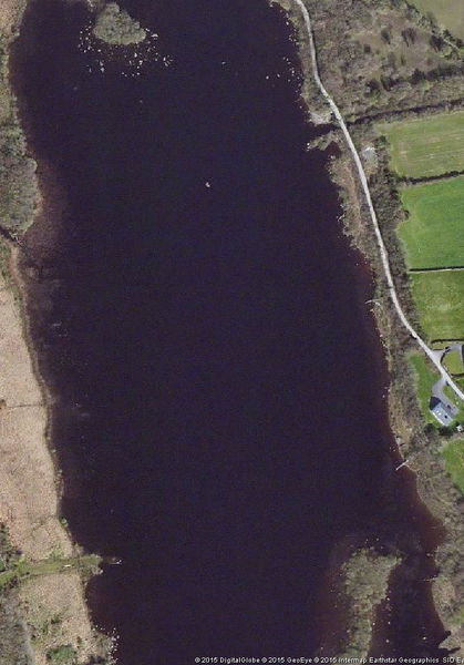
Stones treated as islands, misinterpreted shadows, 272 ways and 8317 nodes… Let’s fix this !
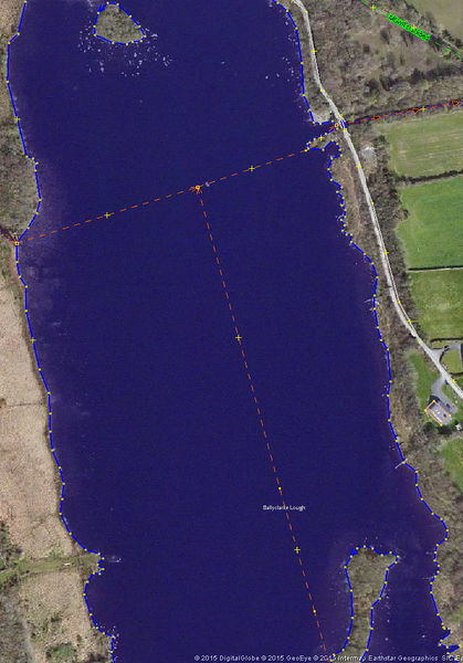
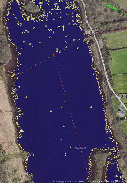
Ahhh much better :) 6 ways and 739 nodes was all that was needed, and it looks much better.
Discussion
Comment from Zverik on 4 December 2015 at 12:28
Which is faster, using Scanaerial + fixing the results, or tracing a river by hand?
Comment from Vincent de Phily on 4 December 2015 at 13:52
Scanaerial is usually for lakes, not rivers. It really depends on how suitable the imagery is.
In the case above, the imagery’s contrast made it realy hard for scanaerial. One can tweak the settings and rerun scanaerial, but I knew from experience that (for this case) it’d be faster to draw from scratch.
Whether you rerun the auto-tracing tool or not, good candidates for improvements (as opposed to replacement) are ways that have too few nodes rather than too many.
Comment from BushmanK on 20 December 2015 at 02:56
Don’t forget the third option - to automatically vectorize low resolution data (Landsat) and then - to add details.
Comment from Vincent de Phily on 20 December 2015 at 20:40
Yup if the lake is big enough, landsat can be used. Not sure how many of those are left to trace ? And yes whatever you autotrace from, a manual check/tweak afterwards is important.