
ALSINA bus from Seville to Cádiz uses OpenStreetMap
Posted by Steven Vance on 10 May 2014 in English. Last updated on 11 May 2014.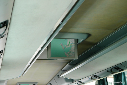
I took a day trip on a coach bus from Seville to Cádiz on Wednesday to visit the beach while staying for a week in Seville. I was surprised near the end of the trip when the bus’s LCD screen started showing its current location using OpenStreetMap.
This bus has free wifi so it obviously has a cellular network connection and can determine its location as well as download the map tiles to display its current location.
It makes sense for the bus company to use OpenStreetMap: it is detailed and free, so the bus company doesn’t have to license the map from Google, Navteq, TomTom, Nokia, Bing, etc.
I think airlines should switch to using OpenStreetMap for their base layer when they show the plane’s position.
Photo originally posted on my Flickr.
Discussion