Adding hiking trails around Debowy Gaj in Poland
Posted by Recursive Loop on 23 April 2012 in English.Hi folks,
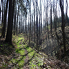
I’m adding some tracks and landscape features we collected during our various stays around Debowy Gaj in Poland.
This includes the named ‘Yellow Road’ trail between Lwowek and Marczow. This hike connects nicely with the trail that has already been mapped between Marczow and Wlen.
By the way, the following hike is really fantastic. Going from Debowy Gaj along the Bobr to Marczow and then Prezezdziedza, pick up the ER-6 bicycle path to Wlen. Buy some lunch in the town square, and continue up to the castle. Descend down the other side to Lupki and take the yellow road back to Debowy Gaj. Count on walking 25km, with a couple of elevation changes of around 150m. Add 15km when doing this from Lwowek. *ER-6 is not a real bicycle path, but if you have a decent ATB, this route can be cycled very well.
Anyway, we’ll be adding more paths soon!
Discussion