I recently moved to Singasandra and realised that being a new colony, this area was very badly mapped. The creation of AECS(Aeronautical Engineers Cooperative society) Layout involved the area being carved out of Chikka Begur village, Singasandra. Not the problem is that the area is not not mapped correctly on any official or non-official platform. Let me Illustrate
The highlighted area is designated as AECS B Block(Verified on location)
Given that its a new area, there are very few location markers placed by authorities- precisely 3 in the area(highlighted below)
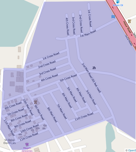
(1) Marked as 2nd Main Road (2) Marked as 3rd Cross Road (3) Marked as 2nd Cross Road
These are the only 3 physical markers in the area and the rest of the area just has to guess its own address. All the roads have been marked out on the basis of these 3 reference points. But there are some major issues here.
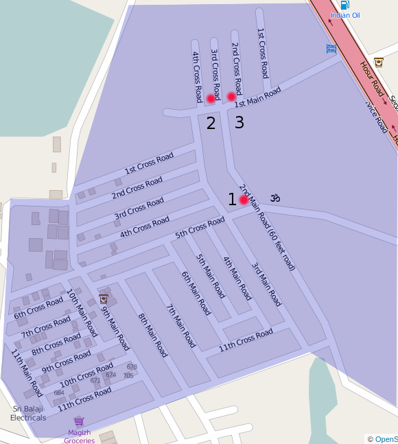
Point 1–2nd Main Road is a north-south running road as per the convention. But, Where is the 1st Main Road? It cannot be the one as labelled because that is an east-west road and should ideally be a Cross Road Points 2 & 3–2nd and 3rd Cross roads are marked by physical markers. These are north-south roads and should not ideally be Cross Roads, they should be mail roads. This has led to a complete breakdown of the addressing system.
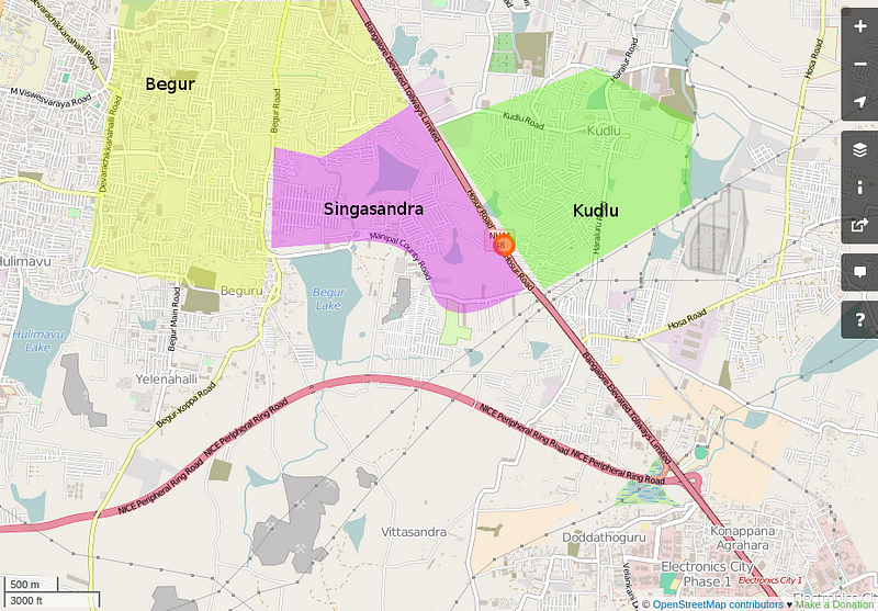
Approximate locality boundaries The addresses in AECS B Block area identify themselves with Begur, Singasandra and Kudlu whereas they all belong in Singasandra. This may seem like a trivial issue but there are many real-world implications in this hyper-local world we live in. It is almost impossible to accurately call a cab because this area is not correctly mapped o google maps(the service that is used by Ola ad Uber) and hence cab drivers go in circles around the house without actually being led to the correct location. Same goes for grocery deliveries and courier deliveries. Sharing a location with a friend marking the location of the house is pointless since the navigation does not understand how to direct them here. Calling upon fellow mappers to help resolve this issue.
Discussion
Comment from PlaneMad on 29 August 2016 at 15:40
Completely normal in India :D
Your best bet is to hunt down the local BBMP ward office and get a paper map saying you are completely lost. They are usually quite friendly and happy to help.