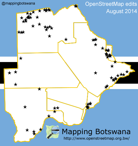
August 2014 was a busy month, we unveiled our Mapping Botswana website officially on August 12th, the 10th birthday of OpenStreetMap, and several new contributors joined the cause.
The map below shows the nearly 70 locations, some large and some small, that were updated during the month.

Nearly exhaustive list:
- Beetsha
- Bokaa
- Bokaa Dam
- Borolong
- Chadibe, Central Mahalapye
- Chadibe, Central Tutume
- Dikgathlong Dam
- Dobe
- Dukwi
- Eensterus
- Eretswa
- Etsha 1
- Gaborone
- Groote Laagte
- Gudingwa
- Gulubane
- Gunitsuga
- Juanqu
- Kanyu
- Kasane
- Kauxhwi
- Kazungula
- Keng
- Khama Rhino Sanctuary
- Lebala
- Letsibogo Dam
- Lotsane Dam
- Mahito
- Makaleng
- Malotwana Siding
- Maposa
- Martin’s Drift
- Maun
- Mawana
- McCarthy’s Rust
- Metsiimantsho
- Mmanxoate
- Mogithlo
- Mogomotho
- Mohembo
- Mokgacha
- Mokobeng
- Moremi Game Reserve
- Nata
- Ngarange
- Ngwapa
- Ntimbale Dam
- Nxamasere
- Palamakoloi
- Qangwa
- Sand Road
- Sangoshe
- Sefhare
- Sekondomboro
- Seronga
- Shashe Dam
- Shashe-Mooke
- Sherwood
- Tamacha
- Tau Pan Camp
- Tjiponga
- Tlokweng
- Tsodilo
- Tsootsha
- Xakao
- Xamshiko
- Xaree

Discussion