
Mapping for Flood Response in Hanang District, Manyara-Tanzania 2023
Posted by KAWAMALA on 22 January 2024 in English.Overview
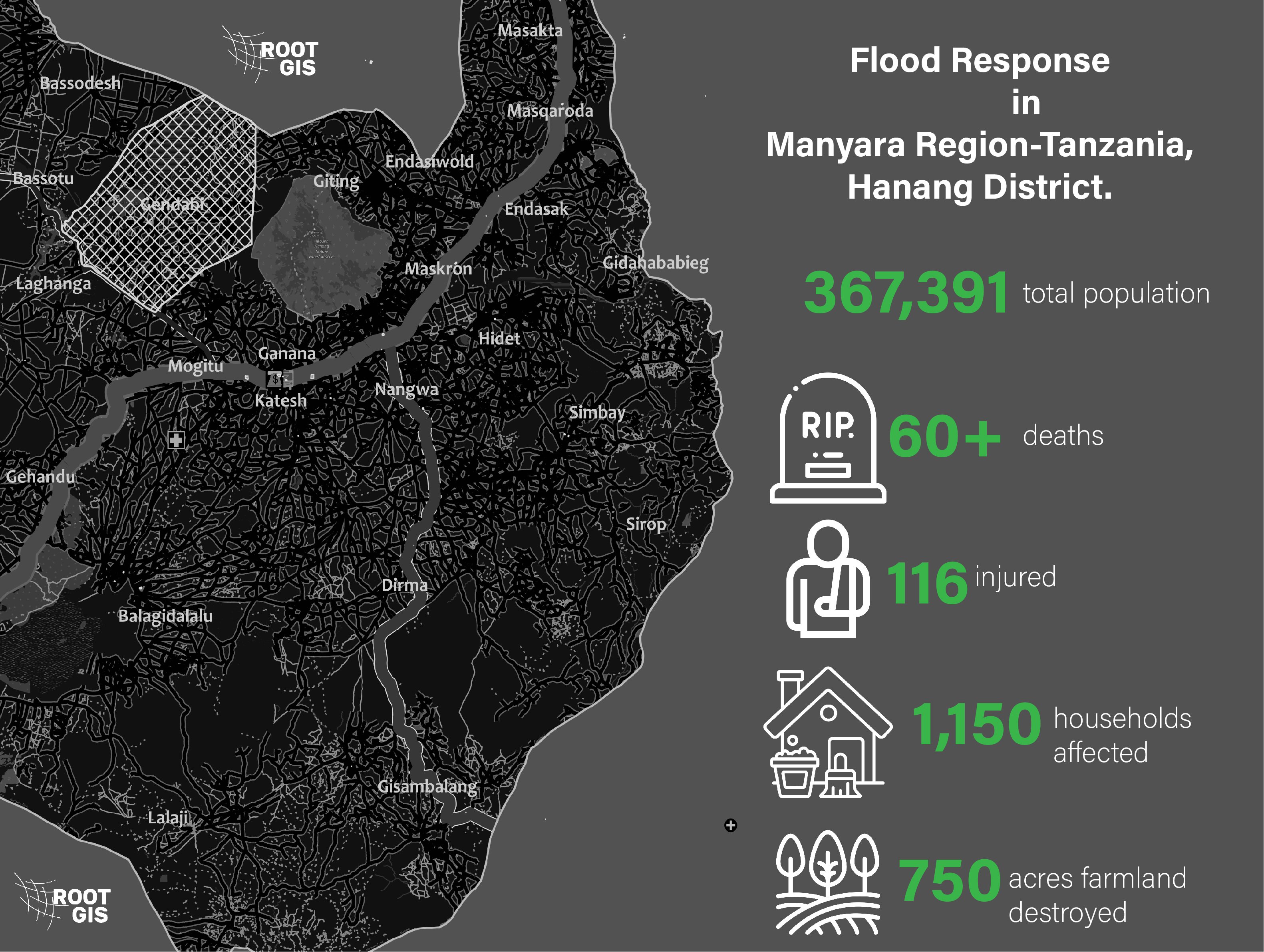
In December 2023, the Hanang District of the northern Manyara Region in Tanzania faced a catastrophic disaster. The heavy rainfall triggered flooding and landslides, causing widespread destruction in the areas around the towns of Katesh and Gendabi, as well as the steep slopes of Mount Hanang.

Mapping Initiative
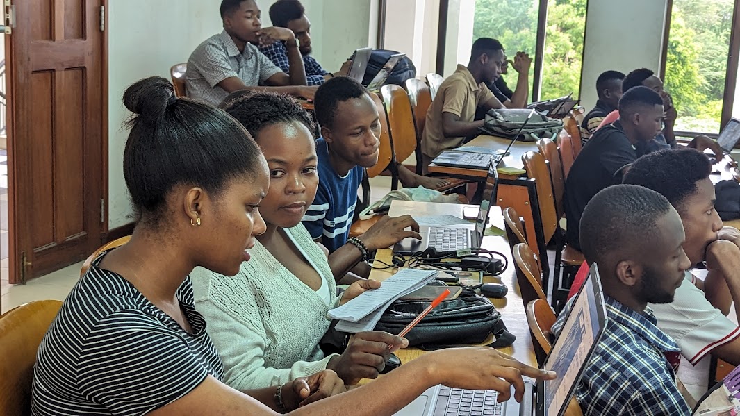
In response to the crisis, a collaborative mapping effort was initiated between ROOTGIS, HOT Eastern and Southern Africa hub, local and global partners to aid in flood response and recovery. A total of 252 contributors, ranging from beginners to advanced mappers, actively participated in this crucial task. The mapping community came together, comprising 76 mappers and 15 validators.
Tools and Platforms
The mapping initiative leveraged the ESRI World Imagery as the base map, and the Humanitarian OpenStreetMap Team (HOT) Tasking Manager served as the primary platform for coordination. Various mapping tools were employed, including the iD Editor and JOSM (Java OpenStreetMap Editor).
Mapping Statistics
The collaborative effort resulted in an impressive set of statistics, showcasing the dedication and impact of the mapping community:
- Changesets: 842
- Map Edits: 16,668
- Buildings Mapped: 4,364
- Roads Mapped: 261 kilometers
Data Utilization by Government and Stakeholders
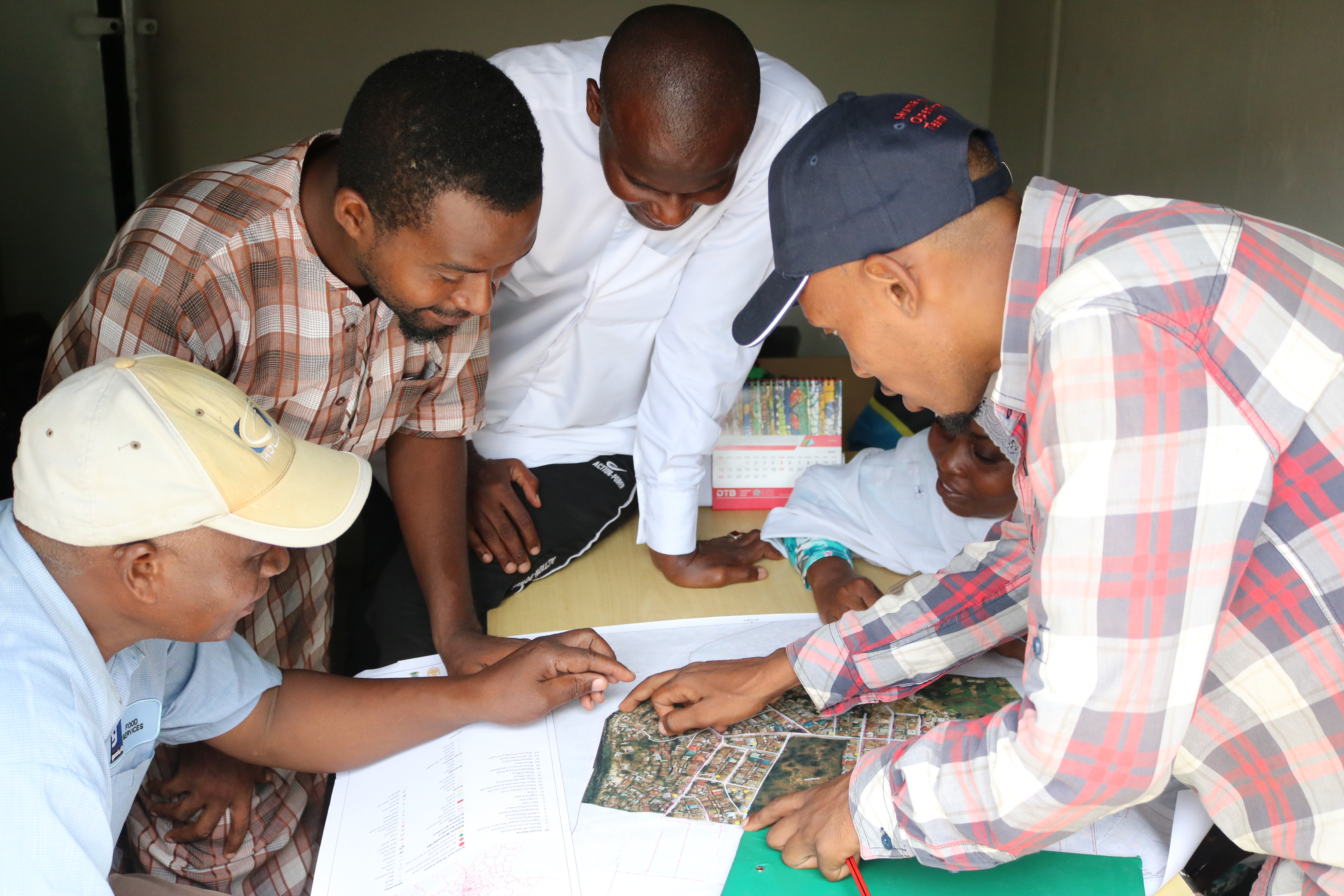
The mapped data became a valuable resource for the government in orchestrating an effective disaster recovery strategy. Local authorities utilized the detailed maps to assess the extent of the damage, identify critical infrastructure, and plan evacuation routes for affected citizens. The geospatial information played a crucial role in streamlining the allocation of resources and coordinating emergency response efforts.
Stakeholder Analysis
Government agencies, non-governmental organizations (NGOs), and other stakeholders actively analyzed the mapped data to understand the impact of the floods comprehensively. This analysis facilitated targeted interventions, enabling relief organizations to prioritize areas with the greatest need. Additionally, the information gathered through mapping contributed to long-term planning and resilience-building initiatives to mitigate the impact of future disasters.
Lessons Learned
The mapping initiative in Hanang District provided valuable insights into the strengths and challenges of collaborative mapping in disaster response. Key lessons learned include the importance of community engagement, the need for standardized mapping protocols, and the significance of real-time data updates during dynamic situations. The experience highlighted the resilience and adaptability of the mapping community in responding to urgent humanitarian needs.
Recommendations
Building on the lessons learned, recommendations for future mapping initiatives in disaster response include:
-
Community Training: Conduct regular training sessions to empower local communities with mapping skills, ensuring a faster and more effective response during disasters.
-
Real-time Collaboration: Foster real-time collaboration between mappers, validators, and stakeholders to ensure up-to-date and accurate geospatial information during rapidly evolving situations.
-
Post-Disaster Evaluation: Conduct post-disaster evaluations to assess the impact of mapping initiatives, identify areas for improvement, and refine strategies for future humanitarian mapping projects.
Conclusion
The mapping initiative for flood response in Hanang District exemplifies the power of collaborative mapping in disaster management. The detailed maps created through this effort not only assisted immediate response teams but also provided a foundation for long-term recovery and resilience-building efforts.
Our sincere gratitude goes to all 252 contributors who generously dedicated their time and expertise to make a positive impact in the lives of those affected by the floods in Hanang District. We encourage others to join the mapping community and contribute to future humanitarian mapping projects, as these efforts play a vital role in building more resilient communities worldwide.
Discussion
Comment from arnalielsewhere on 22 January 2024 at 23:57
Kudos!
Comment from pedrito1414 on 23 January 2024 at 10:33
Fantastic summary and seems like a really effective activation. Kudos to all involved….
Comment from Raquel Dezidério Souto on 12 February 2024 at 05:06
Excellent!