
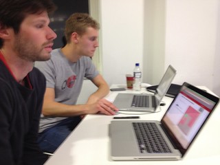
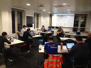
London Typhoon Haiyan Mapathon
Posted by Harry Wood on 19 November 2013 in English. Last updated on 25 November 2013.On Thursday we did a London meet-up which was a bit unusual. A “mapathon” event to improve map coverage in the Philipinnes after the typhoon. Check out the HOT blog post about the typhoon and the Typhoon Haiyan wiki page for general information about this disaster response mapping activity which is being coordinated by the Humanitarian OpenStreetMap Team.
On the Wednesday I was summoned to broadcasting house, to do an interview about OpenStreetMap Typhoon mapping on BBC radio (Listen to Wednesday’s World Business Report and skip ahead to 6:52). Fresh from the excitment of having the BBC pay some attention to us, Grant and I decided we should do an event, so we organised this at very short notice. I asked the ODI if we could host it there in 24 hours time.
I half expected that the event would be a full house, but I really wasn’t sure. Turns out we had about 10 people come along, most of whome were seasoned OpenStreetMappers, so not quite the big band of people I was expecting, coming to learn editing for the first time. I guess more notice is needed for most people, and maybe more time to get the word out (what? Why isn’t everyone following @OSMLondon!)
However it was worth it for a couple of reasons. Firstly we got a bit of mapping done, got some people mapping for the first time, and some people mapping more confidently (Worrying that you’re doing something wrong seems a common problem, but mostly the worrying is not justified. Be bold! Give it a try!)
Secondly we had various special guests…
Heather Leson, fellow H.O.T. board members, was in London again. Happening a lot these days! She still doesn’t understand our accents, but she’ll learn soon enough :-)
We had Ivan Gayton from MSF (Medecins Sans Frontiers). This is one of the most impressively active and effective disaster response aid agencies. Here in London, MSF UK have an office for research, including a small GIS team. I have met with them before, but we need stronger links, so it was great to have Ivan along, and so enthusiastic about our map data. He gave a presentation on one kind of use case they have, analysing the spread of disease using GIS, and in the case of Haiti, using OpenStreetMap data for geocoding.
We were joined by Andrew Braye from the British Red Cross. In the London office they have been actively mapping the philipinnes in OpenStreetMap to help our efforts and to help get maps data ready for their purposes: to equip their teams as they head out there.
GIS teams in aid organisations will naturally work with OpenStreetMap data when it’s useful, but OpenStreetMap is about the community. We can do rather unique things like improve maps of an area on request, perhaps by running mapathon events, and we can help them with the unique technical capabilities and challenges around feeding off our community-built ever-improving map. They’re not much different from challenges faced by organisations worldwide and across all industries, but these are humanitarian organisations based in London. Let’s make sure we OSMLondon people are helping them in whatever way we can.
Another special guest was Dan Cunningham who was scouting for hacking ideas for an upcoming hack4good hackathon event which he organises. In the aftermath of large disasters, groups like this suddenly spring into hacking action, with lots of keen volunteers who don’t do much at other times. This seems like a good opportunity for OpenStreetMap to get some improvements made, although it requires hack-weekend sized tasks and there’s some coordination overhead. Any improvement to OpenStreetMap, the website, the editors, the downloads, the apps, the stylesheets, the documentation, etc etc… any improvement is is an improvement to H.O.T.’s capabilities in a disaster (it just happens to be an improvement for all the other uses too!) If that kind of thing interests you, please join in with one of the many hack events. In fact the next OpenStreetMap event we had planned in London will be the London Hack Weekend kicking off Friday after next.
With these unexpected special guests we had some important conversations. So, although it wasn’t quite the way I expected, the event was a success.
[UPDATE - I’ve done write up about this event on the Open Data Institute blog. Less OSMy audience]
Sam Leach blogged about the event too!
If you’re in London and interested in coming to OpenStreetMap events, we do pub meet-ups very regularly. Follow OSMLondon on twitter. If you’re not in London, note that there have been, and will be, a number of similar mapathon events around the world, but of course most of the actual crisis mapping and hacking takes place online. Join in!
Discussion
Comment from aseerel4c26 on 20 November 2013 at 01:52
Just a … thank you for the good report with the many links, Harry! Very interesting!
Comment from Harry Wood on 20 November 2013 at 04:23
I do like my links :-) Actually I wrote this on the train without and internet connection. Frustrating. I had to leave the links to fill in later.