
We’ve had a few OpenStreetMap events lately which I didn’t report back on yet. The big one of course. State of the map, up in Birmingham. I’ll come back to that, but also quite a few London events (The next London event is this coming Thursday)
There were the pre-SOTM drinks with the MapBox guys. Strongroom bar was less annoyingly crowded than I remembered it, so that was good. I shall have to go back there (pretty close to my office) Having said that, we did have quite a crowd made up of OSMers getting together before the conference, and some other Shoreditch start-up tech community type folks.
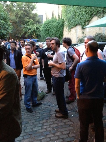
There was a couple of guys who had printed OSM maps onto little cards as a conceptual experiment in sharing city information with friends. Interesting idea I thought. Can’t find it online though. Mysterious. At this meet-up I full of the usual pre-SOTM excitement, plus I was excited at having just taken delivery of loads polo shirts.
An earlier OSMLondon event was our meet-up and mapping session in Victoria. I’ve avoided the Victoria area for mapping parties in the past because it has been well mapped for a long time. I’m not sure why actually. I mean I wasn’t able to determine one particular user who has mapped the area. Maybe I could by looking at historical data somehow. Or I guess it’s possible the area has been quite collaboratively mapped by various waves of fly-by mappers commuting out the station there.
In any case, Billy suggested going to Victoria, pointing out that there’s some new construction coming to completion in the area. Some construction is still ongoing, so they’ll be significant mapping todo in the coming months, but we managed to add a few things including a little waitrose newly appearing in the shiny new block there. Before that we were checking the buildings in the streets to the south of that, and before that we met to set off from outside “Westminster Cathedral” which I don’t think I’d ever seen/noticed before. This whole part of London is pretty unfamiliar to me.
And we went to an unfamiliar pub too. Hopefully everyone who came looking for us did find us hidden upstairs at The Windsor Castle. Upstairs was very spacious and quiet. Perhaps a little too quiet actually. It felt like we should whisper quietly about maps to eachother, but we had some beers so that didn’t last long.
If I’m looking at the right set of minutes, we talked about a lot of Mapnik stuff. Width as a variable in stylesheets, and in particular the idea of adjusting motorway widths by number lanes (lanes tag). Andy Allan’s openstreetmap-carto work has come to fruition now with it being used on the main OSM tile server. OpenStreetMap.fr are also using openstreetmap-carto stylesheets. Christian Quest did some of his own customisations but he forked from quite an early version apparently. We talked about vector tiles which Mapbox and Mapnik developers have been working on. It’s an intermediate representation generated by Mapnik, rather than something Mapnik just reads from as a datasource. For Mapbox it’s a way of doing their nifty flexible style infrastructure with no need for database style disk interactions. …was the gist of the Andy’s explanation I think. We also talked about banning potlatch, OSMPlus non-video-coverage, and something about POI shop mapping.
And we had along User:Rovastar who has an interesting little personal mission to improve the coverage of all the football clubs (sport=soccer that is). He’s in London for a while, so he came along for his first face-to-face encounter with OpenStreetMappers, and enjoyed it… we know because he’s been back! (in fact you can see him in the photo of the Mapbox gathering above)
He was also back more recently for the Cheshire Cheese pub meet-up. I think this pub is a nice one to bring overseas visitors to because it’s superdooper-old-and-traditional. It was built (excavated) by some beer-addled monks back in the days of kings and queens and dragons. So with Kate Chapman and Heather Leson in town this pub seemed like a good choice. Nice to have some face-to-face time with fellow H.O.T. board members. Come to think of it we probably should’ve steered discussion topics onto humanitarian mapping a little more, but we also had a lively crowd of London OSMers. Maybe the echoing low-rooved chamber made it see more lively. I did note down a discussion we had about tasks.hotosm.org (check out this tool if you haven’t already. On there at the moment there’s a few mapping jobs set up in response to specific aid agencies requests. It’s easy to help!) We discussed an interesting kind of user psychology problem with the tool. It has a button “Mark Task As Done”. People tend to only click this button if they have mapped every last thing in the square area including building outlines. Now sometimes that is the aim, but when we’ve tried to use the tool differently e.g. to map large areas quickly with some basic map information e.g. just main roads, or just finding villages, people seem more reluctant to take the bold step of marking their square done. Also people don’t tend to mark a square as done, unless they did it themselves. We want people to look out for squares which are already mapped or which have no mapping to do, and click ‘Done’ on them, but people don’t tend to do this so much. These factors combined, mean that the tool doesn’t work as well as it might for tracking progress or for directing people to obvious mapping work.
Meanwhile there was a discussion verging on blazing row about “armchair mapping”. We have some very dedicated surveying mappers in London, who are very anti armchair mapping. I knew that putting Rovastar around the same table as these people had the potential for some lively discussion, and I was secretly looking forward to it because it’s always bothered me that people in the community hold quite opposing views on armchair mapping without really airing them to eachother properly. My attempt to rectify this a little while back, was to present the issues and some guidelines on the Armchair Mapping wiki page. I invite everyone to discuss and work towards consensus there, but aside from Rovastar on the talk page, that hasn’t really happened much. For example how do the OpenStreetMap.US editathons fit in with this? They don’t seem to be following the guidelines for event organisers but then… as stated, the guidelines need not apply so strictly in an area of the world where there’s not much of a community of on-the-ground survey mappers. As US OpenStreetMapping builds momentum, which it has done spectacularly this past year, they’ll no doubt see more surveyors having issues with armchair mappers I guess it’s up to them, but I don’t think the decision should be that the guidelines don’t apply at all there (after all the guidelines don’t say “don’t do it”)
Besides those big topics we discussed the passed SOTM conference (more on that later) and FOSS4G in Nottingham. We also talked about wikimedia’s OpenGlam and a project at the british library to do with digital sound clips.
For our next London event they’ll be more mappy chit chat, but also a pre-pub little mapping session. All the details on the wiki page. You may think there’s not much mapping left to do in the area, and there isn’t, but there’s enough for a short mapping intro. That’s the idea. We’d like to welcome along new people, so if you know any one who knows anyone who would be interested in trying out OpenStreetMapping, pass on the link: http://bit.ly/londonosm9 and get them to get in touch with me about Thursday evening.
Discussion
Comment from robert on 6 October 2013 at 11:30
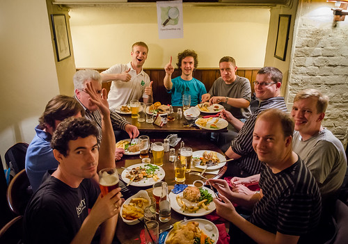
The third (Alex’s) photo there is an excellent photo. It’s a bit like an osm last supper.
Comment from Harry Wood on 6 October 2013 at 11:46
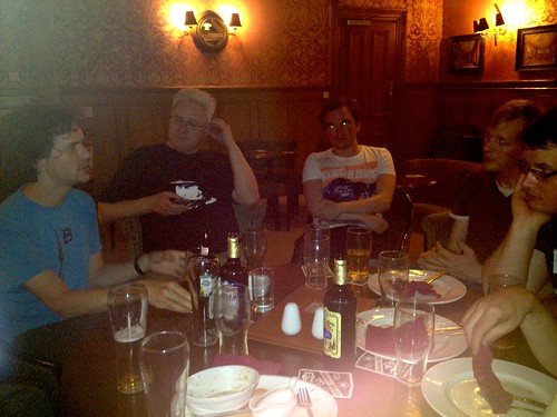
It is good. It’s a shame Kate and Heather had left the room when he got his camera out. Should’ve taken a few snaps myself, but you can see how well my iPhone does when it decides to flash in pub (middle photo)
Comment from malenki on 9 October 2013 at 16:43
Since a comment I wrote regarding HOT got a little lengthy I posted it as a blog entry of mine: http://www.openstreetmap.org/user/malenki/diary/20179