Pontefract Castle meet-up + next one now!
Posted by Harry Wood on 8 November 2011 in English. Last updated on 14 November 2011.A couple of weeks ago we had our last EVER London Summer 2011 mapping party.
I suggested a pub meeting time of 7p.m. and just half an hour of mapping, but I usually start mapping about half an hour late, so it wasn't much of a mapping session for me. I did spend a few minutes trying to check some little details as I approached the pub on my bike, but mostly the building outlines I sketched in from Bing remain unchecked for this one. One thing I tried to check was this building which doesn't correspond well with bing. I was looking from Queen Ann's Street, but couldn't see what that was, so maybe its supposed to be on the Portland Place street front.
The expansion of building coverage has hit a sticking point at Marylebone and Mayfair. Setting cake diagrams repeatedly on the same areas doesn't seem to be helping! I suppose this is because they are not very interesting areas to map in. Given the new flurries of building coverage around Paddington, Bayswater, and South Kensington, it would be a shame not to get these bits filled in, but maybe it'll have to wait for next summer. The nights are too dark for mapping now.
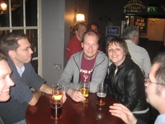
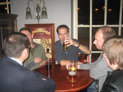
In the Pontefract Castle pub we took a while to get a table this time. We met Ryan who works for British Waterways. He was describing some map data he has, and hopes to open up. He was also saying he set some work placement students a programming challenge to create a game involving OpenStreetMap and OpenLayers vectors. I forget the details but it sounded like fun.
We talked about Mapnik stuff again. Mapnik has now moved to git. I'm not sure whether we were talking about Mapnik itself or the OSM Mapnik stylesheets, but in any case they are now both in git as part of the march towards total gitification of everything (it's forktastically fashionable, so one day I'll have to actually figure out how it works) I notice the stylesheets are still in SVN. Maybe not for much longer(?)
I discussed something we were pondering for some client work we were doing at placr.co.uk . With Mapnik, at zoom level 15 for example, minor roads are still shown, but in crowded cities most road labels tend to disappear. They have to. They wouldn't fit. But we were looking at a printed (manual cartography) map where a frequent trick for very short streets, is to wrap labels onto multiple lines. I wondered whether Mapnik could be persuaded to do this. It does it for point labels on things like schools, but what about for the angled (and sometimes bent) text of road labels. Anyone seen this done?
We talked about simplifying. For example if you want to simplify down all of the motorways of UK for low zoom level overview. This can't be done by Mapnik natively. It can kind of be done by postgres, except that ideally you'd have some sophistication in there to join up all the ways e.g. where there's bridges represented as itty bitty little ways. That problem may make you think of relations or some other in-OSM data, but really it's just a post-processing challenge.
These days all the cool kids are using Tile Mill and loading data into Mapnik using Osmium instead of osm2pgsql. The latter still has a major feature advantage though. It can feed in diffs.
We also talked about some OSM London plans related to the Olympics. More on that later...
The next OSM London meetup is... RIGHT NOW! Time for me to get on my bike (in fact I'll be a little bit late) Come join us in the Monkey Puzzle if you can! This is the first of the "officially doing no mapping" winter meet-ups.


Discussion
Comment from chriscf on 10 November 2011 at 13:49
So, how much mapping was eventually done at this "officially doing no mapping" event? :-)
Comment from Harry Wood on 10 November 2011 at 14:05
Well you'll have to wait for the diary entry about that event, but I can disclose that in fact no mapping was done. Although we do need to do more buildings around the Monkey Puzzle.