London meetup: Logos, Missing Streets, Imagery offsets, XAPI etc
Posted by Harry Wood on 29 January 2011 in English. Last updated on 3 February 2011.We were at the Blue Posts again on Thursday night (London OSM meet-up)
Alex was there. Congratulations to him on getting accepted for a PHD in London. We'll be seeing more of him! Hopefully he can work in some OpenStreetMap into his PHD topic too.
Matt (who sometimes goes under the pseudonym of a Japanese cartoon porn star) was there. We discussed how he is now considerably less evil. Although his new employer polluted the world with many unnecessary CDs in the late nineties, at least they didn't... lets just leave it. Don't want the big T coming after me. Anyway, congratulations to him on starting at (AOL) Mapquest. I hope they'll put him onto creating more OpenStreetMaptastic stuff.
Matt is the creator of the OpenStreetMap logo. We got onto talking about logos, and asked him if the pattern of 1s and 0s in the design encodes a hidden message. He neither confirmed nor denied it. On the topic of the the new HOT logo Andy pointed out that it could be confused for a "warning this is hot" symbol. Good point. Guess this means we should try to use the version with text alongside whenever possible. In any case, it's pretty nice design. Time to turn our logo designing attention to the SOTM logo design challenge!
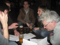
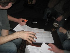
In the above pictures you can see us hatching a plot to find another focus for some more London mapping. We're poring over printouts of the rankings of street completeness by council district, a nifty bit of analysis by itoworld, which uses ordnance survey data (the open "OS Locator" dataset) to find missing or incorrectly named streets. See their original blog post, and more recent one about the map, for some more explanation. We decided that the London boroughs should really kick more ass. When we get any London borough up to 100%, we shall celebrate by having an OSM pub meet-up in that borough (UPDATE: OK 95%! see Andy's blog about this) So there you have it. The challenge is set! There's a few subtleties to consider when working on fixing up these things. Please don't just copy the ordnance survey values into OpenStreetMap. That's not the idea at all!
We talked about aerial imagery offsets and about the true offset process idea. Potlatch allows you to apply an offset to the aerial imagery by holding down [Space] while dragging it. JOSM allows this by selecting 'New offset' on the 'imagery' menu, and then dragging. Some people spend a long time agonising about applying the correct offset to align things with reality as a far as possible, using a GPS traces. Other people kind of vaguely line things up sometimes with mapping work already in place. Probably quite a lot of people don't know about the offset capability in editors, and with many people it probably doesn't even occur to them that imagery might not line up with reality. A system to make it easier to be more accurate and consistent with other contributors seems like a sensible aim. But it's a bit of complicated rabbit hole. We want people to be able to define a correction which then gets easily fed into other people's editors. Fed in automatically, or only on prompt? Allow anyone to define corrections or moderate this somehow? Define corrections as bounding box? polygon? or "control points". Use GDAL to create a "surface" of offset data from control points? Does editor software need to apply warping or can we simplify to just shifting tiles? Dave described the way different areas of bing imagery are stitched along main roads (presumably manually) to try to make the interface less noticeable. Here in Putney is probably the example he was talking about.
Andy mentioned another neat imagery thing. Potlatch 2 features area-sensitive imagery options, so while editing in the UK for example, you are automatically presented with out of copyright scanned OS maps as an option (also a layer for showing the aforementioned itoworld OS Locater checks) These can be configured with other localised sets of imagery all around the world. This is something the Humanitarian OpenStreetMap Team should be aware of, and setting up each time we get new imagery sets available.
Later on we talked about XAPI. People complain about the availability and performance of the existing XAPI. Ian Dees has been working on a new java version backed onto postGIS, which briefly came to life last week before his server broke. It's a tricky one. XAPI (when it's working) is a rather a magical black box. It lets you search within a bounding box, or over the whole planet, and to filter by particular tags which may be quite rare, or very prevalent. This kind of querying can only work with clever indexing of one sort or another, but there's several different directions in which you can optimise, and then there's minutely diffs to feed into the indexes, so it's a bit of hairy one to architect. And to test it, you really need to pipe in the whole planet and fire multiple awkward queries all at once.
There's been some recent changes to the default Mapnik rendering. Seemingly it's now treating various landuse areas with some transparency, resulting in weird effects. The oceans around San Francisco have turned an algae infested green. Meanwhile military areas and allotments have turned stripy.
Although he didn't do his B B B burritos dance, we could tell Matt was was getting irritable so we had to head to node:787474861 half way through the proceedings. Nom nom nom.
The next meet-up will will be Monday 7th February at the Euston Tap. That's quite soon, but I've been organised and set it all up, so sign up now! I've squeezed it in there before #geomob which is Thursday that week, and which everyone should also go to too.


Discussion
Comment from Tom Chance on 31 January 2011 at 14:23
Drat, Camden and Brent are now both above Southwark in the ITO table. I obviously need to get my bum over to Rotherhithe and Surrey Quays.
On XAPI, for those of us unable to run a mirror of the full OSM database it's really the main way to get at the data so further work on a reliable implementation would be much appreciated. I'd even be willing to pay a small fee for a subscription to a reliable server with a limited number of keys.
Comment from Kachkaev on 3 February 2011 at 22:03
Guys, I was glad to see you all again!
By the way, Matt finally told that there is a kind of an easter egg in the OSM logo. If you look at the numbers closer, you will see that it is a repeating sequence of
0100
1000
1110
Ones and zeros form a glider figure from Conway’s Life:
http://en.wikipedia.org/wiki/Glider_(Conway's_Life)
By the way, the glider can be also found on hackers’ emblem:
http://en.wikipedia.org/wiki/Hacker_Emblem
P. S.: Before I knew about the glider from Matt I was vainly trying to find 42 in this “binary code” a couple of times.
Comment from Kachkaev on 3 February 2011 at 22:29
D’oh! I’ve just remembered one more thing after saving the comment, so have to add another one as they are undeletable even right after the submission.
As Harry mentioned, I started my PhD studies recently. The topic of my dissertation has not been defined yet so now I just know the area of my future research: Intelligent Road Transport Systems. I have like half a year for studying, reading, meeting people and at the end I should come up with some idea which will form my topic.
OSM can be associated to transport problems and ITS (Intelligent Transport Systems) and is actually very close to all these things. So if anyone has any superfluous ideas which just came in mind, but there is no time for implementation or further thinking, I will appreciate sharing them with me a lot.
Cheers!
Comment from Harry Wood on 3 February 2011 at 22:30
Ah yeah. But the logo actually has two gliders sat on top of eachother
00100
01000
01110
00100
01000
01110
I tried it. It doesn't work, although it does do interesting things for a few generations.